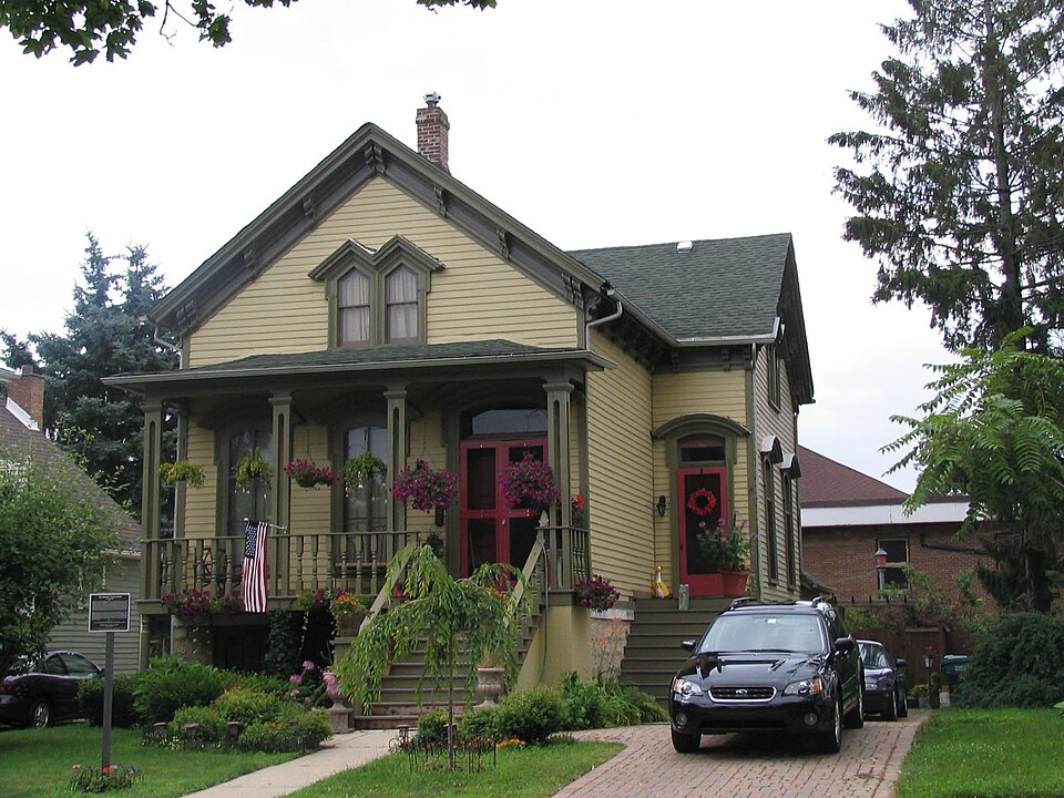
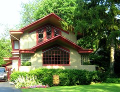
Listed on the National Register of Historic Places in 1982.
From the record
“Young House, also known as the McGee House, is a historic house at 2445 High Street in Blue Island, Illinois. The house was built in 1852 for land developer Joshua P.”
Wikipedia article Joshua P. Young House, CC BY-SA 4.0.
One of 621 National Register listings published here for Cook County · listed in 1982 · category: Building.
National Register reference number.82002525- the number the National Park Service assigned this property when it was listed, and the key its nomination file is catalogued under at the National Archives.
The first settlers were Patrick Fitzgerald, who built a small house south of the Forging Company's shops, in 1S5.;, or 1S53, since moved to Missouri ; James Ryan, who built near Fitzgerald, since deceased at Crown Point, Intl.; Patrick Shanahan who was a neighbor of Ryan's; John Cooper, now of Chicago, had a small house on Front Street, between Kensington Avenue and One Hundred and Sixteenth Street, and was the first to erect one of the principal buildings that was used for a boarding house for many years and is still extant. The station agent was F. Rexford, son of Norman Rexford, of Blue Island ; the name of the station was Calumet, and its location just south of the present Illinois Central Railroad depot of Kensington. But in the immediate vicinity of Kensington is an old settler who far antedates those mentioned, David Andrews, who came to Chicago in 1834, and occupied the same office with Wilson Brothers, of Chicago Journal fame ; lie was a civil engineer and surveyor, and after remaining in Chicago some lime settled upon the farm on the Indian Ridge, about half a mile northwest nf Wildwood,* i:i 1840. Mi. Andrews was horn in Sussex County, New Jersey, thence moving to Northumberland County, Pennsylvania, near Harrisburg. In 1835, he was in the United States Land - Office at Chicago, under James Whillock, and subsequently was in the Recorder's office. At the time he moved to his present farm his only near neighbors were Davit! I'erriani, at Wildwood, and Norman Rexford, at Blue Island, three miles away. Then prairie wolves, tleer aild prairie chickens abounded, and occasionally a lynx was seen, as were large timber wolves. Mr. Andrews married Caroline Ward in Crete, Will County, since deceased, in 1840, and brought his wife to the farm and built his homestead. The farm originally comprised three hundred and sixty acres, but now has only two hundred. Seven children were bom to Mr. Andrews, of whom live are now living: Mary E. Becker, Edwin Rutlvven, Charles M., Milo J. and Warren J. Mr. Andrews is still hale and st rong, despite his seventy-eight years of age. Upon the farm have been exhumed numl>ers of Indian- antiquities arrow heads, hammer heads, etc., and not long since an Indian skull was discovered.
JULIUS KEICHARDT. merchant taiior and dealer in gent*' furnishing good;, was born in Saxony, (Jermany, September S, 1S50. His parents with their family came the same year and settled at Blue Island. Cook Co., III., where he was raised and educated. He began in his present line of business at Kiverdale in 1S7S, where he yet owns some propeity. In the spring of lsSi he opened at Kensington, and is now erecting a store there. September 26. 1878. he married Miss Amelia Mctzncr, a native of Saxony, Germany. They have two children, Minnie and Clara. His wife has two children by a former marriage. Amelia and Henry. Mr. Reichaidl is a member of the K. & L. of 11., of Chicago.
Regional context, not property-specific
evidence. The federal mineral resources record lists
3 workings within 5 miles of Joshua P. Young House: 2 past producers, 1 producer.
1 still produces. What was taken out: Clay, Stone, Crushed/Broken. Distance is straight-line from the
map coordinates, so a quarry counted here may appear on a neighbouring
settlement's page as well.
Regional context, not property-specific
evidence. The National Weather Service names
Blue Island, the town this property stands in, in 2 storm reports between 2024 and 2025: 1 flood, 1 thunderstorm wind.
No death or injury is recorded in these reports. Each account below is quoted exactly as the forecast office
filed it, from the NOAA Storm Events Database, and each date
opens the federal record of that event.
No historic map-sheet match is published
for this property yet. That does not mean no map exists. This record needs
a coordinate-quality review before it can be joined to a sheet boundary.
Browse the county's mapped places while that work is
pending.
Listed places nearby
6 within 8 miles
Other National Register properties close
enough to walk or drive between, ordered by distance from this one. Both
positions come from the same geocoding pass that matched these properties
to their map sheets.
Listing record. National Park Service National Register of Historic Places, listed-properties dataset, current to 2026-05-22.
Map join. Address geocoded through the United States Census geocoder, then tested against the published boundary of every sheet in the USGS Historical Topographic Map Collection.
How this page is made. Listing fields come from federal records; map-sheet coverage is a labelled coordinate-to-boundary calculation, not a source-field claim.
Mines and quarries. USGS Mineral Resources Data System (MRDS) https://mrdata.usgs.gov/mrds/ A work of the United States government, no copyright under 17 U.S.C. 105.
Storms. NOAA National Centers for Environmental Information, Storm Events Database https://www.ncei.noaa.gov/stormevents/ A work of the United States government, no copyright under 17 U.S.C. 105. Narratives are quoted verbatim from the National Weather Service report and are not edited or summarised.
 Block