 Block
From the record
One of 29 National Register listings published here for Ogle County · listed in 1983 · category: Site.
Sources: the case file at the National Archives · the National Register database, National Park Service · the Wikipedia article
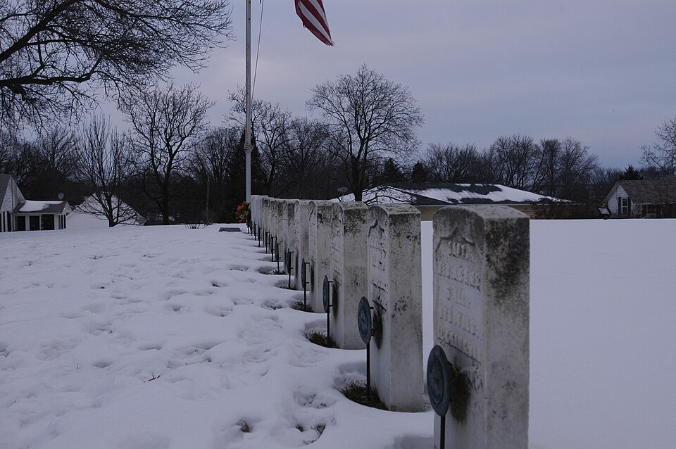
Listed on the National Register of Historic Places in 1983.
One of 29 National Register listings published here for Ogle County · listed in 1983 · category: Site.
Sources: the case file at the National Archives · the National Register database, National Park Service · the Wikipedia article
The chapter on Marion Township in The History of Ogle County, Illinois, Containing a History of the County, Its Cities, Towns, Etc., a Biographical Directory of Its Citizens, War Record of Its Volunteers in the Late Rebellion, General and Local Statistics ... History of the Northwest, History of Illinois ... Etc, published 1878 names Stillman Valley. This is what it says, exactly as the scans read.
BIRD RUIiEPH, Farmer; Sec. 26; P. O. Stillman Valley; was born in Morris Co., N. J., April 16, 1819 ; married Azuba Ainsworth Nov. 8, 1842 ; she was born in Seneca Co., N. Y., May 9, 1824; came to this Co. and settled near his present estate, in 1844 ; have had eight children, five of whom are living: Albert M., born March 6, 1844; William A., May 19, 1848; George R., June 23, 1850 ; Ella E., Nov. 8, 1855; Bertha A., Jan 4, 1861; have 160 acres; both are members of the Congregational Church; lived in a log cabin when he first settled, from which no human habitation could be seen.
Passage source: The History of Ogle County, Illinois, Containing a History of the County, Its Cities, Towns, Etc., a Biographical Directory of Its Citizens, War Record of Its Volunteers in the Late Rebellion, General and Local Statistics ... History of the Northwest, History of Illinois ... Etc, published 1878.
BJLECKEB WM. Farmer; Sec. 32; P. O. Oregon; was born in Washington Co., Md., Sept. 26, 1821 ; married Elizabeth Welty, who was born in Washington Co., Md., July 25, 1823; have three children living: John Henry, born Jan. 14, 1848; Marion D., Oct. 29, 1857 ; Delia N., Jan 1, 1859 ; Mr. Blecker came to this state in 1841, remaining two years, when he returned to Md. ; in 1846 he settled in Carroll Co., and in 1847 moved upon his present estate, consisting of 160 acres, and 400 acres in Pine Rock ; the country was not much settled when he bought his farm, and experienced all the hardship of Dioneer life. BLY JOHXS. Farmer; Sec. 36; P. O. Stillman Valley; born Herkimer Co., N. Y., June 10, 1835; married Ann Atwood in this Co. in 1855 ; she was born in Canada, June, 1837; have had nine children, seven of whom are living : Ida L., born Jan. 16, 1856; Walter W., Oct. 27, 1858; Perley F., April 23, 1860; Clara E., Oct. 15, 1863 ; Alice A., May 26, 1865 ; Irena E., June 5, 1868; Lydia A., June 1, 1872; Eliza M., Jan. 31, 1873; Wesley E. and Walter W. deceased ; came to this Co. in the Fall of 1854 and settled upon his present estate ; has over 200 acres. Bly Nathan, Farmer ; Sec. 10 ; P. O. Stillman Valley. BliY ^WIIililAM M. Farmer; Sec. 25; P. O. Stillman Valley; born in Herkimer Co., N. Y., in 1837 ; married Frances Bennett in Scott Co., 1866 ; she was born in Herkimer Co., N. Y., in 1846; have five children: Julia E., Mary E., Nathan N., Ada M. and Cora M. ; came to this Co. and settled in 1856; enlisted Aug. 11, 1862, in 92d Regt. I. S. V., Co. K, and served until June 24, 1865; was with Kilpatrick in all the battles he engaged in, Chicamauga and other engagements ; was sick in hospital four months, and captured March 8, 1«65, near Fayetteville and held ; traveled 250 miles under rebel guard; was confined in Libby Prison twenty-two days ; was parolled and obtained furlough for thirty days, when he was sent to Springfield and honorably discharged ; he then returned to this Co. and settled on his farm of 185 acres, valued at $7,500; both members of the Methodist Church. Bradley C. C. physician ; Stillman Valley. BBOWIC AliBERT F. Farmer; Sec. 1; P. O. Stillman Valley; born m Brimfield, Mass., in 1819 ; married Eunice C. Cothrinat Byron Precinct, Dec. 8, 1843} she was born in Yates Co., N. Y., May 8, 1823; both members of Congregational Church ; Mr. Brown came to Dixon, Lee Co., with his father, Dauphin Brown, in 1837, and settled in Ogle Co. the same year; have seven children, all living: Henrietta C, Chai-les F., George H., Nettie E. J., Cora C, Albert C. and Silas Percus, Mr. Brown is present Supervisor of this town, having served in this capacity three years, and been otherwise identified with the interests of the Co. ; many incidents are related by Mr. Brown of his pioneer life, interesting and filled with the stirring events of his early history; the scene of the famous Black Hawk battleground is upon his farm and near the door of his dwelling. Brown Gee. H. farmer; Sec. 36; P. O. Stillman Valley.
Passage source: The History of Ogle County, Illinois, Containing a History of the County, Its Cities, Towns, Etc., a Biographical Directory of Its Citizens, War Record of Its Volunteers in the Late Rebellion, General and Local Statistics ... History of the Northwest, History of Illinois ... Etc, published 1878.
Machine-read from a century-old scan, so expect the errors a machine makes: misspelled names, dropped words, stray characters.
Read the whole chapter on Marion Township - 7,525 words on its settlement, mills, schools and churches.
Regional context, not property-specific evidence. The federal wildfire occurrence database lists 1 fire within 5 miles of Stillman's Run Battle Site in 2020, burning about 5 acres in total. None started naturally. None was recorded as arson. Distance is straight-line from the map coordinates, so a fire counted here may appear on a neighbouring settlement's page as well.
| Reported cause | Fires |
|---|---|
| Debris and open burning | 1 |
The most recent of them, most recent first, with the day each was reported and the service that recorded it.
| Date | Cause | Size | Reported by | Name on the report |
|---|---|---|---|---|
| 23 March 2020 | Debris and open burning | 5.0 acres | Illinois Division of Forestry Resources | 20-0203 |
Regional context, not property-specific evidence. The federal mineral resources record lists 11 workings within 5 miles of Stillman's Run Battle Site: 9 past producers, 2 producers. 2 still produce. What was taken out: Stone, Crushed/Broken. Distance is straight-line from the map coordinates, so a quarry counted here may appear on a neighbouring settlement's page as well.
| Where | Site | Commodity | Status | Recorded |
|---|---|---|---|---|
| Aschelford Quarry | Stone, Crushed/Broken | Producer | ||
| Farmco Quarry No. 1 | Stone, Crushed/Broken | Producer | ||
| Larsons Quarry | Stone, Crushed/Broken | Past Producer | ||
| Lumpkin Quarry | Stone, Crushed/Broken | Past Producer | ||
| R. Mcgee Quarry | Stone, Crushed/Broken | Past Producer | ||
| Unnamed Limestone Quarry | Stone, Crushed/Broken | Past Producer | ||
| Unnamed Limestone Quarry | Stone, Crushed/Broken | Past Producer | ||
| Unnamed Limestone Quarry | Stone, Crushed/Broken | Past Producer | ||
| Unnamed Limestone Quarry | Stone, Crushed/Broken | Past Producer | ||
| Unnamed Limestone Quarry | Stone, Crushed/Broken | Past Producer |
Regional context, not property-specific evidence. The National Weather Service names Stillman Valley, the town this property stands in, in 6 storm reports between 2014 and 2024: 5 thunderstorm wind, 1 hail. No death or injury is recorded in these reports. Each account below is quoted exactly as the forecast office filed it, from the NOAA Storm Events Database, and each date opens the federal record of that event.
| When | Event | Place named | Harm | What the report says |
|---|---|---|---|---|
| June 2017 | Thunderstorm Wind | Stillman Valley | $5,000 | Tree damage was reported with power lines blown down in two mobile home parks near Stillman Road. A commercial seed building was damaged and a propane tank was moved. |
| May 2024 | Thunderstorm Wind | Stillman Valley | - | Power lines were damaged causing power outages. |
| August 2021 | Thunderstorm Wind | Stillman Valley | - | Several large tree limbs were snapped. |
| August 2021 | Thunderstorm Wind | Stillman Valley | - | Multiple reports of tree damage were received in the vicinity of Stillman Valley. |
| June 2019 | Thunderstorm Wind | Stillman Valley | - | Several trees were blown down along Route 2 between Kennedy Hill Road and Prairie Road. |
| June 2014 | Hail | Stillman Valley | - | no account filed |
No historic map-sheet match is published for this property yet. That does not mean no map exists. This record needs a coordinate-quality review before it can be joined to a sheet boundary. Browse the county's mapped places while that work is pending.
Other National Register properties close enough to walk or drive between, ordered by distance from this one. Both positions come from the same geocoding pass that matched these properties to their map sheets.
| Photograph | Property | Distance | Listed |
|---|---|---|---|
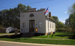 | Village of Davis Junction Town Hall | 4.0 miles | 2008 |
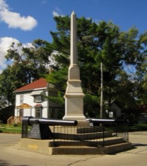 | Soldier's Monument | 5.0 miles | 1985 |
| National Archives record | The nomination case file for reference 83003587 in Record Group 79. |
| Wikipedia article | Community-written account of this property, licensed CC BY-SA. |
| Ogle County | All 29 listed properties in this county. |