 Block
Allisonville, Indiana
19 topographic sheets cover this place, the earliest surveyed in 1952 and the latest in 1998. It stands in Washington Township. It lies in ZIP code area 46250. It stands on Ivy Branch. The Survey maps it on the Fishers quadrangle.
Topographic sheets covering this place
9 surveys from 19 printed sheetsMatched by testing this settlement's coordinate against the published boundary of every sheet in the United States Geological Survey's historical collection. Each opens the scanned sheet at the Survey.
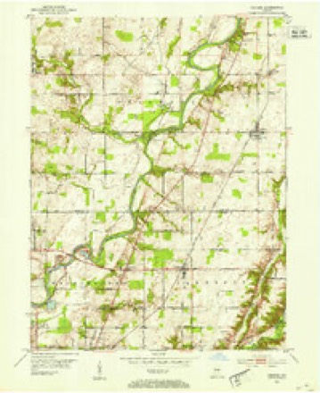
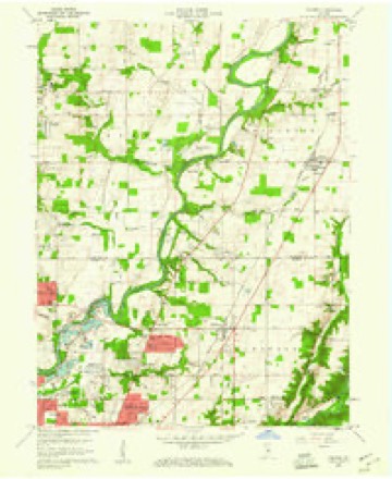
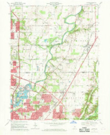
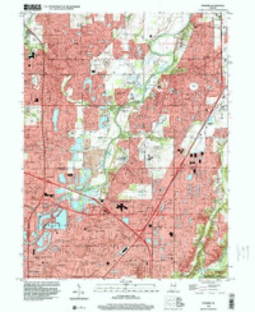
- 1952 USGS Fishers quadrangle1:24000
- 1953 USGS Indianapolis quadrangle1:250000, 4 printings
- 1956 USGS Indianapolis quadrangle1:250000
- 1957 USGS Indianapolis quadrangle1:250000, 2 printings
- 1959 USGS Fishers quadrangle1:24000, 2 printings
- 1962 USGS Indianapolis quadrangle1:250000
- 1967 USGS Fishers quadrangle1:24000, 5 printings
- 1986 USGS Indianapolis quadrangle1:100000, 2 printings
- 1998 USGS Fishers quadrangle1:24000





In the county-history sources
15,135 words on this townshipHistory of Indianapolis and Marion County, Indiana, published 1884 names this settlement in its chapter on Washington Township. These are the passages that mention it, exactly as the scans read.
One of the earliest, if not the very first, of the pioneer settlers who came to make their homes within the territory now embraced in the township of Washington was John Allison. He was born in Virginia about 1759, and went from there to Lexington, Ky., at the age of fourteen years, with his parents. Subsequently he moved to Nicholas County, Ky., and from there came to this township in October, 1819. He came through with his family, consisting of wife (formerly Anna Gray) and eight children, via Brookville, Ind., in wagons, cutting his road for quite a distance between here and Brookville. He left two married daughters in Kentucky, who subsequently came here. He entered eighty acres near where Allisonville now stands (at present owned by the Widow Devanberger), upon which he resided till his death, September, 1837. He was a hard-working, industrious citizen, and followed farming all his life. He at one time owned two hundred and seventy acres in one body, two hundred acres of which he cleared. His wife died Jan. 2, 1838. When Mr. Allison settled here in the woods, his nearest neighbors were William Coats and Joseph Coats, who lived two miles distant in a northwest direction. He. lived there about nine years before his family enjoyed the privileges of even a subscription school. The Indians were in the neighborhood for three years after he settled. Mr. Allison laid out the town of Allisonville. He was a Freemason for years before he came to this State, and was regarded as a moral, industrious.
Passage source: History of Indianapolis and Marion County, Indiana, published 1884.
Charles Allison was born in Kentucky, and came from that State to this township with his parents in October, 1819, and settled near where the town of Allisonville now is, and where he remained with his parents until thirty-five years of age. He owned eighty acres east of Allisonville, now owned by the Widow Sterrett. He removed to Howard County, Ind., and established a trading-post eight miles east of Kokomo, on Wild Cat, where he traded with the Indians for some time. He followed farming and teaming while he lived here, and was a merchant while in Howard County. He kept the first store ever kept in Kokomo. He died about 1864, and his widow and one child are now living in Kokomo.
Passage source: History of Indianapolis and Marion County, Indiana, published 1884.
John Kimberlain was born in Kentucky in March, 1800. He came to this township in 1821, and entered eighty acres one half-mile northeast of where Allisonville now is. He owned it but a short time, - worked on the Wabash Canal, and was a contractor in the work. He lived in this county seven years, and died at Anderson, Ind., in 1840.
Passage source: History of Indianapolis and Marion County, Indiana, published 1884.
Machine-read from a century-old scan, so expect the errors a machine makes: misspelled names, dropped words, stray characters.
Read the whole chapter on Washington Township - it names this place 8 more 8 times.
Mines and quarries near this place
7 within 5 milesRegional context, not property-specific evidence. The federal mineral resources record lists 7 workings within 5 miles of Allisonville: 4 producers, 3 past producers. 4 still produce. What was taken out: Sand and Gravel, Construction, Stone, Crushed/Broken. Distance is straight-line from the map coordinates, so a quarry counted here may appear on a neighbouring settlement's page as well.
| Where | Site | Commodity | Status | Recorded |
|---|---|---|---|---|
| Indianapolis 521 Quarry | Stone, Crushed/Broken | Producer | ||
| Carmel 512 Pit | Sand and Gravel, Construction | Producer | ||
| Eighty-Sixth Street Sand | Sand and Gravel, Construction | Producer | ||
| Indianapolis 513 Pit | Sand and Gravel, Construction | Producer | ||
| Standard Materials Corp S&G Pit | Sand and Gravel, Construction | Past Producer | ||
| U. S. Aggregates, Inc. | Sand and Gravel, Construction | Past Producer | ||
| U. S. Allied Aggregates, Inc. | Sand and Gravel, Construction | Past Producer |
Storms near this place
18 since 2006Regional context, not property-specific evidence. The National Weather Service names Allisonville in 18 storm reports between 2006 and 2026: 7 thunderstorm wind, 5 hail, 4 flash flood, 2 flood. No death or injury is recorded in these reports. Each account below is quoted exactly as the forecast office filed it, from the NOAA Storm Events Database, and each date opens the federal record of that event.
| When | Event | Place named | Harm | What the report says |
|---|---|---|---|---|
| July 2009 | Thunderstorm Wind | Allisonville | $2,000,000 | The Indianapolis Star reported that strong thunderstorm wind gusts led to widespread damage to the Kittle's Superstore in Castleton. Damage to the roof and ruptured water pipes at the furniture store caused the sprinkler system to activate, dumping numerous gallons of water on the inventory. Kittle's Chairman Jim Kittle Jr. estimated the damage at several million dollars. |
| April 2024 | Flood | Allisonville | $100,000 | Heavy rainfall totaling 2.00 to 4.00 inches in 15 hours through 0800 EST on the 11th over much of eastern Marion County, produced isolated areal flooding which led to a multi-vehicle accident on Interstate Route 69 between Thompson Road and Edgewood Avenue, and an automobile sliding into an inundated ditch near 75th Street and Binford Blvd. Cars were also stuck in high water at 10th Street and North Sherman Drive, and a school at 6401 75th Street cancelled classes. |
| August 2024 | Flash Flood | Allisonville | $25,000 | Interstate 465 at Fall Creek bridge flooded with the road temporarily closed and at least one car stalled in the water. Additional flooding on secondary streets through eastern Marion County. The Castleton 2 S COOP station measured vast majority of day's rainfall in a 1-hour 2.70 observation. |
| May 2019 | Thunderstorm Wind | Allisonville | $6,000 | A two-foot diameter, healthy tree was down across the road, falling on a utility pole and power lines, due to damaging thunderstorm wind gusts. |
| March 2026 | Thunderstorm Wind | Allisonville | $5,000 | Thunderstorm wind gusts downed multiple trees. |
| August 2022 | Flash Flood | Allisonville | $5,000 | Heavy rainfall led to water flowing over several roads near Castleton. Standing water was deeper than 12 inches on parts of 86th street. The area's greatest rainfall report was 2.90 inches at the Castleton 2 S COOP site, with radar estimates of 2.00-2.50 inches for the area where flooding occurred. |
| May 2019 | Thunderstorm Wind | Allisonville | $5,000 | Multiple trees were down and blocking Dean Road near the 6800 block due to damaging thunderstorm wind gusts. |
| August 2016 | Flash Flood | Allisonville | $5,000 | The parking lot at Castleton Square was flooded due to heavy thunderstorm rainfall. |
| March 2017 | Thunderstorm Wind | Allisonville | $2,500 | Pine trees and part of a fence was knocked down due to damaging thunderstorm wind gusts. |
| June 2016 | Thunderstorm Wind | Allisonville | $1,500 | Four to eight large tree limbs were downed, including one on a house, due to damaging thunderstorm wind gusts on 71st Street between Binford Boulevard and Keystone Avenue. |
| August 2016 | Flash Flood | Allisonville | $500 | Several inches of water was over the intersection of Allisonville Road and 65th Street due to heavy thunderstorm rainfall. |
| February 2009 | Flood | Allisonville | - | Flooding occurred along the White River in Marion County, including in and near Nora, due to heavy rain. It affected the Ravenswood area, 86th Street area, 69th Street, and east 77th Street. |
| May 2009 | Hail | Allisonville | - | Golf ball size hail fell in the proximity of the intersection of 86th Street and Allisonville Road. |
| June 2009 | Hail | Allisonville | - | Ping-pong ball sized hail was observed near 86th Street and Allisonville Road. |
| May 2008 | Thunderstorm Wind | Allisonville | - | An eight inch tree was blown down due to damaging thunderstorm winds. |
| June 2021 | Hail | Allisonville | - | no account filed |
| March 2017 | Hail | Allisonville | - | no account filed |
| April 2006 | Hail | Allisonville | - | no account filed |
Nearest settlements
The eight closest, with where each one stands in the county. Distances are straight-line, computed from the Geographic Names Information System coordinates.
| Map | Place | Distance | Sheets |
|---|---|---|---|
| Ivy Hills | 0.5 miles | 19 | |
| Castleton | 1.4 miles | 19 | |
| Mayflower Meadows | 1.5 miles | 19 | |
| Pleasant Acres | 1.6 miles | 19 | |
| Vertland | 1.8 miles | 19 | |
| Devonshire | 2.0 miles | 19 | |
| Glendale Heights | 2.2 miles | 19 | |
| Avalon Hills | 2.2 miles | 19 |
Elsewhere
Matched on this settlement's Geographic Names Information System number rather than its name, so it cannot be a different place of the same name in another state.
| Wikidata item Q122559010 | The structured record the population and elevation above come from. Public domain (CC0). |
Provenance
This settlement is recorded in the Geographic Names Information System as feature 430104. The sheet list is computed by point-in-boundary test against the United States Geological Survey's historical topographic inventory. Both are works of the United States government and carry no copyright under 17 U.S.C. 105.
Mines and quarries. USGS Mineral Resources Data System (MRDS) https://mrdata.usgs.gov/mrds/ A work of the United States government, no copyright under 17 U.S.C. 105.
Storms. NOAA National Centers for Environmental Information, Storm Events Database https://www.ncei.noaa.gov/stormevents/ A work of the United States government, no copyright under 17 U.S.C. 105. Narratives are quoted verbatim from the National Weather Service report and are not edited or summarised.