 Block
Castleton, Indiana
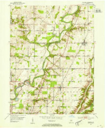
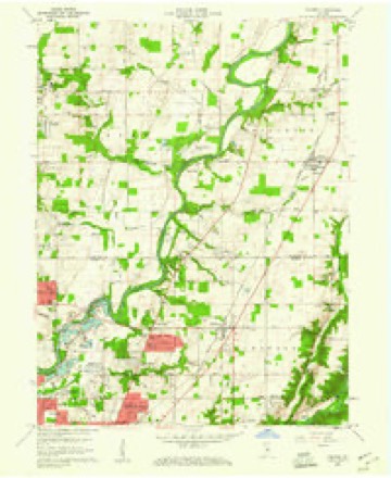
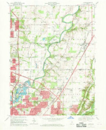
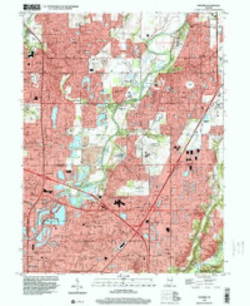
19 topographic sheets cover this place, the earliest surveyed in 1952 and the latest in 1998. It stands in Lawrence Township. It lies in ZIP code area 46250. It stands on Castle Creek. The Survey maps it on the Fishers quadrangle.
Topographic sheets covering this place
9 surveys from 19 printed sheetsMatched by testing this settlement's coordinate against the published boundary of every sheet in the United States Geological Survey's historical collection. Each opens the scanned sheet at the Survey.
- 1952 USGS Fishers quadrangle1:24000
- 1953 USGS Indianapolis quadrangle1:250000, 4 printings
- 1956 USGS Indianapolis quadrangle1:250000
- 1957 USGS Indianapolis quadrangle1:250000, 2 printings
- 1959 USGS Fishers quadrangle1:24000, 2 printings
- 1962 USGS Indianapolis quadrangle1:250000
- 1967 USGS Fishers quadrangle1:24000, 5 printings
- 1986 USGS Indianapolis quadrangle1:100000, 2 printings
- 1998 USGS Fishers quadrangle1:24000





In the county-history sources
25,786 words on this townshipHistory of Indianapolis and Marion County, Indiana, published 1884 names this settlement in its chapter on Lawrence Township. These are the passages that mention it, exactly as the scans read.
The number of their children was ten, two of whom never came into this county, and but three are now living. Margaret lived here twenty years, married, went to Missouri, and died, aged eighty-two. Polly married James Giles. Died about 1831. Katie lived in this county forty years ; married James Gittleman. Died in Kansas in May, 1883, of apoplexy, at the age of eighty-nine. Elisha (first settler in Lawrence as before mentioned). Joshua (noticed elsewhere). Helen ijiarried Alexander McClaren. Died two years ago in Illinois, at the age of seventy-two. Lived in this county thirty years, and was thirty-five when she left. Lucinda lives at Lathrop, Mo. She lived in this county forty years. Rachel married Moses McClaren, and lives in this county, one mile west of Castleton. She was fourteen years old when her parents came to this county, and has lived here ever since. Aged seventythree.
Passage source: History of Indianapolis and Marion County, Indiana, published 1884.
William Orpurd, an old pioneer of Lawrence township, was born in Frederick County, Md., Nov. 9, 1793. He served in the war of 1812 from commencement to close, and afler discharge from the army he emigrated to Indiana. He came to this county in 1821, and located on what is known as the Metzger farm, on White River. In the year 1830 he entered eighty acres about one mile southwest of where Castleton now is, and resided upon it until his death, which occurred Aug. 5, 1871. On Aug. 18, 1824, he was united in marriage to Nancy Allison, who came to this county with her parents in 1S19, and who walked every rod of the way from Kentucky to where Allisonville now is. Mr. Orpurd was a farmer. During his early residence here his living was made by clearing land and hunting deer. During the last twenty-five years of his life he was a pious man, and believed in the doctrines of the Methodist Episcopal Church. He was strictly moral and temperate in all his habits. The first school attended by his children was in a log cabin, just south of Allisonville. His wife survives him, living on the old homestead of eighty acres, and holds the old patent for the property, signed by Andrew Jackson. She joined the Methodist Episcopal Church when nineteen years of age, and although nearly eighty-seven now, she has not let her faith be shaken. During the past four years she has been alBicted with almost total blindness. The number of children born unto these pious people was six, three of whom are now living, viz. : Lavica, Calvin, and Marion. Lavica, now in her fifty-seventh year, was never married, and lives with her mother. Marion is a widow, in her forty-eighth year, and resides with her mother. Calvin went to Missouri fourteen years ago, and in 1883 moved to Kansas.
Passage source: History of Indianapolis and Marion County, Indiana, published 1884.
James T. Wright came to the township with a large family at a comparatively late period, but it can be truly said of him that he accomplished as much for the morals of the people of the township as any other man that ever resided within it. He was a minister of the Methodist Episcopal Church, and for many years labored zealously for the cause of Christianity and the welfare of his fellow-men. He was beloved by all who knew him, and the moral, temperate. Christian influences by him spread among the people were lasting. He was the founder of the Castleton Methodist Episcopal Church, and for many years preached " without money and without price" to the people at various points in the townships of Washington and Lawrence.
Passage source: History of Indianapolis and Marion County, Indiana, published 1884.
Machine-read from a century-old scan, so expect the errors a machine makes: misspelled names, dropped words, stray characters.
Read the whole chapter on Lawrence Township - it names this place 17 more 17 times.
Mines and quarries near this place
7 within 5 milesRegional context, not property-specific evidence. The federal mineral resources record lists 7 workings within 5 miles of Castleton: 5 producers, 2 past producers. 5 still produce. What was taken out: Sand and Gravel, Construction, Stone, Crushed/Broken. Distance is straight-line from the map coordinates, so a quarry counted here may appear on a neighbouring settlement's page as well.
| Where | Site | Commodity | Status | Recorded |
|---|---|---|---|---|
| Indianapolis 521 Quarry | Stone, Crushed/Broken | Producer | ||
| Carmel 512 Pit | Sand and Gravel, Construction | Producer | ||
| Eighty-Sixth Street Sand | Sand and Gravel, Construction | Producer | ||
| Fishers Sand Plant | Sand and Gravel, Construction | Producer | ||
| Indianapolis 513 Pit | Sand and Gravel, Construction | Producer | ||
| U. S. Aggregates, Inc. | Sand and Gravel, Construction | Past Producer | ||
| U. S. Allied Aggregates, Inc. | Sand and Gravel, Construction | Past Producer |
Storms near this place
34 since 1994Regional context, not property-specific evidence. The National Weather Service names Castleton in 34 storm reports between 1994 and 2026: 16 hail, 14 thunderstorm wind, 2 heavy rain, 2 flash flood. No death or injury is recorded in these reports. Each account below is quoted exactly as the forecast office filed it, from the NOAA Storm Events Database, and each date opens the federal record of that event.
| When | Event | Place named | Harm | What the report says |
|---|---|---|---|---|
| March 2026 | Thunderstorm Wind | Castleton | $20,000 | Thunderstorm wind gusts downed a large tree onto a house. |
| June 2025 | Thunderstorm Wind | Castleton | $15,000 | Large tree uprooted from thunderstorm wind gusts and fell onto a house. |
| May 2008 | Flash Flood | Castleton | $15,000 | Water was running over Interstate 465 and cars were abandoned due to flash flooding. |
| April 2020 | Thunderstorm Wind | Castleton | $10,000 | A tree was downed on a house due to thunderstorm wind gusts east of Hague ROad between 71st and 75th streets. Relayed via twitter. |
| April 2026 | Thunderstorm Wind | Castleton | $5,000 | Thunderstorm wind gusts downed multiple trees. |
| October 2013 | Thunderstorm Wind | Castleton | $3,000 | A thunderstorm wind gust, estimated at 65 mph, was observed in this location. Large trees bending halfway over and electrical transformers blowing were also observed. |
| January 2013 | Thunderstorm Wind | Castleton | $1,000 | Damage to power lines was observed on East 86th Street due to damaging thunderstorm wind gusts. |
| June 2009 | Thunderstorm Wind | Castleton | $1,000 | A thunderstorm wind gust downed a large tree near 71st Street and Shadeland Avenue. In 40 minutes, 1.3 inches of rainfall fell in this location as well. |
| August 2011 | Thunderstorm Wind | Castleton | $800 | Healthy, 5 inch diameter tree branches were blown down on Pinecreek Way due to damaging thunderstorm wind gusts. |
| June 2008 | Flash Flood | Castleton | $250 | Rain water accumulated to an estimated depth of between 2 1/2 and 3 feet over the intersection of 75th Street and Binford Avenue. An SUV stalled out in the flood water. |
| March 2017 | Thunderstorm Wind | Castleton | $100 | Small tree limbs, garden furniture, and fountains were blown down due to strong thunderstorm wind gusts. |
| March 2016 | Hail | Castleton | - | The largest stones were quarter size. |
| February 2009 | Heavy Rain | Castleton | - | A storm total of 1.74 inches of rainfall was reported. The event begin time is roughly estimated. |
| June 2009 | Hail | Castleton | - | Half dollar sized hail was observed near 75th street and Binford boulevard. |
| May 2008 | Thunderstorm Wind | Castleton | - | Trees and limbs were reported down in addition to structural damage caused by damaging thunderstorm winds. |
| August 2007 | Heavy Rain | Castleton | - | Street flooding occured in the Castleton area due to heavy rains. |
| June 2021 | Hail | Castleton | - | no account filed |
| March 2017 | Hail | Castleton | - | no account filed |
| March 2017 | Hail | Castleton | - | no account filed |
| March 2016 | Hail | Castleton | - | no account filed |
| April 2012 | Hail | Castleton | - | no account filed |
| April 2012 | Hail | Castleton | - | no account filed |
| July 2012 | Hail | Castleton | - | no account filed |
| July 2012 | Hail | Castleton | - | no account filed |
| May 2009 | Hail | Castleton | - | no account filed |
| April 2006 | Hail | Castleton | - | no account filed |
| April 2006 | Thunderstorm Wind | Castleton | - | no account filed |
| April 2006 | Hail | Castleton | - | no account filed |
| June 2005 | Hail | Castleton | - | no account filed |
| March 2003 | Hail | Castleton | - | no account filed |
| July 2002 | Thunderstorm Wind | Castleton | - | no account filed |
| August 2000 | Thunderstorm Wind | Castleton | - | no account filed |
| September 2000 | Thunderstorm Wind | Castleton | - | no account filed |
| June 1994 | Hail | Castleton | - | no account filed |
Nearest settlements
The eight closest, with where each one stands in the county. Distances are straight-line, computed from the Geographic Names Information System coordinates.
| Map | Place | Distance | Sheets |
|---|---|---|---|
| Vertland | 0.4 miles | 19 | |
| Ivy Hills | 1.2 miles | 19 | |
| Allisonville | 1.4 miles | 19 | |
| Devonshire | 1.9 miles | 19 | |
| Avalon Hills | 2.0 miles | 19 | |
| Fairwood Hills | 2.0 miles | 19 | |
| Mayflower Meadows | 2.4 miles | 19 | |
| Pleasant Acres | 2.9 miles | 19 |
Provenance
This settlement is recorded in the Geographic Names Information System as feature 432233. The sheet list is computed by point-in-boundary test against the United States Geological Survey's historical topographic inventory. Both are works of the United States government and carry no copyright under 17 U.S.C. 105.
Mines and quarries. USGS Mineral Resources Data System (MRDS) https://mrdata.usgs.gov/mrds/ A work of the United States government, no copyright under 17 U.S.C. 105.
Storms. NOAA National Centers for Environmental Information, Storm Events Database https://www.ncei.noaa.gov/stormevents/ A work of the United States government, no copyright under 17 U.S.C. 105. Narratives are quoted verbatim from the National Weather Service report and are not edited or summarised.