 Block
Bethel, Indiana
13 topographic sheets cover this place, the earliest surveyed in 1953 and the latest in 1986. It stands in Harrison Township. It lies in ZIP code area 47396. It stands on Jakes Creek. The Survey maps it on the Gilman quadrangle. It stands 886 feet above sea level.
On record in Bethel
Buildings and businesses the archive holds for this place. Each opens its own page, with the source record it came from.
On the National Register 1 record
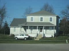 Garner, Job-Miller, Jacob W., Houselisted 1986
Topographic sheets covering this place
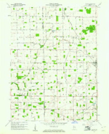
4 surveys from 13 printed sheetsMatched by testing this settlement's coordinate against the published boundary of every sheet in the United States Geological Survey's historical collection. Each opens the scanned sheet at the Survey.
- 1953 USGS Muncie quadrangle1:250000, 5 printings
- 1956 USGS Muncie quadrangle1:250000
- 1960 USGS Gaston quadrangle1:24000, 4 printings
- 1986 USGS Muncie quadrangle1:100000, 3 printings



In the county-history sources
14,234 words on this townshipHistory of Delaware County, Indiana : with Illustrations and Biographical Sketches of Some of Its Prominent Men and Pioneers, published 1881 names this settlement in its chapter on Harrison Township. These are the passages that mention it, exactly as the scans read.
In the fall of 1842, Joshua Howell erected a mill on the banks of Big Kill Buck Creek, about a mile and a half below Bethel, in which he had a run of buhrs for grinding corn and supplying the neighborhood with meal. This was one of the primitive contrivances so often found in new settlements, and was only designed to subserve a baoe: (2 ary purpose.
Passage source: History of Delaware County, Indiana : with Illustrations and Biographical Sketches of Some of Its Prominent Men and Pioneers, published 1881.
In the year 1851, Jacob W. Miller completed a small brick storeroom adjoining his residence on the old Job Garner farm, and, in September of that year, went to Cincinnati, Ohio, and purchased a stock of merchandise, consisting of dry goods and groceries, which he hauled to his store in three wagons. He conducted a good trade here, renewing his stock from year to year until about 1855, when he sold the remnant of his stock to William Moore. During this time, he also served as Postmaster. Mr. Moore established himself at the village of Bethel, where he continued in trade about a year, and was succeeded by James K. Trimble, to whom Mr. Miller had the office of Postmaster transferred. Mr. Trimble sold his stock to Charles Kirk two or three years later, who continued to sell goods for several years longer. The office of Postmaster passed to Dr. Samuel E. Mitchell, the principal physician at that period, 3
Passage source: History of Delaware County, Indiana : with Illustrations and Biographical Sketches of Some of Its Prominent Men and Pioneers, published 1881.
During the earlier years of the settlement, there were a number of self-constituted physicians, but none whose qualifications would fairly entitle them to that hame, until the arrival of Dr. Samuel KE. Mitchell, in 1853 or 1854. He settled at the village of Bethel, where he practiced successfully until his decease. Dr. William J. Morgan settled at Bethel in 1867, continuing to practice there until 1875, when he removed to Gilman, Madison Co., Ind. Dr. Milton Ricks js the only practicing physician in the township at this time (Nov ember, 1880).
Passage source: History of Delaware County, Indiana : with Illustrations and Biographical Sketches of Some of Its Prominent Men and Pioneers, published 1881.
Machine-read from a century-old scan, so expect the errors a machine makes: misspelled names, dropped words, stray characters.
Read the whole chapter on Harrison Township - it names this place 3 more 3 times.
Fires near this place
1 since 2004Regional context, not property-specific evidence. The federal wildfire occurrence database lists 1 fire within 5 miles of Bethel in 2004, burning about 1 acre in total. None started naturally. None was recorded as arson. Distance is straight-line from the map coordinates, so a fire counted here may appear on a neighbouring settlement's page as well.
| Reported cause | Fires |
|---|---|
| Recreation and ceremony | 1 |
The most recent of them, most recent first, with the day each was reported and the service that recorded it.
| Date | Cause | Size | Reported by | Name on the report |
|---|---|---|---|---|
| 30 October 2004 | Recreation and ceremony | 1.0 acres | Indiana State Fire Marshal's Office | not named |
Settlements close enough to share some of these fires:
Mines and quarries near this place
1 within 5 milesRegional context, not property-specific evidence. The federal mineral resources record lists 1 working within 5 miles of Bethel: 1 past producer. None of them still produces. What was taken out: Sand and Gravel, Construction. Distance is straight-line from the map coordinates, so a quarry counted here may appear on a neighbouring settlement's page as well.
| Where | Site | Commodity | Status | Recorded |
|---|---|---|---|---|
| Riddle Sand and Gravel Pit | Sand and Gravel, Construction | Past Producer |
Storms near this place
5 since 2001Regional context, not property-specific evidence. The National Weather Service names Bethel in 5 storm reports between 2001 and 2011: 5 thunderstorm wind. No death or injury is recorded in these reports. Each account below is quoted exactly as the forecast office filed it, from the NOAA Storm Events Database, and each date opens the federal record of that event.
| When | Event | Place named | Harm | What the report says |
|---|---|---|---|---|
| June 2008 | Thunderstorm Wind | Bethel | $40,000 | Thunderstorm winds damaged the roof of Wes-Del High School and brought down tree limbs and utility lines in the immediate area. Other tree and utility line damage of a scattered nature was reported to the north from Gaston to Eaton and Shideler to Albany. |
| June 2008 | Thunderstorm Wind | Bethel | $10,000 | Thunderstorm winds blew a semi truck over on SR 69 at mile marker 46. |
| May 2011 | Thunderstorm Wind | Bethel | - | A 70 mph thunderstorm wind gust was reported in this location. |
| May 2011 | Thunderstorm Wind | Bethel | - | A 70 mph thunderstorm wind gust was reported in this location. |
| June 2001 | Thunderstorm Wind | Bethel | - | no account filed |
Nearest settlements
The eight closest, with where each one stands in the county. Distances are straight-line, computed from the Geographic Names Information System coordinates.
| Map | Place | Distance | Sheets |
|---|---|---|---|
| Reed Station | 2.6 miles | 14 | |
| Cammack | 3.5 miles | 17 | |
| Gaston | 4.7 miles | 13 | |
| Anthony | 5.5 miles | 13 | |
| Yorktown | 5.7 miles | 17 | |
| Andersonville | 5.9 miles | 17 | |
| West Muncie | 6.1 miles | 17 | |
| Stockport | 6.2 miles | 13 |
Elsewhere
Matched on this settlement's Geographic Names Information System number rather than its name, so it cannot be a different place of the same name in another state.
| Wikipedia article on Bethel | An encyclopaedic summary. Its text is share-alike, so it is linked here rather than copied. |
| Wikidata item Q4897813 | The structured record the population and elevation above come from. Public domain (CC0). |
Provenance
This settlement is recorded in the Geographic Names Information System as feature 430880. The sheet list is computed by point-in-boundary test against the United States Geological Survey's historical topographic inventory. Both are works of the United States government and carry no copyright under 17 U.S.C. 105.
Wildfire. Short, Karen C. 2022. Spatial wildfire occurrence data for the United States, 1992-2020 [FPA_FOD_20221014]. 6th Edition. Fort Collins, CO: Forest Service Research Data Archive. https://doi.org/10.2737/RDS-2013-0009.6 Collected with United States Government funding and usable without additional permissions or fees.
Mines and quarries. USGS Mineral Resources Data System (MRDS) https://mrdata.usgs.gov/mrds/ A work of the United States government, no copyright under 17 U.S.C. 105.
Storms. NOAA National Centers for Environmental Information, Storm Events Database https://www.ncei.noaa.gov/stormevents/ A work of the United States government, no copyright under 17 U.S.C. 105. Narratives are quoted verbatim from the National Weather Service report and are not edited or summarised.