| July 1998 | Lightning | Muncie | 1 killed | Man fatally struck by lightning while fishing at Prairie Creek Reservoir during pre-dawn hours. |
| September 1961 | Tornado (F3) | not stated | 1 hurt, $250,000 | no account filed |
| June 2008 | Thunderstorm Wind | Muncie | 1 hurt, $45,000 | A man was seriously injured and suffered head and neck injuries when a tree fell on his van. A tree also fell on the man's mobile home. Two other motorists had trees fall on their vehicles as well. A semi was also overturned due to the damaging thunderstorm winds. |
| September 2011 | Thunderstorm Wind | Morningside | 1 hurt, $28,000 | A large tree damaged 9 cars and injured 1 person in McCulloch Park between East Highland Avenue and McCulloch Boulevard. The injury was believed to be minor. The large tree was downed due to damaging thunderstorm wind gusts. |
| August 2005 | Lightning | Muncie | 1 hurt | Coby A. Harmon, 30, of Muncie, was struck and killed by lightning early Saturday morning in the parking lot of a local bar. His body was discovered shortly after 10:30 a.m. Saturday morning. |
| July 1999 | Thunderstorm Wind | Muncie | 1 hurt | no account filed |
| May 2000 | Hail | Cowan | $15,000,000 | no account filed |
| July 2024 | Thunderstorm Wind | Cross Rds | $4,500,000 | Thunderstorm winds blew trees limbs over 100 feet and lifted a 4.5-ton air-conditioner unit off of its base, tipping it on its side and blowing components 35 feet. |
| March 2024 | Tornado (EF2) | Selma | $4,000,000 | The tornado started northwest of Selma northwest of Truitt Rd damaging roofs|on homes. It then moved east southeast through Selma damaging a|number of homes, uprooting and snapping trees, and knocking over|some utility poles. Highest wind intensity in Selma, indicated by|extensive damage to a couple homes, was estimated at 120 mph, or|EF2 on the Enhanced Fujita Scale. Maximum path width through Selma|was about 125-175 yards. |
| September 2002 | Tornado (F2) | Muncie | $3,000,000 | no account filed |
| April 1996 | Thunderstorm Wind | Muncie | $250,000 | no account filed |
| February 1992 | Tornado (F1) | not stated | $250,000 | no account filed |
| June 1989 | Tornado (F1) | not stated | $250,000 | no account filed |
| June 1973 | Tornado (F1) | not stated | $250,000 | no account filed |
| November 1965 | Tornado (F3) | not stated | $250,000 | no account filed |
| April 2025 | Tornado (EF1) | Devon Park | $200,000 | This tenth tornado to impact central Indiana was the last of five tornadoes spawned within Madison County and Delaware County, and the last of three secondary tornadoes to track within these two counties, tracking to the south of the main tornado. The tornado tracked between the Anthony area and the Delaware County Airport, approaching the Shideier community before ending. Sporadic damage along the track indicates the circulation was not continually on the ground as the tornado was likely embedded within the parent storm's rear flank downdraft. The tornado was strongest at its onset where it destroyed a barn by collapsing its walls, and at the track's end where it completely destroyed a farm outbuilding. Peak wind gusts were 100 mph. |
| August 2000 | Lightning | Yorktown | $200,000 | no account filed |
| August 2000 | Thunderstorm Wind | Muncie | $200,000 | no account filed |
| June 2011 | Lightning | Mayfield | $150,000 | A Muncie church fire that left a firefighter dead on June 15 was caused by a lightning strike. Muncie Fire Department officials announced the cause of the fire on Tuesday. Officials say a lightning strike at 10:45 a.m. that morning sparked the fire. Firefighter Scott Davis, 40, died fighting the blaze. Two other firefighters were injured fighting the fire at Tabernacle of Praise. |
| July 2002 | Thunderstorm Wind | Muncie | $125,000 | no account filed |
| August 2010 | Lightning | Mayfield | $120,000 | A split-level home was reportedly struck by lightning on East Gilbert Street in Muncie. Lightning struck near the bedroom window and the house started smoking. According to the Muncie fire department, the house was pretty well destroyed. |
| March 2023 | Thunderstorm Wind | Delaware Co Arpt | $110,000 | Thunderstorm winds gusted as high as 67 mph at the KMIE Delaware County Airport ASOS. County EMA reported multiple trees and power lines down across Delaware County, while a roof was partially blown off a house in Albany. |
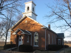
| June 2008 | Lightning | Muncie | $100,000 | Lightning struck a church and caught the church on fire. |
| October 1996 | Thunderstorm Wind | Muncie | $100,000 | no account filed |
| November 2017 | Tornado (EF2) | Eaton | $90,000 | A long track, EF2 tornado, with winds estimated at 134 mph, started northeast of Eaton in Delaware County then traveled into Blackford County and then into Ohio. Mainly tree damage in Delaware County until the Delaware-Blackford County border, where a Quonset hut was collapsed. Several tractors and a vintage Harley Davidson were inside and heavily damaged. Winds in this location before pushing into Blackford County were estimated at 120 mph. More significant damage was done farther north along the path. |
| July 2022 | Thunderstorm Wind | Morningside | $80,000 | Widespread minor tree damage across the town of Muncie due to thunderstorm wind gusts. One large tree limb was snapped and broke into a house with another large tree uprooted into a house. |
| July 2025 | Thunderstorm Wind | Smithfield | $60,000 | Thunderstorm winds downed multiple trees and damaged a school roof and baseball field dugouts. |
| August 2016 | Flash Flood | Mayfield | $60,000 | Muncie Fire Department blocked roads east of Madison Street and south of Memorial Drive through 18th Street due to flash flooding from heavy thunderstorm rainfall. Water rescues were occurring on the south side of Muncie. No reports of any injuries. |
| April 2025 | Flash Flood | West Muncie | $50,000 | Street flooding and flowing water over the roads throughout Muncie. Rain amounts varied from 1.5 to 2.6 inches. |
| September 2024 | Tornado (EF0) | Cammack | $50,000 | The landspout occurred at the northern end of the small Cammack neighborhood within the north side of the Yorktown area, specifically immediately east of the northern end of Cammack Street. Here the narrow vortex tracked to the east-northeast, quasi-parallel, yet across the longitudinal axis of a 200 by 80 foot pole barn. The landspout both began and ended at approximately 1839 EST.||The barn sustained damage to portions of its west side where the wall collapsed inwards; although little to no damage occurred to the frame/structure of the building. |Primarily sheet metal was blown inward into the building and outward back to the west, while remaining parts of the metal building were not damaged. No other damage was found to adjacent properties. |
| November 2017 | Thunderstorm Wind | Muncie | $50,000 | The Muncie Fieldhouse had brick facade damage at the top of the building due to damaging thunderstorm wind gusts. It punctured a large hole in the roof and ruptured sprinkler pipes as big as four inches wide. |
| June 2015 | Flash Flood | Muncie | $50,000 | Cars were stalled and water rescues were performed in Muncie due to heavy thunderstorm rainfall. |
| August 2006 | Lightning | Muncie | $50,000 | A house fire was started by a lightning strike. The home suffered fire damage in the attic and rear portion, with smoke and water damage throughout. |
| May 2000 | Thunderstorm Wind | Eaton | $50,000 | Law enforcement reported an overturned trailer on Interstate 69 at the 51mile marker. Also numerous trees and power lines down including one on a house that caused roof and porch damage. |
| May 2002 | Flash Flood | Countywide | $50,000 | no account filed |
| May 2002 | Flash Flood | Muncie | $50,000 | no account filed |
| March 2026 | Thunderstorm Wind | Yorktown | $40,000 | Thunderstorm wind gusts downed multiple trees and powerlines. A pole barn was also damaged. |
| July 2019 | Thunderstorm Wind | Morningside | $40,000 | An estimated 60 mph thunderstorm wind gust was observed in Muncie. Multiple trees and branches were reported down across the city, with at least one onto a home. Roof damage to a home was also reported. A few power poles and lines were downed as well. |
| June 2008 | Thunderstorm Wind | Bethel | $40,000 | Thunderstorm winds damaged the roof of Wes-Del High School and brought down tree limbs and utility lines in the immediate area. Other tree and utility line damage of a scattered nature was reported to the north from Gaston to Eaton and Shideler to Albany. |
| March 2019 | Thunderstorm Wind | Eaton | $35,000 | Three homes sustained damage with one having the roof blown off due to damaging thunderstorm wind gusts. Some vehicles also sustained damage. |
| April 2025 | Lightning | Daleville | $30,000 | A vehicle was struck by lightning on Interstate 69. No injuries were reported but the vehicle was a total loss after catching in fire. |
| December 2021 | Thunderstorm Wind | Selma Arpt | $30,000 | Numerous reports of trees and or power lines blown down by thunderstorm wind gusts across southeast Delaware County. A tree fell into a house in Selma. |
| February 2019 | Flash Flood | Selma | $30,000 | Water was reported to be flowing over numerous roads in eastern Delaware County, with at least one report of a car stalling, due to flash flooding from heavy rainfall. |
| July 2019 | Flash Flood | Morningside | $30,000 | A car was stuck in high water in front of the Dollar General in this location due to heavy thunderstorm rainfall. There was a water rescue just east of where the entire roadway is flooded. There was another water rescue from a car near the area. |
| March 2026 | Thunderstorm Wind | Daleville | $25,000 | Thunderstorm wind gusts caused tree damage and roof damage to a pole barn. |
| July 2025 | Flash Flood | Muncie Reese Arpt | $25,000 | Car stalled in floodwaters at Memorial Ave and Port Ave. Several reports of water covering intersections to over a foot deep in and near Muncie. |
| July 2022 | Flash Flood | West Muncie | $25,000 | Multiple road closures across much of the county with most severe flooding in Muncie. Several cars stalled in the floodwaters with rescues needed. 24 rainfall amounts were highest in Muncie and Yorktown with reports of 6.00 and 6.26 inches at each location. |
| August 2021 | Thunderstorm Wind | Muncie | $25,000 | Report of partial collapse of an unoccupied metal warehouse structure. |
| March 2020 | Flash Flood | Daleville | $25,000 | Eighteen inches of water was flowing over the intersection of Tillotson and Euclid avenues. There were several water rescues that occurred in Muncie as well as numerous road closures between Anderson and Muncie due to rapidly rising waters. |
| June 2008 | Thunderstorm Wind | Gaston | $25,000 | The thunderstorm winds blew two semi trucks over and caused numerous trees and power lines to fall. |
| May 1963 | Tornado (F1) | not stated | $25,000 | no account filed |
| May 1960 | Tornado (F2) | not stated | $25,000 | no account filed |
| April 1957 | Tornado (F2) | not stated | $25,000 | no account filed |
| November 2017 | Tornado (EF1) | Muncie | $20,000 | Brief EF1 tornado within the heart of Muncie, with winds estimated at 95 mph, destroyed a garage, removed roof panels from a couple houses, snapped numerous trees, and uprooted a large tree then deposited it north of another large tree that was north of it.||A large bow echo on radar producing widespread straight line wind damage spun up this small, brief EF1 tornado. |
| December 2013 | Flash Flood | Muncie Reese Arpt | $20,000 | Multiple water rescues were reported from across the county for motorists stranded in flooded roadways. Multiple road closures including U.S. Highway 35 at County Road 300 South. |
| July 2012 | Thunderstorm Wind | Muncie | $20,000 | Roof damage occurred to the Muncie Mall on the east side due to damaging thunderstorm wind gust. Water damage was occurring too. |
| March 2008 | Flood | Delaware Co Arpt | $20,000 | Flooding occurred along the White River in Delaware County, including near Muncie, due to heavy rain. Multiple County Roads were closed with high water near the White River. On the 19th, one woman had to be rescued from her car after she drove into flood waters. No injuries were reported. |
| March 2007 | Flood | Muncie | $20,000 | Heavy rain caused flooding on roadways in Muncie. Flooding affected a few homes and trailer parks. State Road 32 was closed by high water. |
| August 2003 | Tornado (F0) | Albany | $20,000 | Distinct right moving supercell produced a weak tornado near Albany. The tornado continued northeast into Jay county in the Northern Indiana CWA. A barn was destroyed and a couple of homes recieved minor damage, otherwise there was only damage to trees. |
| March 2022 | Thunderstorm Wind | Desoto | $18,000 | Thunderstorm winds blew poles down at intersection of County Roads 650 East and 500 North. |
 Block