 Block
Bremen, Indiana
13 topographic sheets cover this place, the earliest surveyed in 1953 and the latest in 1984. It stands in German Township. It lies in ZIP code area 46506. It stands on Middle Fork Yellow River. The Survey maps it on the Bremen quadrangle. 4,696 people lived here at the 2020 count. It stands 853 feet above sea level.
On record in Bremen
Buildings and businesses the archive holds for this place. Each opens its own page, with the source record it came from.
On the National Register 5 records
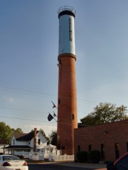 Bremen Water Towerlisted 2013
 Dietrich-Bowen Houselisted 1978
- Bremen Commercial Historic Districtlisted 2017
- Bremen Residential Historic Districtlisted 2017
- Center Street Stone & Concrete Arch Bridgelisted 2026
Population over time
2 figuresBremen grew from 4,588 to 4,696 between 2010 and 2020. These are the recorded population figures Wikidata holds for this place, reached through the Geographic Names Information System number this page is keyed on rather than by name, so they belong to this place and not to another of the same name. Most are census counts, but not all are: an early figure may be a founding or settlement estimate, and an estimate published within five years of a census is left out. The change column is computed, and is left blank where more than 20 years separate a figure from the one before it, because a gap that long is not a change between two counts.
| Year | People | Change |
|---|---|---|
| 2010 | 4,588 | |
| 2020 | 4,696 | +108 (+2%) |
Topographic sheets covering this place
4 surveys from 13 printed sheetsMatched by testing this settlement's coordinate against the published boundary of every sheet in the United States Geological Survey's historical collection. Each opens the scanned sheet at the Survey.
- 1953 USGS Chicago quadrangle1:250000, 5 printings
- 1957 USGS Chicago quadrangle1:250000
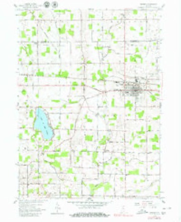
- 1958 USGS Bremen quadrangle1:24000, 5 printings
- 1984 USGS Knox quadrangle1:100000, 2 printings


In the county-history sources
366 words on this townshipMcDonald, Daniel - History Of Marshall County, Indiana 1836-1880 (Kingman Bros., 1881), published 1881 names this settlement in its chapter on German Township. These are the passages that mention it, exactly as the scans read.
Clayton was the name of the first town site located in German Township. This was August 21, 1837. The proprietors were Lathrop M. Taylor and Henry Augustine, of South Bend. Mr. Taylor was at that time Clerk of St. Joseph County. The location was about three miles east of the present town of Bremen. Its form was a diagonal, cut up into gorgeous streets and avenues. But the center of gravity did not seem to be in that region, and the project of building a town there was abandoned.
Passage source: McDonald, Daniel - History Of Marshall County, Indiana 1836-1880 (Kingman Bros., 1881), published 1881.
The town of Bremen, the present seat of justice of German Township, was platted and laid out by George Beiler October 21, 1851. The original plat contained forty-eight lots. Since that time, the following additions have been made to the original plat: Deitrick's, Heim's, Ringle's, Bauer's first and second, Foltz's continued, Mast's, L. R. Martin's, D. Ringle's, Koontz's, Vanner's and J. P. Huff's. The town was organized under the law authorizing the corporation of towns, at the March term, 1871, of the Board of Commissioners. It was divided into six districts. The officers first elected were: Lewis Theobold, Clerk and Treasurer; David Guyer, Marshal; Chris Seiler, Assessor; John Heckaman, Charles Lehr, Chris Hans, John Koontz, Jacob Walter and Chris Schilt, Trustees. In 1572, the town was re-districted, and the
Passage source: McDonald, Daniel - History Of Marshall County, Indiana 1836-1880 (Kingman Bros., 1881), published 1881.
Machine-read from a century-old scan, so expect the errors a machine makes: misspelled names, dropped words, stray characters.
Storms near this place
24 since 1994Regional context, not property-specific evidence. The National Weather Service names Bremen in 24 storm reports between 1994 and 2024: 18 thunderstorm wind, 5 hail, 1 lightning. The reports record 2 injuries. Each account below is quoted exactly as the forecast office filed it, from the NOAA Storm Events Database, and each date opens the federal record of that event.
| When | Event | Place named | Harm | What the report says |
|---|---|---|---|---|
| June 2006 | Lightning | Bremen | 2 hurt | 12 year old girl and 15 year old boy in a paddle boat struck by lightning. Occurred on Lake of the Woods. Children suffered severe burns. Officials reported no signs of lightning damage to paddle boat. |
| August 2024 | Thunderstorm Wind | Bremen | $25,000 | Large tree of 18 to 24 inches in diameter was down onto a car. |
| June 2009 | Thunderstorm Wind | Bremen | $25,000 | Trained spotters reported numerous trees down in Bremen. In addition, a local newspaper reported that the Bremen Ford dealership had several showroom windows blown out with some water damage. A nearby Chevrolet dealership found a hold in the rear window on a delivery van, but no evidence of what caused the damage. Damage is estimated in the area at $25,000. |
| June 2024 | Thunderstorm Wind | Bremen | $10,000 | Trees down on power lines. |
| July 2005 | Thunderstorm Wind | Bremen | $1,000 | Trees and power lines reported blown down. |
| June 2021 | Thunderstorm Wind | Bremen | - | Trees down across much of Marshall County, especially from the northern end of the county near Teegarden to La Paz and Bremen along US 6. |
| July 2017 | Thunderstorm Wind | Bremen | - | The public reported several small branches and a few larger branches were blown down. |
| June 2015 | Thunderstorm Wind | Bremen | - | A tree fell on a powerline on the 300 block of South Whitlock. |
| June 2014 | Thunderstorm Wind | Bremen | - | The public reported several trees down as well as at least one power pole in the Bremen area. |
| September 2014 | Thunderstorm Wind | Bremen | - | Emergency management officials reported a tree was blown down on South Washington Street. |
| August 2013 | Thunderstorm Wind | Bremen | - | The public estimated a 60 mph wind gust. |
| May 2011 | Thunderstorm Wind | Bremen | - | Emergency management officials reported several travel campers being destroyed or blown off their blocks. |
| May 2011 | Thunderstorm Wind | Bremen | - | Emergency management officials reported a tree down in the 1800 block of U.S. 6. |
| May 2005 | Thunderstorm Wind | Bremen | - | Tree blown over. |
| May 2004 | Thunderstorm Wind | Bremen | - | Law enforcement reported trees down in Bremen. |
| July 2004 | Thunderstorm Wind | Bremen | - | Large tree blown down. |
| August 2003 | Thunderstorm Wind | Bremen | - | Several trees down in the northern part of the county, |
| June 1994 | Thunderstorm Wind | Bremen | - | Trees were blown down. |
| June 1994 | Thunderstorm Wind | Bremen | - | Two 6-inch-diameter trees were blown down. |
| March 2017 | Hail | Bremen | - | no account filed |
| June 2012 | Hail | Bremen | - | no account filed |
| June 2006 | Hail | Bremen | - | no account filed |
| March 2004 | Hail | Bremen | - | no account filed |
| June 1994 | Hail | Bremen | - | no account filed |
Nearest settlements
The eight closest, with where each one stands in the county. Distances are straight-line, computed from the Geographic Names Information System coordinates.
| Map | Place | Distance | Sheets |
|---|---|---|---|
| Lake of the Woods | 4.3 miles | 13 | |
| Linkville | 7.7 miles | 11 | |
| La Paz Junction | 7.8 miles | 11 | |
| Harris | 8.5 miles | 11 | |
| La Paz | 8.5 miles | 11 | |
| Inwood | 9.4 miles | 11 | |
| Bourbon | 10.5 miles | 12 | |
| Plymouth | 11.1 miles | 11 |
Elsewhere
Matched on this settlement's Geographic Names Information System number rather than its name, so it cannot be a different place of the same name in another state.
| Wikipedia article on Bremen | An encyclopaedic summary. Its text is share-alike, so it is linked here rather than copied. |
| Wikidata item Q907391 | The structured record the population and elevation above come from. Public domain (CC0). |
Provenance
This settlement is recorded in the Geographic Names Information System as feature 431479. The sheet list is computed by point-in-boundary test against the United States Geological Survey's historical topographic inventory. Both are works of the United States government and carry no copyright under 17 U.S.C. 105.
Storms. NOAA National Centers for Environmental Information, Storm Events Database https://www.ncei.noaa.gov/stormevents/ A work of the United States government, no copyright under 17 U.S.C. 105. Narratives are quoted verbatim from the National Weather Service report and are not edited or summarised.