 Block
Plymouth, Indiana
11 topographic sheets cover this place, the earliest surveyed in 1953 and the latest in 1984. It stands in Center Township. It lies in ZIP code area 46563. The Survey maps it on the Plymouth quadrangle. 10,214 people lived here at the 2020 count. It stands 797 feet above sea level.
Research this city
On record in Plymouth
Buildings and businesses the archive holds for this place. Each opens its own page, with the source record it came from.
On the National Register 12 of 13 shown
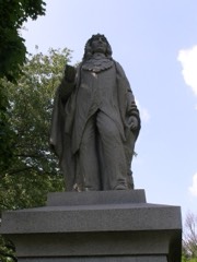 Chief Menominee Memorial Sitelisted 2010
 East Laporte Street Footbridgelisted 1981
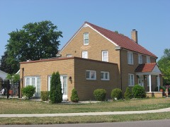 Heminger Travel Lodgelisted 2001
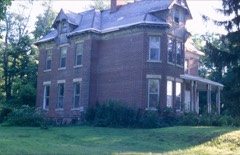 Hoham-Klinghammer-Weckerle House and Brewery Sitelisted 2012
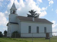 Jacoby Church and Cemeterylisted 2007
 Marshall County Court Houselisted 1983
 Marshall County Infirmarylisted 2000
 Plymouth Downtown Historic Districtlisted 2017
 Plymouth Fire Stationlisted 1981
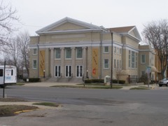 Plymouth Northside Historic Districtlisted 2013
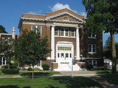 Plymouth Southside Historic Districtlisted 2013
 Ramsay-Fox Round Barn and Farmlisted 2012
Population over time
2 figuresPlymouth grew from 10,033 to 10,214 between 2010 and 2020. These are the recorded population figures Wikidata holds for this place, reached through the Geographic Names Information System number this page is keyed on rather than by name, so they belong to this place and not to another of the same name. Most are census counts, but not all are: an early figure may be a founding or settlement estimate, and an estimate published within five years of a census is left out. The change column is computed, and is left blank where more than 20 years separate a figure from the one before it, because a gap that long is not a change between two counts.
| Year | People | Change |
|---|---|---|
| 2010 | 10,033 | |
| 2020 | 10,214 | +181 (+2%) |
Topographic sheets covering this place
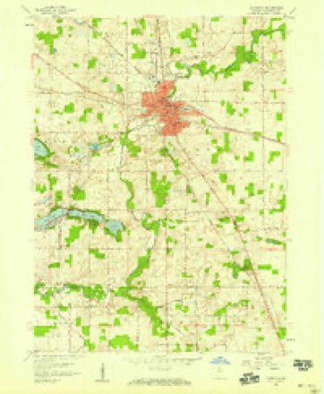
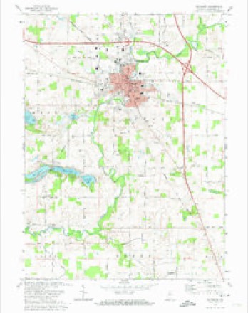
5 surveys from 11 printed sheetsMatched by testing this settlement's coordinate against the published boundary of every sheet in the United States Geological Survey's historical collection. Each opens the scanned sheet at the Survey.
- 1953 USGS Chicago quadrangle1:250000, 5 printings
- 1957 USGS Chicago quadrangle1:250000
- 1957 USGS Plymouth quadrangle1:24000
- 1972 USGS Plymouth quadrangle1:24000, 2 printings
- 1984 USGS Knox quadrangle1:100000, 2 printings


What happened here
An account from the chapter on Center township. The inset identifies its exact source book and publication year.
Thomas K. Houghton
Mr. Houghton is the descendant of British and American parents. His father, John Houghton, was born at Swanwick, near Southampton, Wngland, December 12, 1790. He was a ship-carpenter, and was oneof the workmen engaged in repairing the ship Victory, upon whose decks Lord Nelson was killed at Trafalgar. He subsequently served in the merchant marine, under George III, of England, acting in the capacity of carpenter, and, after visiting nearly all the ports in the civilized world, came to the United States and adopted the life of a farmer.
In the county-history sources
55,664 words on this townshipMcDonald, Daniel - History Of Marshall County, Indiana 1836-1880 (Kingman Bros., 1881), published 1881 names this settlement in its chapter on Center Township. These are the passages that mention it, exactly as the scans read.
In 1840, and prior to that time, as before stated, Center Township comprised what is now Center, Bourbon and West Townships, Among those who were settlers here at that time, and prior to that date, are the following: Andrew Argo, Lot Abrams, Abram F. Ackerman, John Anderson, John Astley, Lyman H. Andrews, William Bishop, John G. Burch, Ransom Barber, William Bowen, Daniel B. Barber, Martin Bailey, Anthony §. Bunnell, Daniel Barber, Jr., William Baker, Norton S. Bureh, Sooy Belangee, George Bradbury, Enoch Brewer, Lewis Boggs, Johnson Brownlee, Calvin Bureh, James Bannon, Chester Clark, John Cougle, Henry H. Cummins, Andrew C. Cornwall, Sterling M. Cone, James A. Corse, Jacob Case, Charles Cook, Allen Crandall, Wesley J. Cruzan, Gilson 5. Cleaveland, Josephus A. Cutshaw, Joseph Camp, William M. Dunham, Samuel I. Davidson, Tolephe Downing, Joseph B. Dunn, Prank Daws, Jesse Doney, Benjamin Doney, David Etherton, Edward Eels, William C, Edwards, Elijah BE. Edwards, Joseph Furry, William J. Forhs, Austin Fuller, Stephen M. Farnsworth, William Fluellen, John Griggs, Ira Green, Moses Gunn, Henry Garver, John Greer, Joseph B. Griffith, Joseph Griffith, Sr., Lyman Griffin, Ephraim
Passage source: McDonald, Daniel - History Of Marshall County, Indiana 1836-1880 (Kingman Bros., 1881), published 1881.
Mrs. Prudy Elliot has, perhaps, lived in this township longer than any other person now here. She became a resident of Plymouth, with her father, Grove Pomeroy, in 1834, and has resided here, with the exception of a short time. on her father's farm, three miles west of Plymouth, ever since. She attended one term of school, tanght in the old court house. in 1837. Time has dealt gently with her, and she is yet an honored citizen of our sprightly three thousand eity.
Passage source: McDonald, Daniel - History Of Marshall County, Indiana 1836-1880 (Kingman Bros., 1881), published 1881.
Mrs. Henry B. Pershing is the next oldest resident of the town and township, so far as is known. She was the daughter of David Steel, who was Probate Judge of the county for many years. After uniting in marriage with H. B. Pershing, she has resided with her husband in Plymouth ever since. Of late years, she has been an invalid, the most of her time being confined to her home. -_ Gilson 5. Cleaveland is one among the oldest business men in the county. He was engaged in the mercantile trade as early as 1837; was also Recorder of the county the same year, and for fifteen years afterward.
Passage source: McDonald, Daniel - History Of Marshall County, Indiana 1836-1880 (Kingman Bros., 1881), published 1881.
Machine-read from a century-old scan, so expect the errors a machine makes: misspelled names, dropped words, stray characters.
Read the whole chapter on Center Township - it names this place 91 more 91 times.
Fires near this place
5 since 2002Regional context, not property-specific evidence. The federal wildfire occurrence database lists 5 fires within 5 miles of Plymouth between 2002 and 2007, burning about 24 acres in total. None started naturally. None was recorded as arson. Distance is straight-line from the map coordinates, so a fire counted here may appear on a neighbouring settlement's page as well.
| Reported cause | Fires |
|---|---|
| Equipment and vehicle use | 2 |
| Missing data/not specified/undetermined | 2 |
| Debris and open burning | 1 |
The most recent of them, most recent first, with the day each was reported and the service that recorded it.
| Date | Cause | Size | Reported by | Name on the report |
|---|---|---|---|---|
| 25 July 2002 | Missing data/not specified/undetermined | 15 acres | Indiana State Fire Marshal's Office | not named |
| 17 June 2007 | Equipment and vehicle use | 1.0 acres | Indiana State Fire Marshal's Office | not named |
| 20 April 2005 | Missing data/not specified/undetermined | 3.0 acres | Indiana State Fire Marshal's Office | not named |
| 29 March 2007 | Debris and open burning | 4.0 acres | Indiana State Fire Marshal's Office | not named |
| 6 November 2004 | Equipment and vehicle use | 1.0 acres | Indiana State Fire Marshal's Office | not named |
Settlements close enough to share some of these fires:
Mines and quarries near this place
3 within 5 milesRegional context, not property-specific evidence. The federal mineral resources record lists 3 workings within 5 miles of Plymouth: 2 producers, 1 past producer. 2 still produce. What was taken out: Sand and Gravel, Construction, Stone. Distance is straight-line from the map coordinates, so a quarry counted here may appear on a neighbouring settlement's page as well.
| Where | Site | Commodity | Status | Recorded |
|---|---|---|---|---|
| Marshall Co. Hwy. Dept. | Stone | Producer | ||
| Aggregate Service | Sand and Gravel, Construction | Producer | ||
| Hooker Gravel Pit | Sand and Gravel, Construction | Past Producer |
Storms near this place
60 of 70 shownRegional context, not property-specific evidence. The National Weather Service names Plymouth in 70 storm reports between 1995 and 2026: 55 thunderstorm wind, 8 hail, 3 flash flood, 2 lightning. The reports record 2 injuries. Each account below is quoted exactly as the forecast office filed it, from the NOAA Storm Events Database, and each date opens the federal record of that event.
| When | Event | Place named | Harm | What the report says |
|---|---|---|---|---|
| August 2003 | Lightning | Plymouth | 2 hurt | 2 Plymouth residents were struck by lightning near Dixon Lake. 2 men, one 19 years and the other 43 years old were waiting for a ride home after a day of fishing on the lake when they were struck by lightning. Both gentlemen suffered burns on their arms, shoulders and portions of their back and were likely knocked unconscious briefly. Both were treated at a nearby hospital and released. |
| May 2006 | Thunderstorm Wind | Plymouth | $100,000 | Numerous trees, tree limbs, power lines and poles were blown down in Plymouth. Several pine trees fell onto a residence. A few fires resulted form trees falling onto power lines as well. |
| January 2008 | Lightning | Plymouth | $90,000 | Lightning struck a three car garage attached to a house in the 11000 block of south Michigan Road. When firefighters arrived, the garage was engulfed in flames. Severe damage occurred to the garage and 3 vehicles in it, as well as smoke and water damage to portions of the house. Damage was estimated $90,000. |
| August 2007 | Thunderstorm Wind | Plymouth | $80,000 | A local newspaper reported significant damage to a residence in the 1000 block of W Lake Ave in Plymouth. 3 sheds around the residence were also damaged. Damage is estimated at $80,000. |
| August 2022 | Thunderstorm Wind | Plymouth | $30,000 | A tree is down on a house at Ewin and Balis Street. |
| August 2008 | Thunderstorm Wind | Plymouth | $25,000 | Law enforcement officials reported several trees and tree limbs down across the county. A tree fell down onto a car, totaling the vehicle, as well as causing damage to the front of a house adjacent to the parked car. Damage is estimated at $10,000 for the car, $5,000 for the front of the house, and $10,000 for power lines down and other minor structure damage in the area. |
| June 1998 | Thunderstorm Wind | Plymouth | $25,000 | NUMEROUS TREES DOWN IN TOWN AND ACROSS THE COUNTY. SEVERAL ROADS WERE BLOCKED DUE TO FALLEN TREES AND DOWNED POWER LINES. |
| July 2024 | Thunderstorm Wind | Plymouth | $20,000 | Emergency Manager reports four trees down with powerlines down on Nutmeg, south of Menominee Elementary School. |
| July 2007 | Flash Flood | Plymouth | $15,000 | Several roads were closed in the southern part of the county by flowing water around 1 foot deep. |
| March 2025 | Thunderstorm Wind | Plymouth | $10,000 | Numerous reports of tree damage around the county. Tree was reported down on a home at Pretty View Condos. |
| July 2005 | Thunderstorm Wind | Plymouth | $10,000 | Trees were reported down northwest of Plymouth. The Lapaz Town Marshall was driving on North Michigan Street in Plymouth when high winds blew a large tree down onto his patrol car. The officer saw the tree falling but was unable to react fast enough to avoid it. |
| July 2005 | Thunderstorm Wind | Plymouth | $10,000 | Several large trees were blown down. One of these large trees fell onto a car. |
| June 2023 | Hail | Plymouth | $5,000 | Twitter photos show baseball size hail in Plymouth. |
| March 2023 | Thunderstorm Wind | Plymouth | $5,000 | An amateur radio operator reports a tree down across the road. |
| August 2022 | Thunderstorm Wind | Plymouth | $5,000 | A large tree is down over the road. |
| May 2001 | Thunderstorm Wind | Plymouth | $4,000 | Large tree down on roof of house. |
| June 2001 | Thunderstorm Wind | Plymouth | $3,000 | Large tree fell near home,knocked down two NIPSCO power poles. |
| March 2023 | Hail | Plymouth | $2,000 | Ping pong ball sized hail reported. |
| July 2022 | Thunderstorm Wind | Plymouth | $2,000 | Trees down on 13th Road west of Queen Road. |
| July 2003 | Thunderstorm Wind | Plymouth | $2,000 | Law enforcement reported a tractor trailer flipped by winds on SR 31. |
| June 2002 | Thunderstorm Wind | Plymouth | $2,000 | Newspaper report of large tree limbs down on a home and a car. Slight damage to roof and gutter of home with roof and windshield damage to car. |
| June 1999 | Thunderstorm Wind | Plymouth | $2,000 | Trees down reported by Indiana state police. |
| June 2025 | Flash Flood | Plymouth | $1,000 | Emergency manager reports flooding of intersections and viaducts near downtown Plymouth, IN in Marshall County. A nearby CoCoRaHS observer recorded 2.43 inches of rain. |
| July 2023 | Thunderstorm Wind | Plymouth | $1,000 | Tree down along North Michigan Street in Plymouth. Time estimated from radar. |
| April 1998 | Thunderstorm Wind | Plymouth | $1,000 | Semi trailer blown over on US-30. Semi trailer also blown over south of Plymouth on US-31. |
| June 1995 | Thunderstorm Wind | Plymouth | $1,000 | Trees were blown down at U.S. 30 and Lylac Road near Plymouth. A funnel cloud was spotted by a pilot north of Plymouth. |
| April 2026 | Flood | Plymouth | - | A majority appears to be in normally flood-prone areas, but it has also started to hit other areas too. Up to 3 vehicle rescues. |
| May 2020 | Thunderstorm Wind | Plymouth | - | The local dispatch center reported two trees were blown down just south of Plymouth. |
| August 2020 | Thunderstorm Wind | Plymouth | - | The public reported numerous trees and power lines down across Plymouth. |
| June 2018 | Thunderstorm Wind | Plymouth | - | Local media reported a partially rotten tree was blown down onto residence. |
| February 2017 | Thunderstorm Wind | Plymouth | - | Local media reported swing sets, a few trees and trampolines blown over. |
| June 2017 | Thunderstorm Wind | Plymouth | - | The public reported a large tree was blown down. |
| July 2015 | Flash Flood | Plymouth | - | Extensive road flooding in Plymouth. 2.47 inches of rain in the past one and a half hours. |
| May 2014 | Thunderstorm Wind | Plymouth | - | Local media reported a tree was blown down onto a residence on Baker Street. |
| September 2014 | Thunderstorm Wind | Plymouth | - | Emergency management officials reported a tree was blown down on the 300 block of South Michigan. |
| September 2014 | Thunderstorm Wind | Plymouth | - | Emergency management officials reported a tree was blown down onto a vehicle at the intersection of US-31 and County Road 9A. There were reports of injuries with the initial call, but no further details could be found. |
| July 2013 | Thunderstorm Wind | Plymouth | - | The public reported a tree was partially blown down onto a garage in Plymouth. |
| June 2013 | Thunderstorm Wind | Plymouth | - | Emergency management officials reported utility lines down on Michigan Street. |
| August 2012 | Thunderstorm Wind | Plymouth | - | Emergency management officials reported trees down throughout the county, including across US 31, south of US 30. |
| April 2011 | Thunderstorm Wind | Plymouth | - | Law enforcement officials reported a tree down in the 1600 block of 9th Street. |
| May 2011 | Thunderstorm Wind | Plymouth | - | Local media reported a large tree was blown down onto a car on Michigan Street. No one was injured. |
| June 2010 | Thunderstorm Wind | Plymouth | - | Law enforcement officials reported large trees down on the west side of Plymouth. |
| June 2010 | Thunderstorm Wind | Plymouth | - | Emergency manager reports trees and power lines down across the entire county. |
| June 2009 | Hail | Plymouth | - | A trained spotter reported nickel size hail. |
| June 2009 | Thunderstorm Wind | Plymouth | - | Law enforcement officials reported a large tree, as well as power lines down near the intersection of 18th Street and Apple Street in Plymouth. |
| July 2004 | Thunderstorm Wind | Plymouth | - | Trees and power lines down. |
| August 2004 | Thunderstorm Wind | Plymouth | - | Law enforcement reported trees down in Plymouth. |
| July 2003 | Thunderstorm Wind | Plymouth | - | Law enforcement reported trees and power lines down west of Plymouth. |
| August 2001 | Thunderstorm Wind | Plymouth | - | Trees blown down. |
| May 2000 | Thunderstorm Wind | Plymouth | - | Trees down just west of Plymouth. |
| June 2000 | Thunderstorm Wind | Plymouth | - | Minor damage to siding of building. |
| June 2000 | Thunderstorm Wind | Plymouth | - | Several trees down. Camper trailers blown over. |
| June 2000 | Thunderstorm Wind | Plymouth | - | Tree down. |
| June 2000 | Thunderstorm Wind | Plymouth | - | Trees and power lines down countywide. |
| September 2000 | Thunderstorm Wind | Plymouth | - | Several trees down. |
| June 1998 | Thunderstorm Wind | Plymouth | - | NUMEROUS TREE LIMBS DOWN |
| July 1998 | Thunderstorm Wind | Plymouth | - | TREES AND POWER LINES DOWN THROUGHOUT THE COUNTY. |
| July 1998 | Thunderstorm Wind | Plymouth | - | SEVERAL TREES DOWN IN COUNTY WITH SOME MINOR ROOF DAMAGE MAINLY NORTHEAST THROUGH SOUTHEAST OF PLYMOUTH. |
| June 1997 | Thunderstorm Wind | Plymouth | - | A line of severe thunderstorms moved into western Marshall county. Winds reaching near 60 mph and heavy rain, resulted in a few small trees blown down. |
| July 1995 | Thunderstorm Wind | Plymouth | - | Trees were blown down. |
Nearest settlements
The eight closest, with where each one stands in the county. Distances are straight-line, computed from the Geographic Names Information System coordinates.
| Map | Place | Distance | Sheets |
|---|---|---|---|
| Twin Lakes | 3.7 miles | 11 | |
| Harris | 4.9 miles | 11 | |
| Linkville | 5.1 miles | 11 | |
| Inwood | 5.9 miles | 11 | |
| Tyner | 6.7 miles | 10 | |
| Lake of the Woods | 7.1 miles | 13 | |
| Donaldson | 7.2 miles | 10 | |
| Rutland | 7.3 miles | 10 |
Elsewhere
Matched on this settlement's Geographic Names Information System number rather than its name, so it cannot be a different place of the same name in another state.
| Wikipedia article on Plymouth | An encyclopaedic summary. Its text is share-alike, so it is linked here rather than copied. |
| Wikidata item Q988952 | The structured record the population and elevation above come from. Public domain (CC0). |
Provenance
This settlement is recorded in the Geographic Names Information System as feature 441379. The sheet list is computed by point-in-boundary test against the United States Geological Survey's historical topographic inventory. Both are works of the United States government and carry no copyright under 17 U.S.C. 105.
Wildfire. Short, Karen C. 2022. Spatial wildfire occurrence data for the United States, 1992-2020 [FPA_FOD_20221014]. 6th Edition. Fort Collins, CO: Forest Service Research Data Archive. https://doi.org/10.2737/RDS-2013-0009.6 Collected with United States Government funding and usable without additional permissions or fees.
Mines and quarries. USGS Mineral Resources Data System (MRDS) https://mrdata.usgs.gov/mrds/ A work of the United States government, no copyright under 17 U.S.C. 105.
Storms. NOAA National Centers for Environmental Information, Storm Events Database https://www.ncei.noaa.gov/stormevents/ A work of the United States government, no copyright under 17 U.S.C. 105. Narratives are quoted verbatim from the National Weather Service report and are not edited or summarised.