 Block
Brownsburg, Indiana
15 topographic sheets cover this place, the earliest surveyed in 1953 and the latest in 1986. It stands in Lincoln Township. It lies in ZIP code area 46112. It stands on West Fork White Lick Creek. The Survey maps it on the Brownsburg quadrangle. 28,973 people lived here at the 2020 count. It stands 879 feet above sea level.
Population over time
2 figuresBrownsburg grew from 21,285 to 28,973 between 2010 and 2020. These are the recorded population figures Wikidata holds for this place, reached through the Geographic Names Information System number this page is keyed on rather than by name, so they belong to this place and not to another of the same name. Most are census counts, but not all are: an early figure may be a founding or settlement estimate, and an estimate published within five years of a census is left out. The change column is computed, and is left blank where more than 20 years separate a figure from the one before it, because a gap that long is not a change between two counts.
| Year | People | Change |
|---|---|---|
| 2010 | 21,285 | |
| 2020 | 28,973 | +7,688 (+36%) |
Topographic sheets covering this place
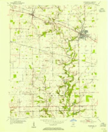
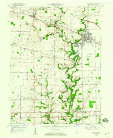
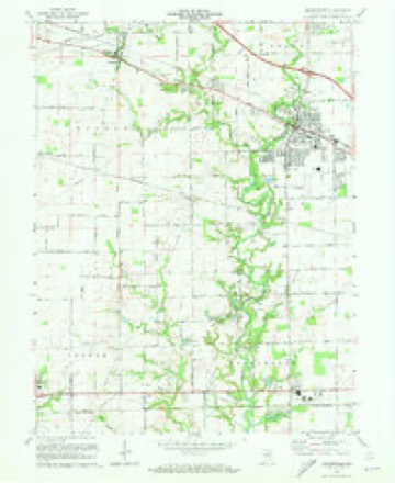
8 surveys from 15 printed sheetsMatched by testing this settlement's coordinate against the published boundary of every sheet in the United States Geological Survey's historical collection. Each opens the scanned sheet at the Survey.
- 1953 USGS Brownsburg quadrangle1:24000
- 1953 USGS Indianapolis quadrangle1:250000, 4 printings
- 1956 USGS Indianapolis quadrangle1:250000
- 1957 USGS Indianapolis quadrangle1:250000, 2 printings
- 1959 USGS Brownsburg quadrangle1:24000
- 1962 USGS Indianapolis quadrangle1:250000
- 1970 USGS Brownsburg quadrangle1:24000, 3 printings
- 1986 USGS Indianapolis quadrangle1:100000, 2 printings





In the county-history sources
7,547 words on this townshipHistory of Hendricks County, Indiana, Together with Sketches of Its Cities, Villages and Towns, Educational, Religious, Civil, Military, and Political History, Portraits of Prominent Persons, and Biographies of Representative Citizens, published 1885 names this settlement in its chapter on Lincoln Township. These are the passages that mention it, exactly as the scans read.
Lincoln , one of the smallest townships in the county, is bounded on the north by Middle and Brown, on the east by Marion Count}-, on tlie suiith by "Washington, and on the west by Middle. It was organized by act of the county commissioners in 1863, by a division of Brown Township into two very near equal parts. The surface of Lincoln is almost a level plain, except in the western part, along White Lick, where the land is broken and rolling. Tb.e land along the stream is rich. The level portion has a very diversified soilj the black alluvial part is very rich and productive, while some of its clay soil is third rate in its advantages for production.
Passage source: History of Hendricks County, Indiana, Together with Sketches of Its Cities, Villages and Towns, Educational, Religious, Civil, Military, and Political History, Portraits of Prominent Persons, and Biographies of Representative Citizens, published 1885.
The first settlement in the territory of Lincoln Township was made by James Brown, in the autumn of 1S24. Previous to 1830 the following came: G. W. Tyler, William Harris, Daniel and Thomas Newman, Daniel Brown, "William Merritt, Robison Turpin, Caleb Shirley, John. Given, Larkip Dollahite, James Shirley and Thomas Nash; also Harvey and T. H. Barlow, who settled with their father Enoch just outside the limits of Brownsburg, in 182S. In 1830 and soon after Asa McDaniel and sons, Joel Smith and sons and Peter Metsker settled in the neighborhood of Brownsburg.
Passage source: History of Hendricks County, Indiana, Together with Sketches of Its Cities, Villages and Towns, Educational, Religious, Civil, Military, and Political History, Portraits of Prominent Persons, and Biographies of Representative Citizens, published 1885.
In the year 1828 or '29, the Regidar Baptists built a church at the cross-roads south of Thomas Newham's, in which Archibald Thorne taught, in the same year, the first school in the township. Thomr.3 JSTewham, D. D. Brown, Y. J. Brown, William Harris, Mrs. Kice and some others were pupils of this school. The next school district organized was near Browusburg, where Jesse Smith taught first in 1832, in the log house wiiich still stands at the toll gate, one-half mile west of town. Rev. Thomas Sparks began his education at this school. The church organized in the meeting house just referred to was the first church organization in the township, and among the earliest of Hendricks County. This congregation worshiped hero for several years, and then built them a new house on the farm of Mr. Swaim, the proximity of which to a tavern proved disastrous to the morals of many of the brethren, and the congregation was dissolved and re-organized at Salem, three miles below, where the church still exists. .
Passage source: History of Hendricks County, Indiana, Together with Sketches of Its Cities, Villages and Towns, Educational, Religious, Civil, Military, and Political History, Portraits of Prominent Persons, and Biographies of Representative Citizens, published 1885.
Machine-read from a century-old scan, so expect the errors a machine makes: misspelled names, dropped words, stray characters.
Read the whole chapter on Lincoln Township - it names this place 16 more 16 times.
Storms near this place
60 of 93 shownRegional context, not property-specific evidence. The National Weather Service names Brownsburg in 93 storm reports between 1993 and 2025: 48 thunderstorm wind, 28 hail, 8 lightning, 5 tornado. The reports record 2 injuries. Each account below is quoted exactly as the forecast office filed it, from the NOAA Storm Events Database, and each date opens the federal record of that event.
| When | Event | Place named | Harm | What the report says |
|---|---|---|---|---|
| June 2008 | Lightning | Brownsburg | 1 hurt | A construction worker was injured by lightning striking a crane. |
| July 1998 | Lightning | Brownsburg | 1 hurt | Lightning struck a man at a golf course. |
| April 1994 | Thunderstorm Wind | Brownsburg | $5,000,000 | Straight line winds demolished a large hangar at Speedway Airport. Twenty small aircraft inside were damaged. Bleachers and ticket booths were damaged or destroyed at Indianapolis Raceway Park. |
| April 2025 | Tornado (EF1) | Brownsburg | $200,000 | This fourth tornado to impact central Indiana was a secondary circulation that tracked north of the main tornado, from west of County Road 1000 East to west of Raceway Road. The tornado began west of County Road 1000 East where scouring occurred in a field, between Shoals Creek Road and County Road 700 North. The tornado then moved east, only bending a small utility pole before reaching the northwest corner of the Branches subdivision where several homes sustained roof and siding damage. The circulation then continued northeast, crossing County Road 750 North, destroying two older barns and a silo, which was only low EF-1 damage due to the age of these buildings. Debris was strewn to the northeast about a quarter mile with clear ground scouring and a debris field, with the tornado ending in this area. Peak wind gusts were 100 mph. |
| July 2023 | Lightning | Brownsburg | $150,000 | Lightning struck a house on the west side of Brownsburg and caused a fire. |
| May 2020 | Lightning | Brownsburg | $150,000 | Lightning is believed to be the cause of two house fires in Hendricks County early Sunday morning. The first happened on Reel Creek Lane in Brownsburg at around 2 a.m. Fire crews say nobody was hurt in the incident, and the family living in the home is not expected to be displaced.||The other fire happened on Beale Street in Plainfield just before 5 a.m. That fire was mostly contained to the exterior of the building. No injuries were reported, however, officials say the family was displaced by the blaze. |
| March 2006 | Tornado (F0) | Brownsburg | $50,000 | A small tornado touched down near Brownsburg on 31 March 2006. Damage was confined mostly to outbuildings and trees. |
| April 2007 | Lightning | Brownsburg | $40,000 | The roof of a home was struck by lightning causing a fire. Fire crews were able to contain the fire to a bonus room over the garage. |
| November 2007 | Lightning | Brownsburg | $30,000 | Lightning struck a house in Brownsburg and started a fire in the house as storms moved through the area. Large parts of the ceiling fell down and the roof will have to be replaced. Clothes, bedding, and other items in the house were also damaged. |
| June 2006 | Lightning | Brownsburg | $20,000 | A home was damaged by a lightning-induced fire. |
| August 2020 | Thunderstorm Wind | Brownsburg | $15,000 | A six to eight inch diameter tree was blown down onto utility lines due to thunderstorm wind gusts. Power line was snapped in 4 locations due to the fallen tree with power out for more than 36 hours. |
| September 2012 | Thunderstorm Wind | Brownsburg | $15,000 | Siding and shingles were blown off a home due to damaging thunderstorm wind gusts. Patio furniture and an gazebo were damaged at neighboring homes. |
| August 2007 | Thunderstorm Wind | Brownsburg | $15,000 | Numerous trees and power lines were reported down throughout town. A trailer storage facility had the roof blown off at US 136 and CR 900 E. |
| August 2007 | Thunderstorm Wind | Brownsburg | $15,000 | A large tree limb fell onto a house and into the living room due to damaging thunderstorm winds. Another limb fell on a truck and was damaged. |
| November 2007 | Lightning | Brownsburg | $15,000 | Lightning struck a house in Brownsburg during the early morning hours. The lightning strike set the house on fire and blew out lighting figures and outlets. |
| February 2006 | Thunderstorm Wind | Brownsburg | $12,000 | A semi was blown over on Interstate 74, briefly trapping the driver, who was not seriously injured. |
| July 2015 | Thunderstorm Wind | Brownsburg | $8,000 | One large tree was down blocking Woodstock Drive due to damaging thunderstorm wind gusts. Numerous other trees were snapped in half as well as uprooted throughout Brownsburg. |
| August 2016 | Tornado (EF1) | Brownsburg | $7,500 | An EF-1 tornado, with maximum winds estimated at 95 mph, uprooted several trees and pushed a pontoon boat across the street. |
| May 2013 | Thunderstorm Wind | Brownsburg | $6,000 | Trees and limbs were reported down in Brownsburg due to damaging thunderstorm wind gusts. |
| June 2025 | Thunderstorm Wind | Brownsburg | $5,000 | Thunderstorm wind gusts downed lots of large tree limbs. |
| August 2016 | Tornado (EF0) | Brownsburg | $5,000 | An EF-0 tornado, with peak winds estimated at 80 mph, removed front porch pillars from a house and downed tree branches. This tornado occurred north of Brownsburg near the Boone-Hendricks County line. |
| August 2007 | Thunderstorm Wind | Brownsburg | $5,000 | Trees fell on two houses on Green Street. At one house a tree limb broke a window. |
| May 1993 | Thunderstorm Wind | Brownsburg | $5,000 | Power lines were downed. |
| December 2025 | Thunderstorm Wind | Brownsburg | $2,000 | Thunderstorm wind gusts downed a large tree. |
| July 2008 | Thunderstorm Wind | Brownsburg | $2,000 | Thunderstorm winds blew down a tree onto United States Highway 136, blocking the eastbound lane. Minor damage occurred to a chimney and siding of a house. |
| August 2020 | Thunderstorm Wind | Brownsburg | $1,000 | A tree of unknown size was blown down by thunderstorm winds. |
| April 2018 | Flash Flood | Brownsburg | $1,000 | White Lick Creek was reported to be well out of the creek's banks due to heavy thunderstorm rainfall. |
| May 2016 | Thunderstorm Wind | Brownsburg | $1,000 | A tree was snapped in the Austin Meadows subdivision due to damaging thunderstorm wind gusts. |
| April 2014 | Flood | Brownsburg | $1,000 | Flooding was occurring along portions of Highway 136 due to heavy thunderstorm rainfall. Also, portions of Cartersburg Road were flooded between Plainfield and Danville. |
| October 2013 | Thunderstorm Wind | Brownsburg | $1,000 | Numerous tree branches were flying through the air and across roadways with near zero visibility due to estimated 60 mph thunderstorm wind gusts. Numerous roadways were also completely covered in water. Some roads were impassable. |
| August 2009 | Flood | Brownsburg | $500 | A ham radio operator reported 6 to 8 inches or more of water over 56th Street just east of Ronald Reagan Parkway. |
| May 2019 | Thunderstorm Wind | Brownsburg | - | A measured thunderstorm wind gust of 59 mph was observed in this location. No hail was present. |
| May 2019 | Flood | Brownsburg | - | Some small stream flooding was noted in northeast Hendricks County due to heavy rainfall. |
| August 2019 | Thunderstorm Wind | Brownsburg | - | An estimated 60 mph thunderstorm wind gust was observed in this location. |
| July 2015 | Thunderstorm Wind | Brownsburg | - | An estimated 60 mph thunderstorm wind gust was observed in this location. No damage was reported. |
| February 2014 | Thunderstorm Wind | Brownsburg | - | An estimated 60 mph thunderstorm wind gust was observed in this location, along with pea sized hail. |
| July 2012 | Hail | Brownsburg | - | Thunderstorm winds were also estimated at 40 mph. |
| September 2012 | Hail | Brownsburg | - | An measured 52 mph thunderstorm wind gust was observed in this location, as the hail was covering the ground. |
| September 2012 | Thunderstorm Wind | Brownsburg | - | An estimated 60 mph thunderstorm wind gust was observed in this location. |
| June 2009 | Hail | Brownsburg | - | Nickel sized hail was observed covering the ground. |
| January 2008 | Thunderstorm Wind | Brownsburg | - | Measured wind gust was reported by a trained spotter. |
| January 2008 | Thunderstorm Wind | Brownsburg | - | Pea size hail was also reported with the damaging thunderstorm wind gust. |
| January 2008 | Thunderstorm Wind | Brownsburg | - | Gust was measured by a trained spotter. Power was out at this location for five minutes. Pea size hail also occurred with this storm. |
| May 2008 | Thunderstorm Wind | Brownsburg | - | An eight inch tree limb was reported down due to damaging thunderstorm winds. |
| August 2007 | Hail | Brownsburg | - | Hail with an estimated size of one inch and winds gusting at 40 MPH were reported in Brownsburg. |
| August 2007 | Hail | Brownsburg | - | Nickel to golfball size hail was reported. |
| August 2007 | Thunderstorm Wind | Brownsburg | - | Downburst winds estimated at 75 to 80 MPH damaged numerous trees and limbs across the city. Several trees fell on power lines, homes, and on vehicles. |
| April 2007 | Thunderstorm Wind | Brownsburg | - | A three inch diameter tree fell due to damaging thunderstorm winds that moved through Brownsburg. |
| April 2007 | Thunderstorm Wind | Brownsburg | - | Wind damaged the goal posts and high jump at Brownsburg Junior High School. |
| May 2005 | Thunderstorm Wind | Brownsburg | - | A 61 mph wind gust was measured in Brownsburg. |
| June 2005 | Thunderstorm Wind | Brownsburg | - | A 63 mph wind gust was measured by a weather station at Tri-West High School. |
| November 2005 | Thunderstorm Wind | Brownsburg | - | Estimated wind gusts of 65 mph occurred. |
| September 2005 | Thunderstorm Wind | Brownsburg | - | Trees were downed. |
| April 2015 | Hail | Brownsburg | - | no account filed |
| April 2015 | Hail | Brownsburg | - | no account filed |
| May 2014 | Hail | Brownsburg | - | no account filed |
| April 2013 | Hail | Brownsburg | - | no account filed |
| April 2013 | Hail | Brownsburg | - | no account filed |
| April 2013 | Hail | Brownsburg | - | no account filed |
| July 2012 | Hail | Brownsburg | - | no account filed |
Nearest settlements
The eight closest, with where each one stands in the county. Distances are straight-line, computed from the Geographic Names Information System coordinates.
| Map | Place | Distance | Sheets |
|---|---|---|---|
| Tilden | 2.7 miles | 15 | |
| Clermont Heights | 3.1 miles | 16 | |
| Pittsboro | 3.9 miles | 15 | |
| Wynbrooke | 4.4 miles | 16 | |
| Avon | 5.6 miles | 15 | |
| Maplewood | 5.7 miles | 12 | |
| Big Four Yard | 6.0 miles | 16 | |
| Raintown | 6.4 miles | 13 |
Elsewhere
Matched on this settlement's Geographic Names Information System number rather than its name, so it cannot be a different place of the same name in another state.
| Wikipedia article on Brownsburg | An encyclopaedic summary. Its text is share-alike, so it is linked here rather than copied. |
| Wikidata item Q991277 | The structured record the population and elevation above come from. Public domain (CC0). |
Provenance
This settlement is recorded in the Geographic Names Information System as feature 431646. The sheet list is computed by point-in-boundary test against the United States Geological Survey's historical topographic inventory. Both are works of the United States government and carry no copyright under 17 U.S.C. 105.
Storms. NOAA National Centers for Environmental Information, Storm Events Database https://www.ncei.noaa.gov/stormevents/ A work of the United States government, no copyright under 17 U.S.C. 105. Narratives are quoted verbatim from the National Weather Service report and are not edited or summarised.