 Block
Avon, Indiana
15 topographic sheets cover this place, the earliest surveyed in 1953 and the latest in 1986. It stands in Washington Township. It lies in ZIP code area 46123. It stands on Lake Forest Creek. The Survey maps it on the Brownsburg quadrangle. 21,474 people lived here at the 2020 count. It stands 833 feet above sea level.
On record in Avon
Buildings and businesses the archive holds for this place. Each opens its own page, with the source record it came from.
On the National Register 2 records
 John W. McClain Houselisted 2004
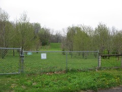 A.A. Parsons Farmsteadlisted 2014
Population over time
2 figuresAvon grew from 12,446 to 21,474 between 2010 and 2020. These are the recorded population figures Wikidata holds for this place, reached through the Geographic Names Information System number this page is keyed on rather than by name, so they belong to this place and not to another of the same name. Most are census counts, but not all are: an early figure may be a founding or settlement estimate, and an estimate published within five years of a census is left out. The change column is computed, and is left blank where more than 20 years separate a figure from the one before it, because a gap that long is not a change between two counts.
| Year | People | Change |
|---|---|---|
| 2010 | 12,446 | |
| 2020 | 21,474 | +9,028 (+73%) |
Topographic sheets covering this place
8 surveys from 15 printed sheetsMatched by testing this settlement's coordinate against the published boundary of every sheet in the United States Geological Survey's historical collection. Each opens the scanned sheet at the Survey.
- 1953 USGS Brownsburg quadrangle1:24000
- 1953 USGS Indianapolis quadrangle1:250000, 4 printings
- 1956 USGS Indianapolis quadrangle1:250000
- 1957 USGS Indianapolis quadrangle1:250000, 2 printings
- 1959 USGS Brownsburg quadrangle1:24000
- 1962 USGS Indianapolis quadrangle1:250000
- 1970 USGS Brownsburg quadrangle1:24000, 3 printings
- 1986 USGS Indianapolis quadrangle1:100000, 2 printings





In the county-history sources
9,569 words on this townshipHistory of Hendricks County, Indiana, published 1885 names this settlement in its chapter on Washington Township. These are the passages that mention it, exactly as the scans read.
The first church organized in Washington Township was at the house of Robert Wilson, in 1823. This is now the Shiloh Church, and it was the first Methodist Episcopal church organization in the i county, and the fourth one of any denomination. There are now in Washington Township three Methodist Episcopal churches - Shiloh and Wesley and Barlett's chapels - ana two Regular | Baptist - Abner's Creek and Salem. The Indianapolis &St. Louis Railroad passes nearly through the center of the township, and the only postoffice in it is at the village of Avon, a station on this rail¬ road.
Passage source: History of Hendricks County, Indiana, published 1885.
The first general election was held Aug. 7, 1826, at the house of ! Daniel C. Hults, when eleven persons voted. These are recorded I on the poll-book as Sidney William?, Daniel C. Hults, James Merit, Joseph Runyon, Isaac Williamson, Dauiel B. Tryer, James Higginbotham, Joseph Philips, William S. Merrill, Robert Wilson and John Triggs. For Congressman, Thomas H. Blake received j nine votes, and Ratliff Boon, two; for Senator, Calvin Fletcher I received nine and J. F. Polk, two; for Representative, Isaiah Drury received eight and John Sims, three; for Sheriff, Robert Cooper received eleven; and for Coroner, William S. Merrill received two.
Passage source: History of Hendricks County, Indiana, published 1885.
Politically Washington was always Whig, and since the death of that party, Republican. It never gave a Democratic majority except in 1832, which was before the name Whig was used by the followers of Henry Clay. Following is the vote for President at j each election :
Passage source: History of Hendricks County, Indiana, published 1885.
Machine-read from a century-old scan, so expect the errors a machine makes: misspelled names, dropped words, stray characters.
Read the whole chapter on Washington Township - it names this place 1 more 1 time.
Fires near this place
2 since 2007Regional context, not property-specific evidence. The federal wildfire occurrence database lists 2 fires within 5 miles of Avon in 2007, burning under an acre in total. None started naturally. None was recorded as arson. Distance is straight-line from the map coordinates, so a fire counted here may appear on a neighbouring settlement's page as well.
| Reported cause | Fires |
|---|---|
| Missing data/not specified/undetermined | 2 |
The most recent of them, most recent first, with the day each was reported and the service that recorded it.
| Date | Cause | Size | Reported by | Name on the report |
|---|---|---|---|---|
| 21 May 2007 | Missing data/not specified/undetermined | under an acre | Indiana State Fire Marshal's Office | not named |
| 11 March 2007 | Missing data/not specified/undetermined | under an acre | Indiana State Fire Marshal's Office | not named |
Settlements close enough to share some of these fires:
Storms near this place
54 since 1996Regional context, not property-specific evidence. The National Weather Service names Avon in 54 storm reports between 1996 and 2026: 28 hail, 22 thunderstorm wind, 2 flash flood, 1 lightning. No death or injury is recorded in these reports. Each account below is quoted exactly as the forecast office filed it, from the NOAA Storm Events Database, and each date opens the federal record of that event.
| When | Event | Place named | Harm | What the report says |
|---|---|---|---|---|
| January 2008 | Thunderstorm Wind | Avon | $750,000 | Damaging thunderstorm winds caused significant damage to ten homes and minor damage to nearly fifty homes near County Road 800 East and 100 North along Captain Drive. |
| August 2021 | Flash Flood | Avon | $250,000 | Very intense rainfall led to brief flash flooding across portions of Avon and Plainfield. Several roads had water over the curb while also rapidly flowing. Avon High school was partially flooded after the roof began to leak. 2 reports of rainfall over 4 inches were received with the rainfall occurring over a period of less than 2 hours. |
| July 2014 | Thunderstorm Wind | Avon | $65,000 | A building was destroyed along US Route 36, west of Ronald Reagan Parkway, due to damaging thunderstorm wind gusts. A few other structures and barns were heavily damaged or destroyed across the county. |
| August 2003 | Lightning | Avon | $60,000 | A house was struck by lightning. The home received 60K in damage to the roof and attic. |
| April 2006 | Hail | Avon | $50,000 | The roof was torn off of an industrial building, and quarter size hail fell in Avon. |
| June 2017 | Thunderstorm Wind | Avon | $17,000 | Storms Wednesday led to some major damage in Hendricks County, toppling the batting cages at baseball fields managed by the Avon Junior Athletic Association.||Poles were ripped up from the ground and left in a pile. Nets for the batting cages were strewn about.||The storm came quickly Wednesday night and was gone just as suddenly. Video provided to FOX59 showed strong winds churning up what appeared to be a gustnado, according to the National Weather Service. |
| August 2022 | Thunderstorm Wind | Avon | $10,000 | Numerous reports of tree damage due to thunderstorm wind gusts across Hendricks county with most concentrated damage in Avon. Several larger trees were also either snapped or damaged, but most showed some amounts of rot. |
| August 2021 | Thunderstorm Wind | Avon | $10,000 | Thunderstorm wind gusts blew over 30 feet of fences and trees of unknown size. |
| August 2020 | Thunderstorm Wind | Avon | $10,000 | A tree roughly 18 inches in diameter was snapped due to thunderstorm wind gusts and fell onto utility lines. |
| August 2016 | Tornado (EF1) | Avon | $5,000 | A few tree trunks were snapped due to this brief EF-1 tornado touchdown, with maximum wind speeds of 95 mph. |
| June 2010 | Flash Flood | Avon | $5,000 | Heavy rainfall draining into White Lick Creek caused the creek to overflow. A mobile home park near 600 East and 100 North was in the process of evacuation due to concern of a possible dam break. Damage estimate is greatly estimated. |
| June 2009 | Thunderstorm Wind | Avon | $5,000 | A tree, twenty inches in diameter, and power lines were downed at Highway 267 and 200 North in Avon due to thunderstorm wind gusts. The time of this event has been estimated. |
| January 2008 | Thunderstorm Wind | Avon | $5,000 | Trees and power lines were reported down throughout the county due to damaging thunderstorm winds. |
| July 2021 | Thunderstorm Wind | Avon | $2,000 | Trees downed by thunderstorm wind gusts in Avon with a trampoline badly damaged after it was blown into the street. |
| August 2021 | Thunderstorm Wind | Avon | $2,000 | Numerous medium to large tree limbs downed by thunderstorm wind gusts. Minor street flooding also noted at the time the report was sent. |
| August 2021 | Thunderstorm Wind | Avon | $1,000 | A tree was blown down by thunderstorm wind gusts near Avon Intermediate West school and accompanied by dime size hail and torrential rain. |
| August 2014 | Thunderstorm Wind | Avon | $1,000 | A large portion of a pear tree was broken off due to damaging thunderstorm wind gusts. |
| June 2018 | Thunderstorm Wind | Avon | $500 | A six to eight-inch diameter section of a moderate-sized tree split off due to damaging thunderstorm wind gusts. |
| March 2026 | Hail | Avon | - | A large volume of hail which covered the roadways. |
| September 2016 | Hail | Avon | - | Lots of pea to dime sized hail observed just east of the Highway 267 and Highway 36 intersection. |
| May 2014 | Thunderstorm Wind | Avon | - | An estimated thunderstorm wind gust of 60 mph was observed in this location. |
| September 2012 | Hail | Avon | - | Quarter sized hail covered the ground to approximately one foot deep. |
| August 2012 | Hail | Avon | - | Nickel to quarter sized hail was observed in this location. |
| April 2011 | Thunderstorm Wind | Avon | - | A thunderstorm wind gust, estimated at 65 mph, was reported in Avon. |
| April 2010 | Hail | Avon | - | Nickel sized hail was observed in this location and lasted for 3 to 4 minutes. |
| April 2010 | Hail | Avon | - | The hail stones were mostly half inch sized, with several three quarter inch sized stones as well. The event started at 531 PM EDT and lasted 10 minutes. |
| June 2010 | Thunderstorm Wind | Avon | - | Thunderstorm wind gusts between 50 to 60 mph were estimated in this location. |
| June 2008 | Thunderstorm Wind | Avon | - | A twelve inch diameter tree was down on State Route 267 and County Road 2600 South due to damaging thunderstorm winds. |
| June 2008 | Thunderstorm Wind | Avon | - | Three trees were blown down due to damaging thunderstorm winds. |
| July 2005 | Thunderstorm Wind | Avon | - | Power lines were blown down. |
| July 2022 | Hail | Avon | - | no account filed |
| June 2015 | Hail | Avon | - | no account filed |
| March 2012 | Hail | Avon | - | no account filed |
| September 2012 | Hail | Avon | - | no account filed |
| September 2012 | Hail | Avon | - | no account filed |
| September 2012 | Hail | Avon | - | no account filed |
| September 2012 | Hail | Avon | - | no account filed |
| September 2012 | Hail | Avon | - | no account filed |
| September 2012 | Hail | Avon | - | no account filed |
| May 2011 | Hail | Avon | - | no account filed |
| March 2011 | Hail | Avon | - | no account filed |
| April 2010 | Hail | Avon | - | no account filed |
| April 2010 | Hail | Avon | - | no account filed |
| July 2003 | Thunderstorm Wind | Avon | - | no account filed |
| April 2002 | Hail | Avon | - | no account filed |
| June 2002 | Thunderstorm Wind | Avon | - | no account filed |
| October 2001 | Thunderstorm Wind | Avon | - | no account filed |
| August 2000 | Hail | Avon | - | no account filed |
| May 1999 | Hail | Avon | - | no account filed |
| April 1998 | Hail | Avon | - | no account filed |
| March 1997 | Hail | Avon | - | no account filed |
| March 1997 | Hail | Avon | - | no account filed |
| June 1996 | Hail | Avon | - | no account filed |
| April 1996 | Hail | Avon | - | no account filed |
Nearest settlements
The eight closest, with where each one stands in the county. Distances are straight-line, computed from the Geographic Names Information System coordinates.
| Map | Place | Distance | Sheets |
|---|---|---|---|
| Big Four Yard | 2.2 miles | 16 | |
| Gale | 3.6 miles | 15 | |
| Wynbrooke | 3.8 miles | 16 | |
| Plainfield | 4.0 miles | 16 | |
| Six Points | 4.2 miles | 17 | |
| Tilden | 4.5 miles | 15 | |
| Clermont Heights | 5.3 miles | 16 | |
| Magnetic Springs | 5.4 miles | 16 |
Elsewhere
Matched on this settlement's Geographic Names Information System number rather than its name, so it cannot be a different place of the same name in another state.
| Wikipedia article on Avon | An encyclopaedic summary. Its text is share-alike, so it is linked here rather than copied. |
| Wikidata item Q791269 | The structured record the population and elevation above come from. Public domain (CC0). |
Provenance
This settlement is recorded in the Geographic Names Information System as feature 430358. The sheet list is computed by point-in-boundary test against the United States Geological Survey's historical topographic inventory. Both are works of the United States government and carry no copyright under 17 U.S.C. 105.
Wildfire. Short, Karen C. 2022. Spatial wildfire occurrence data for the United States, 1992-2020 [FPA_FOD_20221014]. 6th Edition. Fort Collins, CO: Forest Service Research Data Archive. https://doi.org/10.2737/RDS-2013-0009.6 Collected with United States Government funding and usable without additional permissions or fees.
Storms. NOAA National Centers for Environmental Information, Storm Events Database https://www.ncei.noaa.gov/stormevents/ A work of the United States government, no copyright under 17 U.S.C. 105. Narratives are quoted verbatim from the National Weather Service report and are not edited or summarised.