 Block
Buckskin, Indiana
20 topographic sheets cover this place, the earliest surveyed in 1902 and the latest in 1986. It stands in Barton Township. It lies in ZIP code area 47613. It stands on Halfmoon Creek. The Survey maps it on the Elberfeld quadrangle. It stands 459 feet above sea level.
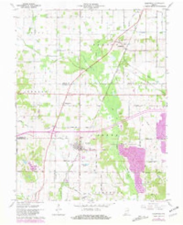
Topographic sheets covering this place
7 surveys from 20 printed sheetsMatched by testing this settlement's coordinate against the published boundary of every sheet in the United States Geological Survey's historical collection. Each opens the scanned sheet at the Survey.
- 1902 USGS Boonville quadrangle1:62500, 4 printings
- 1902 USGS Ditney quadrangle1:125000, 3 printings
- 1956 USGS Vincennes quadrangle1:250000, 4 printings
- 1957 USGS Vincennes quadrangle1:250000
- 1958 USGS Vincennes quadrangle1:250000, 2 printings
- 1961 USGS Elberfeld quadrangle1:24000, 4 printings
- 1986 USGS Princeton quadrangle1:100000, 2 printings




In the county-history sources
2,160 words on this townshipHistory of Gibson County Indiana, published 1884 names this settlement in its chapter on Barton Township. These are the passages that mention it, exactly as the scans read.
Puysicrans. - The first physician to locate here was Dr. George Austin, who came in the fall of 1823. Before that time there was no physician nearer than Princeton. The settlers, however, were a hardy people and required but little attention from the doctors.
Passage source: History of Gibson County Indiana, published 1884.
Machine-read from a century-old scan, so expect the errors a machine makes: misspelled names, dropped words, stray characters.
Read the whole chapter on Barton Township - it names this place 1 more 1 time.
Storms near this place
6 since 2006Regional context, not property-specific evidence. The National Weather Service names Buckskin in 6 storm reports between 2006 and 2024: 2 hail, 2 tornado, 1 funnel cloud, 1 thunderstorm wind. The reports record 1 death and 1 injury. Each account below is quoted exactly as the forecast office filed it, from the NOAA Storm Events Database, and each date opens the federal record of that event.
| When | Event | Place named | Harm | What the report says |
|---|---|---|---|---|
| May 2015 | Thunderstorm Wind | Buckskin | 1 killed, 1 hurt, $2,000 | A small child was killed when a tree limb landed on her. The incident occurred at an outdoor family reunion. The tree limb fell about 50 feet, striking a father and his daughter. The father was hospitalized with a broken neck and other injuries. The young girl died in the hospital a couple of days later. There were a couple of other downed tree limbs in the immediate area. |
| April 2011 | Tornado (EF1) | Buckskin | $50,000 | The tornado entered Gibson County from Warrick County in sparsely populated bottomland near Pigeon Creek. Two houses were damaged and trees were down along County Road 850E. The house damage consisted mainly of roof and siding damage. The majority of the damage to one home was on the east side of the home. There was relatively little damage to the west side. Large trees were down in the entire damage path. Through the wetlands along Pigeon Creek, the tops of trees were broken off. Peak winds were estimated near 95 mph. The average path width was 75 yards. |
| July 2024 | Tornado (EF1) | Buckskin | $20,000 | A brief EF-1 tornado associated with the remnants of Hurricane Beryl occurred in eastern Gibson County, Indiana, during the afternoon of Tuesday, July 9, 2024. The most significant damage occurred near the intersection of County Rd 575 East and County Rd 500 East. Here, a detached garage was destroyed, and a single family residence had about half its roof removed. Additionally, two wooden power poles were leaning. The rest of the damage caused by the tornado was damaging crops in nearby agricultural fields. Peak width of the tornado was estimated from images and video. Peak estimated winds with this tornado were 105 mph. NWS Paducah would like to thank the Gibson County Emergency Management Agency for their assistance with this damage survey. |
| July 2012 | Hail | Buckskin | - | The hail was reported on Highway 57. |
| May 2011 | Funnel Cloud | Buckskin | - | no account filed |
| May 2006 | Hail | Buckskin | - | no account filed |
Nearest settlements
The eight closest, with where each one stands in the county. Distances are straight-line, computed from the Geographic Names Information System coordinates.
| Map | Place | Distance | Sheets |
|---|---|---|---|
| Mackey | 2.0 miles | 17 | |
| Somerville | 3.8 miles | 17 | |
| Oak Hill | 5.6 miles | 18 | |
| Gudgel | 5.8 miles | 18 | |
| Fort Gibson (historical) | 6.1 miles | 24 | |
| Francisco | 7.4 miles | 17 | |
| Warrenton | 7.5 miles | 17 | |
| Gray Junction | 7.6 miles | 18 |
Elsewhere
Matched on this settlement's Geographic Names Information System number rather than its name, so it cannot be a different place of the same name in another state.
| Wikipedia article on Buckskin | An encyclopaedic summary. Its text is share-alike, so it is linked here rather than copied. |
| Wikidata item Q4983508 | The structured record the population and elevation above come from. Public domain (CC0). |
Provenance
This settlement is recorded in the Geographic Names Information System as feature 431754. The sheet list is computed by point-in-boundary test against the United States Geological Survey's historical topographic inventory. Both are works of the United States government and carry no copyright under 17 U.S.C. 105.
Storms. NOAA National Centers for Environmental Information, Storm Events Database https://www.ncei.noaa.gov/stormevents/ A work of the United States government, no copyright under 17 U.S.C. 105. Narratives are quoted verbatim from the National Weather Service report and are not edited or summarised.