 Block
Campbellsburg, Indiana
13 topographic sheets cover this place, the earliest surveyed in 1956 and the latest in 1990. It stands in Brown Township. It lies in ZIP code area 47108. The Survey maps it on the Campbellsburg quadrangle. 529 people lived here at the 2020 count. It stands 827 feet above sea level.
Population over time
2 figuresCampbellsburg fell from 585 to 529 between 2010 and 2020. These are the recorded population figures Wikidata holds for this place, reached through the Geographic Names Information System number this page is keyed on rather than by name, so they belong to this place and not to another of the same name. Most are census counts, but not all are: an early figure may be a founding or settlement estimate, and an estimate published within five years of a census is left out. The change column is computed, and is left blank where more than 20 years separate a figure from the one before it, because a gap that long is not a change between two counts.
| Year | People | Change |
|---|---|---|
| 2010 | 585 | |
| 2020 | 529 | -56 (-10%) |
Topographic sheets covering this place
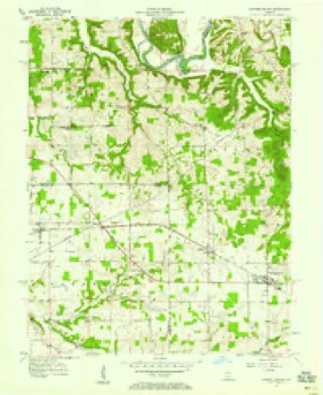
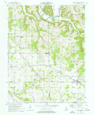
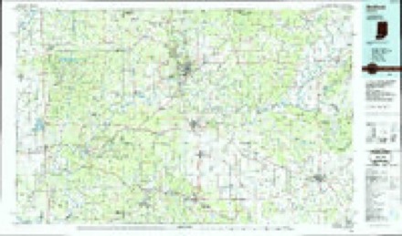
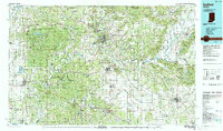
7 surveys from 13 printed sheetsMatched by testing this settlement's coordinate against the published boundary of every sheet in the United States Geological Survey's historical collection. Each opens the scanned sheet at the Survey.
- 1956 USGS Vincennes quadrangle1:250000, 4 printings
- 1957 USGS Campbellsburg quadrangle1:24000, 2 printings
- 1957 USGS Vincennes quadrangle1:250000
- 1958 USGS Vincennes quadrangle1:250000, 2 printings
- 1970 USGS Campbellsburg quadrangle1:24000, 2 printings
- 1986 USGS Bedford quadrangle1:100000
- 1990 USGS Bedford quadrangle1:100000



What happened here
An account from the chapter on Brown township. The inset identifies its exact source book and publication year.
A Noted Hunter
In early times there were many good hunters in the township, but Isaac Hammersley was concefled to be the best marksman. In the township are many caves and most all of them were bear dens. Some l>ear wallows are still to l)e seen in these caves, though the animals were all killed almost a century ago. "Old Ike" possessed a trusty flint-lock rifle and little else except two good cur dogs that were his constant companions.
In the county-history sources
2,528 words on this townshipCentennial History of Washington County, Indiana : Its People, Industies and Institutions : with Biographical Sketches of Representative Citizens and Genealogical Records of Many of the Old Families, published 1916 names this settlement in its chapter on Brown Township. These are the passages that mention it, exactly as the scans read.
A flouring-mill is operated by Alvin L. Freed and Fernandow W. Lewis, under the name of Freed & Lewis ; there are three hotels, the Mather House, operated by R. P. Mather, Central Hotel, by C. A. Housefield, and the Star Hotel, by W. A. Childers; George W. Wener and George K. Evans have barber shops; James W. Holaday and John J. Trinkle are blacksmiths; E. L. Woodward is manager of the Standard Oil Company agency; James C. Brown is agent of the Chicago, Indianapolis & Louisville railway; Lawrence W. Paynter is a ])hysician; Charles L. Holesapple a veterinary surgeon: Dr. B. E. Diefendnrf is a dentist; Harry C. W'esner is postmaster; Max .Abrahams conducts the affairs of the Bank of Campbellsburg, which has a large patronage; R. P. Mather is editor and proprietor of the Graf^Iiic, a Hve weekly newspaper which has been pulilished by him for many years and now enjoys a liberal patronage; Frank L. Driskell is an attorney.
Passage source: Centennial History of Washington County, Indiana : Its People, Industies and Institutions : with Biographical Sketches of Representative Citizens and Genealogical Records of Many of the Old Families, published 1916.
Machine-read from a century-old scan, so expect the errors a machine makes: misspelled names, dropped words, stray characters.
Mines and quarries near this place
1 within 5 milesRegional context, not property-specific evidence. The federal mineral resources record lists 1 working within 5 miles of Campbellsburg: 1 producer. All of them still produce. What was taken out: Sand and Gravel, Construction. Distance is straight-line from the map coordinates, so a quarry counted here may appear on a neighbouring settlement's page as well.
| Where | Site | Commodity | Status | Recorded |
|---|---|---|---|---|
| Littleton Gravel Pit | Sand and Gravel, Construction | Producer |
Storms near this place
17 since 1995Regional context, not property-specific evidence. The National Weather Service names Campbellsburg in 17 storm reports between 1995 and 2025: 10 thunderstorm wind, 5 hail, 1 tornado, 1 flood. No death or injury is recorded in these reports. Each account below is quoted exactly as the forecast office filed it, from the NOAA Storm Events Database, and each date opens the federal record of that event.
| When | Event | Place named | Harm | What the report says |
|---|---|---|---|---|
| May 1995 | Tornado (F0) | Campbellsburg | $500 | Two barns damaged and a tool shed damaged by a possible tornado. Also, several fruit trees were strewn out over the roadway. Report from county sheriff. |
| March 2025 | Thunderstorm Wind | Campbellsburg | - | A tree was down on a house on Suder Lane. |
| June 2018 | Thunderstorm Wind | Campbellsburg | - | Local media reported trees down in the area. |
| March 2017 | Hail | Campbellsburg | - | Local law enforcement reported hail up to 3/4 inch in diameter. |
| June 2016 | Thunderstorm Wind | Campbellsburg | - | Local broadcast media reported trees down in the area. |
| June 2016 | Thunderstorm Wind | Campbellsburg | - | State officials reported trees down on powerlines on North Sycamore Street. This resulted in power outages. |
| May 2015 | Hail | Campbellsburg | - | A broadcast meteorologist relayed to the NWS a public video of dime size hail. |
| July 2012 | Thunderstorm Wind | Campbellsburg | - | The Washington County emergency management reported a few trees down near Campbellsburg. |
| July 2012 | Thunderstorm Wind | Campbellsburg | - | The local emergency management reported that two trees were downed across the county. One fell in Campbellsburg. The other fell in Delaney Park in the western portion of the county. |
| May 2011 | Thunderstorm Wind | Campbellsburg | - | Trees and power lines were blown down in the Campbellsburg area. |
| April 2008 | Flood | Campbellsburg | - | A few county roads were closed due to high water. |
| February 1999 | Hail | Campbellsburg | - | One inch hail fell in Cambellsburg |
| July 2008 | Hail | Campbellsburg | - | no account filed |
| September 2002 | Thunderstorm Wind | Campbellsburg | - | no account filed |
| May 1998 | Thunderstorm Wind | Campbellsburg | - | no account filed |
| June 1998 | Thunderstorm Wind | Campbellsburg | - | no account filed |
| April 1996 | Hail | Campbellsburg | - | no account filed |
Nearest settlements
The eight closest, with where each one stands in the county. Distances are straight-line, computed from the Geographic Names Information System coordinates.
| Map | Place | Distance | Sheets |
|---|---|---|---|
| Saltillo | 1.8 miles | 13 | |
| Claysville | 2.5 miles | 11 | |
| Smedley | 2.7 miles | 15 | |
| Prowsville | 3.7 miles | 15 | |
| Mount Carmel | 4.6 miles | 15 | |
| Hitchcock | 4.9 miles | 15 | |
| Rush Creek Valley | 5.7 miles | 15 | |
| Brimstone Corners | 5.9 miles | 13 |
Elsewhere
Matched on this settlement's Geographic Names Information System number rather than its name, so it cannot be a different place of the same name in another state.
| Wikipedia article on Campbellsburg | An encyclopaedic summary. Its text is share-alike, so it is linked here rather than copied. |
| Wikidata item Q3296616 | The structured record the population and elevation above come from. Public domain (CC0). |
Provenance
This settlement is recorded in the Geographic Names Information System as feature 449630. The sheet list is computed by point-in-boundary test against the United States Geological Survey's historical topographic inventory. Both are works of the United States government and carry no copyright under 17 U.S.C. 105.
Mines and quarries. USGS Mineral Resources Data System (MRDS) https://mrdata.usgs.gov/mrds/ A work of the United States government, no copyright under 17 U.S.C. 105.
Storms. NOAA National Centers for Environmental Information, Storm Events Database https://www.ncei.noaa.gov/stormevents/ A work of the United States government, no copyright under 17 U.S.C. 105. Narratives are quoted verbatim from the National Weather Service report and are not edited or summarised.