 Block
Carmel, Indiana
19 topographic sheets cover this place, the earliest surveyed in 1952 and the latest in 1998. It stands in Clay Township. It lies in ZIP code area 46032. It stands on Little Cool Creek. The Survey maps it on the Fishers quadrangle. 99,757 people lived here at the 2020 count. It stands 853 feet above sea level.
On record in Carmel
Buildings and businesses the archive holds for this place. Each opens its own page, with the source record it came from.
On the National Register 5 records
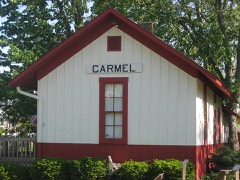 Carmel Monon Depotlisted 2013
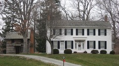 John Kinzer Houselisted 1975
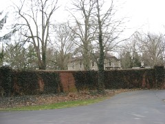 Micah Newby Houselisted 1986
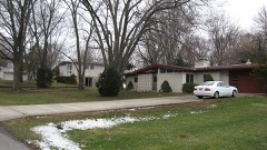 Thornhurst Additionlisted 2010
- Applegate-Johnson Farmsteadlisted 2024
Population over time
2 figuresCarmel grew from 79,191 to 99,757 between 2010 and 2020. These are the recorded population figures Wikidata holds for this place, reached through the Geographic Names Information System number this page is keyed on rather than by name, so they belong to this place and not to another of the same name. Most are census counts, but not all are: an early figure may be a founding or settlement estimate, and an estimate published within five years of a census is left out. The change column is computed, and is left blank where more than 20 years separate a figure from the one before it, because a gap that long is not a change between two counts.
| Year | People | Change |
|---|---|---|
| 2010 | 79,191 | |
| 2020 | 99,757 | +20,566 (+26%) |
Topographic sheets covering this place
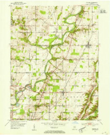
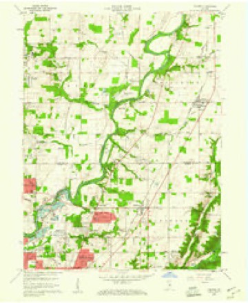
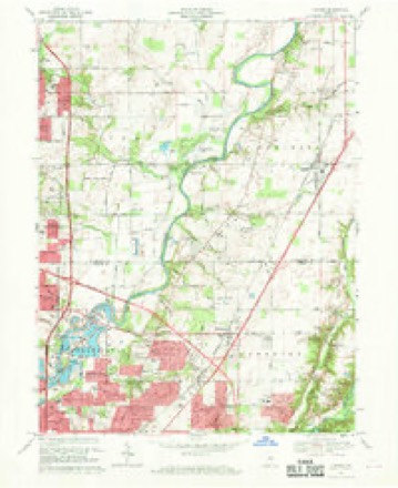
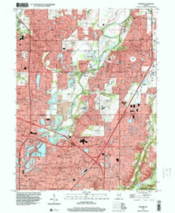
9 surveys from 19 printed sheetsMatched by testing this settlement's coordinate against the published boundary of every sheet in the United States Geological Survey's historical collection. Each opens the scanned sheet at the Survey.
- 1952 USGS Fishers quadrangle1:24000
- 1953 USGS Indianapolis quadrangle1:250000, 4 printings
- 1956 USGS Indianapolis quadrangle1:250000
- 1957 USGS Indianapolis quadrangle1:250000, 2 printings
- 1959 USGS Fishers quadrangle1:24000, 2 printings
- 1962 USGS Indianapolis quadrangle1:250000
- 1967 USGS Fishers quadrangle1:24000, 5 printings
- 1986 USGS Indianapolis quadrangle1:100000, 2 printings
- 1998 USGS Fishers quadrangle1:24000





In the county-history sources
6,892 words on this townshipThe county-history sources names this settlement in its chapter on Clay Township. These are the passages that mention it, exactly as the scans read.
Machine-read from a century-old scan, so expect the errors a machine makes: misspelled names, dropped words, stray characters.
Read the whole chapter on Clay Township - it names this place 2 more 2 times.
Mines and quarries near this place
4 within 5 milesRegional context, not property-specific evidence. The federal mineral resources record lists 4 workings within 5 miles of Carmel: 3 producers, 1 past producer. 3 still produce. What was taken out: Sand and Gravel, Construction, Stone, Crushed/Broken. Distance is straight-line from the map coordinates, so a quarry counted here may appear on a neighbouring settlement's page as well.
| Where | Site | Commodity | Status | Recorded |
|---|---|---|---|---|
| Indianapolis 521 Quarry | Stone, Crushed/Broken | Producer | ||
| Carmel 512 Pit | Sand and Gravel, Construction | Producer | ||
| Indianapolis 513 Pit | Sand and Gravel, Construction | Producer | ||
| Road Materials Pit | Sand and Gravel, Construction | Past Producer |
Storms near this place
60 of 101 shownRegional context, not property-specific evidence. The National Weather Service names Carmel in 101 storm reports between 1996 and 2025: 48 hail, 34 thunderstorm wind, 16 lightning, 1 heavy rain. The reports record 1 death and 2 injuries. Each account below is quoted exactly as the forecast office filed it, from the NOAA Storm Events Database, and each date opens the federal record of that event.
| When | Event | Place named | Harm | What the report says |
|---|---|---|---|---|
| April 1999 | Lightning | Carmel | 1 killed | A 32 year old male was struck by an isolated cloud-to-ground lightning bolt and became comatose. He died a week later. The man was struck while standing next to a tree in his yard. |
| May 1996 | Lightning | Carmel | 1 hurt, $500,000 | no account filed |
| June 2002 | Lightning | Carmel | 1 hurt | Lightning struck a man in a parking lot. |
| May 1998 | Lightning | Carmel | $400,000 | Lightning struck 5 Carmel area homes igniting fires. |
| July 2001 | Lightning | Carmel | $350,000 | no account filed |
| May 1996 | Lightning | Carmel | $120,000 | no account filed |
| August 2000 | Lightning | Carmel | $110,000 | no account filed |
| April 2003 | Thunderstorm Wind | Carmel | $100,000 | no account filed |
| July 2002 | Thunderstorm Wind | Carmel | $100,000 | no account filed |
| August 2000 | Lightning | Carmel | $95,000 | no account filed |
| September 2001 | Lightning | Carmel | $85,000 | A house was struck by lightning. The fire was contained to the basement by the rest of the house received heavy smoke damage. |
| August 2000 | Lightning | Carmel | $81,000 | no account filed |
| March 2021 | Thunderstorm Wind | Carmel | $50,000 | Several trees knocked down due to thunderstorm wind gusts. One tree had fallen on a home. |
| June 2019 | Flash Flood | Carmel | $50,000 | Water rescues were occurring across parts of Carmel due to thunderstorm heavy rainfall. |
| May 2006 | Lightning | Carmel | $50,000 | A lightning strike ignited a fire in a residence which severely damaged the roof, attic, and the upstairs ceiling and hallway. |
| July 2001 | Lightning | Carmel | $50,000 | no account filed |
| July 2017 | Thunderstorm Wind | Carmel | $35,000 | Multiple reports of trees being downed across Carmel due to damaging thunderstorm wind gusts. There were several reports of trees and large tree limbs on houses. |
| June 2023 | Thunderstorm Wind | Carmel | $25,000 | Trees and tree limbs downed by thunderstorm wind gusts. |
| August 2000 | Lightning | Carmel | $20,000 | no account filed |
| January 2018 | Thunderstorm Wind | Carmel | $15,000 | A tree was uprooted and fell on a house due to damaging thunderstorm wind gusts. This report came in via Twitter. |
| February 2008 | Lightning | Carmel | $15,000 | Lightning struck a flexible natural gas line that went to the basement. The homeowner was treated by medics for smoke inhalation, but was not taken to the hospital. |
| July 2005 | Lightning | Carmel | $12,000 | Lightning sparked a fire which damaged a home. The damage amount is estimated. |
| August 2022 | Thunderstorm Wind | Carmel | $10,000 | Multiple trees downed onto power lines by thunderstorm wind gusts across Carmel. |
| June 2010 | Thunderstorm Wind | Carmel | $10,000 | Numerous trees were reported down in downtown Carmel due to damaging thunderstorm wind gusts. Trees were also reported down on buildings. No information about damage to these buildings was received. |
| August 2016 | Hail | Carmel | $8,000 | Multiple trees and power lines were down near this location in addition to the large hail. |
| July 2017 | Thunderstorm Wind | Carmel | $7,000 | A large tree snapped and fell onto a house in this location due to damaging thunderstorm wind gusts. Several power lines were downed as well. |
| May 2019 | Thunderstorm Wind | Carmel | $5,000 | The Home Place area had numerous trees down blocking roads due to damaging thunderstorm wind gusts. |
| July 2024 | Thunderstorm Wind | Carmel | $3,000 | Thunderstorm winds downed at least one large tree on the east side of Carmel with multiple large branches downed throughout the area. About 15 minutes prior, winds gusted to 55 mph in Westfield. |
| June 2014 | Thunderstorm Wind | Carmel | $2,500 | Shingles were damaged on some roofs due to strong thunderstorm wind gusts. Several small tree limbs were downed as well. |
| August 2009 | Thunderstorm Wind | Carmel | $2,000 | Power lines were blown down due to thunderstorm wind gusts. |
| October 1996 | Thunderstorm Wind | Carmel | $2,000 | no account filed |
| August 1997 | Thunderstorm Wind | Carmel | $1,500 | Thunderstorm winds blew down trees and power lines. |
| July 2022 | Thunderstorm Wind | Carmel | $1,000 | Tree limbs downed by thunderstorm wind gusts. |
| May 2019 | Thunderstorm Wind | Carmel | $1,000 | An uprooted tree blocked traffic between Greyhound Pass and 146th Street on Spring Mill Road due to damaging thunderstorm wind gusts. |
| June 2012 | Thunderstorm Wind | Carmel | $1,000 | A tree, about one foot in diameter, was reported down in this location due to strong thunderstorm wind gusts. |
| July 2010 | Thunderstorm Wind | Carmel | $1,000 | A tree was reported down at 136th Street and Keystone Avenue due to damaging thunderstorm wind gusts. |
| November 2005 | Thunderstorm Wind | Carmel | $1,000 | Power lines were downed throughout town. |
| July 2017 | Flood | Carmel | $500 | One to two feet of water was on the road at 126th Street due to heavy rainfall. |
| November 2016 | Thunderstorm Wind | Carmel | $500 | Large tree limbs were reported down due to damaging thunderstorm wind gusts. |
| April 2013 | Hail | Carmel | $500 | Some holes were ripped in window screens due to the hail. |
| March 2021 | Hail | Carmel | - | Two separate reports of nickel size hail in downtown Carmel. |
| March 2021 | Hail | Carmel | - | Relayed via Emergency Management. |
| March 2020 | Hail | Carmel | - | This report was relayed via the SKYWARN network. |
| March 2020 | Hail | Carmel | - | Report was relayed via mPing. |
| March 2020 | Hail | Carmel | - | Report relayed via mPing. |
| June 2010 | Thunderstorm Wind | Carmel | - | A wind gust, estimated at 60 mph, was observed in northwest Carmel. |
| February 2009 | Heavy Rain | Carmel | - | A retired National Weather Service Meteorologist reported 1.77 inches of rainfall since 0640 EST and a storm total of 2.75 inches. Begin time of event is roughly estimated. |
| April 2006 | Hail | Carmel | - | No property damage estimates were available. |
| April 2006 | Hail | Carmel | - | No property damage estimates were available. |
| August 2005 | Lightning | Carmel | - | Lightning struck a home, causing a fire. The home had been the victim of another lightning-induced fire just three weeks before. |
| July 2003 | Thunderstorm Wind | Carmel | - | 4" diameter trees down |
| August 2000 | Thunderstorm Wind | Carmel | - | Numerous trees were blown down in the Carmel area. Report from law enforcement and media. |
| May 2025 | Hail | Carmel | - | no account filed |
| March 2024 | Hail | Carmel | - | no account filed |
| March 2020 | Hail | Carmel | - | no account filed |
| April 2020 | Hail | Carmel | - | no account filed |
| April 2020 | Hail | Carmel | - | no account filed |
| April 2018 | Hail | Carmel | - | no account filed |
| March 2017 | Hail | Carmel | - | no account filed |
| April 2013 | Hail | Carmel | - | no account filed |
Nearest settlements
The eight closest, with where each one stands in the county. Distances are straight-line, computed from the Geographic Names Information System coordinates.
| Map | Place | Distance | Sheets |
|---|---|---|---|
| Newark Village | 0.8 miles | 19 | |
| Echo Crest | 2.0 miles | 17 | |
| Home Place | 2.7 miles | 17 | |
| Orchard Park | 2.9 miles | 17 | |
| Holaday Hills and Dales | 2.9 miles | 19 | |
| Northern Beach | 3.0 miles | 19 | |
| College Meadows | 3.2 miles | 17 | |
| Northwood Hills | 3.2 miles | 19 |
Elsewhere
Matched on this settlement's Geographic Names Information System number rather than its name, so it cannot be a different place of the same name in another state.
| Wikipedia article on Carmel | An encyclopaedic summary. Its text is share-alike, so it is linked here rather than copied. |
| Wikidata item Q537853 | The structured record the population and elevation above come from. Public domain (CC0). |
Provenance
This settlement is recorded in the Geographic Names Information System as feature 432143. The sheet list is computed by point-in-boundary test against the United States Geological Survey's historical topographic inventory. Both are works of the United States government and carry no copyright under 17 U.S.C. 105.
Mines and quarries. USGS Mineral Resources Data System (MRDS) https://mrdata.usgs.gov/mrds/ A work of the United States government, no copyright under 17 U.S.C. 105.
Storms. NOAA National Centers for Environmental Information, Storm Events Database https://www.ncei.noaa.gov/stormevents/ A work of the United States government, no copyright under 17 U.S.C. 105. Narratives are quoted verbatim from the National Weather Service report and are not edited or summarised.