 Block
Cicero, Indiana
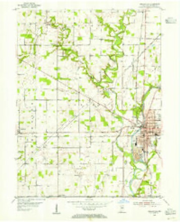
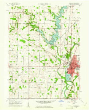
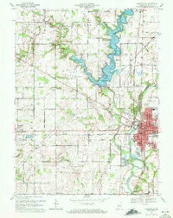
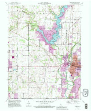
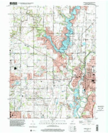
15 topographic sheets cover this place, the earliest surveyed in 1953 and the latest in 1998. It stands in Jackson Township. It lies in ZIP code area 46034. The Survey maps it on the Noblesville quadrangle. 5,301 people lived here at the 2020 count. It stands 833 feet above sea level.
Population over time
2 figuresCicero grew from 4,812 to 5,301 between 2010 and 2020. These are the recorded population figures Wikidata holds for this place, reached through the Geographic Names Information System number this page is keyed on rather than by name, so they belong to this place and not to another of the same name. Most are census counts, but not all are: an early figure may be a founding or settlement estimate, and an estimate published within five years of a census is left out. The change column is computed, and is left blank where more than 20 years separate a figure from the one before it, because a gap that long is not a change between two counts.
| Year | People | Change |
|---|---|---|
| 2010 | 4,812 | |
| 2020 | 5,301 | +489 (+10%) |
Topographic sheets covering this place
9 surveys from 15 printed sheetsMatched by testing this settlement's coordinate against the published boundary of every sheet in the United States Geological Survey's historical collection. Each opens the scanned sheet at the Survey.
- 1953 USGS Danville quadrangle1:250000, 3 printings
- 1953 USGS Noblesville quadrangle1:24000
- 1955 USGS Danville quadrangle1:250000
- 1956 USGS Danville quadrangle1:250000
- 1960 USGS Noblesville quadrangle1:24000, 2 printings
- 1969 USGS Noblesville quadrangle1:24000, 3 printings
- 1984 USGS Lafayette quadrangle1:100000, 2 printings
- 1992 USGS Noblesville quadrangle1:24000
- 1998 USGS Noblesville quadrangle1:24000




In the county-history sources
6,516 words on this townshipHistory of Hamilton County, Indiana : with Illustrations and Biographical Sketches of Some of Its Prominent Men and Pioneers : to Which Are Appended Maps of Its Several Townships, published 1880 names this settlement in its chapter on Jackson Township. These are the passages that mention it, exactly as the scans read.
E.\RI,V Iin.Mis, In the early days of eiiiigralion, the liio.st direct lino between two stations was the object sought by the emigrant, and Strawtown was, perhaps, tho most noted point on the line usually traveled by emigrant trains. Here they could find the provisions to replenish their supply and last until ihcy could reach the scltlcmcnls on Wild Cat Prairie, in Tippecanoe County. The most direct route between Strawtown and the latter point w,is indicated by an Indian "truce," which in time became a well-defined road, from tlie frci[uency with which it was traveled, but its course was rambling and irregular, as the driver would often bo compelled to make a circuit in order to ovoid a iniidhole. About the year 1830, this road was surveyed by order of tho State, and was oderward known as the Newcastle and La Fayette Slate road. About the
Passage source: History of Hamilton County, Indiana : with Illustrations and Biographical Sketches of Some of Its Prominent Men and Pioneers : to Which Are Appended Maps of Its Several Townships, published 1880.
Townships HI and 211 norlli, and running west to Thornlown. It was known as Ihc Cicero and Thornlown Slate road. The Indianapolis and Peru Stale road was surveyed about a year later. It traverses the eastern portion of the township from north lo south. In the course of lime, these all became good roads, or at least good (Plough to admit of travel without danger to the occupants of vehicles who traversed the routes. They placed Cicero in communication with the outside world, and played no inconsideruble port in cslablishing the early prosperity of tho town, for a location on tho great public highways of that period was scarcely less beneficial lo a town llian a location on one of tho railroads of lo-day.
Passage source: History of Hamilton County, Indiana : with Illustrations and Biographical Sketches of Some of Its Prominent Men and Pioneers : to Which Are Appended Maps of Its Several Townships, published 1880.
Between the several neighborlionds of the town-hip, roads were cut out through the woods to serve in facilitating communieation between the neighbors. Subscipicnt surveys changed the course of some of theso roads ; some, however, remain nearly oa at first located.
Passage source: History of Hamilton County, Indiana : with Illustrations and Biographical Sketches of Some of Its Prominent Men and Pioneers : to Which Are Appended Maps of Its Several Townships, published 1880.
Machine-read from a century-old scan, so expect the errors a machine makes: misspelled names, dropped words, stray characters.
Read the whole chapter on Jackson Township - it names this place 12 more 12 times.
Mines and quarries near this place
2 within 5 milesRegional context, not property-specific evidence. The federal mineral resources record lists 2 workings within 5 miles of Cicero: 2 producers. All of them still produce. What was taken out: Sand and Gravel, Construction. Distance is straight-line from the map coordinates, so a quarry counted here may appear on a neighbouring settlement's page as well.
| Where | Site | Commodity | Status | Recorded |
|---|---|---|---|---|
| Riverwood Gravel Pit | Sand and Gravel, Construction | Producer | ||
| Southard Pit | Sand and Gravel, Construction | Producer |
Storms near this place
26 since 1998Regional context, not property-specific evidence. The National Weather Service names Cicero in 26 storm reports between 1998 and 2023: 14 thunderstorm wind, 10 hail, 2 flood. No death or injury is recorded in these reports. Each account below is quoted exactly as the forecast office filed it, from the NOAA Storm Events Database, and each date opens the federal record of that event.
| When | Event | Place named | Harm | What the report says |
|---|---|---|---|---|
| August 2010 | Thunderstorm Wind | Cicero | $13,000 | Several lagre trees were reportedly snapped off five feet above the ground due to damaging thunderstorm wind gusts. Several light poles were also reportedly snapped off in the same location. |
| July 2017 | Thunderstorm Wind | Cicero | $10,000 | Numerous trees and power lines were downed along Carrigan Road near Morse Reservoir due to damaging thunderstorm wind gusts. |
| June 2015 | Thunderstorm Wind | Cicero | $10,000 | Multiple large trees were downed in northeastern Hamilton County, from Cicero to Atlanta and eastward, due to damaging thunderstorm wind gusts. |
| July 2011 | Thunderstorm Wind | Cicero | $7,000 | Trees and a telephone pole were downed in Cicero due to damaging thunderstorm wind gusts. |
| October 2010 | Thunderstorm Wind | Cicero | $6,000 | Numerous trees were reported down in an east-west line near 236th Street in Cicero. The tree damage was due to damaging thunderstorm wind gusts. |
| May 2013 | Thunderstorm Wind | Cicero | $5,000 | Trees and limbs were reported down in this location due to damaging thunderstorm wind gusts. |
| August 2014 | Thunderstorm Wind | Cicero | $3,000 | Trees were reported to be downed across a road. This report was relayed from Noblesville Fire Department. |
| August 2022 | Thunderstorm Wind | Cicero | $2,000 | Large tree downed by thunderstorm wind gusts at Bear Slide Golf Club. |
| June 2012 | Thunderstorm Wind | Cicero | $2,000 | Two trees were downed in this location due to damaging thunderstorm wind gusts. |
| June 2010 | Thunderstorm Wind | Cicero | $2,000 | Medium sized tree branches were reported down in a yard and on a storage shed just west of Cicero, near the intersection of Morse Landing Drive and Tollgate Road. Minor damage to the shed was reported. Also, a tree was reported downed on East 231st Street near Bear Slide Golf Club. |
| June 2016 | Thunderstorm Wind | Cicero | $1,000 | A tree was downed in this location due to damaging thunderstorm wind gusts. |
| June 2015 | Flood | Cicero | $1,000 | Ponding and water was running over county roadways due to heavy rainfall. Flooding was up to a foot and a half deep at the intersections of Toll Gate Road and 231st Street and Morse Landing Drive. |
| June 2023 | Hail | Cicero | - | Thunderstorm hail continued across northern Hamilton County, including 1.00 hail in Cicero. |
| July 2017 | Hail | Cicero | - | There was sparse coverage of pea-sized hail with a few larger ones, near penny size, mixed in for 4 minutes at Toll Gate Road and 231st Street. |
| July 2017 | Hail | Cicero | - | Rainfall of 0.95 inches of rain fell in 25 minutes. |
| June 2010 | Thunderstorm Wind | Cicero | - | A thunderstorm wind gust measured at 62 mph was observed in this location. |
| March 2007 | Flood | Cicero | - | Bear Slide Creek flooded, closing Toll Gate Road near 236th Street. |
| March 2016 | Hail | Cicero | - | no account filed |
| March 2016 | Hail | Cicero | - | no account filed |
| May 2011 | Hail | Cicero | - | no account filed |
| May 2011 | Hail | Cicero | - | no account filed |
| March 2011 | Hail | Cicero | - | no account filed |
| August 2005 | Hail | Cicero | - | no account filed |
| May 2003 | Thunderstorm Wind | Cicero | - | no account filed |
| July 2003 | Thunderstorm Wind | Cicero | - | no account filed |
| July 1998 | Hail | Cicero | - | no account filed |
Nearest settlements
The eight closest, with where each one stands in the county. Distances are straight-line, computed from the Geographic Names Information System coordinates.
| Map | Place | Distance | Sheets |
|---|---|---|---|
| Clare | 2.8 miles | 15 | |
| Riverwood | 2.9 miles | 15 | |
| Arcadia | 3.6 miles | 11 | |
| Strawtown | 3.7 miles | 15 | |
| Meadows Knoll | 4.0 miles | 15 | |
| Meadows Glen | 4.1 miles | 15 | |
| Deming | 4.6 miles | 15 | |
| Walnut Grove | 4.7 miles | 12 |
Elsewhere
Matched on this settlement's Geographic Names Information System number rather than its name, so it cannot be a different place of the same name in another state.
| Wikipedia article on Cicero | An encyclopaedic summary. Its text is share-alike, so it is linked here rather than copied. |
| Wikidata item Q38648 | The structured record the population and elevation above come from. Public domain (CC0). |
Provenance
This settlement is recorded in the Geographic Names Information System as feature 432518. The sheet list is computed by point-in-boundary test against the United States Geological Survey's historical topographic inventory. Both are works of the United States government and carry no copyright under 17 U.S.C. 105.
Mines and quarries. USGS Mineral Resources Data System (MRDS) https://mrdata.usgs.gov/mrds/ A work of the United States government, no copyright under 17 U.S.C. 105.
Storms. NOAA National Centers for Environmental Information, Storm Events Database https://www.ncei.noaa.gov/stormevents/ A work of the United States government, no copyright under 17 U.S.C. 105. Narratives are quoted verbatim from the National Weather Service report and are not edited or summarised.