 Block
Concord, Indiana
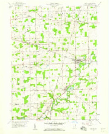
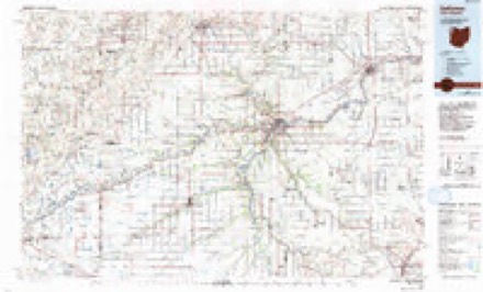
10 topographic sheets cover this place, the earliest surveyed in 1953 and the latest in 1986. It stands in Concord Township. It lies in ZIP code area 46706. The Survey maps it on the Saint Joe quadrangle.
Topographic sheets covering this place
4 surveys from 10 printed sheetsMatched by testing this settlement's coordinate against the published boundary of every sheet in the United States Geological Survey's historical collection. Each opens the scanned sheet at the Survey.
- 1953 USGS Fort Wayne quadrangle1:250000, 4 printings
- 1956 USGS Fort Wayne quadrangle1:250000, 2 printings
- 1958 USGS Saint Joe quadrangle1:24000, 3 printings
- 1986 USGS Defiance quadrangle1:100000


In the county-history sources
1,429 words on this townshipHistory of Dekalb County, Indiana, with Biographical Sketches of Representative Citizens and Genealogical Records of Old Families, published 1914 names this settlement in its chapter on Concord Township. These are the passages that mention it, exactly as the scans read.
In the southeastern portion of DeKalb county is the township of Concord. This township is bounded on the north by Wilmington township, on the east by Newville township, on the south by Spencer township, and on the west by Jackson township. The St. Joseph river flows in a meandering direction from the northeast to the southwest, and Bear creek, entering in the northwest corner, flows toward the center. In the early day many good mills were situated along these rivers. A saw mill was constructed near the center of the township on Bear creek many years ago, and also one on the stream known as the "Twenty-six IMile creek." In land, the township is well favored. The river bottom lands are excellent for the production of grain, and at one time extra good timber covered portions of the township. This growth has been largely cleared off at this day. Spencer township has recently been made, on June 7, 1909, frorn a part of Concord, so that the latter is now the upper half only of the original bounds designated as Concord.
Passage source: History of Dekalb County, Indiana, with Biographical Sketches of Representative Citizens and Genealogical Records of Old Families, published 1914.
The first name given to the township was DeKalb, in the fall of 1837. It included at that time the territory embraced in Stafford and Newville townships, but in March following Stafford was detached and temporarily added to Wilmington, while the name Concord was substituted for DeKalb. An election was held on the first Monday of April following, at the home of Jared Ball, and Cornelius Woodcox was appointed inspector of elections. At this election Washington Robinson was chosen justice of the peace. New- ville was also made a separate township shortly afterward, leaving Concord, which was again divided in halves, making Spencer township of the southern half.
Passage source: History of Dekalb County, Indiana, with Biographical Sketches of Representative Citizens and Genealogical Records of Old Families, published 1914.
In the year 1835 nine families out of the ten settled in the county of DeKalb were in the limits of Concord township. The St. Joseph of the Maumee at an early day was a main channel for all commercial trafific, and on the banks of this river were found the earliest settlements of the county. From 1835 to 1839 many settled along the river, namely: Homer Blake, David Butler, John Mathews, Thomas L. Yates, John T. Rhodes, Jerry Rhodes, Daniel Rhodes, Brandt Rood, Cramwell Rood, William Mathews, Mr. Lytle, Jared Ball and several others. In the spring of 1834 Washington Robinson entered a tract of land across the river from the present site of Orangeville, built a small cabin, and settled in January, 1837. In the month of November, 1837, he platted a portion of section 12, and named the tract Orangeville. In the spring of 1837 Platter and others opened the first store in the county. Other early settlers who came later and at this time were: Gavin Hamilton, Lott Herrick, who was the first probate judge of DeKalb county ; George Barney, once treasurer of the county ; James Hadsell, Cornelius Woodcox, R. J. Dawson, John Blair and sons, William Burley, Charles Wilbur, Joseph Ludwick, Judge Walden, Samuel Widney, John P. Widney, Rev. Benjamin Alton and Dr. Babcock. James Hadsell became one of the most important of the early pioneers, serving as minister of the Disciples
Passage source: History of Dekalb County, Indiana, with Biographical Sketches of Representative Citizens and Genealogical Records of Old Families, published 1914.
Machine-read from a century-old scan, so expect the errors a machine makes: misspelled names, dropped words, stray characters.
Read the whole chapter on Concord Township - it names this place 2 more 2 times.
Fires near this place
4 since 2002Regional context, not property-specific evidence. The federal wildfire occurrence database lists 4 fires within 5 miles of Concord between 2002 and 2004, burning about 35 acres in total. None started naturally. 1 was recorded as arson. Distance is straight-line from the map coordinates, so a fire counted here may appear on a neighbouring settlement's page as well.
| Reported cause | Fires |
|---|---|
| Recreation and ceremony | 2 |
| Arson/incendiarism | 1 |
| Missing data/not specified/undetermined | 1 |
The most recent of them, most recent first, with the day each was reported and the service that recorded it.
| Date | Cause | Size | Reported by | Name on the report |
|---|---|---|---|---|
| 8 July 2004 | Arson/incendiarism | under an acre | Indiana State Fire Marshal's Office | not named |
| 28 April 2003 | Recreation and ceremony | under an acre | Indiana State Fire Marshal's Office | not named |
| 26 April 2002 | Missing data/not specified/undetermined | under an acre | Indiana State Fire Marshal's Office | not named |
| 20 October 2002 | Recreation and ceremony | 35 acres | Indiana State Fire Marshal's Office | not named |
Settlements close enough to share some of these fires:
Mines and quarries near this place
2 within 5 milesRegional context, not property-specific evidence. The federal mineral resources record lists 2 workings within 5 miles of Concord: 2 producers. All of them still produce. What was taken out: Sand and Gravel, Construction. Distance is straight-line from the map coordinates, so a quarry counted here may appear on a neighbouring settlement's page as well.
| Where | Site | Commodity | Status | Recorded |
|---|---|---|---|---|
| Krafft Sand & Gravel | Sand and Gravel, Construction | Producer | ||
| Spencerville Pit | Sand and Gravel, Construction | Producer |
Nearest settlements
The eight closest, with where each one stands in the county. Distances are straight-line, computed from the Geographic Names Information System coordinates.
| Map | Place | Distance | Sheets |
|---|---|---|---|
| Saint Joe | 2.4 miles | 10 | |
| Spencerville | 3.2 miles | 10 | |
| Orangeville | 4.7 miles | 11 | |
| Moore | 4.9 miles | 10 | |
| Hopewell | 5.1 miles | 11 | |
| Newville | 5.5 miles | 11 | |
| Newville Center | 6.2 miles | 11 | |
| Auburn | 6.6 miles | 11 |
Provenance
This settlement is recorded in the Geographic Names Information System as feature 432848. The sheet list is computed by point-in-boundary test against the United States Geological Survey's historical topographic inventory. Both are works of the United States government and carry no copyright under 17 U.S.C. 105.
Wildfire. Short, Karen C. 2022. Spatial wildfire occurrence data for the United States, 1992-2020 [FPA_FOD_20221014]. 6th Edition. Fort Collins, CO: Forest Service Research Data Archive. https://doi.org/10.2737/RDS-2013-0009.6 Collected with United States Government funding and usable without additional permissions or fees.
Mines and quarries. USGS Mineral Resources Data System (MRDS) https://mrdata.usgs.gov/mrds/ A work of the United States government, no copyright under 17 U.S.C. 105.