Block
From the record
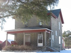
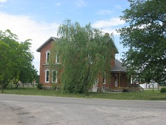
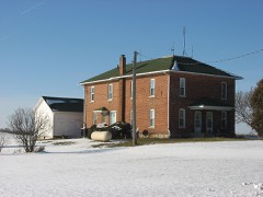
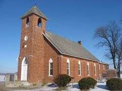
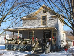
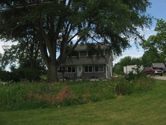
29 National Register listings published here, 1 of them a National Historic Landmark.
Sources: the county history on the Internet Archive · the National Register database, National Park Service
41 topographic sheets cover 26 settlements here, and 29 properties are on the National Register of Historic Places.
29 National Register listings published here, 1 of them a National Historic Landmark.
Sources: the county history on the Internet Archive · the National Register database, National Park Service
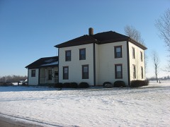
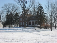
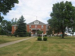
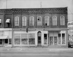
Every property in this county listed on the National Register of Historic Places, with the year it was listed and the federal nomination document.
DeKalb County has 1 covered bridge on the National Register. Each is a listed structure with a federal nomination on file.
 | Spencerville Covered Bridge | Listed 1981 |
Every wildfire the federal occurrence database records inside this county: 14 of them, burning about 64 acres. None started naturally and 3 were recorded as arson. Each settlement page carries the fires within five miles of it.
| Reported cause | Fires |
|---|---|
| Recreation and ceremony | 5 |
| Missing data/not specified/undetermined | 3 |
| Arson/incendiarism | 3 |
| Debris and open burning | 2 |
| Equipment and vehicle use | 1 |
The five largest, by the area the report gives. Two of them were set deliberately.
| Date | Cause | Size | Reported by | Name on the report |
|---|---|---|---|---|
| 20 October 2002 | Recreation and ceremony | 35 acres | Indiana State Fire Marshal's Office | not named |
| 10 November 2004 | Debris and open burning | 20 acres | Indiana State Fire Marshal's Office | not named |
| 12 November 2004 | Recreation and ceremony | 4.0 acres | Indiana State Fire Marshal's Office | not named |
| 16 February 2002 | Missing data/not specified/undetermined | 1.0 acres | Indiana State Fire Marshal's Office | not named |
| 16 April 2003 | Arson/incendiarism | 1.0 acres | Indiana State Fire Marshal's Office | not named |
| 27 April 2004 | Debris and open burning | 1.0 acres | Indiana State Fire Marshal's Office | not named |
| 16 November 2004 | Recreation and ceremony | 1.0 acres | Indiana State Fire Marshal's Office | not named |
| 23 March 2003 | Arson/incendiarism | under an acre | Indiana State Fire Marshal's Office | not named |
Every settlement page carries the fires within five miles of it - see the settlement index below.
The NOAA Storm Events Database holds 199 reports for this county, causing 3 deaths, 10 injuries and about $28,423,250 in recorded property damage. Each settlement page carries the reports that name it.
| Kind of event | Reports |
|---|---|
| Thunderstorm Wind | 120 |
| Hail | 58 |
| Tornado | 13 |
| Flash Flood | 4 |
| Flood | 3 |
| Lightning | 1 |
The most serious of them, by death, then injury, then recorded damage. The accounts are quoted exactly as the forecast office filed them.
| When | Event | Place named | Harm | What the report says |
|---|---|---|---|---|
| May 1996 | Flash Flood | N Dekalb County | 1 killed, $30,000 | no account filed |
| August 2011 | Thunderstorm Wind | Auburn | 1 killed | Law enforcement officials reported multiple trees down along 7th Street. One of these trees in the 400 block of 7th Street, fell onto a westbound United Parcel Service truck, striking the driver compartment. The 46 year old male driver was killed instantly. |
| March 1991 | Thunderstorm Wind | not stated | 1 killed | no account filed |
| July 2016 | Thunderstorm Wind | Spencerville | 3 hurt | Emergency management officials and local media report a 27 year old female was critically injured when a large tree fell onto her vehicle on County Road 68, near State Road 101 in Spencerville. The tree fell onto her minivan's roof between the windshield and rear of the front seats. The van continued forward before going off the road, striking a tree. Two minors were also in the van, but only suffered minor injuries. |
| September 1984 | Thunderstorm Wind | not stated | 3 hurt | no account filed |
| July 2024 | Thunderstorm Wind | Auburn Jct | 1 hurt, $75,000 | State police report a semi truck driver was injured when a tree fell onto the cab of the truck. |
| June 1973 | Tornado (F1) | not stated | 1 hurt, $25,000 | no account filed |
| May 2015 | Thunderstorm Wind | Waterloo | 1 hurt | Emergency management officials reported a empty semi trailer was blown off the road by high winds on Interstate 69, near mile marker 334. The driver sustained minor injuries. |
| May 2015 | Thunderstorm Wind | Waterloo | 1 hurt | Emergency management officials reported a empty semi trailer was blown off the road by high winds on Interstate 69, near mile marker 334. The driver sustained minor injuries. |
| July 1992 | Tornado (F2) | not stated | $25,000,000 | no account filed |
| October 2001 | Tornado (F2) | Corunna | $1,000,000 | no account filed |
| November 2005 | Thunderstorm Wind | Countywide | $750,000 | 4 houses suffered extensive damage in the city of Auburn. Numerous trees, tree limbs, power lines and poles were also blown down. A shed and other building suffered varying degrees of damage. A truck was blown over onto its side. A local resident reported a 2 by 6 stud was driven into the ground. An officer on his way to work reported a large piece of metal being wrapped around a tree on county road 427. Surveys from local emergency and NWS officials found evidence of the formation of gustnadoes where concentrated areas of damage were observed. |
| August 2022 | Thunderstorm Wind | Altona | $300,000 | The Auburn-Garrett drive-in theatre outdoor movie screen suffered extensive damage with half of the panels being ripped off the screen and some supports bent or removed. Damage was estimated at $300,000. |
| June 2000 | Tornado (F1) | Butler Center | $300,000 | Once the previous tornado lifted up into the clouds, the thunderstorm cell moved northeast when this second tornado touched down and followed a skipping path near CR 60. The tornado reached the ground about 3 times. The tornado touched down first in a forested area and knocked down many trees. It then lifted and dropped down again in a residential area about a quarter mile away. There was much damage to houses and barns. A window was broken and a downspout torn off of a house. A satellite dish was twisted and bent while a television antenna was knocked off of a roof. Several trees were snapped and knocked onto power lines before the tornado lifted. It touched down a third time less than a quarter mile away. Trees were knocked down; two of them fell on automobiles. Damage was also seen in fields with corn plants being bent or uprooted. The tornado then lifted back up into the clouds. |
| May 2024 | Hail | Corunna | $200,000 | Hail damage in Corunna, cars, siding, and roofs damaged from 3 inch hail stones. |
| June 2000 | Tornado (F2) | Butler Center | $200,000 | The tornado touched down on CR 64, one half mile west of Indian Springs Camp Ground. Trees and power lines were knocked down and many were snapped and uprooted. Extensive roof damage occurred to houses in the area. A barn was damaged with much of its roof torn off and outbuildings were either damaged or destroyed. The tornado then lifted back into its parent cloud. |
| January 2008 | Flood | Auburn | $150,000 | At least 6 roads were temporarily closed, with many others posted with high water signs, as ditches overflowed and low areas filled. A senior care center was threatened by flood waters coming out of a overflown retention pond. Sandbags were placed to help, but luckily no evacuations were needed. No exact damage figure were available, but are estimated at around $150,000. |
| May 2010 | Flash Flood | Artic | $50,000 | Trained spotters reported several flooded roads across eastern portions of the county. Water was as high as the bumpers on vehicles, with water approaching a few homes and washing out road shoulders. |
| July 2000 | Tornado (F1) | Corunna | $50,000 | This tornado was the first of two weak tornadoes that formed from the same storm. The first touchdown occurred at SR327 and CR16 in the western part of the county. A mobile home was blown off its foundation and completely destroyed. A garage/shed to the northwest of this home sustained damaged to the roof and the garage door was ripped off and left inside the garage. |
| May 2024 | Hail | Summit | $40,000 | no account filed |
| May 2024 | Hail | Summit | $30,000 | Facebook photo of 3 inch hail. |
| August 1997 | Flash Flood | Across County | $25,000 | no account filed |
| April 1969 | Tornado (F0) | not stated | $25,000 | no account filed |
| March 2025 | Thunderstorm Wind | Corunna | $20,000 | Power poles and trees are down. |
| March 2025 | Thunderstorm Wind | Auburn | $20,000 | Power pole on fire due to a lightning strike. Downed power lines in and around Auburn. |
| April 1999 | Thunderstorm Wind | Auburn | $20,000 | One home had its roof blown off with several large trees and limbs down in town. |
| March 2025 | Lightning | Auburn | $15,000 | Power pole on fire due to a lightning strike. |
| July 2024 | Thunderstorm Wind | Auburn | $15,000 | Photo on Twitter shows a large tree down onto a covered porch. Porch roof collapsed. |
| May 2024 | Hail | Corunna | $15,000 | no account filed |
| August 2021 | Thunderstorm Wind | Auburn | $10,000 | Numerous trees were down across the entire county. |
| May 2007 | Thunderstorm Wind | St Joe | $10,000 | Two power poles were snapped off. |
| October 2007 | Thunderstorm Wind | Garrett | $10,000 | Numerous trees and power lines were blown down. |
| June 2023 | Thunderstorm Wind | Auburn | $8,000 | Some shingles removed from a roof and a flag pole was snapped 2 feet above the ground. |
| June 2001 | Thunderstorm Wind | Garrett | $5,000 | Mobile home blown off foundation. Roof damage to some homes. |
| August 2001 | Thunderstorm Wind | Auburn | $5,000 | A mobile home on CR 427 was knocked on its side. Large tree limbs crushed the side of the trailer. A newspaper report stated that a citizens' band radio tower, set in cement, also toppled over and bent across the trailer. At another property across the street several trees were knocked down and two large pine trees were uprooted. |
| July 2000 | Tornado (F0) | Sedan | $5,000 | This second tornado touched down just west of Sedan on US HWY6. Damage at this location consisted of large tree branches being torn off trees and a few small trees being blown over. A garage made of concrete blocks was shifted off its foundation to the southwest a couple of inches. The roof was also peeled off of a small house at CR19 and US6. |
| October 2001 | Thunderstorm Wind | Waterloo | $3,000 | HAM radio operator reported roof blown off house near Waterloo. |
| June 1973 | Tornado (F0) | not stated | $2,500 | no account filed |
| April 1968 | Tornado | not stated | $2,500 | no account filed |
| July 2005 | Thunderstorm Wind | Garrett | $2,000 | Several power lines and tree limbs were blown down. |
| August 2021 | Thunderstorm Wind | Sedan | $1,500 | US highway 6 was closed due to a tree downed or a sign downed. |
| July 2025 | Flood | Auburn | $1,000 | Photo on social media of standing water, estimated to be a few inches deep, throughout a strip mall parking lot. |
| July 2021 | Thunderstorm Wind | Auburn | $1,000 | Tree blown down. |
| July 1995 | Thunderstorm Wind | not stated | $1,000 | Powerlines were blown down in Waterloo. |
| June 2001 | Thunderstorm Wind | Butler | $750 | Roof blown off porch of house. |
| July 2023 | Thunderstorm Wind | St Joe | - | Tree limbs down in the Saint Joe area. Time estimated by radar. |
| May 2022 | Thunderstorm Wind | Auburn | - | The pubic reported a small tree was blown down. |
| March 2022 | Thunderstorm Wind | St Joe | - | The public reported a trampoline was destroyed with parts of it piercing through a garage wall. |
| March 2022 | Thunderstorm Wind | Moore | - | The public reported several three inch diameter tree branches were broken. |
| August 2022 | Thunderstorm Wind | Auburn Dekalb Co Arp | - | The AWOS station KGWB Auburn Dekalb County Airport reported a 51 knot wind gust. |
| July 2022 | Hail | Fairfield Center | - | Quarter size hail lasted about one minute at Story Lake. |
| June 2021 | Thunderstorm Wind | Garrett | - | The public reported a tree down in the roadway. |
| June 2021 | Thunderstorm Wind | Corunna | - | The public reports that a tree fell onto a house and knocked town the phone lines. |
| June 2021 | Thunderstorm Wind | Auburn | - | The public reports a tree is down and blocking the roadway. |
| June 2021 | Thunderstorm Wind | Hamilton | - | The public reports a tree is blocking the west lane of the roadway. |
| June 2021 | Thunderstorm Wind | Auburn | - | The public reports that a tree fell into wires and that both are in the roadway. |
| June 2021 | Thunderstorm Wind | Spencerville | - | A large tree limb fell onto a house, a motorhome, and powerlines. |
| June 2021 | Thunderstorm Wind | Waterloo | - | A spotter recorded a 59 mph wind gust. |
| July 2021 | Thunderstorm Wind | Altona | - | Trees down. Report via social media. Time estimated from radar. |
| May 2020 | Thunderstorm Wind | Auburn | - | Central dispatch relayed a report of a tree being blown down onto a garage on 9th Street in Auburn. No information on the size or health of the tree and no injuries were reported. |
History of Dekalb County, Indiana, with Biographical Sketches of Representative Citizens and Genealogical Records of Old Families devotes a chapter to each township: its boundaries and streams, who settled it and when, the mills, the schools and the churches. All 15 are reproduced here in full. Each row shows the township's own shape and where it lies in the county, drawn from the Census Bureau's boundary. Which settlements belong to which township is computed from that same boundary, not taken from the book.
| Shape and position in the county | Township | Settlements in it | Length | Sections |
|---|---|---|---|---|
| Butler Township | Butler Center, Cedar, New Era, Saint Johns | 586 words | 3 | |
| Concord Township | Concord, Orangeville, Saint Joe | 1,429 words | 4 | |
| Fairfield Township | Fairfield Center | 852 words | 3 | |
| Franklin Township | Taylor Corner | 1,061 words | 3 | |
| Grant Township | Waterloo | 1,203 words | 3 | |
| Jackson Township | Auburn Junction, Hopewell | 1,125 words | 5 | |
| Keyser Township | Altona, Garrett | 2,823 words | 12 | |
| Newville Township | Newville, Newville Center | 614 words | 2 | |
| Richland Township | Corunna, Sedan | 839 words | 3 | |
| Smithfield Township | Ashley, Summit | 1,855 words | 3 | |
| Spencer Township | Spencerville | 126 words | 0 | |
| Stafford Township | Stafford Center | 546 words | 2 | |
| Troy Township | Artic | 444 words | 2 | |
| Union Township | Auburn | 4,466 words | 16 | |
| Wilmington Township | Butler, Moore | 2,634 words | 7 |
One book written about this county, cut here where the book itself is cut, at its printed chapters: 18 chapters in all. Every chapter is public domain, machine-read from the scan and reproduced complete. A chapter already given under one of the county's towns is not repeated in this list.
| Chapter | Length |
|---|---|
| Biographical sketches (1 of 2 so headed) | 5,316 words |
| Chapter 2: Geology, Topography and Zoology | 5,019 words |
| Chapter 3: Early Settlement of County | 12,215 words |
| Chapter 4: Organization and Government of County | 4,673 words |
| Chapter 5: Military History | 8,055 words |
| Chapter 6: Reminiscences | 10,297 words |
| Chapter 8: Religious History | 10,857 words |
| Chapter 9: History of Journalism | 5,041 words |
| Chapter 10: The Medical Profession | 3,896 words |
| The Bench and Bar | 1,969 words |
| Chapter 12: Political History | 2,004 words |
| Chapter 13: History of Education | 7,353 words |
| Chapter 14: Agriculture | 2,769 words |
| Chapter 15: Railroads and Transportation | 6,714 words |
| Chapter 16: Sanks and Banking | 2,239 words |
| Chapter 17: Lodges and Societies | 2,420 words |
| Chapter 18: Miscellaneous | 1,228 words |
| Biographical sketches (2 of 2 so headed) | 304,783 words in 20 parts |
Named settlements recorded in the Geographic Names Information System, each with the topographic sheets covering it. Villages, hamlets and abandoned places alike. Each is shown with the nearest named watercourse or landform and the survey quadrangle it falls on.