 Block
Waterloo, Indiana
11 topographic sheets cover this place, the earliest surveyed in 1953 and the latest in 1994. It stands in Grant Township. It lies in ZIP code area 46793. The Survey maps it on the Waterloo quadrangle. 2,116 people lived here at the 2020 count. It stands 906 feet above sea level.
On record in Waterloo
Buildings and businesses the archive holds for this place. Each opens its own page, with the source record it came from.
On the National Register 1 record
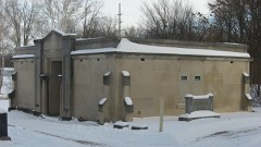 Waterloo Community Mausoleumlisted 2014
Population over time
2 figuresWaterloo fell from 2,242 to 2,116 between 2010 and 2020. These are the recorded population figures Wikidata holds for this place, reached through the Geographic Names Information System number this page is keyed on rather than by name, so they belong to this place and not to another of the same name. Most are census counts, but not all are: an early figure may be a founding or settlement estimate, and an estimate published within five years of a census is left out. The change column is computed, and is left blank where more than 20 years separate a figure from the one before it, because a gap that long is not a change between two counts.
| Year | People | Change |
|---|---|---|
| 2010 | 2,242 | |
| 2020 | 2,116 | -126 (-6%) |
Topographic sheets covering this place
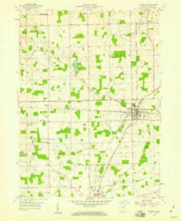
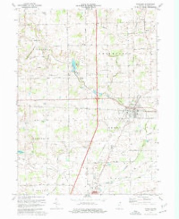
6 surveys from 11 printed sheetsMatched by testing this settlement's coordinate against the published boundary of every sheet in the United States Geological Survey's historical collection. Each opens the scanned sheet at the Survey.
- 1953 USGS Fort Wayne quadrangle1:250000, 4 printings
- 1956 USGS Fort Wayne quadrangle1:250000, 2 printings
- 1957 USGS Waterloo quadrangle1:24000
- 1973 USGS Waterloo quadrangle1:24000, 2 printings
- 1984 USGS Fort Wayne quadrangle1:100000
- 1994 USGS Fort Wayne quadrangle1:100000




In the county-history sources
1,203 words on this townshipHistory of Dekalb County, Indiana, with Biographical Sketches of Representative Citizens and Genealogical Records of Old Families, published 1914 names this settlement in its chapter on Grant Township. These are the passages that mention it, exactly as the scans read.
Four and a half miles north of Auburn is located the town of Waterloo, in Grant township. The town was formerly in Union township, but upon the division of the latter, the place fell within the bounds of the new township of Grant. Two branches of the Lake Shore & Michigan Southern railroad meet at Waterloo, making the town important as a shipping center. In 1890 the town had a population of one thousand four hundred and seventythree; in 1900, one thousand two hundred and forty-four; and in 1910, one thousand one hundred and sixty seven.
Passage source: History of Dekalb County, Indiana, with Biographical Sketches of Representative Citizens and Genealogical Records of Old Families, published 1914.
The first settlement near the present site of Waterloo was made near Cedar creek, northeast, and was called Uniontown; it is now a mere suburb to Waterloo. Wesley Park erected a board shanty on the site of Uniontown in 1838 as a shelter for two men who were building a bridge over Cedar creek at that point. In November, 1838, D. Altenburg and L. Walsworth and their families, together with the two bridge builders, passed a night while the settlers were on their way from Steubenville to their selections of land in Union township.
Passage source: History of Dekalb County, Indiana, with Biographical Sketches of Representative Citizens and Genealogical Records of Old Families, published 1914.
Owing to the fact that the place was on the line of the state road from Fort Wayne north through Angola, and being remote from other settlements, it was thought to be a splendid site for a town, and accordingly a plat was made by Frederick Krum. George Trout built a store building and estab- lished a trading point. The firm of M. & A. Hale next entered the merchandise business. James Bowman erected a water power saw mill, and about 1856, after the laying out of Waterloo, changed it to a steam power mill. Richard Burniston was the local blacksmith; Dr. Jones the physician, Mr. Wareham the gunsmith, and a Mr. Smith had a cabinet shop.
Passage source: History of Dekalb County, Indiana, with Biographical Sketches of Representative Citizens and Genealogical Records of Old Families, published 1914.
Machine-read from a century-old scan, so expect the errors a machine makes: misspelled names, dropped words, stray characters.
Read the whole chapter on Grant Township - it names this place 3 more 3 times.
Fires near this place
8 since 2002Regional context, not property-specific evidence. The federal wildfire occurrence database lists 8 fires within 5 miles of Waterloo between 2002 and 2004, burning about 62 acres in total. None started naturally. 1 was recorded as arson. Distance is straight-line from the map coordinates, so a fire counted here may appear on a neighbouring settlement's page as well.
| Reported cause | Fires |
|---|---|
| Recreation and ceremony | 4 |
| Debris and open burning | 2 |
| Missing data/not specified/undetermined | 1 |
| Arson/incendiarism | 1 |
The most recent of them, most recent first, with the day each was reported and the service that recorded it.
| Date | Cause | Size | Reported by | Name on the report |
|---|---|---|---|---|
| 27 April 2004 | Debris and open burning | 1.0 acres | Indiana State Fire Marshal's Office | not named |
| 23 March 2003 | Arson/incendiarism | under an acre | Indiana State Fire Marshal's Office | not named |
| 11 March 2002 | Recreation and ceremony | under an acre | Indiana State Fire Marshal's Office | not named |
| 16 November 2004 | Recreation and ceremony | 1.0 acres | Indiana State Fire Marshal's Office | not named |
| 12 November 2004 | Recreation and ceremony | 4.0 acres | Indiana State Fire Marshal's Office | not named |
| 10 November 2004 | Debris and open burning | 20 acres | Indiana State Fire Marshal's Office | not named |
| 10 November 2003 | Missing data/not specified/undetermined | under an acre | Indiana State Fire Marshal's Office | not named |
| 20 October 2002 | Recreation and ceremony | 35 acres | Indiana State Fire Marshal's Office | not named |
Settlements close enough to share some of these fires:
Mines and quarries near this place
2 within 5 milesRegional context, not property-specific evidence. The federal mineral resources record lists 2 workings within 5 miles of Waterloo: 2 producers. All of them still produce. What was taken out: Sand and Gravel, Construction. Distance is straight-line from the map coordinates, so a quarry counted here may appear on a neighbouring settlement's page as well.
| Where | Site | Commodity | Status | Recorded |
|---|---|---|---|---|
| Bailey Pit | Sand and Gravel, Construction | Producer | ||
| Brand Sand Pit | Sand and Gravel, Construction | Producer |
Storms near this place
11 since 1998Regional context, not property-specific evidence. The National Weather Service names Waterloo in 11 storm reports between 1998 and 2021: 7 thunderstorm wind, 4 hail. The reports record 2 injuries. Each account below is quoted exactly as the forecast office filed it, from the NOAA Storm Events Database, and each date opens the federal record of that event.
| When | Event | Place named | Harm | What the report says |
|---|---|---|---|---|
| May 2015 | Thunderstorm Wind | Waterloo | 1 hurt | Emergency management officials reported a empty semi trailer was blown off the road by high winds on Interstate 69, near mile marker 334. The driver sustained minor injuries. |
| May 2015 | Thunderstorm Wind | Waterloo | 1 hurt | Emergency management officials reported a empty semi trailer was blown off the road by high winds on Interstate 69, near mile marker 334. The driver sustained minor injuries. |
| October 2001 | Thunderstorm Wind | Waterloo | $3,000 | HAM radio operator reported roof blown off house near Waterloo. |
| June 2021 | Thunderstorm Wind | Waterloo | - | A spotter recorded a 59 mph wind gust. |
| June 2008 | Thunderstorm Wind | Waterloo | - | Tree limbs were reported down across some roads in the area, causing brief closures and some power outages in the Waterloo area. |
| June 2006 | Hail | Waterloo | - | Ashley is located on the Steuben and Deklab county line. |
| July 2003 | Thunderstorm Wind | Waterloo | - | Emergency management reported trees and power lines down in Waterloo. |
| July 2005 | Hail | Waterloo | - | no account filed |
| April 2003 | Hail | Waterloo | - | no account filed |
| May 1999 | Hail | Waterloo | - | no account filed |
| July 1998 | Thunderstorm Wind | Waterloo | - | no account filed |
Nearest settlements
The eight closest, with where each one stands in the county. Distances are straight-line, computed from the Geographic Names Information System coordinates.
| Map | Place | Distance | Sheets |
|---|---|---|---|
| Sedan | 4.2 miles | 11 | |
| Moore | 4.3 miles | 10 | |
| Auburn | 4.9 miles | 11 | |
| Taylor Corner | 5.3 miles | 10 | |
| Summit | 5.6 miles | 14 | |
| Auburn Junction | 6.2 miles | 11 | |
| Fairfield Center | 6.7 miles | 10 | |
| Corunna | 6.8 miles | 10 |
Elsewhere
Matched on this settlement's Geographic Names Information System number rather than its name, so it cannot be a different place of the same name in another state.
| Wikipedia article on Waterloo | An encyclopaedic summary. Its text is share-alike, so it is linked here rather than copied. |
| Wikidata item Q2705510 | The structured record the population and elevation above come from. Public domain (CC0). |
Provenance
This settlement is recorded in the Geographic Names Information System as feature 445542. The sheet list is computed by point-in-boundary test against the United States Geological Survey's historical topographic inventory. Both are works of the United States government and carry no copyright under 17 U.S.C. 105.
Wildfire. Short, Karen C. 2022. Spatial wildfire occurrence data for the United States, 1992-2020 [FPA_FOD_20221014]. 6th Edition. Fort Collins, CO: Forest Service Research Data Archive. https://doi.org/10.2737/RDS-2013-0009.6 Collected with United States Government funding and usable without additional permissions or fees.
Mines and quarries. USGS Mineral Resources Data System (MRDS) https://mrdata.usgs.gov/mrds/ A work of the United States government, no copyright under 17 U.S.C. 105.
Storms. NOAA National Centers for Environmental Information, Storm Events Database https://www.ncei.noaa.gov/stormevents/ A work of the United States government, no copyright under 17 U.S.C. 105. Narratives are quoted verbatim from the National Weather Service report and are not edited or summarised.