 Block
Connersville, Indiana
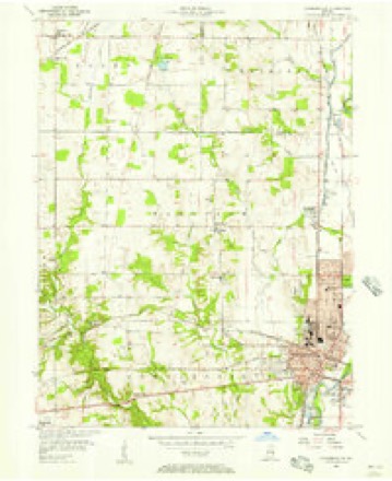
9 topographic sheets cover this place, the earliest surveyed in 1953 and the latest in 1986. It stands in Connersville Township. It lies in ZIP code area 47331. The Survey maps it on the Connersville quadrangle. 13,324 people lived here at the 2020 count. It stands 823 feet above sea level.
Research this city
On record in Connersville
Buildings and businesses the archive holds for this place. Each opens its own page, with the source record it came from.
On the National Register 6 records
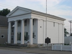 Canal Houselisted 1973
 Elmhurstlisted 1977
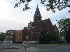 Fayette County Courthouselisted 2006
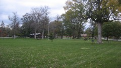 Roberts Parklisted 2014
- Newkirk Mansionlisted 2021
- Trinity Episcopal Church & Parish Houselisted 2022
Population over time
2 figuresConnersville fell from 13,481 to 13,324 between 2010 and 2020. These are the recorded population figures Wikidata holds for this place, reached through the Geographic Names Information System number this page is keyed on rather than by name, so they belong to this place and not to another of the same name. Most are census counts, but not all are: an early figure may be a founding or settlement estimate, and an estimate published within five years of a census is left out. The change column is computed, and is left blank where more than 20 years separate a figure from the one before it, because a gap that long is not a change between two counts.
| Year | People | Change |
|---|---|---|
| 2010 | 13,481 | |
| 2020 | 13,324 | -157 (-1%) |
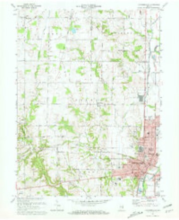
Topographic sheets covering this place
5 surveys from 9 printed sheetsMatched by testing this settlement's coordinate against the published boundary of every sheet in the United States Geological Survey's historical collection. Each opens the scanned sheet at the Survey.
- 1953 USGS Cincinnati quadrangle1:250000, 3 printings
- 1956 USGS Connersville quadrangle1:24000
- 1957 USGS Cincinnati quadrangle1:250000
- 1972 USGS Connersville quadrangle1:24000, 2 printings
- 1986 USGS New Castle quadrangle1:100000, 2 printings



In the county-history sources
5,332 words on this townshipHistory of Fayette County, Indiana: Containing a History of the Townships, Towns, Villages, Schools, Churches, Industries, Etc.; Portraits of Early Settlers and Prominent Men; Biographies, Etc., Etc. .., published 1885 names this settlement in its chapter on Connersville Township. These are the passages that mention it, exactly as the scans read.
The first settlement in the township was made at Conner's trading-post or station, some time between the years 1804 and 1808. Here John Conner and family are believed to have dwelt for several years among the Indians, with no white neighbors save those on East Fork and on West Fork in what are now Union and Franklin Counties. However, the lands surrounding him were settled at a period beginning about the year 1811.
Passage source: History of Fayette County, Indiana: Containing a History of the Townships, Towns, Villages, Schools, Churches, Industries, Etc.; Portraits of Early Settlers and Prominent Men; Biographies, Etc., Etc. .., published 1885.
Alexander Saxon with family emigrated from Georgia in the fall of 1811, and settled on the southeast quarter of Section 25. Near a point opposite where the lower mill in Connersville now stands, was the place for crossing the river. Here Mr. Saxon kept a canoe, and ferried travelers across the river. n The localities of settlement of a number of the following named pioneers can be traced by reference to the land entries given above. Moses Lookhart from Kentucky, settled in the township in 1812. Thomas Reed, from the same State, settled the same year. Joseph Minor located on the land where Joe and Sam Minor now live in 1812. John and Thomas Reed built cabins on the same land. They were father and son. Larkin Sims, from Kentucky, and
Passage source: History of Fayette County, Indiana: Containing a History of the Townships, Towns, Villages, Schools, Churches, Industries, Etc.; Portraits of Early Settlers and Prominent Men; Biographies, Etc., Etc. .., published 1885.
Thomas Sergeant, a native of North Carolina, removed with his parents to Virginia in 1796. In 1807 he removed to Kentucky, and in 1813 to Indiana Territory, and settled south of Connersville. In 1820 he entered land in Rush County |at the land sales at Brookville, and that winter removed thereon, cutting the road for the wagon as he went.
Passage source: History of Fayette County, Indiana: Containing a History of the Townships, Towns, Villages, Schools, Churches, Industries, Etc.; Portraits of Early Settlers and Prominent Men; Biographies, Etc., Etc. .., published 1885.
Machine-read from a century-old scan, so expect the errors a machine makes: misspelled names, dropped words, stray characters.
Read the whole chapter on Connersville Township - it names this place 18 more 18 times.
Mines and quarries near this place
3 within 5 milesRegional context, not property-specific evidence. The federal mineral resources record lists 3 workings within 5 miles of Connersville: 3 producers. All of them still produce. What was taken out: Sand and Gravel, Construction, Stone. Distance is straight-line from the map coordinates, so a quarry counted here may appear on a neighbouring settlement's page as well.
| Where | Site | Commodity | Status | Recorded |
|---|---|---|---|---|
| Fayette Co. Hwy. Dept. - Own Crews | Stone | Producer | ||
| Connersville Pit | Sand and Gravel, Construction | Producer | ||
| Park Road Gravel Pit | Sand and Gravel, Construction | Producer |
Storms near this place
60 of 76 shownRegional context, not property-specific evidence. The National Weather Service names Connersville in 76 storm reports between 1995 and 2025: 47 thunderstorm wind, 12 hail, 8 flood, 7 flash flood. The reports record 1 injury. Each account below is quoted exactly as the forecast office filed it, from the NOAA Storm Events Database, and each date opens the federal record of that event.
| When | Event | Place named | Harm | What the report says |
|---|---|---|---|---|
| August 2024 | Lightning | Connersville | 1 hurt | A person carrying an aluminum umbrella pole was struck by lightning at a park pool. |
| February 2019 | Flash Flood | Connersville | $100,000 | Two county roads were washed away due to flooding. In addition, numerous roads were closed due to flooding. |
| July 2012 | Thunderstorm Wind | Connersville | $25,000 | Several large trees were downed, parts of roofing were removed from a business, and a billboard was blown down due to thunderstorm winds. |
| August 1995 | Thunderstorm Wind | Connersville | $20,000 | The wall framing and roof trusses of a department store under construction were destroyed by thunderstorm winds. |
| June 1995 | Hail | Connersville | $20,000 | Large hail damaged automobiles and destroyed crops. |
| May 2011 | Thunderstorm Wind | Connersville | $16,000 | Trailers were overturned due to damaging thunderstorm winds. |
| June 2023 | Thunderstorm Wind | Connersville | $10,000 | A tree fell onto a residence. |
| July 2023 | Thunderstorm Wind | Connersville | $10,000 | Numerous trees were downed in the Connersville area. |
| April 2019 | Thunderstorm Wind | Connersville | $8,000 | Several pine trees were knocked down at 930 Ranch Rd. A roof was damaged at 1062 West 10th Street. |
| June 2025 | Thunderstorm Wind | Connersville | $5,000 | Several trees were downed throughout the county, especially in the Connersville area. |
| May 2022 | Thunderstorm Wind | Connersville | $5,000 | Several trees were downed across Fayette County. |
| March 2011 | Flood | Connersville | $5,000 | Several roads were flooded due to heavy rainfall. |
| April 2006 | Thunderstorm Wind | Connersville | $5,000 | Two trees, large limbs and power poles were knocked down. |
| October 2001 | Thunderstorm Wind | Connersville | $5,000 | Trees were knocked down on Big Bear Rd. |
| August 2000 | Thunderstorm Wind | Connersville | $5,000 | Numerous trees downed by thunderstorm winds. |
| November 2000 | Thunderstorm Wind | Connersville | $5,000 | Numerous trees and power lines knocked down. |
| June 1998 | Thunderstorm Wind | Connersville | $5,000 | Numerous trees and power lines downed. |
| June 1998 | Thunderstorm Wind | Connersville | $5,000 | Trees and power lines downed. |
| June 1995 | Thunderstorm Wind | Connersville | $5,000 | Several trees and power lines were downed. |
| June 2001 | Hail | Connersville | $5,000 | no account filed |
| June 1995 | Thunderstorm Wind | Connersville | $4,000 | Power lines were downed by thunderstorm winds along State Route One. |
| June 2022 | Thunderstorm Wind | Connersville | $3,000 | A few trees were downed in Roberts Park. |
| July 2008 | Thunderstorm Wind | Connersville | $3,000 | Trees were downed. |
| May 2006 | Thunderstorm Wind | Connersville | $3,000 | Trees were knocked down. |
| June 2006 | Thunderstorm Wind | Connersville | $3,000 | Trees and power lines were downed. |
| June 2005 | Thunderstorm Wind | Connersville | $3,000 | Large limbs were knocked down along Williams Road. |
| June 2005 | Thunderstorm Wind | Connersville | $3,000 | Two trees were downed along Base Road. |
| July 2005 | Thunderstorm Wind | Connersville | $3,000 | Several trees and large limbs were knocked down. |
| July 2003 | Thunderstorm Wind | Connersville | $3,000 | Several trees were downed across town. One tree fell on Third Street, causing the road to close for a short period of time. |
| September 2002 | Thunderstorm Wind | Connersville | $3,000 | A few trees were blown down. |
| November 2001 | Thunderstorm Wind | Connersville | $3,000 | Two trees were knocked down across the western part of the county. |
| June 2000 | Thunderstorm Wind | Connersville | $3,000 | Trees and powerlines were blown down. |
| June 1998 | Thunderstorm Wind | Connersville | $3,000 | Trees downed. |
| May 1995 | Thunderstorm Wind | Connersville | $3,000 | Trees downed, some across railroad tracks. |
| March 1997 | Thunderstorm Wind | Connersville | $3,000 | no account filed |
| July 2020 | Thunderstorm Wind | Connersville | $2,000 | A tree was downed and a privacy fence was blown over. Several large branches were also downed in Dale Cemetery. |
| April 2020 | Thunderstorm Wind | Connersville | $2,000 | Two large trees were knocked onto Western Avenue, blocking the road. |
| July 2013 | Thunderstorm Wind | Connersville | $2,000 | A tree was downed on wires in Connersville due to thunderstorm winds. |
| April 2011 | Flash Flood | Connersville | $2,000 | Multiple roads were closed due to high water. |
| October 2010 | Thunderstorm Wind | Connersville | $2,000 | Numerous trees were reported down due to damaging thunderstorm winds. |
| August 2009 | Thunderstorm Wind | Connersville | $2,000 | Powerlines were reported down due to damaging thunderstorm winds. |
| February 2006 | Thunderstorm Wind | Connersville | $2,000 | Two trees were knocked down. |
| May 2003 | Thunderstorm Wind | Connersville | $2,000 | Numerous large limbs were downed in and around town. |
| April 2007 | Thunderstorm Wind | Connersville | $2,000 | no account filed |
| January 1996 | Thunderstorm Wind | Connersville | $2,000 | no account filed |
| March 2025 | Thunderstorm Wind | Connersville | $1,000 | A tree was downed. |
| April 2025 | Thunderstorm Wind | Connersville | $1,000 | A tree was downed on Country Club Road. |
| May 2014 | Thunderstorm Wind | Connersville | $1,000 | Two trees were downed due to thunderstorm winds. One was located near Ohio Avenue and the other was located at Vine Street and Alquina Road in Connersville. |
| June 2014 | Thunderstorm Wind | Connersville | $1,000 | One tree was downed on 29th Street due to thunderstorm winds. |
| August 2011 | Thunderstorm Wind | Connersville | $1,000 | Large tree limbs were reported down due to damaging thunderstorm winds. |
| June 2010 | Thunderstorm Wind | Connersville | $1,000 | Trees were reported down due to damaging thunderstorm winds. |
| May 2002 | Flash Flood | Connersville | $1,000 | State Route 121 was closed due to high water. |
| April 1997 | Lightning | Connersville | $1,000 | no account filed |
| March 2023 | Flood | Connersville | - | High water was reported near the intersection of County Road 175 S and State Route 121. |
| June 2022 | Flood | Connersville | - | High water was on the road near County Road 150N and County Road 150E. |
| December 2021 | Thunderstorm Wind | Connersville | - | Several trees were downed in the Connersville area. |
| March 2020 | Flash Flood | Connersville | - | High water was running over the roadway near the intersection of State Route 121 and W County Road 175 South. |
| March 2020 | Flash Flood | Connersville | - | Several roads were closed throughout the county due to high water. |
| February 2019 | Flood | Connersville | - | Several roads remained closed due to flooding. |
| April 2018 | Flash Flood | Connersville | - | High water was reported running across Route 1 near 300 South. |
Nearest settlements
The eight closest, with where each one stands in the county. Distances are straight-line, computed from the Geographic Names Information System coordinates.
| Map | Place | Distance | Sheets |
|---|---|---|---|
| Tyner Crossing | 2.1 miles | 9 | |
| Huber | 3.1 miles | 9 | |
| Harrisburg | 3.8 miles | 9 | |
| Bunker Hill | 3.8 miles | 9 | |
| Nulltown | 4.3 miles | 10 | |
| Longwood Crossing | 4.7 miles | 9 | |
| Lyonsville | 4.7 miles | 10 | |
| Springersville | 4.8 miles | 10 |
Elsewhere
Matched on this settlement's Geographic Names Information System number rather than its name, so it cannot be a different place of the same name in another state.
| Wikipedia article on Connersville | An encyclopaedic summary. Its text is share-alike, so it is linked here rather than copied. |
| Wikidata item Q532408 | The structured record the population and elevation above come from. Public domain (CC0). |
Provenance
This settlement is recorded in the Geographic Names Information System as feature 432888. The sheet list is computed by point-in-boundary test against the United States Geological Survey's historical topographic inventory. Both are works of the United States government and carry no copyright under 17 U.S.C. 105.
Mines and quarries. USGS Mineral Resources Data System (MRDS) https://mrdata.usgs.gov/mrds/ A work of the United States government, no copyright under 17 U.S.C. 105.
Storms. NOAA National Centers for Environmental Information, Storm Events Database https://www.ncei.noaa.gov/stormevents/ A work of the United States government, no copyright under 17 U.S.C. 105. Narratives are quoted verbatim from the National Weather Service report and are not edited or summarised.