 Block
Springersville, Indiana
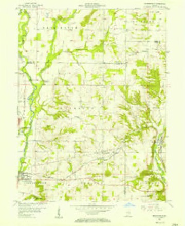
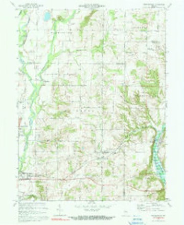
10 topographic sheets cover this place, the earliest surveyed in 1953 and the latest in 1986. It stands in Waterloo Township. It lies in ZIP code area 47331. The Survey maps it on the Brownsville quadrangle. It stands 909 feet above sea level.
Topographic sheets covering this place
5 surveys from 10 printed sheetsMatched by testing this settlement's coordinate against the published boundary of every sheet in the United States Geological Survey's historical collection. Each opens the scanned sheet at the Survey.
- 1953 USGS Cincinnati quadrangle1:250000, 3 printings
- 1956 USGS Brownsville quadrangle1:24000
- 1957 USGS Cincinnati quadrangle1:250000
- 1972 USGS Brownsville quadrangle1:24000, 3 printings
- 1986 USGS New Castle quadrangle1:100000, 2 printings



In the county-history sources
7,163 words on this townshipHistory of Fayette County, Indiana: Containing a History of the Townships, Towns, Villages, Schools, Churches, Industries, Etc.; Portraits of Early Settlers and Prominent Men; Biographies, Etc., Etc. .., published 1885 names this settlement in its chapter on Waterloo Township. These are the passages that mention it, exactly as the scans read.
In 1839 or thereabouts Drs. Richardson and Chapman were the physicians of the village, Reuben Hawkins and Isaac Kline were the blacksmiths, and Joseph Forrey inn-keeper (Eagle House). Not far from this period Dr. Richardson built a sawmill on Nolan's Fork, which was then in operation. This was subsequently owned by John Grewell and still later , ^ by John Troxell, in whose hands it fell into disuse. Nearly sixty years ago Waterloo was a Methodist preaching place on the old Whitewater Circuit. Prior to the war of the Rebellion there was built at Waterloo a frame church by subscription, in which all denominations were to hold worship. It was probably used more frequently by the United Brethren Society. All religious societies there have long since passed into history, there being no church building or organization now in the village.
Passage source: History of Fayette County, Indiana: Containing a History of the Townships, Towns, Villages, Schools, Churches, Industries, Etc.; Portraits of Early Settlers and Prominent Men; Biographies, Etc., Etc. .., published 1885.
Machine-read from a century-old scan, so expect the errors a machine makes: misspelled names, dropped words, stray characters.
Mines and quarries near this place
2 within 5 milesRegional context, not property-specific evidence. The federal mineral resources record lists 2 workings within 5 miles of Springersville: 2 producers. All of them still produce. What was taken out: Sand and Gravel, Construction, Stone. Distance is straight-line from the map coordinates, so a quarry counted here may appear on a neighbouring settlement's page as well.
| Where | Site | Commodity | Status | Recorded |
|---|---|---|---|---|
| Fayette Co. Hwy. Dept. - Own Crews | Stone | Producer | ||
| Park Road Gravel Pit | Sand and Gravel, Construction | Producer |
Storms near this place
1 since 2018Regional context, not property-specific evidence. The National Weather Service names Springersville in 1 storm report in 2018: 1 flash flood. No death or injury is recorded in these reports. Each account below is quoted exactly as the forecast office filed it, from the NOAA Storm Events Database, and each date opens the federal record of that event.
| When | Event | Place named | Harm | What the report says |
|---|---|---|---|---|
| April 2018 | Flash Flood | Springersville | - | Several roads were closed countywide due to flash flooding. |
Nearest settlements
The eight closest, with where each one stands in the county. Distances are straight-line, computed from the Geographic Names Information System coordinates.
| Map | Place | Distance | Sheets |
|---|---|---|---|
| Lyonsville | 0.3 miles | 10 | |
| Alquina | 3.1 miles | 11 | |
| Waterloo | 4.1 miles | 10 | |
| Connersville | 4.8 miles | 9 | |
| Huber | 4.9 miles | 9 | |
| Tyner Crossing | 6.5 miles | 9 | |
| Everton | 6.8 miles | 11 | |
| Harrisburg | 7.0 miles | 9 |
Elsewhere
Matched on this settlement's Geographic Names Information System number rather than its name, so it cannot be a different place of the same name in another state.
| Wikipedia article on Springersville | An encyclopaedic summary. Its text is share-alike, so it is linked here rather than copied. |
| Wikidata item Q7580878 | The structured record the population and elevation above come from. Public domain (CC0). |
Provenance
This settlement is recorded in the Geographic Names Information System as feature 444008. The sheet list is computed by point-in-boundary test against the United States Geological Survey's historical topographic inventory. Both are works of the United States government and carry no copyright under 17 U.S.C. 105.
Mines and quarries. USGS Mineral Resources Data System (MRDS) https://mrdata.usgs.gov/mrds/ A work of the United States government, no copyright under 17 U.S.C. 105.
Storms. NOAA National Centers for Environmental Information, Storm Events Database https://www.ncei.noaa.gov/stormevents/ A work of the United States government, no copyright under 17 U.S.C. 105. Narratives are quoted verbatim from the National Weather Service report and are not edited or summarised.