 Block
Harrisburg, Indiana
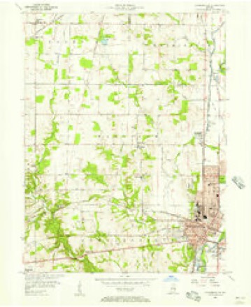
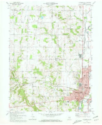
9 topographic sheets cover this place, the earliest surveyed in 1953 and the latest in 1986. It stands in Harrison Township. It lies in ZIP code area 47331. The Survey maps it on the Connersville quadrangle. It stands 1,007 feet above sea level.
Topographic sheets covering this place
5 surveys from 9 printed sheetsMatched by testing this settlement's coordinate against the published boundary of every sheet in the United States Geological Survey's historical collection. Each opens the scanned sheet at the Survey.
- 1953 USGS Cincinnati quadrangle1:250000, 3 printings
- 1956 USGS Connersville quadrangle1:24000
- 1957 USGS Cincinnati quadrangle1:250000
- 1972 USGS Connersville quadrangle1:24000, 2 printings
- 1986 USGS New Castle quadrangle1:100000, 2 printings



In the county-history sources
12,702 words on this townshipHistory of Fayette County, Indiana: Containing a History of the Townships, Towns, Villages, Schools, Churches, Industries, Etc.; Portraits of Early Settlers and Prominent Men; Biographies, Etc., Etc. .., published 1885 names this settlement in its chapter on Harrison Township. These are the passages that mention it, exactly as the scans read.
Its surface is undulating and well adapted for agricultural purposes, having good natural drainage, and the greater portion being well watered by springs and streams, the larger of which are West Fork, Big and Little Williams Creeks, and Lick Creek. At the last appraisement the lands were rated for taxation at $38 per acre without and 141 with improvements. The people are industrious and given almost entirely to agricultural pursuits, there being one notable industry, a tile factory, in the township. For several years past some special attention has been given to the manufacture of butter and cheese, there having been established two dairies of probably less than 100 cows each, the proprietors of which are Enoch Caldwell and Warner Broaddus. The eastern part of the township is crossed north and south by the White, water Valley, and Fort Wayne, Cincinnati & Louisville Railroads, and the citizens of that locality have, too, the advantage of the Hydraulic, which runs parallel with the railroads.
Passage source: History of Fayette County, Indiana: Containing a History of the Townships, Towns, Villages, Schools, Churches, Industries, Etc.; Portraits of Early Settlers and Prominent Men; Biographies, Etc., Etc. .., published 1885.
Located in the northwestern part of the township are extensive tile works, which have been in operation for quite a period of years, carried on for some time by Ellis & Williams, and subsequently by John Payne, the present Auditor of the county.
Passage source: History of Fayette County, Indiana: Containing a History of the Townships, Towns, Villages, Schools, Churches, Industries, Etc.; Portraits of Early Settlers and Prominent Men; Biographies, Etc., Etc. .., published 1885.
Among the early merchants at Harrisburg were Nathaniel McGlure and Lyman Thomas. The firm of Lackey & McCliire were granted license by the County Commissioners as merchants in the county, in July, 1827, for the period of one year, for which they paid 112. 50. In August, 1828, the firm was McClure & Dickson, and in 1829 Nathaniel McCluro & John Murphy. Lyman Thomas was licensed to keep a grocery and spirituous liquors at the " Cross-roads in Harrison Township" in 1828, which was renewed the following year.
Passage source: History of Fayette County, Indiana: Containing a History of the Townships, Towns, Villages, Schools, Churches, Industries, Etc.; Portraits of Early Settlers and Prominent Men; Biographies, Etc., Etc. .., published 1885.
Machine-read from a century-old scan, so expect the errors a machine makes: misspelled names, dropped words, stray characters.
Read the whole chapter on Harrison Township - it names this place 9 more 9 times.
Mines and quarries near this place
1 within 5 milesRegional context, not property-specific evidence. The federal mineral resources record lists 1 working within 5 miles of Harrisburg: 1 producer. All of them still produce. What was taken out: Stone. Distance is straight-line from the map coordinates, so a quarry counted here may appear on a neighbouring settlement's page as well.
| Where | Site | Commodity | Status | Recorded |
|---|---|---|---|---|
| Fayette Co. Hwy. Dept. - Own Crews | Stone | Producer |
Storms near this place
8 since 1996Regional context, not property-specific evidence. The National Weather Service names Harrisburg in 8 storm reports between 1996 and 2026: 3 hail, 3 thunderstorm wind, 1 flash flood, 1 flood. No death or injury is recorded in these reports. Each account below is quoted exactly as the forecast office filed it, from the NOAA Storm Events Database, and each date opens the federal record of that event.
| When | Event | Place named | Harm | What the report says |
|---|---|---|---|---|
| March 2008 | Flood | Harrisburg | $5,000 | Several creeks had risen out of their banks across the southern part of the county. State Route 121 near Alpine and Road 425S near State Route 1 were both flooded. |
| October 2006 | Hail | Harrisburg | $5,000 | Quarter size hail fell northwest of Connersville. |
| July 2000 | Flash Flood | Harrisburg | $5,000 | Heavy rainfall caused roads to be flooded. |
| May 2015 | Thunderstorm Wind | Harrisburg | $4,000 | Several trees and power lines were downed in the vicinity of West County Road 300N and North County Road 150W. |
| April 2026 | Thunderstorm Wind | Harrisburg | $3,000 | A few trees were downed just south of Fayette Central Elementary School. |
| March 2016 | Thunderstorm Wind | Harrisburg | $1,000 | A large tree was downed near the intersection of County Road 400 N and north County Road 450 W. |
| June 1998 | Hail | Harrisburg | - | no account filed |
| April 1996 | Hail | Harrisburg | - | no account filed |
Nearest settlements
The eight closest, with where each one stands in the county. Distances are straight-line, computed from the Geographic Names Information System coordinates.
| Map | Place | Distance | Sheets |
|---|---|---|---|
| Huber | 2.2 miles | 9 | |
| Tyner Crossing | 2.2 miles | 9 | |
| Longwood Crossing | 3.3 miles | 9 | |
| Connersville | 3.8 miles | 9 | |
| Bunker Hill | 4.1 miles | 9 | |
| Bentonville | 4.1 miles | 9 | |
| Waterloo | 4.2 miles | 10 | |
| Springersville | 7.0 miles | 10 |
Elsewhere
Matched on this settlement's Geographic Names Information System number rather than its name, so it cannot be a different place of the same name in another state.
| Wikipedia article on Harrisburg | An encyclopaedic summary. Its text is share-alike, so it is linked here rather than copied. |
| Wikidata item Q5665185 | The structured record the population and elevation above come from. Public domain (CC0). |
Provenance
This settlement is recorded in the Geographic Names Information System as feature 449668. The sheet list is computed by point-in-boundary test against the United States Geological Survey's historical topographic inventory. Both are works of the United States government and carry no copyright under 17 U.S.C. 105.
Mines and quarries. USGS Mineral Resources Data System (MRDS) https://mrdata.usgs.gov/mrds/ A work of the United States government, no copyright under 17 U.S.C. 105.
Storms. NOAA National Centers for Environmental Information, Storm Events Database https://www.ncei.noaa.gov/stormevents/ A work of the United States government, no copyright under 17 U.S.C. 105. Narratives are quoted verbatim from the National Weather Service report and are not edited or summarised.