 Block
Danville, Indiana
12 topographic sheets cover this place, the earliest surveyed in 1953 and the latest in 1986. It stands in Center Township. It lies in ZIP code area 46122. It stands on Thompson Creek. The Survey maps it on the Danville quadrangle. 10,559 people lived here at the 2020 count. It stands 951 feet above sea level.
On record in Danville
Buildings and businesses the archive holds for this place. Each opens its own page, with the source record it came from.
On the National Register 10 records
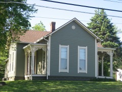 Ora Adams Houselisted 2009
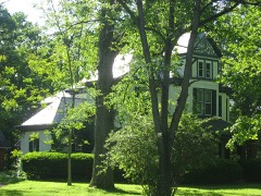 Leander Campbell Houselisted 2003
 Danville Courthouse Square Historic Districtlisted 2010
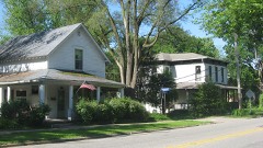 Danville Main Street Historic Districtlisted 1994
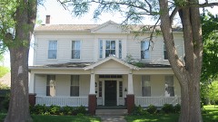 Dr. Jeremiah and Ann Jane DePew Houselisted 2006
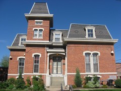 Hendricks County Jail and Sheriff's Residencelisted 1983
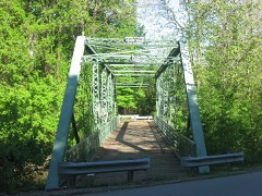 Twin Bridgeslisted 2000
 Wilson-Courtney Houselisted 1984
- Forest W. and Jeannette Wales Blanton Houselisted 2016
- Hendricks County Poor Asylumlisted 2018
Population over time
2 figuresDanville grew from 9,001 to 10,559 between 2010 and 2020. These are the recorded population figures Wikidata holds for this place, reached through the Geographic Names Information System number this page is keyed on rather than by name, so they belong to this place and not to another of the same name. Most are census counts, but not all are: an early figure may be a founding or settlement estimate, and an estimate published within five years of a census is left out. The change column is computed, and is left blank where more than 20 years separate a figure from the one before it, because a gap that long is not a change between two counts.
| Year | People | Change |
|---|---|---|
| 2010 | 9,001 | |
| 2020 | 10,559 | +1,558 (+17%) |
Topographic sheets covering this place
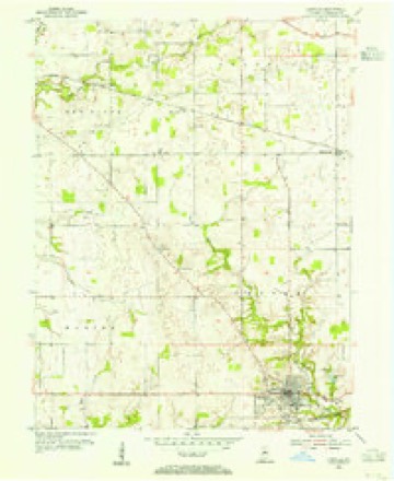
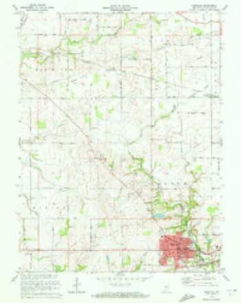
7 surveys from 12 printed sheetsMatched by testing this settlement's coordinate against the published boundary of every sheet in the United States Geological Survey's historical collection. Each opens the scanned sheet at the Survey.
- 1953 USGS Danville quadrangle1:24000
- 1953 USGS Indianapolis quadrangle1:250000, 4 printings
- 1956 USGS Indianapolis quadrangle1:250000
- 1957 USGS Indianapolis quadrangle1:250000, 2 printings
- 1962 USGS Indianapolis quadrangle1:250000
- 1970 USGS Danville quadrangle1:24000
- 1986 USGS Indianapolis quadrangle1:100000, 2 printings





What happened here
An account from the chapter on Center township. The inset identifies its exact source book and publication year.
History Of Hendriok8 County
1 1 He was found dead in bis stable and was supposed to have been i murdered by his servant for his money. He was a man of note and ] influence. The Hadleys have been noted for their thrift, both in this and the old country. The most of them have been farmers i and all have owned the land they worked. Until the last genera- ; tion or two all have been Friends, and none were military men 1 until the late civil war, when several bore arms in defense of the !
In the county-history sources
36,715 words on this townshipHistory of Hendricks County, Indiana, Together with Sketches of Its Cities, Villages and Towns, Educational, Religious, Civil, Military, and Political History, Portraits of Prominent Persons, and Biographies of Representative Citizens, published 1885 names this settlement in its chapter on Center Township. These are the passages that mention it, exactly as the scans read.
Justices of the Peace: Samuel Wick, 182G (resigned 1830); Lewis Mastin, 1829 (resigned 1830); John C. Julian, 1830; William A. Stephens, 1831 ; Job Osborn and Noah Harden, 1833 ; Larkin K. Campbell, 1834; John Dunn, 183-1; William A. Stephens, Job Osborn and Eldred Huff, 1836; Samuel Brenton, D. S. Carter, James Dugan and William Miller, 1837; Stephen C. Crawford, 1811; James Dugan and Samuel Mclogue, 1843; Henry Miller, 1841; Edmund Clark, 1846; Samuel Melogue, James Dugan and James Christie, 1847; James Ward, 1848; John D. Burks, 1850; Jesse S. Woodard, 1851; Henry Miller, 1852; William Astley, Robert H. West and Job Osborn, 1854; Peter S. Kennedy, John D.Burks and Benjamin F. Tout, 1855; K. H. Morehead, 1856; Enion Singer, William Howland, Salmon Hall and Leonard T. Maccoun, 1856; Allen P. Burks, 1857; George S. Rich and William Astley, 1858; Enion Singer, 1860; Julius A.Perkins, 18G2; Eniou Singer and Willis Tabert, 1864; F. M. Darnall, 1865; R. H. Morehead and William Henson, 1866; Samuel Craddick, 1867 E. C. Dibble, 1S6S; Linn Rammel and James T. xMatlock, 1869 R. H. Morehead and Enoch Henry, 1870; Simon Rammel, 1872 E. H. Morehead and Enoch Henry, 1874; N. M. Taylor and Thomas Nichols, 1876; Simon Rammel, 1878; Thomas Nichols and James W. Hamrick, 1880; Asa Martin, 1882; Thomas Nichols, James W. Hamrick and Joseph S. Miller, 1S84.
Passage source: History of Hendricks County, Indiana, Together with Sketches of Its Cities, Villages and Towns, Educational, Religious, Civil, Military, and Political History, Portraits of Prominent Persons, and Biographies of Representative Citizens, published 1885.
The oldest document in existence pertaining to Center Township is believed to be the poll-book and tally sheet of the general election held Aug. 7, 1826, when the people voted for congressman, senator, representative, sheriff and coroner. Altogether, sixtysix persons voted iu Center Township at this election, indicating a population at that time of perhaps 200. We give below the names of the voters, as entered on the poll-book. Many names are spelled incorrectly, but we leave it to the reader to correct them mentally. The list is doubly valuable, e.s it includes all the first pioneers of the township:
Passage source: History of Hendricks County, Indiana, Together with Sketches of Its Cities, Villages and Towns, Educational, Religious, Civil, Military, and Political History, Portraits of Prominent Persons, and Biographies of Representative Citizens, published 1885.
Two years later, at the presidential election of 1S2S, the number of voters had increased four-fold, or to 252. Andrew Jackson received 166 votes, am ohn Qnincy Adams eighty-eight; plurality for Jackson, seventy-.. ght. The township has been first Whig and then Republican, continuously, except that it gave Jackson majorities in 183S and 1S32, and in 1856 it gave a majority of one for Buchanan. Following is the vote at each presidential election:
Passage source: History of Hendricks County, Indiana, Together with Sketches of Its Cities, Villages and Towns, Educational, Religious, Civil, Military, and Political History, Portraits of Prominent Persons, and Biographies of Representative Citizens, published 1885.
Machine-read from a century-old scan, so expect the errors a machine makes: misspelled names, dropped words, stray characters.
Read the whole chapter on Center Township - it names this place 127 more 127 times.
Mines and quarries near this place
1 within 5 milesRegional context, not property-specific evidence. The federal mineral resources record lists 1 working within 5 miles of Danville: 1 producer. All of them still produce. What was taken out: Stone. Distance is straight-line from the map coordinates, so a quarry counted here may appear on a neighbouring settlement's page as well.
| Where | Site | Commodity | Status | Recorded |
|---|---|---|---|---|
| Hendricks Co. Hwy. Dept. | Stone | Producer |
Storms near this place
47 since 1994Regional context, not property-specific evidence. The National Weather Service names Danville in 47 storm reports between 1994 and 2025: 21 hail, 21 thunderstorm wind, 3 flood, 1 lightning. No death or injury is recorded in these reports. Each account below is quoted exactly as the forecast office filed it, from the NOAA Storm Events Database, and each date opens the federal record of that event.
| When | Event | Place named | Harm | What the report says |
|---|---|---|---|---|
| April 2020 | Thunderstorm Wind | Danville | $50,000 | Numerous trees and power poles snapped across the county due to thunderstorm wind gusts. Damage was locally concentrated in Danville. |
| July 2015 | Flash Flood | Danville | $50,000 | Four to five roads were washed out with numerous roads flooded county-wide due to heavy thunderstorm rainfall. |
| April 2011 | Thunderstorm Wind | Danville | $50,000 | Approximately 10 homes were damaged, due to damaging thunderstorm wind gusts, in the Clear Creek housing edition. One home had major roof damage. The others had mainly vinyl siding and garage door damage. No injuries were reported. |
| January 2008 | Thunderstorm Wind | Danville | $30,000 | A house was heavily damaged on the southwest side of Danville due to damaging thunderstorm winds. |
| September 2012 | Thunderstorm Wind | Danville | $15,000 | The roof was blown off a barn, east of Danville, due to damaging thunderstorm wind gusts. |
| August 2002 | Lightning | Danville | $15,000 | Lightning struck an office building. |
| August 2019 | Thunderstorm Wind | Danville | $10,000 | Several large tree limbs downed due to thunderstorm wind gusts. A roof was blown off along with several trees uprooted or snapped near the location. |
| June 2006 | Thunderstorm Wind | Danville | $10,000 | A garage was destroyed by a falling tree. |
| October 2010 | Thunderstorm Wind | Danville | $2,000 | An 18 inch diameter tree and power lines were downed due to damaging thunderstorm wind gusts on Cook Avenue in Danville. Power outages in Danville, Pittsboro, and Brownsburg were reported as well. |
| June 2018 | Thunderstorm Wind | Danville | $1,000 | A large tree was downed on State Road 39 in Danville due to damaging thunderstorm wind gusts. |
| June 2017 | Flood | Danville | $500 | Portions of Cartersburg Road was closed due to flooding from heavy rainfall. |
| June 2013 | Flood | Danville | $500 | Water was reported over the roadway near the intersection of Main Street and County Road 200 East due to thunderstorm heavy rainfall. |
| August 2009 | Thunderstorm Wind | Danville | $300 | A decayed 12 inch diameter limb was blown down due to thunderstorm wind gusts. This limb blocked Highway 39 south of Danville. |
| April 2025 | Thunderstorm Wind | Danville | - | Two 70 mph thunderstorm wind gusts were measured at or near this location. |
| July 2023 | Hail | Danville | - | Hail near Danville as large as 1.55 inches. CoCoRaHS observer (Danville 1.6 NE) reported 1.00 inch hail that shredded leaves. Widespread crop damage to Beasley Orchard (2.6 miles east of Danville), with the entire apple and sunflower crop destroyed and additional damage noted to tomato, pumpkin, and sweet corn crops. Several additional reports of 0.75-0.88 inch hail between Danville and Avon. |
| July 2015 | Hail | Danville | - | The hail was accompanied by 45 mph wind gusts. |
| July 2015 | Thunderstorm Wind | Danville | - | An estimated 60 mph thunderstorm wind gust was observed in this location. |
| December 2015 | Thunderstorm Wind | Danville | - | A 61 mph thunderstorm wind gust was measured on the west side of Danville. |
| July 2014 | Thunderstorm Wind | Danville | - | An estimated 60 to 70 mph thunderstorm wind gust was observed just south of Danville High School. |
| March 2012 | Thunderstorm Wind | Danville | - | A thunderstorm wind gust estimated at 60 mph was observed in this location. |
| September 2012 | Hail | Danville | - | An estimated 30 mph thunderstorm wind gust was also observed. |
| June 2010 | Thunderstorm Wind | Danville | - | A wind gust, measured at 60 mph, was observed in north Danville. |
| February 2009 | Flood | Danville | - | A flooded roadway was reported at State Route 39 North and United States 36. |
| January 2008 | Hail | Danville | - | There were also winds estimated at 55 mph. |
| February 2006 | Thunderstorm Wind | Danville | - | A large tree was downed in an intersection. |
| April 2006 | Hail | Danville | - | No property damage estimates were available. |
| May 2005 | Thunderstorm Wind | Danville | - | Large tree branches broken. |
| August 2005 | Thunderstorm Wind | Danville | - | Trees were blown down. |
| April 2017 | Hail | Danville | - | no account filed |
| July 2015 | Hail | Danville | - | no account filed |
| March 2012 | Hail | Danville | - | no account filed |
| September 2012 | Hail | Danville | - | no account filed |
| September 2012 | Hail | Danville | - | no account filed |
| April 2010 | Hail | Danville | - | no account filed |
| April 2006 | Hail | Danville | - | no account filed |
| May 2006 | Hail | Danville | - | no account filed |
| May 2005 | Hail | Danville | - | no account filed |
| April 2005 | Hail | Danville | - | no account filed |
| April 2005 | Hail | Danville | - | no account filed |
| May 2003 | Thunderstorm Wind | Danville | - | no account filed |
| July 2003 | Thunderstorm Wind | Danville | - | no account filed |
| August 2000 | Hail | Danville | - | no account filed |
| August 2000 | Hail | Danville | - | no account filed |
| August 2000 | Hail | Danville | - | no account filed |
| June 1998 | Thunderstorm Wind | Danville | - | no account filed |
| April 1996 | Hail | Danville | - | no account filed |
| June 1994 | Hail | Danville | - | no account filed |
Nearest settlements
The eight closest, with where each one stands in the county. Distances are straight-line, computed from the Geographic Names Information System coordinates.
| Map | Place | Distance | Sheets |
|---|---|---|---|
| Nash | 1.0 miles | 12 | |
| Gale | 3.2 miles | 15 | |
| Hadley | 4.5 miles | 12 | |
| Magnetic Springs | 4.6 miles | 16 | |
| North Belleville | 4.9 miles | 16 | |
| Clayton | 4.9 miles | 12 | |
| Summit | 5.0 miles | 12 | |
| Maplewood | 5.2 miles | 12 |
Elsewhere
Matched on this settlement's Geographic Names Information System number rather than its name, so it cannot be a different place of the same name in another state.
| Wikipedia article on Danville | An encyclopaedic summary. Its text is share-alike, so it is linked here rather than copied. |
| Wikidata item Q1022769 | The structured record the population and elevation above come from. Public domain (CC0). |
Provenance
This settlement is recorded in the Geographic Names Information System as feature 433314. The sheet list is computed by point-in-boundary test against the United States Geological Survey's historical topographic inventory. Both are works of the United States government and carry no copyright under 17 U.S.C. 105.
Mines and quarries. USGS Mineral Resources Data System (MRDS) https://mrdata.usgs.gov/mrds/ A work of the United States government, no copyright under 17 U.S.C. 105.
Storms. NOAA National Centers for Environmental Information, Storm Events Database https://www.ncei.noaa.gov/stormevents/ A work of the United States government, no copyright under 17 U.S.C. 105. Narratives are quoted verbatim from the National Weather Service report and are not edited or summarised.