 Block
Delphi, Indiana
9 topographic sheets cover this place, the earliest surveyed in 1953 and the latest in 1985. It stands in Deer Creek Township. It lies in ZIP code area 46923. It stands on Robinson Branch. The Survey maps it on the Delphi quadrangle. 2,961 people lived here at the 2020 count. It stands 568 feet above sea level.
Research this city
On record in Delphi
Buildings and businesses the archive holds for this place. Each opens its own page, with the source record it came from.
On the National Register 12 of 18 shown
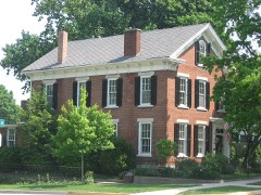 Barnett-Seawright-Wilson Houselisted 1980
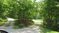 Baum-Shaeffer Farmlisted 1998
 Carroll County Courthouselisted 2003
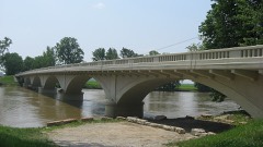 Carrollton Bridgelisted 2003
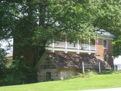 Deer Creek Valley Rural Historic Districtlisted 2002
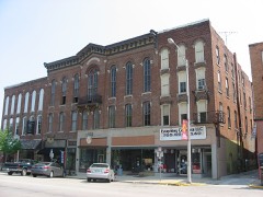 Delphi City Halllisted 1998
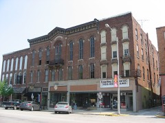 Delphi Courthouse Square Historic Districtlisted 2010
 Delphi Methodist Episcopal Churchlisted 2015
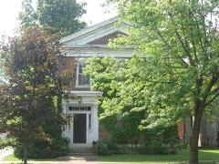 Foreman-Case Houselisted 1990
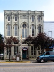 Niewerth Buildinglisted 1984
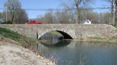 Washington Street Stone Arch Bridgelisted 2021
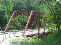 Wilson Bridgelisted 2001
Population over time
2 figuresDelphi grew from 2,893 to 2,961 between 2010 and 2020. These are the recorded population figures Wikidata holds for this place, reached through the Geographic Names Information System number this page is keyed on rather than by name, so they belong to this place and not to another of the same name. Most are census counts, but not all are: an early figure may be a founding or settlement estimate, and an estimate published within five years of a census is left out. The change column is computed, and is left blank where more than 20 years separate a figure from the one before it, because a gap that long is not a change between two counts.
| Year | People | Change |
|---|---|---|
| 2010 | 2,893 | |
| 2020 | 2,961 | +68 (+2%) |
Topographic sheets covering this place
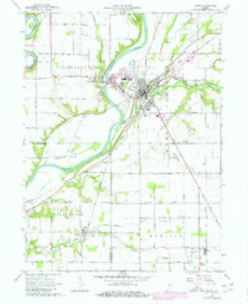
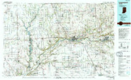
5 surveys from 9 printed sheetsMatched by testing this settlement's coordinate against the published boundary of every sheet in the United States Geological Survey's historical collection. Each opens the scanned sheet at the Survey.
- 1953 USGS Danville quadrangle1:250000, 3 printings
- 1955 USGS Danville quadrangle1:250000
- 1956 USGS Danville quadrangle1:250000
- 1962 USGS Delphi quadrangle1:24000, 2 printings
- 1985 USGS Logansport quadrangle1:100000, 2 printings



In the county-history sources
11,192 words on this townshipHistory of Carroll County, Indiana : With Illustrations and Biographical Sketches of Some of Its Prominent Men and Pioneers ..., published 1882 names this settlement in its chapter on Deer Creek Township. These are the passages that mention it, exactly as the scans read.
Hem7 Robinson and William McCord. when the ehm-ch had been fully organized, were chosen Ruling Elders, and continued such for many years. Without delay, the services of Mi-. Crawford were seciu-ed as a stated supply to preach to the congregation, and, during the succeeding six years, until 1834, he continued in that relation, within that time receiving into the chm-ch twenty-five additional members. Of those who were in fellowship with the church from the beginning uj3 to the time
Passage source: History of Carroll County, Indiana : With Illustrations and Biographical Sketches of Some of Its Prominent Men and Pioneers ..., published 1882.
While Mr. Crawford was the Pastor of this church, he piu' chased a lot and built thereon a log house, one of the first dwellings erected in Delphi, which was then a general hazel thicket. This humble dwelling was torn down many years ago, and the site occupied by the more stately mansion of S. D. Mcintosh. For several years, the meetings of the congregation were held in the old log schoolhouse built by Deer Creek Township in the winter of 1828-29, which served the pm-pose of a meeting-place in its time for not only the religious organizations, but for all congi'egations, whether for secular or other piu'poses.
Passage source: History of Carroll County, Indiana : With Illustrations and Biographical Sketches of Some of Its Prominent Men and Pioneers ..., published 1882.
TN the latter part of July, 1829, a number of persons, members -*- of the Regular Baptist Chiu-ch in other jiu'isdietions, who, having become residents of CaiToll County and vicinity, had prociu-ed letters of recommendation to those of like faith in this jui'isdiction to the end that they might unite with such in the formation of a chiu-ch here, and thus eujoy the privileges of public worship in their own neighborhood, made application to the proper authority for consent to foim a chiu'ch in this county, requesting the necessaiy attendance of church officers and delegates for the purpose. The consent was obtained accordingly, and ou the 8th of August following a council of delegates was held, composed of the representatives named, to wit: Jacob Kester, A. B. Martin and James Duncan, from Sugar Creek Chiu'ch. in Boone County; Elder R. Stapleton, David Kuth and Michael Donahoe, from Bethel Chiu'ch; and J. F. Martin, Newbeny Stockton and Elder Samuel Ai-thiu-, from the First Baptist Chiu'ch in Wea, Tippecanoe County. The council was organized by electing Elder Stapleton, Moderator, and A. B. Martin. Clerk. The covenant of faith which had been signed by the applicants Ijeing read, with their letters of recommendation, in open council, the following persons, with their foimer affiliation - John Knight. Abigail Knight. Elsa Green. Hannah Green and Sarah Hance, from the Baptist Church of Staunton. Ohio; William Hance and Isabel Cox, from Lick Creek Chm-ch, Marion County. Ohio, were accepted, and, in compliance with their re quest, constituted a Regular Baptist Chiu'ch in Delphi.
Passage source: History of Carroll County, Indiana : With Illustrations and Biographical Sketches of Some of Its Prominent Men and Pioneers ..., published 1882.
Machine-read from a century-old scan, so expect the errors a machine makes: misspelled names, dropped words, stray characters.
Read the whole chapter on Deer Creek Township - it names this place 16 more 16 times.
Fires near this place
7 since 2007Regional context, not property-specific evidence. The federal wildfire occurrence database lists 7 fires within 5 miles of Delphi between 2007 and 2008, burning about 9 acres in total. 1 started naturally. None was recorded as arson. Distance is straight-line from the map coordinates, so a fire counted here may appear on a neighbouring settlement's page as well.
| Reported cause | Fires |
|---|---|
| Missing data/not specified/undetermined | 3 |
| Recreation and ceremony | 2 |
| Natural | 1 |
| Debris and open burning | 1 |
The most recent of them, most recent first, with the day each was reported and the service that recorded it.
| Date | Cause | Size | Reported by | Name on the report |
|---|---|---|---|---|
| 13 September 2007 | Missing data/not specified/undetermined | under an acre | Indiana State Fire Marshal's Office | not named |
| 8 August 2007 | Debris and open burning | under an acre | Indiana State Fire Marshal's Office | not named |
| 22 May 2007 | Missing data/not specified/undetermined | under an acre | Indiana State Fire Marshal's Office | not named |
| 15 May 2007 | Natural | under an acre | Indiana State Fire Marshal's Office | not named |
| 6 April 2008 | Recreation and ceremony | 7.0 acres | Indiana State Fire Marshal's Office | not named |
| 16 March 2008 | Recreation and ceremony | 1.0 acres | Indiana State Fire Marshal's Office | not named |
| 5 February 2008 | Missing data/not specified/undetermined | under an acre | Indiana State Fire Marshal's Office | not named |
Settlements close enough to share some of these fires:
Mines and quarries near this place
5 within 5 milesRegional context, not property-specific evidence. The federal mineral resources record lists 5 workings within 5 miles of Delphi: 3 producers, 1 past producer, 1 occurrence. 3 still produce. What was taken out: Sand and Gravel, Construction, Stone, Crushed/Broken, Lead, Zinc, Sulfur. Distance is straight-line from the map coordinates, so a quarry counted here may appear on a neighbouring settlement's page as well.
| Where | Site | Commodity | Status | Recorded |
|---|---|---|---|---|
| Delphi Limestone Quarry | Stone, Crushed/Broken | Producer | ||
| Sphalerite Occurrence Z55 | Lead, Zinc, Sulfur | Occurrence | Sphalerite | |
| Munson Pit | Sand and Gravel, Construction | Producer | ||
| Rider Sand and Gravel Pit | Sand and Gravel, Construction | Producer | ||
| Vianco Pit | Sand and Gravel, Construction | Past Producer |
Storms near this place
42 since 1994Regional context, not property-specific evidence. The National Weather Service names Delphi in 42 storm reports between 1994 and 2025: 26 thunderstorm wind, 10 hail, 4 flash flood, 1 lightning. No death or injury is recorded in these reports. Each account below is quoted exactly as the forecast office filed it, from the NOAA Storm Events Database, and each date opens the federal record of that event.
| When | Event | Place named | Harm | What the report says |
|---|---|---|---|---|
| April 2020 | Thunderstorm Wind | Delphi | $50,000 | Emergency manager reports numerous power lines were knocked down due to thunderstorm wind gusts. Trees and tree limbs of unknown size were also snapped. |
| June 1996 | Lightning | Delphi | $30,000 | no account filed |
| March 2025 | Thunderstorm Wind | Delphi | $25,000 | A few structures sustained minor damage caused by thunderstorm winds across the county with a centralized location near Delphi. |
| March 2025 | Thunderstorm Wind | Delphi | $20,000 | Dozens of trees downed by thunderstorm wind gusts near Delphi and points to the northeast. |
| July 2011 | Flash Flood | North Delphi | $20,000 | Several culverts were washed out on County Roads between Delphi and the Tippecanoe River due to over 5 inches of thunderstorm rainfall. |
| June 2011 | Thunderstorm Wind | Delphi | $9,000 | Numerous power lines and trees were downed on roadways due to damaging thunderstorm wind gusts. |
| July 2012 | Thunderstorm Wind | Delphi | $5,000 | Trees were downed in Delphi due to damaging thunderstorm wind gusts. |
| July 2011 | Thunderstorm Wind | North Delphi | $5,000 | Trees were downed in this location due to damaging thunderstorm wind gusts. |
| June 2010 | Thunderstorm Wind | Delphi | $5,000 | Trees were reported down in Delphi due to damaging thunderstorm wind gusts. |
| August 2014 | Thunderstorm Wind | Delphi | $3,000 | A tree fell on top of a shop building due to damaging thunderstorm wind gusts. |
| May 2010 | Thunderstorm Wind | Delphi | $3,000 | Numerous trees of unknown size were reported down in Delphi. |
| August 2020 | Thunderstorm Wind | North Delphi | $2,000 | Trees of unknown size downed due to thunderstorm wind gusts across Old Indiana 25 going into Delphi at the Carroll and Tippecanoe county border going down the hill. |
| June 2015 | Thunderstorm Wind | North Delphi | $1,000 | A tree was blown down on the west side of Delphi, blocking Bicycle Bridge Road, due to damaging thunderstorm wind gusts. |
| August 2014 | Flood | Delphi | $500 | Four to five inches of water was over the road due to heavy thunderstorm rainfall. Wind gusts of 45 mph were also observed. |
| May 2010 | Hail | Delphi | - | Nickel sized hail was reported at the intersection of Highway 450 W and 375 N. |
| August 2007 | Thunderstorm Wind | Delphi | - | Trees were down on Franklin Street in Delphi due to damaging thunderstorm winds. |
| May 2007 | Hail | Delphi | - | Hail lasted three minutes at State Road 29 and 900 North. |
| April 2006 | Hail | Delphi | - | No damage estimates were available. |
| April 2006 | Hail | Delphi | - | No damage estimates were available. |
| April 2006 | Flash Flood | Delphi | - | Roads were flooded in Delphi. No property damage was reported. |
| April 2006 | Hail | Delphi | - | No property damage estimates were available. |
| August 2006 | Thunderstorm Wind | Delphi | - | Nine trees were downed. |
| May 2005 | Thunderstorm Wind | Delphi | - | Trees were blown down near Delphi. |
| September 2005 | Thunderstorm Wind | Delphi | - | A large tree was downed. |
| July 2003 | Thunderstorm Wind | Delphi | - | Trees and power lines down |
| June 2013 | Hail | Delphi | - | no account filed |
| May 2007 | Hail | Delphi | - | no account filed |
| May 2007 | Hail | Delphi | - | no account filed |
| June 2006 | Thunderstorm Wind | Delphi | - | no account filed |
| May 2004 | Thunderstorm Wind | Delphi | - | no account filed |
| July 2003 | Flash Flood | Delphi | - | no account filed |
| July 2003 | Thunderstorm Wind | Delphi | - | no account filed |
| May 2001 | Thunderstorm Wind | Delphi | - | no account filed |
| June 2001 | Thunderstorm Wind | Delphi | - | no account filed |
| June 2001 | Thunderstorm Wind | Delphi | - | no account filed |
| August 2001 | Thunderstorm Wind | Delphi | - | no account filed |
| October 2001 | Thunderstorm Wind | Delphi | - | no account filed |
| April 2000 | Hail | Delphi | - | no account filed |
| June 2000 | Thunderstorm Wind | Delphi | - | no account filed |
| June 1996 | Flash Flood | Delphi | - | no account filed |
| July 1996 | Thunderstorm Wind | Delphi | - | no account filed |
| July 1994 | Hail | Delphi | - | no account filed |
Nearest settlements
The eight closest, with where each one stands in the county. Distances are straight-line, computed from the Geographic Names Information System coordinates.
| Map | Place | Distance | Sheets |
|---|---|---|---|
| Pittsburg | 1.5 miles | 9 | |
| Harley Siding | 3.3 miles | 9 | |
| Harley | 3.8 miles | 9 | |
| Sleeth | 4.8 miles | 8 | |
| Radnor | 5.8 miles | 9 | |
| Yeoman | 6.1 miles | 8 | |
| Rockfield | 6.5 miles | 10 | |
| Sandy Beach | 6.7 miles | 9 |
Elsewhere
Matched on this settlement's Geographic Names Information System number rather than its name, so it cannot be a different place of the same name in another state.
| Wikipedia article on Delphi | An encyclopaedic summary. Its text is share-alike, so it is linked here rather than copied. |
| Wikidata item Q2953412 | The structured record the population and elevation above come from. Public domain (CC0). |
Provenance
This settlement is recorded in the Geographic Names Information System as feature 433461. The sheet list is computed by point-in-boundary test against the United States Geological Survey's historical topographic inventory. Both are works of the United States government and carry no copyright under 17 U.S.C. 105.
Wildfire. Short, Karen C. 2022. Spatial wildfire occurrence data for the United States, 1992-2020 [FPA_FOD_20221014]. 6th Edition. Fort Collins, CO: Forest Service Research Data Archive. https://doi.org/10.2737/RDS-2013-0009.6 Collected with United States Government funding and usable without additional permissions or fees.
Mines and quarries. USGS Mineral Resources Data System (MRDS) https://mrdata.usgs.gov/mrds/ A work of the United States government, no copyright under 17 U.S.C. 105.
Storms. NOAA National Centers for Environmental Information, Storm Events Database https://www.ncei.noaa.gov/stormevents/ A work of the United States government, no copyright under 17 U.S.C. 105. Narratives are quoted verbatim from the National Weather Service report and are not edited or summarised.