 Block
Donaldson, Indiana
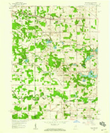
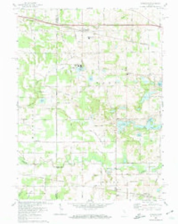
10 topographic sheets cover this place, the earliest surveyed in 1953 and the latest in 1984. It stands in West Township. It lies in ZIP code area 46513. The Survey maps it on the Donaldson quadrangle. It stands 781 feet above sea level.
Topographic sheets covering this place
5 surveys from 10 printed sheetsMatched by testing this settlement's coordinate against the published boundary of every sheet in the United States Geological Survey's historical collection. Each opens the scanned sheet at the Survey.
- 1953 USGS Chicago quadrangle1:250000, 5 printings
- 1957 USGS Chicago quadrangle1:250000
- 1958 USGS Donaldson quadrangle1:24000
- 1972 USGS Donaldson quadrangle1:24000
- 1984 USGS Knox quadrangle1:100000, 2 printings


In the county-history sources
5,967 words on this townshipHistory of Indiana : Containing a History of Indiana and Biographical Sketches of Governors and Other Leading Men. Also a Statement of the Growth and Prosperity of Marshall County, Together with a Personal and Family Histry of Many of Its Citizens, published 1890 names this settlement in its chapter on West Township. These are the passages that mention it, exactly as the scans read.
John E. Hoover, a well-known young man, is a native of West township, born in 1862. His father, John Hoover, was a preacher in the German Baptist church, but, like most of the ministers of that denomination, followed the occupation of farming. He was of German descent, but was a native of Altoona, Ontario, where his birth occurred in 1822. In 1859 he came to West township, where he bought land of the Pa. R. R. Co. and became a well-known farmer. His wife, Hettie Miller, was a native of Ohio, born about 1831. Their family consisted of four children, three of whom are living. Noah V. is a prominent merchant of Plymouth. Margaret is the wife of W. G. Cook; they live in South Dakota; Daniel (deceased), and J. E., the subject of this sketch. The latter was raised on the farm, received a good education in the public schools of Plymouth, and finished at Valparaiso. His education fitted him for the profession of teaching, which he began in 1S79, and followed for seven years. He was considered a successful instructor, being engaged four successive terms in the only graded school in West township. In 1886 Mr. Hoover engaged in mercantile business at Donaldson, where he soon became popular on account of his fair dealing, and earnest efforts to please his patrons. Since he became a citizen of Donaldson he has bren a very useful one, having erected several substantial buildings and otherwise aided in the improvement of the town. In 1888 he was put in nomination by the republican party, of which he is a member, for the office of township trustee, and, notwithstanding a strong democratic sentiment, his popularity was sufiicientto gain him a handsome majority. Mr. Hoover is one of the young men who are, as a class, bringing Marshall county into prominence as one of the leading counties of the state.
Passage source: History of Indiana : Containing a History of Indiana and Biographical Sketches of Governors and Other Leading Men. Also a Statement of the Growth and Prosperity of Marshall County, Together with a Personal and Family Histry of Many of Its Citizens, published 1890.
Among the younger citizens of Donaldson, but one of its leading business men, is Silas H. Joseph, a native of the state of Delaware, as were also his parents, who trace their ancestry back to the first settlers of that state. His early life was passed in Delaware, near the town of Smyrna, where he first saw the light of day. He received his education in the common schools of that state, and his first work was upon his father's farm. In 1878 the entire family came to Marshall county, where they still reside, having become well-known and substantial citizens. Three years after becoming a Hoosier by adoption, Mr. Joseph was married to Anna P. Hudson, also a native of Delaware, but a resident of Marshall county at the time of marriage. The young couple lived on a farm two years, when they removed to Donaldson, where Mr. Joseph purchas^^d a small general store. The business prospered, and the stock of goods increased in proportion to the demand of trade, so that in 1S87, Mr. Joseph erected a fine store room, the one now occupied by the Burgener Bros. He also built a large grain and ware house near the Pennsylvania railroad, and a substantial residence. In 1S8S he sold his store to the Burgener Bros., and purchased the one on the southeast corner, which he now occupies. Mr. Joseph has been a valuable addition to the population of Donaldson, always alive to the interests of the place. Politically he represents the young democracy, and is ever ready to use honorable means to promote his party's welfare. That his efforts are appreciated is evinced by the fact that, in the spring of 1S90, he was nominated for township trustee, and triumphantly elected. Mr. Joseph is a member of the United Brethren church, and lends his energy to church affairs, as he does to all that he undertakes. Personally, Mr. Joseph is quiet and earnest in his intercourse with his fellow citizens, and his business methods have been such as to gain the confidence and respect of the community in which he lives.
Passage source: History of Indiana : Containing a History of Indiana and Biographical Sketches of Governors and Other Leading Men. Also a Statement of the Growth and Prosperity of Marshall County, Together with a Personal and Family Histry of Many of Its Citizens, published 1890.
and J. C. are successful teachers; the others are still in youth and childhood. Mr. and Mrs. Warnes are both members of the United Brethren congregation, of Donaldson. Mr. Warnes is a republican, and is well known, politically, as an honest and faithful party leader in his township.
Passage source: History of Indiana : Containing a History of Indiana and Biographical Sketches of Governors and Other Leading Men. Also a Statement of the Growth and Prosperity of Marshall County, Together with a Personal and Family Histry of Many of Its Citizens, published 1890.
Machine-read from a century-old scan, so expect the errors a machine makes: misspelled names, dropped words, stray characters.
Fires near this place
4 since 2002Regional context, not property-specific evidence. The federal wildfire occurrence database lists 4 fires within 5 miles of Donaldson between 2002 and 2007, burning about 23 acres in total. None started naturally. None was recorded as arson. Distance is straight-line from the map coordinates, so a fire counted here may appear on a neighbouring settlement's page as well.
| Reported cause | Fires |
|---|---|
| Missing data/not specified/undetermined | 2 |
| Debris and open burning | 1 |
| Equipment and vehicle use | 1 |
The most recent of them, most recent first, with the day each was reported and the service that recorded it.
| Date | Cause | Size | Reported by | Name on the report |
|---|---|---|---|---|
| 25 July 2002 | Missing data/not specified/undetermined | 15 acres | Indiana State Fire Marshal's Office | not named |
| 20 April 2005 | Missing data/not specified/undetermined | 3.0 acres | Indiana State Fire Marshal's Office | not named |
| 29 March 2007 | Debris and open burning | 4.0 acres | Indiana State Fire Marshal's Office | not named |
| 6 November 2004 | Equipment and vehicle use | 1.0 acres | Indiana State Fire Marshal's Office | not named |
Settlements close enough to share some of these fires:
Storms near this place
10 since 2013Regional context, not property-specific evidence. The National Weather Service names Donaldson in 10 storm reports between 2013 and 2025: 7 thunderstorm wind, 2 tornado, 1 hail. The reports record 1 injury. Each account below is quoted exactly as the forecast office filed it, from the NOAA Storm Events Database, and each date opens the federal record of that event.
| When | Event | Place named | Harm | What the report says |
|---|---|---|---|---|
| March 2025 | Tornado (EF1) | Donaldson | 1 hurt, $100,000 | Tornado developed 2 miles southwest of Ancilla College and quickly intensified to EF1 intensity as it raced northeastward. The tornado caused extensive tree and generally minor structural damage across the Ancilla College campus and Gilbert lake. Here the tornado widened to 750 yards before contracting down as it continued northeast. A mobile home was torn from its anchored undercarriage and overturned, injuring one inside. Several homes sustained generally minor siding and roof damage. Two barns just northeast of Ancilla college were flattened. Strong inflow winds were noted at many locations just east/southeast of the tornado track. |
| August 2022 | Thunderstorm Wind | Donaldson | $20,000 | Two large trees are down across the road. |
| June 2025 | Thunderstorm Wind | Donaldson | $10,000 | Emergency manager reports trees down in Donaldson, Argos, and Mentone. |
| July 2025 | Thunderstorm Wind | Donaldson | $1,000 | Emergency Manager reports a few trees down in Donaldson. |
| July 2022 | Thunderstorm Wind | Donaldson | $1,000 | A treed down on 6th Road and Union Road. |
| July 2021 | Thunderstorm Wind | Donaldson | - | A tree down at 4B and Underwood RD. |
| August 2021 | Thunderstorm Wind | Donaldson | - | Trees down. Road closed. |
| June 2014 | Tornado (EF1) | Donaldson | - | A NWS storm survey found damage consistent with an EF-1 tornado. The tornado touched down just south of Donaldson where it caused extensive damage to hardwood trees. The tornado moved east and heavily damaged two residences on a farm on Sycamore Road, just south of the railroad tracks. The tornado continued to produce extensive tree damage as it tracked east-northeast into Plymouth to south of the Lear Corporation. Several trees were either topped or snapped with an empty semi-trailer being flipped. The tornado continued northeast with widespread mixed hardwood and softwood trees being snapped and minor structural damage to the Behavior Science Building on North Oak road. The tornado caused partial uplift of the northwest side of the roof and collapsed the interior cinder block wall on the east side of the Department of Transportation garage, just south of US-30 before lifting. Maximum winds were estimated at 105 mph. |
| July 2013 | Thunderstorm Wind | Donaldson | - | The public reported numerous uprooted trees in the area. |
| April 2018 | Hail | Donaldson | - | no account filed |
Nearest settlements
The eight closest, with where each one stands in the county. Distances are straight-line, computed from the Geographic Names Information System coordinates.
Elsewhere
Matched on this settlement's Geographic Names Information System number rather than its name, so it cannot be a different place of the same name in another state.
| Wikipedia article on Donaldson | An encyclopaedic summary. Its text is share-alike, so it is linked here rather than copied. |
| Wikidata item Q5295352 | The structured record the population and elevation above come from. Public domain (CC0). |
Provenance
This settlement is recorded in the Geographic Names Information System as feature 433626. The sheet list is computed by point-in-boundary test against the United States Geological Survey's historical topographic inventory. Both are works of the United States government and carry no copyright under 17 U.S.C. 105.
Wildfire. Short, Karen C. 2022. Spatial wildfire occurrence data for the United States, 1992-2020 [FPA_FOD_20221014]. 6th Edition. Fort Collins, CO: Forest Service Research Data Archive. https://doi.org/10.2737/RDS-2013-0009.6 Collected with United States Government funding and usable without additional permissions or fees.
Storms. NOAA National Centers for Environmental Information, Storm Events Database https://www.ncei.noaa.gov/stormevents/ A work of the United States government, no copyright under 17 U.S.C. 105. Narratives are quoted verbatim from the National Weather Service report and are not edited or summarised.