 Block
Rutland, Indiana
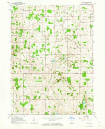
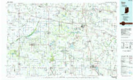
10 topographic sheets cover this place, the earliest surveyed in 1953 and the latest in 1984. It stands in Union Township. It lies in ZIP code area 46511. The Survey maps it on the Rutland quadrangle. It stands 791 feet above sea level.
Topographic sheets covering this place
4 surveys from 10 printed sheetsMatched by testing this settlement's coordinate against the published boundary of every sheet in the United States Geological Survey's historical collection. Each opens the scanned sheet at the Survey.
- 1953 USGS Chicago quadrangle1:250000, 5 printings
- 1957 USGS Chicago quadrangle1:250000
- 1962 USGS Rutland quadrangle1:24000, 2 printings
- 1984 USGS Knox quadrangle1:100000, 2 printings


In the county-history sources
6,589 words on this townshipHistory of Indiana : Containing a History of Indiana and Biographical Sketches of Governors and Other Leading Men. Also a Statement of the Growth and Prosperity of Marshall County, Together with a Personal and Family Histry of Many of Its Citizens, published 1890 names this settlement in its chapter on Union Township. These are the passages that mention it, exactly as the scans read.
I. L. Mosher, a representative citizen of Union township, was born in Erie county, N. Y., F'ebruary 18, 1842, and is a son of Jeremiah and Sarah M. Mosher, natives respectively of New York and Vermont. Jeremiah and Sarah Mosher were married in Rutland county, Vt., after which they located in Erie county, N. Y., and about the year 1S55, immigrated to Indiana and settled in Stark county. Three years later they became residents of Marshall county, locating in Union township, where Mr. Mosher cleared a farm, upon which his death occurred ir» 1882. Mrs. Mosher survived her husband two years, djnng in 1884. They had a family of seven children, two of whom, the subject of this biography, and M. F., are living. J. L. Mosher came to Indiana when thirteen years of age, and has since been an honored citizen of the state of his adoption. Being the oldest son he was in early life obliged to contribute his share toward working the farm and supporting the family, in consequence of which his educational training was of a limited character, confined principally to a few months' attendance each winter at the country schools, in which he obtained a fair knowledge of the elementary branches of learning. He married in 1862 Miss Sarah J. Thompson, daughter of William E. Thompson, one of the pioneers of Union township, and the same year responded to the country's call for volunteers, enlisting in the Twenty-first Indiana battery, light artillery, with which he served gallantly until the close of the war. Mr. Mosher has been a farmer all his life, and as such ranks with the successful agriculturists of Union township. He is a member of Yellow River grange. No. 155, P. of H., belongs to Tibbett's post. No. 260, G. A. R., and politically adheres to no party creed, preferring to be known as an independent. The names of the children born to Mr. and Mrs. Mosher are as follows: Ada B., wife of John C. Butler, county surveyor; Mariam, wife of T. M. Walker, of Green township, and Tracy, who still resides under the parental roof. William Overmyer, a substantial farmer of Union township, is a native of Perry county, Ohio, and son of Peter and Mary Overmyer; parents born in Pennsylvania and New Jersey, respectively. The father was a farmer by occupation, served in the war of 1S12, and by his first marriage with Mary Hodge, reared a family, three members of which are still living, namely: the subject of this mention, Ezekiel, and Levi Overmyer, both residents of Fulton county, Ind. Mrs. Overmyer departed this life in Sandusky county, Ohio, and subsequently Mr. Overmyer took to wife Mary Shiveley, who bore him the following children: Mrs. Catherine Boyer, Mrs. Maria Overmyer, Mrs. Mary J. Boyer, Mrs. Ellen Hubbard, Henry H. Chauncy, and Mrs. Isabella Meyer, all of whom reside in the state of Ohio. William Overmyer, whose name introduces this biography, was born on the 19th day of May, 1S26, and grew to manhood in his native state, attending the common schools at intervals during the years of his minority. On attaining his majority, he engaged in farming, which has been his life work. In 1S53, he moved to Indiana, settling in Pulaski county, where he cleared a farm upon which he resided until his removal to Marshall county, in the spring of 1878. He settled where he now lives, in Union town- ship, and has a comfortable home, the result of his unaided efforts. He is a man of strict morals, an earnest Christian, and as a member of the United Brethren church, has been the means of accomplishing much good in the community. Mr. Overmyer's first marriage, which was solemnized in 1852, with Mary C. Ernsperger, daughter of Jacob and Mary Ann Ernsperger, was blessed with the birth of several children, of whom the following are living, viz.: Mary A., wife of S. S. Smith, of Fulton county; Frank P., Ida M. and Georgiana, the last three living at home. A daughter, Fannie Bell, whose death occurred in Stark county, May 23, 18S7, was married to Willis Burkett, by whom she had one child, Ethel C, born August 31, 1S85. Mrs. Overmyer died in 1876. Subsequently Mr. Overmyer married a second wife in the person of Mrs. Bowersocks, whose death occurred in 188 1. To this marriage was born one son, Eugene, whose birth occurred October i, 1877. In 1882, Mr. Overmyer married his present wife, whose maiden name was Elizabeth Snyder, daughter of William and Sarah (Hillerl Snyder, of Dauphin county, Penn. There has been no issue to this marriage.
Passage source: History of Indiana : Containing a History of Indiana and Biographical Sketches of Governors and Other Leading Men. Also a Statement of the Growth and Prosperity of Marshall County, Together with a Personal and Family Histry of Many of Its Citizens, published 1890.
Machine-read from a century-old scan, so expect the errors a machine makes: misspelled names, dropped words, stray characters.
Mines and quarries near this place
2 within 5 milesRegional context, not property-specific evidence. The federal mineral resources record lists 2 workings within 5 miles of Rutland: 1 past producer, 1 producer. 1 still produces. What was taken out: Limestone, General, Sand and Gravel, Construction. Distance is straight-line from the map coordinates, so a quarry counted here may appear on a neighbouring settlement's page as well.
| Where | Site | Commodity | Status | Recorded |
|---|---|---|---|---|
| Burr Oak Sand & Gravel Company | Sand and Gravel, Construction | Producer | ||
| Eddy Lake Marl Pit | Limestone, General | Past Producer |
Storms near this place
1 since 2025Regional context, not property-specific evidence. The National Weather Service names Rutland in 1 storm report in 2025: 1 tornado. No death or injury is recorded in these reports. Each account below is quoted exactly as the forecast office filed it, from the NOAA Storm Events Database, and each date opens the federal record of that event.
| When | Event | Place named | Harm | What the report says |
|---|---|---|---|---|
| April 2025 | Tornado (EF1) | Rutland | $600,000 | A survey of damage revealed a tornado touched down southeast of Rutland on SR-10 and tracked quickly northeast. The tornado moved over numerous empty fields but also impacted several wooded areas as well as snapped or uprooted trees on private property. The tornado entered Bourbon and reached peak intensity on the northeast side of town in the area of Crocus Ct and Rose Lane where several homes suffered extensive roof damage. Debris was thrown into the field. Many homes showed garage doors being compromised, lowering potentially higher wind speeds. The tornado continued out of town, producing sporadic tree and power pole damage until reaching north of Etna Green in Kosciusko county where the damage ended. |
Nearest settlements
The eight closest, with where each one stands in the county. Distances are straight-line, computed from the Geographic Names Information System coordinates.
| Map | Place | Distance | Sheets |
|---|---|---|---|
| Maxinkuckee | 2.8 miles | 11 | |
| Burr Oak | 3.2 miles | 10 | |
| Culver | 3.9 miles | 11 | |
| Twin Lakes | 4.1 miles | 11 | |
| Plymouth | 7.3 miles | 11 | |
| Argos | 7.6 miles | 11 | |
| Walnut | 9.0 miles | 11 | |
| Donaldson | 9.3 miles | 10 |
Elsewhere
Matched on this settlement's Geographic Names Information System number rather than its name, so it cannot be a different place of the same name in another state.
| Wikidata item Q7383456 | The structured record the population and elevation above come from. Public domain (CC0). |
Provenance
This settlement is recorded in the Geographic Names Information System as feature 442427. The sheet list is computed by point-in-boundary test against the United States Geological Survey's historical topographic inventory. Both are works of the United States government and carry no copyright under 17 U.S.C. 105.
Mines and quarries. USGS Mineral Resources Data System (MRDS) https://mrdata.usgs.gov/mrds/ A work of the United States government, no copyright under 17 U.S.C. 105.
Storms. NOAA National Centers for Environmental Information, Storm Events Database https://www.ncei.noaa.gov/stormevents/ A work of the United States government, no copyright under 17 U.S.C. 105. Narratives are quoted verbatim from the National Weather Service report and are not edited or summarised.