 Block
Dongola, Indiana
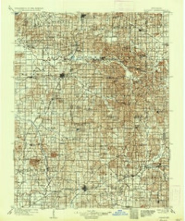
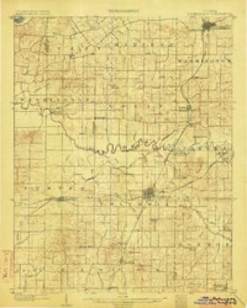
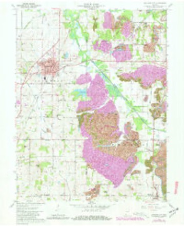
18 topographic sheets cover this place, the earliest surveyed in 1902 and the latest in 1986. It stands in Columbia Township. It lies in ZIP code area 47660. It stands on Hurricane Creek. The Survey maps it on the Oakland City quadrangle.
Topographic sheets covering this place
7 surveys from 18 printed sheetsMatched by testing this settlement's coordinate against the published boundary of every sheet in the United States Geological Survey's historical collection. Each opens the scanned sheet at the Survey.
- 1902 USGS Ditney quadrangle1:125000, 3 printings
- 1903 USGS Petersburg quadrangle1:62500, 2 printings
- 1956 USGS Vincennes quadrangle1:250000, 4 printings
- 1957 USGS Vincennes quadrangle1:250000
- 1958 USGS Vincennes quadrangle1:250000, 2 printings
- 1961 USGS Oakland City quadrangle1:24000, 4 printings
- 1986 USGS Princeton quadrangle1:100000, 2 printings




In the county-history sources
7,891 words on this townshipSPC BOOKS STOR - 977.235 H History Of Gibson County Indiana, published 1884 names this settlement in its chapter on Columbia Township. These are the passages that mention it, exactly as the scans read.
1829. Samnel Baldwin and Jacob Skelton were over: seers of the poor in 1825-26, The west y Brown and William Pearson had charge of the poor, and the same year Silas Edrington was appointed in. spector of elections. In 1828 William Devi 'MeDill attended to the wants of the poor, James Skelton and Silas Edrington sume ofice. In 1823 John Hargrove spector of elections and James W. Cockrum in 1829, and the same year Samuel Whitsitt was appointed constable, Cohmbia Township is well supplied with schools and churches and plenty of wagon roads, and her railroad facilities are as good as any other town ship in the county. The Louisville, Evansville & St. Lonis Railroad (Air Line) enters the township on Se tion 17, erossen the "Straight "Line at Oakland and leaves the township on Section 15 on the west. 'The 1 & E. R. Ra, familiarly "Straight Line" enters Columbia on the so 5 anl ex tends in a due northeasterly direction through the township, crossing the Patoka River om Section 3 Township 10, Tange M, At the city of Oakland i crosses the "Air Line is situated on the south bank of the Patoka River, he proprietors were William Carpenter amd Lame They Inid ont the town in March, 1851, on . Township 1, Ramse 8, and Section 6, Town Range 8. Iwas herethat the old Wabash & Ei id state rond crussed the Patoka River. Dongola was Haid ont with road st fonr to seventy-six feet wide. the town south of the river wis laid ont à public square. The mmes of the prineipal streets were Columbia, Locust, Chery, Canal, Walnut, Main and Mulberry. For a while this place bid town, Several business homses were established here, and for a few penes consid done is situated on a beatiful viuinenee, and commande an extensive view of the surrounding country, and is 19. tel in the midst of a rieh farming district, It has ample railroad facilities, the Lomisville, Evansville & St Louis, aud Indianapolis & Exmwville Ruilronds eros each other at this place, svi mann. fucturers and shippers direet communication with the principal cities and marts of trade, east and west nnd south. With these advantages und its h location, its prosperons growth simply a matter of time. It is twenty-sev northeast from Evansville, ninetf-u Louisville, 136 cast of St. L from Indianapolis. One of tl is, who sold his place in 1827 to Col. ues W. Cockrum. The place was afterward better known as the old Hargrove farm. Cockrum resided there until 1898, then went south and engaged im steamboating. In 1835 he returned and bought the land on which the greater part of Onkland now stands from Richard Barrett, his brother-in-law, who was living in a small enbin that stood abot one hundred feet northwest of where the Air Line sand house now stands. He lived in it for several years. Mr. Cockrum built two heavy hewed log cabins, built after the old style, with a large entry between. It stoo few yards west of where Abraham Cole now lives, n the First Baptist Church, where he and farmed a portion of the land that Oakland new stands on during the remainder of his life. His deth occurred in November, 1875. Another prominently identified with the early history of the place was Jacob W. Har grove, one of the founders of the town. He livel on his farm, cast of town, from early boyhood up to the time of his death, He was a Dor in leaf t» reco, a merchant, produce ant stock trader: also a miller. Tu 1855 the first stow grist wall was built by a stock company, consisting of James W. Cockrum, Jacob W. Hu 1.6. ©. Hargrove, Edward Crow, Willium M. Cockrum und Charles T. Shannon, It cost, when cor pleted, $8,000, und stood on what would now bo the morth part of town, on Mill Street fronting the railroad. Ti had four of burrs, The mill proved to be an un profitable investment, the county not then being im proved enonzh to support sneh a burge mill. Tt burned gether with n lange woolen factory, 'The same year Jacoh W. Hargrove and James W. Cock rum Imilt the first støre room. Tt stood a little north of the publie well, on Main Street, They establisho general country store, and it was the first stock of goods there. The stock cost $3 The Wabash was dao operation Dn Ta point to and a half miles worth of Oakland at the town of Dongola, on the Patoka Hiver. This wax the shipping point at that time for this community, At this tims considerable work had been done the Straight Line Railrond, and it was suppose that the world be completed very soon, nt its projectors became involved, hence they were compelled, in 1856, to suspend Imsinens entirely, and the work was aban a Messrs, Cockrum amd. Hargrove did an exten sive lines for those times ax merchants and ge traders, besides shipping flat boat loads of pork, vorn and flour out of the Patoka and Wabush Rivers. Piarren. Onkland was laid out hy James W. Cockrum and Warrick Hargrove, on art of the south st and part of the southeast quarters of Section 18, Township 2 senth, Range M. The streets und alleys "The plat was filed for record. on the 15th of
Passage source: SPC BOOKS STOR - 977.235 H History Of Gibson County Indiana, published 1884.
Machine-read from a century-old scan, so expect the errors a machine makes: misspelled names, dropped words, stray characters.
Read the whole chapter on Columbia Township - it names this place 1 more 1 time.
Fires near this place
13 since 1999Regional context, not property-specific evidence. The federal wildfire occurrence database lists 13 fires within 5 miles of Dongola between 1999 and 2016, burning about 1,319 acres in total. None started naturally. 1 was recorded as arson. Distance is straight-line from the map coordinates, so a fire counted here may appear on a neighbouring settlement's page as well.
| Reported cause | Fires |
|---|---|
| Missing data/not specified/undetermined | 5 |
| Recreation and ceremony | 4 |
| Arson/incendiarism | 1 |
| Equipment and vehicle use | 1 |
| Debris and open burning | 1 |
| Smoking | 1 |
The most recent of them, most recent first, with the day each was reported and the service that recorded it.
| Date | Cause | Size | Reported by | Name on the report |
|---|---|---|---|---|
| 6 July 2007 | Missing data/not specified/undetermined | 5.0 acres | Patoka River National Wildlife Refuge | PECAN |
| 22 June 2012 | Missing data/not specified/undetermined | 418 acres | Indiana Division of Forestry | MERIDIAN FIRE |
| 13 June 2012 | Missing data/not specified/undetermined | 15 acres | Patoka River National Wildlife Refuge | OATSVILLE FIRE |
| 8 April 2001 | Equipment and vehicle use | 8.5 acres | Patoka River National Wildlife Refuge | MAXEY! |
| 7 April 2011 | Recreation and ceremony | under an acre | Patoka River National Wildlife Refuge | SNAKEY POINT |
| 15 April 2013 | Missing data/not specified/undetermined | 716 acres | Indiana Division of Forestry | COAL CAR |
| 19 February 2016 | Recreation and ceremony | 1.0 acres | Patoka River National Wildlife Refuge | BOYD TRAIL FIRE |
| 6 November 2016 | Arson/incendiarism | 3.0 acres | Patoka River National Wildlife Refuge | HUGHES FIRE |
Settlements close enough to share some of these fires:
Nearest settlements
The eight closest, with where each one stands in the county. Distances are straight-line, computed from the Geographic Names Information System coordinates.
| Map | Place | Distance | Sheets |
|---|---|---|---|
| Oakland City | 2.3 miles | 18 | |
| Gray Junction | 3.2 miles | 18 | |
| Gudgel | 4.8 miles | 18 | |
| Oak Hill | 5.0 miles | 18 | |
| Francisco | 6.2 miles | 17 | |
| Wheeling | 6.7 miles | 17 | |
| Somerville | 6.9 miles | 17 | |
| Mackey | 8.7 miles | 17 |
Provenance
This settlement is recorded in the Geographic Names Information System as feature 433632. The sheet list is computed by point-in-boundary test against the United States Geological Survey's historical topographic inventory. Both are works of the United States government and carry no copyright under 17 U.S.C. 105.
Wildfire. Short, Karen C. 2022. Spatial wildfire occurrence data for the United States, 1992-2020 [FPA_FOD_20221014]. 6th Edition. Fort Collins, CO: Forest Service Research Data Archive. https://doi.org/10.2737/RDS-2013-0009.6 Collected with United States Government funding and usable without additional permissions or fees.