 Block
Downeyville, Indiana
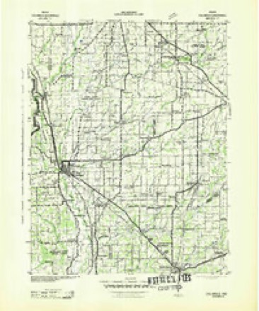
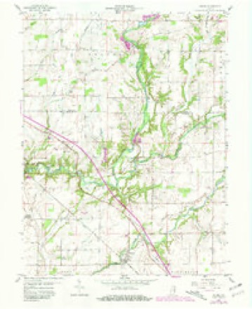
10 topographic sheets cover this place, the earliest surveyed in 1942 and the latest in 1986. It stands in Adams Township. It lies in ZIP code area 47240. The Survey maps it on the Adams quadrangle. It stands 840 feet above sea level.
Topographic sheets covering this place
5 surveys from 10 printed sheetsMatched by testing this settlement's coordinate against the published boundary of every sheet in the United States Geological Survey's historical collection. Each opens the scanned sheet at the Survey.
- 1942 USGS Columbus quadrangle1:125000
- 1953 USGS Cincinnati quadrangle1:250000, 3 printings
- 1957 USGS Cincinnati quadrangle1:250000
- 1959 USGS Adams quadrangle1:24000, 3 printings
- 1986 USGS Greensburg quadrangle1:100000, 2 printings



What happened here
An account from the chapter on Adams township. The inset identifies its exact source book and publication year.
The First Settler
The first white man to take up his abode in Adams township is believed to have been John Gullion. He came from Switzerland county, and was an old Revolutionary soldier - said to have been perfectly irrepressible and uncontrollable in battle. He had been shot through the cheek and mouth in some of the battles of that war, and was greatly disfigured.
In the county-history sources
7,596 words on this townshipHistory of Decatur County, Indiana : Its People, Industries and Institutions, published 1915 names this settlement in its chapter on Adams Township. These are the passages that mention it, exactly as the scans read.
Downeyville is a small hamlet in Adams township. This village was never platted and, although the name covers considerable space on the county map, there are only four or five houses in the cluster that marks the town limits. The business interests, which consist of a general store, are conducted by J. F. Downey & Sons.
Passage source: History of Decatur County, Indiana : Its People, Industries and Institutions, published 1915.
Few of the present generation know that the first town laid out within the present Hmits of Decatur county was located in Adams township. Shortly after land in the "New Purchase" was offered for sale at Brookville, Abraham Heaton bought one hundred and sixty acres in section 6 of Adams township. In the early part of the following year John Shelhorn entered a tract in the same section and these two men conceived the idea of laying out a town above the confluence of Big and Little Flatrock. The county of Decatur had not yet been organized and no one, of course, knew how much territory the new county might include. Heaton and Shelhorn hoped to induce the authorities to select the site of their proposed town for the county seat and when they laid out their town provided for a public square. On the Franklin county records may still be seen the town of Rockville, which these two enterprising Yankees laid out in the early spring of 1 82 1. The plat was recorded at Brook ville, February 19, 1821 (Deed record E, page 76), and shows one hundred and eight lots. The streets were one chain in width and seventy-five links in length. The plat shows the following streets : Main, Broadway, Walnut, Water, Mulberry and Market. While the site was a beautiful one, the proprietors never realized anything from their patriotic efforts to make it a town. During the following year the locating commissioners placed the county seat of the new county at Greensburg and thus blasted any hopes that Heaton and Shelhorn might have entertained for their town. The present town of Downeyville is in the neighborhood of this long- forgotten, prospective county seat of Decatur county.
Passage source: History of Decatur County, Indiana : Its People, Industries and Institutions, published 1915.
Machine-read from a century-old scan, so expect the errors a machine makes: misspelled names, dropped words, stray characters.
Fires near this place
1 since 2004Regional context, not property-specific evidence. The federal wildfire occurrence database lists 1 fire within 5 miles of Downeyville in 2004, burning about 3 acres in total. None started naturally. None was recorded as arson. Distance is straight-line from the map coordinates, so a fire counted here may appear on a neighbouring settlement's page as well.
| Reported cause | Fires |
|---|---|
| Recreation and ceremony | 1 |
The most recent of them, most recent first, with the day each was reported and the service that recorded it.
| Date | Cause | Size | Reported by | Name on the report |
|---|---|---|---|---|
| 30 October 2004 | Recreation and ceremony | 3.0 acres | Indiana State Fire Marshal's Office | not named |
Settlements close enough to share some of these fires:
Mines and quarries near this place
4 within 5 milesRegional context, not property-specific evidence. The federal mineral resources record lists 4 workings within 5 miles of Downeyville: 3 producers, 1 unknown. 3 still produce. What was taken out: Stone, Crushed/Broken, Sand and Gravel, Construction, Limestone, Dimension. Distance is straight-line from the map coordinates, so a quarry counted here may appear on a neighbouring settlement's page as well.
| Where | Site | Commodity | Status | Recorded |
|---|---|---|---|---|
| Mc Corkle Quarry | Stone, Crushed/Broken, Limestone, Dimension | Producer | ||
| St Omer Gravel Pit | Sand and Gravel, Construction | Unknown | ||
| Rush County Stone Quarry | Stone, Crushed/Broken | Producer | ||
| St. Paul Quarry | Stone, Crushed/Broken | Producer |
Storms near this place
3 since 2012Regional context, not property-specific evidence. The National Weather Service names Downeyville in 3 storm reports between 2012 and 2022: 2 thunderstorm wind, 1 hail. No death or injury is recorded in these reports. Each account below is quoted exactly as the forecast office filed it, from the NOAA Storm Events Database, and each date opens the federal record of that event.
| When | Event | Place named | Harm | What the report says |
|---|---|---|---|---|
| May 2022 | Thunderstorm Wind | Downeyville | $10,000 | Thunderstorm winds downed multiple trees over a widespread area, including large trees, with some trees landing on homes. Trained spotter estimates wind gusts approaching 75 mph. |
| June 2018 | Thunderstorm Wind | Downeyville | $750 | Power lines were downed in this location due to strong thunderstorm wind gusts. |
| April 2012 | Hail | Downeyville | - | no account filed |
Nearest settlements
The eight closest, with where each one stands in the county. Distances are straight-line, computed from the Geographic Names Information System coordinates.
| Map | Place | Distance | Sheets |
|---|---|---|---|
| Saint Omer | 2.3 miles | 10 | |
| Adams | 3.1 miles | 10 | |
| Germantown | 3.9 miles | 12 | |
| Saint Paul | 3.9 miles | 12 | |
| Sandusky | 4.1 miles | 10 | |
| Williamstown | 4.8 miles | 10 | |
| Milford | 6.3 miles | 11 | |
| Craig | 6.8 miles | 11 |
Elsewhere
Matched on this settlement's Geographic Names Information System number rather than its name, so it cannot be a different place of the same name in another state.
| Wikipedia article on Downeyville | An encyclopaedic summary. Its text is share-alike, so it is linked here rather than copied. |
| Wikidata item Q5303135 | The structured record the population and elevation above come from. Public domain (CC0). |
Provenance
This settlement is recorded in the Geographic Names Information System as feature 433674. The sheet list is computed by point-in-boundary test against the United States Geological Survey's historical topographic inventory. Both are works of the United States government and carry no copyright under 17 U.S.C. 105.
Wildfire. Short, Karen C. 2022. Spatial wildfire occurrence data for the United States, 1992-2020 [FPA_FOD_20221014]. 6th Edition. Fort Collins, CO: Forest Service Research Data Archive. https://doi.org/10.2737/RDS-2013-0009.6 Collected with United States Government funding and usable without additional permissions or fees.
Mines and quarries. USGS Mineral Resources Data System (MRDS) https://mrdata.usgs.gov/mrds/ A work of the United States government, no copyright under 17 U.S.C. 105.
Storms. NOAA National Centers for Environmental Information, Storm Events Database https://www.ncei.noaa.gov/stormevents/ A work of the United States government, no copyright under 17 U.S.C. 105. Narratives are quoted verbatim from the National Weather Service report and are not edited or summarised.