 Block
Elwren, Indiana
22 topographic sheets cover this place, the earliest surveyed in 1908 and the latest in 1986. It stands in Van Buren Township. It lies in ZIP code area 47403. It lies near Blair Hollow. The Survey maps it on the Stanford quadrangle. It stands 840 feet above sea level.
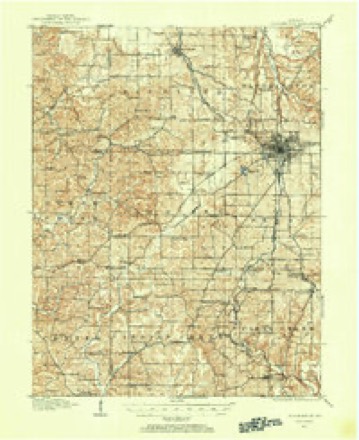
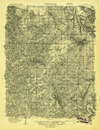
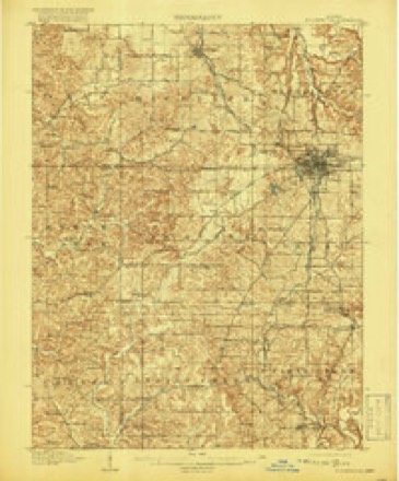
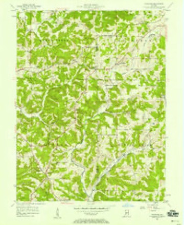
Topographic sheets covering this place
9 surveys from 22 printed sheetsMatched by testing this settlement's coordinate against the published boundary of every sheet in the United States Geological Survey's historical collection. Each opens the scanned sheet at the Survey.
- 1908 USGS Bloomington quadrangle1:62500
- 1908 USGS Bloomington quadrangle1:48000
- 1910 USGS Bloomington quadrangle1:62500, 6 printings
- 1953 USGS Indianapolis quadrangle1:250000, 4 printings
- 1956 USGS Indianapolis quadrangle1:250000
- 1956 USGS Stanford quadrangle1:24000, 3 printings
- 1957 USGS Indianapolis quadrangle1:250000, 2 printings
- 1962 USGS Indianapolis quadrangle1:250000
- 1986 USGS Bloomington quadrangle1:100000, 3 printings





In the county-history sources
9,632 words on this township1884 History of Monroe County Indiana, published 1884 has no passage naming this settlement, which was common for smaller places. Its township is covered in full.
The chapter on Van Buren Township covers the township.
Read the chapter on Van Buren Township - 9,632 words.
Fires near this place
63 since 1993Regional context, not property-specific evidence. The federal wildfire occurrence database lists 63 fires within 5 miles of Elwren between 1993 and 2013, burning about 57 acres in total. 2 started naturally. 5 were recorded as arson. Distance is straight-line from the map coordinates, so a fire counted here may appear on a neighbouring settlement's page as well.
| Reported cause | Fires |
|---|---|
| Debris and open burning | 23 |
| Recreation and ceremony | 20 |
| Missing data/not specified/undetermined | 9 |
| Arson/incendiarism | 5 |
| Natural | 2 |
| Equipment and vehicle use | 2 |
| Smoking | 1 |
| Other causes | 1 |
The most recent of them, most recent first, with the day each was reported and the service that recorded it.
| Date | Cause | Size | Reported by | Name on the report |
|---|---|---|---|---|
| 7 September 2007 | Missing data/not specified/undetermined | under an acre | Indiana State Fire Marshal's Office | not named |
| 3 September 2007 | Arson/incendiarism | under an acre | Indiana State Fire Marshal's Office | not named |
| 23 September 2005 | Natural | under an acre | Indiana State Fire Marshal's Office | not named |
| 20 September 2007 | Debris and open burning | 1.0 acres | Indiana State Fire Marshal's Office | not named |
| 18 September 2006 | Missing data/not specified/undetermined | under an acre | Indiana State Fire Marshal's Office | not named |
| 4 August 2007 | Arson/incendiarism | under an acre | Indiana State Fire Marshal's Office | not named |
| 27 August 2007 | Recreation and ceremony | under an acre | Indiana State Fire Marshal's Office | not named |
| 22 August 2006 | Recreation and ceremony | under an acre | Indiana State Fire Marshal's Office | not named |
Settlements close enough to share some of these fires:
Mines and quarries near this place
10 of 11 shownRegional context, not property-specific evidence. The federal mineral resources record lists 11 workings within 5 miles of Elwren: 7 occurrences, 2 past producers, 1 prospect, 1 producer. 1 still produces. What was taken out: Iron, Limestone, Dimension, Flagstone. Distance is straight-line from the map coordinates, so a quarry counted here may appear on a neighbouring settlement's page as well.
| Where | Site | Commodity | Status | Recorded |
|---|---|---|---|---|
| Hinkle Sandstone Quarry | Flagstone | Past Producer | ||
| Independent Limestone Company | Limestone, Dimension | Producer | ||
| Shawnee Quarry | Limestone, Dimension | Past Producer | ||
| Unnamed Prospect | Iron | Occurrence | ||
| Unnamed Prospect | Iron | Prospect | ||
| Unnamed Prospect | Iron | Occurrence | ||
| Unnamed Prospect | Iron | Occurrence | ||
| Unnamed Prospect | Iron | Occurrence | ||
| Unnamed Prospect | Iron | Occurrence | ||
| Unnamed Prospect | Iron | Occurrence |
Storms near this place
3 since 2025Regional context, not property-specific evidence. The National Weather Service names Elwren in 3 storm reports between 2025 and 2026: 1 tornado, 1 flash flood, 1 thunderstorm wind. No death or injury is recorded in these reports. Each account below is quoted exactly as the forecast office filed it, from the NOAA Storm Events Database, and each date opens the federal record of that event.
| When | Event | Place named | Harm | What the report says |
|---|---|---|---|---|
| May 2025 | Tornado (EF2) | Elwren | $1,200,000 | The episode's third tornado was the last of three tornadoes spawned from a rotating supercell that crossed southern central Indiana. This long-track circulation crossed southern Monroe County and Brown County before tracking into west-central Bartholomew County for its final 3 miles. The tornado produced mainly EF1 damage, although EF2 intensity occurred occasionally in Monroe County, especially in the Clear Creek area, as well as an approximate 4-mile length in Brown County near and just north of the Stone Head area.||The tornado touched down about a quarter-mile southwest of the intersection of West Elwren Road and West Elwren Lane and tracked eastward, producing minor structural damage while damaging many trees up until it crossed Indiana Route 45 at West Elwren Road. Here the south and east walls and the entire roof of a large horse barn were removed; the building's main supporting vertical wooden posts were broken, but the walls that were lost were not anchored to the dirt foundation. The circulation continued east into the Clear Creek community, damaging many trees and causing minor damage to homes. The small Clear Creek Post Office's roof was removed and thrown about 50 yards to the east-northeast; this cinder-block building was only anchored by mortar with no reinforcement, with the blocks caving on the eastern wall when the roof was pulled off. Adjacent to the post office, numerous trees were topped or snapped about two-thirds of the way up. A nearly-constant path of EF0 to EF1 damage to trees and structures continued east from the post office. The tornado strengthened to EF2 intensity around Old Indiana Route 37: two unanchored garages/outbuildings were destroyed with debris thrown nearly 100 yards, while a metal storage unit was lifted and tossed nearly 40 yards, landing on top of two cars; single-floor double rental units on the north side of the tornado saw substantial roof damage, and several cars were rolled. The tornado continued east, where an A-frame building was pulled south off its foundation while remaining intact, and an older motel lost its roof and an east side wall while numerous adjacent trees were snapped. The tornado then tracked south of the Knight Ridge community while crossing the northern-most portion of Monroe Lake, maintaining EF0 to EF1 intensity, damaging trees and some buildings. The vortex's width peaked in Monroe County at 350 yards.||The tornado crossed Brown County from west to east, tracking over Crooked Creek Lake, through Brown County State Park and just north of the Stone Head community; the circulation lifted occasionally, yet was on the ground most of the time. Extensive tree damage occurred amid the very dense woods of the county's western half, with isolated structures also occasionally impacted. The vortex intensified and widened substantially within Brown County State Park, with significant tree damage along a long path from well west of Horseman Camp Road, over a ridge and into Horseman Camp where several campers were staying at the time; trees were snapped and uprooted, with very few left standing in the camp. The width was 300-350 yards from the camp through Mount Liberty Road. The tornado then shrank in width in far-eastern Brown County, with remaining damage to mostly trees, and EF0 to EF1 damage to any structures.||The circulation continued into west-central Bartholomew County with a path width of 100-200 yards, producing mainly tree damage, especially through the northern portions of Grandview Lake. The tornado continued to weaken and finally ended about two-thirds of a mile northeast of Grandview Lake. Peak wind gusts were 128 mph. |
| April 2025 | Flash Flood | Elwren | $100,000 | Street flooding across Monroe county with numerous road closures. Total rainfall ranged from 2.9 to 4.1 inches. |
| April 2026 | Thunderstorm Wind | Elwren | $20,000 | Thunderstorm wind gusts downed a tree onto a home which allowed rain water to flood basement. |
Nearest settlements
The eight closest, with where each one stands in the county. Distances are straight-line, computed from the Geographic Names Information System coordinates.
| Map | Place | Distance | Sheets |
|---|---|---|---|
| Stanford | 1.3 miles | 22 | |
| Kirby | 3.7 miles | 25 | |
| Garden Acres | 5.0 miles | 27 | |
| Van Buren Park | 5.1 miles | 25 | |
| Buenavista | 5.3 miles | 22 | |
| Kirksville | 5.3 miles | 27 | |
| Leonard Springs | 5.4 miles | 25 | |
| Victor | 5.8 miles | 27 |
Elsewhere
Matched on this settlement's Geographic Names Information System number rather than its name, so it cannot be a different place of the same name in another state.
| Wikipedia article on Elwren | An encyclopaedic summary. Its text is share-alike, so it is linked here rather than copied. |
| Wikidata item Q5368362 | The structured record the population and elevation above come from. Public domain (CC0). |
Provenance
This settlement is recorded in the Geographic Names Information System as feature 434146. The sheet list is computed by point-in-boundary test against the United States Geological Survey's historical topographic inventory. Both are works of the United States government and carry no copyright under 17 U.S.C. 105.
Wildfire. Short, Karen C. 2022. Spatial wildfire occurrence data for the United States, 1992-2020 [FPA_FOD_20221014]. 6th Edition. Fort Collins, CO: Forest Service Research Data Archive. https://doi.org/10.2737/RDS-2013-0009.6 Collected with United States Government funding and usable without additional permissions or fees.
Mines and quarries. USGS Mineral Resources Data System (MRDS) https://mrdata.usgs.gov/mrds/ A work of the United States government, no copyright under 17 U.S.C. 105.
Storms. NOAA National Centers for Environmental Information, Storm Events Database https://www.ncei.noaa.gov/stormevents/ A work of the United States government, no copyright under 17 U.S.C. 105. Narratives are quoted verbatim from the National Weather Service report and are not edited or summarised.