 Block
Stanford, Indiana
22 topographic sheets cover this place, the earliest surveyed in 1908 and the latest in 1986. It stands in Van Buren Township. It lies in ZIP code area 47403. The Survey maps it on the Stanford quadrangle. It stands 761 feet above sea level.
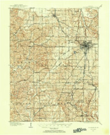
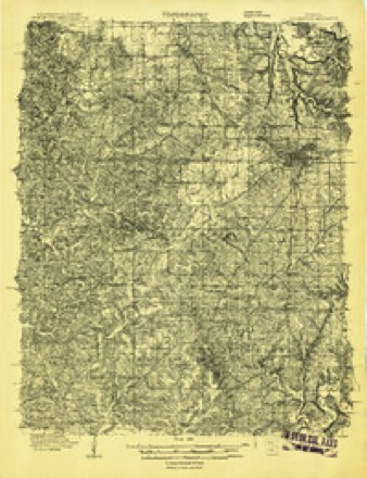
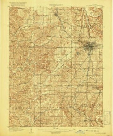
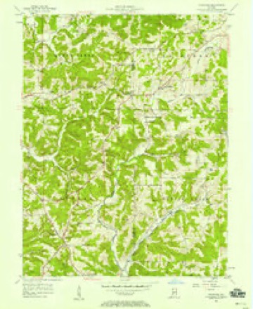
Topographic sheets covering this place
9 surveys from 22 printed sheetsMatched by testing this settlement's coordinate against the published boundary of every sheet in the United States Geological Survey's historical collection. Each opens the scanned sheet at the Survey.
- 1908 USGS Bloomington quadrangle1:62500
- 1908 USGS Bloomington quadrangle1:48000
- 1910 USGS Bloomington quadrangle1:62500, 6 printings
- 1953 USGS Indianapolis quadrangle1:250000, 4 printings
- 1956 USGS Indianapolis quadrangle1:250000
- 1956 USGS Stanford quadrangle1:24000, 3 printings
- 1957 USGS Indianapolis quadrangle1:250000, 2 printings
- 1962 USGS Indianapolis quadrangle1:250000
- 1986 USGS Bloomington quadrangle1:100000, 3 printings





In the county-history sources
9,632 words on this township1884 History of Monroe County Indiana, published 1884 names this settlement in its chapter on Van Buren Township. These are the passages that mention it, exactly as the scans read.
In general, the citizens of Van Buren Township have been a very well-behaved people. A large portion, since the earliest settlement, has been connected with the various religious classes ; and the other portion - the non-professors; or unbelievers - has been sober and moral. A class of the Church of Christ was early organized - about 1830 - and for a time met for worship at the house of Joseph Berry, who was one of the leading members. Robert Hamilton, Joseph Berry, John Porch, John Goodnight, Dudley C. Smith, John Givens, John Bunger and their families, were members. This class was made up from Van Buren and Indian Creek Townships. A log church was built quite early - about 1834 - and was used for many years. The Methodists established a class in the southwestern part early in the thirties, the leading early members being Lewis Harman, David Carpenter, Dennison Whaley, E. W. Tarkington, Malden Baker, Jacob Baker, William Higgins, Lewis L. Allen, Jesse Tarkington, Samuel Day, George G. Walker and their families. Lewis Dale was the pastor in 1850. This class has endured until the present, and early built a church at Stanford, which is yet used. Early in the forties, the United Baptists organized a class in the vicinity of Stanford, among the earliest members being the families of John Griffith, Jesse Goss, James Steele, Henry Flood, William Sparks, Abe May, W. H. Treadway - the latter four also belonging to the Baptist Church in Richland 'Township. This class grew, thrived, and built a church about 1850. The old Union Meeting-house. on Section 36, also had a large membership in the four townships - Van Buren, Perry, Clear Creek and Indian Creek. The old Baptist Church in the southern part of Richland Township, drew a strong membership from the limits of Van Buren. 'The citizens in the northeastern part joined the churches at Bloomington. The educational and religious community at the village of Harmony, northeast of Stanford, was the earliest union of religious sentiment in the county. Members of any orthodox denomination were eligible to membership. Later years have seen the organization of other religious classes, and the increased membership and prosperity of the old, until no portion of the county is better supplied with moral advantages.
Passage source: 1884 History of Monroe County Indiana, published 1884.
The first school was taught in about the year 1824, at what afterward became the village of Harmony, the teacher being, so it is stated, Jonathan Nichols. The house was a vacated log cabin that had been erected for a dwelling, and was temporarily fixed up for school purposes. It is not certain where the next was started unless it was at the village of Harmony, where two or three terms of excellent school were conducted under the supervision of the Blue Spring Community. A school was started in the sontheastern part about 1828, one of the Berrys, it is said, being the first teacher. A schoolhouse that was erected in the southern part of Richland Township was attended by the children of Van Buren, in the northern part, but soon after 1830 a log schoolhouse was constructed on Section 4 or 9, which answered the purpose for several' years. Some state that the first school in the township was taught near what is now Stanford, one of the Tarkingtons being the first teacher. In 1836, there were four school districts and schoolhouses. In 1847, there were eight school districts in the township, and during the winter of 1846-47, six schools were taught. The enumeration in the districts at this time was as follows: No. 1, 73; No. 2, 94; No. 3, 64; No. 4,47; No. 5, 72; No. 6,19; No. 7, 66; No. 8,48. School was not taught during the winter in Districts No. 5 and 6. The average daily attendance was as follows : No. 1,.48; - No. 2; 15; Nes 8,175, Nos LACINO Ties No. 8, 13. Six months school was taught in District No. 3; two months in No. 7, and three months in the others. The teachers were paid for the term, exclusive of a small amount of tuition or subscription, as follows: No. 1, $80; No. 2, $25; Nv. 3, $75; No. 4, $45; No. 7, $36; No. 8, $415. The School Trustees at this time were Conrad Koons, John H. Porch and James P. Givens. In 1849 (March), there were eight school districts, as above given, with the following enumeration: No. 1, 38 males and 48 females; No. 2, 26 males and 24 females; No. 3, 36 males and 12 females; No. 4, 30 males and 23 females; No. 5, 34 males and 42 females; No. 6, 45 males and 31 females; No. 7, 24 males and 25 females; No. 8, 28 males and 28 females. Total enumeration, males 261, females 233; grand total, 494. The schools at this time were not surpassed by any other country portion of the county. When the new school law came into effect in 1453, and one Trustee took the place of three, and new funds were created for the common schools, within a few years many of the districts built new houses - not of logs, but of the best native lumber. Great improvements were made during the fifties in school methods and systems. During the sixties, still greater improvements were made, and now the school system of the township, the county and the State, is not only the pride of the residents, but the mee: object of neighboring States. The following table explains itself :
Passage source: 1884 History of Monroe County Indiana, published 1884.
From the table it will be seen that Stanford (District No. 4) has two schools. The old frame house at Stanford, built late in the forties, was succeeded by a better frame building, with two rooms, some eight or ten years ago. Now there are two teachers, as indicated in the table.
Passage source: 1884 History of Monroe County Indiana, published 1884.
Machine-read from a century-old scan, so expect the errors a machine makes: misspelled names, dropped words, stray characters.
Read the whole chapter on Van Buren Township - it names this place 4 more 4 times.
Fires near this place
57 since 1993Regional context, not property-specific evidence. The federal wildfire occurrence database lists 57 fires within 5 miles of Stanford between 1993 and 2013, burning about 53 acres in total. 1 started naturally. 5 were recorded as arson. Distance is straight-line from the map coordinates, so a fire counted here may appear on a neighbouring settlement's page as well.
| Reported cause | Fires |
|---|---|
| Debris and open burning | 21 |
| Recreation and ceremony | 19 |
| Missing data/not specified/undetermined | 7 |
| Arson/incendiarism | 5 |
| Smoking | 2 |
| Natural | 1 |
| Equipment and vehicle use | 1 |
| Other causes | 1 |
The most recent of them, most recent first, with the day each was reported and the service that recorded it.
| Date | Cause | Size | Reported by | Name on the report |
|---|---|---|---|---|
| 7 September 2007 | Missing data/not specified/undetermined | under an acre | Indiana State Fire Marshal's Office | not named |
| 3 September 2007 | Arson/incendiarism | under an acre | Indiana State Fire Marshal's Office | not named |
| 23 September 2005 | Natural | under an acre | Indiana State Fire Marshal's Office | not named |
| 20 September 2007 | Debris and open burning | 1.0 acres | Indiana State Fire Marshal's Office | not named |
| 4 August 2007 | Arson/incendiarism | under an acre | Indiana State Fire Marshal's Office | not named |
| 27 August 2007 | Recreation and ceremony | under an acre | Indiana State Fire Marshal's Office | not named |
| 22 August 2006 | Recreation and ceremony | under an acre | Indiana State Fire Marshal's Office | not named |
| 14 August 2007 | Debris and open burning | 1.0 acres | Indiana State Fire Marshal's Office | not named |
Settlements close enough to share some of these fires:
Mines and quarries near this place
10 of 15 shownRegional context, not property-specific evidence. The federal mineral resources record lists 15 workings within 5 miles of Stanford: 10 occurrences, 2 prospects, 2 past producers, 1 producer. 1 still produces. What was taken out: Iron, Limestone, Dimension, Flagstone. Distance is straight-line from the map coordinates, so a quarry counted here may appear on a neighbouring settlement's page as well.
| Where | Site | Commodity | Status | Recorded |
|---|---|---|---|---|
| Hinkle Sandstone Quarry | Flagstone | Past Producer | ||
| Independent Limestone Company | Limestone, Dimension | Producer | ||
| Shawnee Quarry | Limestone, Dimension | Past Producer | ||
| Unnamed Prospect | Iron | Occurrence | ||
| Unnamed Prospect | Iron | Occurrence | ||
| Unnamed Prospect | Iron | Prospect | ||
| Unnamed Prospect | Iron | Prospect | ||
| Unnamed Prospect | Iron | Occurrence | ||
| Unnamed Prospect | Iron | Occurrence | ||
| Unnamed Prospect | Iron | Occurrence |
Storms near this place
2 since 2004Regional context, not property-specific evidence. The National Weather Service names Stanford in 2 storm reports between 2004 and 2023: 1 flash flood, 1 tornado. No death or injury is recorded in these reports. Each account below is quoted exactly as the forecast office filed it, from the NOAA Storm Events Database, and each date opens the federal record of that event.
| When | Event | Place named | Harm | What the report says |
|---|---|---|---|---|
| June 2023 | Tornado (EF1) | Stanford | $450,000 | A supercell thunderstorm spawned this third tornado of the day, which would track across far southwestern Monroe County, for its first 3 miles in a mainly easterly direction, before turning more east-southeasterly along the track's final 1.5 miles. The tornado inflicted a combination of EF0 and EF1 intensity damage. Strongest winds were estimated at 100 mph over latter portions of the track, both where the tornado turned right and again when impacting a home shortly after crossing South Rockport Road.||The tornado began as an EF0 on the south side of West Carmichael Road, about 1500 feet west-northwest of the intersection of West Carmichael Road and West Rock East Road; here it damaged multiple outbuildings and a barn. About a half mile of EF1 intensity damage then occurred along West Rock East Road including multiple trees snapped at the trunk. Near the midpoint of the track upon crossing South Lee Phillips Road, the tornado caused isolated tree and home damage including uprooted a hardwood tree and blowing out a window. 0.9 miles later the tornado reached peak intensity over a slight rise of ground, with winds snapping trees, destroying a wood-anchored shed, and bending an anchored steel plate. The tornado then turned to the east-southeast, and again exhibited peak intensity upon crossing South Rockport Road where a well-built barn was partially destroyed and a 2-story home sustained extensive roof damage. For the final 0.8 miles of its track, the tornado roughly paralleled South Rockport Road while occasionally snapping pine trees, before ending about 4 miles west of the western end of Monroe Lake. |
| May 2004 | Flash Flood | Stanford | - | no account filed |
Nearest settlements
The eight closest, with where each one stands in the county. Distances are straight-line, computed from the Geographic Names Information System coordinates.
| Map | Place | Distance | Sheets |
|---|---|---|---|
| Elwren | 1.3 miles | 22 | |
| Buenavista | 4.0 miles | 22 | |
| Kirksville | 4.2 miles | 27 | |
| Kirby | 4.4 miles | 25 | |
| Victor | 5.0 miles | 27 | |
| Garden Acres | 5.3 miles | 27 | |
| Van Buren Park | 5.6 miles | 25 | |
| Leonard Springs | 5.9 miles | 25 |
Elsewhere
Matched on this settlement's Geographic Names Information System number rather than its name, so it cannot be a different place of the same name in another state.
| Wikipedia article on Stanford | An encyclopaedic summary. Its text is share-alike, so it is linked here rather than copied. |
| Wikidata item Q7598706 | The structured record the population and elevation above come from. Public domain (CC0). |
Provenance
This settlement is recorded in the Geographic Names Information System as feature 444059. The sheet list is computed by point-in-boundary test against the United States Geological Survey's historical topographic inventory. Both are works of the United States government and carry no copyright under 17 U.S.C. 105.
Wildfire. Short, Karen C. 2022. Spatial wildfire occurrence data for the United States, 1992-2020 [FPA_FOD_20221014]. 6th Edition. Fort Collins, CO: Forest Service Research Data Archive. https://doi.org/10.2737/RDS-2013-0009.6 Collected with United States Government funding and usable without additional permissions or fees.
Mines and quarries. USGS Mineral Resources Data System (MRDS) https://mrdata.usgs.gov/mrds/ A work of the United States government, no copyright under 17 U.S.C. 105.
Storms. NOAA National Centers for Environmental Information, Storm Events Database https://www.ncei.noaa.gov/stormevents/ A work of the United States government, no copyright under 17 U.S.C. 105. Narratives are quoted verbatim from the National Weather Service report and are not edited or summarised.