 Block
Fayette, Indiana
12 topographic sheets cover this place, the earliest surveyed in 1953 and the latest in 1986. It stands in Zionsville town. It lies in ZIP code area 46052. The Survey maps it on the Fayette quadrangle. It stands 932 feet above sea level.
On record in Fayette
Buildings and businesses the archive holds for this place. Each opens its own page, with the source record it came from.
On the National Register within a mile 1 record
The National Register names another town for these. They stand within one mile of this settlement's coordinate.
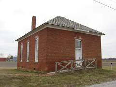 Howard Schoollisted 2009 · 0.8 miles away
Topographic sheets covering this place
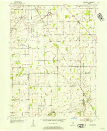
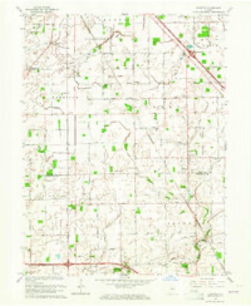
7 surveys from 12 printed sheetsMatched by testing this settlement's coordinate against the published boundary of every sheet in the United States Geological Survey's historical collection. Each opens the scanned sheet at the Survey.
- 1953 USGS Fayette quadrangle1:24000
- 1953 USGS Indianapolis quadrangle1:250000, 4 printings
- 1956 USGS Indianapolis quadrangle1:250000
- 1957 USGS Indianapolis quadrangle1:250000, 2 printings
- 1962 USGS Indianapolis quadrangle1:250000
- 1963 USGS Fayette quadrangle1:24000
- 1986 USGS Indianapolis quadrangle1:100000, 2 printings





In the county-history sources
37,254 words on this townshipEarly Life and Times in Boone County Indiana, published 1861 names this settlement in its chapter on Zionsville Town. These are the passages that mention it, exactly as the scans read.
Eagle Village, one of the oldest towns in Boone County, was laid out in 1831. It is located on the Michigan Road, in the southeast part of Eagle Township, about one mile east of Zionsville. Until 1852, when the Indianapolis, Cincinnati & Lafayette Railroad was built, the village was a place of some importance. From the year 1850, when it was at its zenith, it gradually went down, until now there are but few houses left. Many of the buildings were removed from there to Zionsville in 1852, when the latter place was laid out. Among the early merchants and business men of Eagle Village, most of whom are now deceased, we find the following: Daniel and James M. Larimore, Reuben Price, J. F. Daugherty, John Harden, Addison Nicholas, J. B. Pitzer, John P. Welch, Oel Thayer, T. P. Miller and Fielding Utterback, all of whom sold goods from 1835 until 1851. Among the physicians who practiced here from time to time, were H. G. Larimore, S. W. Rodman, Jeremiah Larimore, J. M. Gaston, Nathan Crosby and Dr. Johnson. H.G. Larimore died in Fayette County, Ind., in 1874, aged near ninety years. S. W. Rodman lives in Washington Territory. J. M. Gaston, who did not remain long in Eagle Village, lives in Indianapolis. Dr. Johnson's whereabouts are unknown. Jeremiah Larimore died in Indianapolis about the year 1880. He is buried at Mount's Run, in this county. Nathan Crosby, quite an old man, lives in Zionsville. He came from the East to Eagle Village in 1849. Of the early merchants we give the following: Daniel Larimore came from Fayette County, Ind., in 183-, was engaged in business only a few years when he died. He died in 1839, and is buried at Eagle Village. J. M., his son, succeeded him, and was engaged in active business until March, 1849, when he died of consumption. He was a fine-looking man, was never married, and is buried by the side of his father. He was the first Odd Fellow in Boone County. J. F. Daugherty came in 1836, and was in business a number of years. He finally moved to Zionsville, where he sold goods a number of years. He now resides in Indianapolis. John Harden engaged in business in 1842. He died in Ohio, February, 1877, and is buried at Zionsville, Boone County. Fielding Utterback was engaged in business several years. He was elected county sheriff in 1845. He went West and died there ten or fifteen years ago. Oel Thayer came to Boone County in 1839; was first a merchant in Clarkstown, then in Eagle Village. He finally removed ta Lebanon, where he died February 4, 1877. John Welch engaged in business with J. B. Pitzer (his brother-in-law), in 1846. He died in September, 1850, and is buried on Eagle Creek, six miles southwest of Zionsville. J. B. Pitzer was in business several years. He was elected county auditor in 1863. He resides in Zionsville, and is seventy-four years old. er. Miller was born in Tennessee. He came with his father to Eagle
Passage source: Early Life and Times in Boone County Indiana, published 1861.
Fayette is located in Whitelick, in Perry Township, and in the southern part of it near the Hendricks County line and on section ten. The town is well located on an elevated, well drained piece of land. The town contains two stores, school house and. several good private residences. Fayette was laid out on the land originally owned by Edmond Shurly and Mr. Turner. The present merchants are Mr. McDaniel and Shurly, Drs. W. E. Everts and Jourden. Drug store by Josephus Dodson. Former merchants were Charles J. Lumpkins and Thos. Fitch. Dr. Jorden's family kept the drug store here. Fayette is the voting place of Perry Township, and is the center of considerable trade, not only of Boone County, but that also of Hendricks County. The postoffice is now kept by Dr. W. E. Everts, who has been here several years and has a fine practice. The town contains some three hundred inhabitants, of sober, industrious habits. The settlement here on Whitelick dates back in the thirties. The town, however, is not quite that old.
Passage source: Early Life and Times in Boone County Indiana, published 1861.
Thirty years ago it was not then known that sufficient gravel could be found here to construct a system of gravel roads in the county. In 1864 a company was organized to construct a gravel highway from Thorntown to Darlington, to connect and extend to Crawfordsville. This was the first gravel road enterprise in the county. It and the Rosston gravel road, on the old Michigan road, are the only toll collecting highways in the county. In the year 1867 the Lebanon and Royalton and the Lebanon and Sugar Creek Gravel Road companies were organized. At first these two roads were toll collecting, but in the year 1884 were bought by the tax-payers living along them and turned over to the county. as a part of the free gravel road system. Under the legislative act of 1877, petitions for free gravel roads were filed before the board of commissioners, at a called session held August 6, 1879. The first road ordered constructed under this act was the Lebanon and New Brunswick, followed in quick succession by the Lebanon and Dover, Middle Jamestown, Lebanon and Noblesville, Thorntown and Bethel, Kirk's Mill and Sharon, Kirk's Mill south to Crawfordsville road, Lebanon and Thorntown, east end Noblesville, Elizaville, éleven roads, which exhausted the limit allowed by law, the limit being one per centum of taxables of the county. "In the construction of these roads gravel was found in sufficient quantities to build and maintain them with only one exception. The roads constructed were highly satisfactory. The contractors on the Lebanon and Elizaville found materials of the poorest and in smallest quantities. Bad as it was when completed, it is now by careful management as good as the best. Gravel road building was started anew by the bond limit being increased from one to one aud a half percentum and the Thorntorn and Sharon and Whitestown's two roads, and Zionsville's two, the Lebanon and Fayette, Dover and Shannondale, Lebanon and Ladoga, Lebanon and Slabtown and Thorntown, Hazelrigg and Lebanon roads were ordered constructed. At this time twentyfour free gravel roads have been built, aggregating 181 miles, costing $189,100. The first issue of bonds for this public improvement was redeemed by the treasurer in February, 1886, and from his report he has ample means to redeem all that become due during the present and ensuing years. It will be seen that where gravel was considered so scarce, with many other seeming obstacles in the way, our roads have cost on an average of $1,181 per mile. Much of this can be attributed to the good management of our county board. Once constructed, the keeping of so many miles of road in proper repair has been no small task. These roads are managed by the county commissioners as a board of free turnpike directors. They first organized as such July 15, 1881, being Nathan Perrill, William Curry and James Coombs, with Charles L. Wheeler asclerk. This board meets quarterly. Hach commissioner has especial charge of all free pikes in his district, and each road has its superintendent of repairs. Once each year these superintendents meet with the turnpike board and receive orders for repairs for the year. The present board of directors are W. C. Crump, Ben. C. Booher and Jacob S. Miller. The expenditures on account of repairs to the several roads in the county, to the present time aggregates $46,824.71, which includes the re-building of the Lebanon and Royalton and Lebanon and Sugar Creek roads. Including the extensive repairs to the roads last named, our roads cost us near $60 per mile each year.
Passage source: Early Life and Times in Boone County Indiana, published 1861.
Machine-read from a century-old scan, so expect the errors a machine makes: misspelled names, dropped words, stray characters.
Read the whole chapter on Zionsville Town - it names this place 1 more 1 time.
Storms near this place
1 since 2005Regional context, not property-specific evidence. The National Weather Service names Fayette in 1 storm report in 2005: 1 thunderstorm wind. No death or injury is recorded in these reports. Each account below is quoted exactly as the forecast office filed it, from the NOAA Storm Events Database, and each date opens the federal record of that event.
| When | Event | Place named | Harm | What the report says |
|---|---|---|---|---|
| November 2005 | Thunderstorm Wind | Fayette | $15,000 | A barn was blown down. |
Nearest settlements
The eight closest, with where each one stands in the county. Distances are straight-line, computed from the Geographic Names Information System coordinates.
| Map | Place | Distance | Sheets |
|---|---|---|---|
| Herr | 2.5 miles | 12 | |
| Shepherd | 3.1 miles | 12 | |
| Royalton | 3.1 miles | 18 | |
| Stonegate | 4.2 miles | 18 | |
| Eaglewood Estates | 4.7 miles | 18 | |
| Russell Lake | 5.2 miles | 18 | |
| Whitestown | 5.3 miles | 18 | |
| The Woodlands | 5.6 miles | 18 |
Elsewhere
Matched on this settlement's Geographic Names Information System number rather than its name, so it cannot be a different place of the same name in another state.
| Wikipedia article on Fayette | An encyclopaedic summary. Its text is share-alike, so it is linked here rather than copied. |
| Wikidata item Q5438998 | The structured record the population and elevation above come from. Public domain (CC0). |
Provenance
This settlement is recorded in the Geographic Names Information System as feature 434422. The sheet list is computed by point-in-boundary test against the United States Geological Survey's historical topographic inventory. Both are works of the United States government and carry no copyright under 17 U.S.C. 105.
Storms. NOAA National Centers for Environmental Information, Storm Events Database https://www.ncei.noaa.gov/stormevents/ A work of the United States government, no copyright under 17 U.S.C. 105. Narratives are quoted verbatim from the National Weather Service report and are not edited or summarised.