 Block
Fleener, Indiana
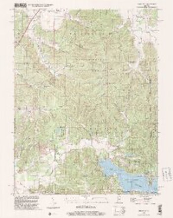
21 topographic sheets cover this place, the earliest surveyed in 1942 and the latest in 1998. It stands in Benton Township. It lies in ZIP code area 47468. It stands on Wolf Creek. The Survey maps it on the Hindustan quadrangle.
On record in Fleener
Buildings and businesses the archive holds for this place. Each opens its own page, with the source record it came from.
On the National Register within a mile 1 record
The National Register names another town for these. They stand within one mile of this settlement's coordinate.
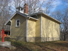 Honey Creek Schoollisted 1978 · 0.3 miles away
Topographic sheets covering this place
9 surveys from 21 printed sheetsMatched by testing this settlement's coordinate against the published boundary of every sheet in the United States Geological Survey's historical collection. Each opens the scanned sheet at the Survey.
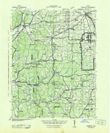
- 1942 USGS Franklin quadrangle1:125000
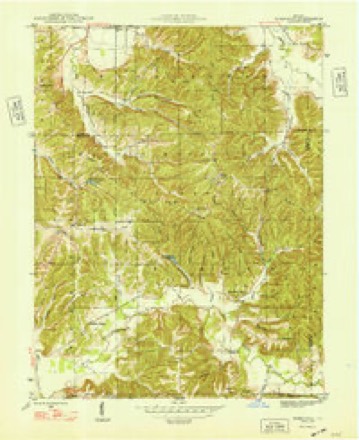
- 1948 USGS Hindustan quadrangle1:24000, 3 printings
- 1953 USGS Indianapolis quadrangle1:250000, 4 printings
- 1956 USGS Indianapolis quadrangle1:250000
- 1957 USGS Indianapolis quadrangle1:250000, 2 printings
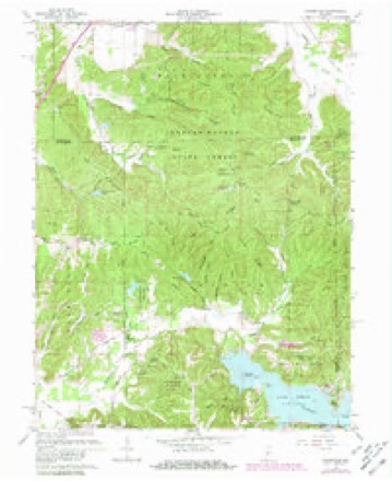
- 1961 USGS Hindustan quadrangle1:24000, 5 printings
- 1962 USGS Indianapolis quadrangle1:250000
- 1986 USGS Bloomington quadrangle1:100000, 3 printings
- 1998 USGS Hindustan quadrangle1:24000





In the county-history sources
4,386 words on this township1884 History of Monroe County Indiana, published 1884 names this settlement in its chapter on Benton Township. These are the passages that mention it, exactly as the scans read.
James Allen, Abraham Allen, William Alexander, James J. Alexander, David Banan, Joseph C. Bates, Joab Brummet, Isaac Boltinghouse, Christopher Blessey, William Carr, John B. Cox, William Cox, David Chitwood, Isaac Cox, Griffith Davidson, J. J. Fulford, William Fry, Nicholas Fleener, Martin Gamble, James Graham, Madison Graham, Sampson Hensley, Edward Jackson, Hugh McClung, James Payton, B. F. Rogers, William Richardson, Joshua Richardson, George Richardson, Pleasant Robertson, Jonathan Richardson, Thomas Stephenson, Jordan Stephens, Adam Stephens, David Young, Jr., Abraham Young, Silas Young. The highest tax was paid by the following men: Abraham Allen, $4.93; William Alexander, $7; J. J. Alexander, $7; David Banan, $7; David Chitwood, $4.98; the Youngs estate, $9.90; Sampson Hensley, $7.77; Edward Jackson, $7.82; Hugh McClung, $6.40 ; David Young, Jr., $5.79; Abraham Young, $5.90. The total value of township lands with improvements was $18,605, and as the township then included Marion, those figures, of course, included the latter. The total tax for the two townships was $299.74. The county tax was $109.18 ; the State tax, $190.56; total amount of taxables.was $32,519 for both townships.
Passage source: 1884 History of Monroe County Indiana, published 1884.
This is the only village in Benton township. It is likely that J. J. Alexander was the first merchant; at any rate he opened a store of general merchandise, worth about $900, in the year 1836, and soon had a flourishing trade. He continued in the business many years. Late in the forties, James Carter engaged in business in the village, continuing for several years. About the same time C. ©. Fleener also opened a general store. In about 1852, F. R. Miller engaged in the mercantile pursuit. Thus the business went on, usually one or two mercantile establishments present. A blacksmith shop, a post office, a carpenter or two, a dozen families, a doggery, etc., make up the sum and substance of Unionville.
Passage source: 1884 History of Monroe County Indiana, published 1884.
Machine-read from a century-old scan, so expect the errors a machine makes: misspelled names, dropped words, stray characters.
Mines and quarries near this place
1 within 5 milesRegional context, not property-specific evidence. The federal mineral resources record lists 1 working within 5 miles of Fleener: 1 occurrence. None of them still produces. What was taken out: Zinc, Sulfur. Distance is straight-line from the map coordinates, so a quarry counted here may appear on a neighbouring settlement's page as well.
| Where | Site | Commodity | Status | Recorded |
|---|---|---|---|---|
| Sphalerite Occurrence Z71 | Zinc, Sulfur | Occurrence | Sphalerite |
Storms near this place
5 since 2017Regional context, not property-specific evidence. The National Weather Service names Fleener in 5 storm reports between 2017 and 2025: 2 hail, 2 thunderstorm wind, 1 flood. The reports record 1 injury. Each account below is quoted exactly as the forecast office filed it, from the NOAA Storm Events Database, and each date opens the federal record of that event.
| When | Event | Place named | Harm | What the report says |
|---|---|---|---|---|
| March 2025 | Thunderstorm Wind | Fleener | 1 hurt, $15,000 | A tree of unknown size was downed by thunderstorm wind gusts onto a mobile home causing an injury with brief entrapment. |
| May 2017 | Flood | Fleener | $35,000 | A trained spotter reported flooding over several roads in northern Monroe County due to thunderstorm heavy rainfall. ||Also, WISH-TV reported that the Monroe County dive team responded to two separate calls related to flooded roads. The first call was at Anderson and Bean Blossom Roads at 7:30 AM when they responded to a call of a vehicle mostly submerged in flood water. The driver, a 53-year-old woman, was out of the vehicle and safe by the time they arrived. Dive team members observed a second car driving into flood waters after clearing the first scene. They proceeded to push the two occupants to more shallow waters before placing them in a squad car for safety.||Additionally, the Bartholomew County Sheriffs Office says its water rescue team pulled a woman from an overturned, submerged car at about 1:30 AM Saturday south of Columbus. It says she was transported to a hospital with minor injuries. No details on location or why the car overturned. |
| April 2024 | Thunderstorm Wind | Fleener | $5,000 | Thunderstorm winds in an apparent microburst on the north side of Lake Lemon, lifted a small boat and blew it into softwood pine trees, damaging them. |
| June 2021 | Hail | Fleener | - | no account filed |
| July 2017 | Hail | Fleener | - | no account filed |
Nearest settlements
The eight closest, with where each one stands in the county. Distances are straight-line, computed from the Geographic Names Information System coordinates.
| Map | Place | Distance | Sheets |
|---|---|---|---|
| Unionville | 3.6 miles | 21 | |
| Hindustan | 4.1 miles | 21 | |
| Dolan | 5.4 miles | 21 | |
| New Unionville | 5.6 miles | 21 | |
| Wayport | 5.9 miles | 17 | |
| Modesto | 7.3 miles | 17 | |
| Marlin Hills | 7.6 miles | 25 | |
| Eastern Heights | 8.3 miles | 21 |
Provenance
This settlement is recorded in the Geographic Names Information System as feature 434579. The sheet list is computed by point-in-boundary test against the United States Geological Survey's historical topographic inventory. Both are works of the United States government and carry no copyright under 17 U.S.C. 105.
Mines and quarries. USGS Mineral Resources Data System (MRDS) https://mrdata.usgs.gov/mrds/ A work of the United States government, no copyright under 17 U.S.C. 105.
Storms. NOAA National Centers for Environmental Information, Storm Events Database https://www.ncei.noaa.gov/stormevents/ A work of the United States government, no copyright under 17 U.S.C. 105. Narratives are quoted verbatim from the National Weather Service report and are not edited or summarised.