 Block
Fountain, Indiana
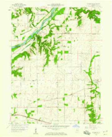
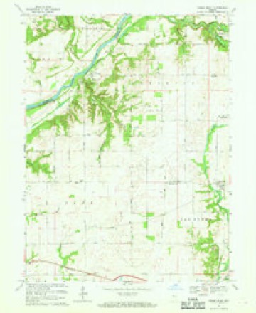
9 topographic sheets cover this place, the earliest surveyed in 1953 and the latest in 1987. It stands in Shawnee Township. It lies in ZIP code area 47918. It stands on Bear Creek. The Survey maps it on the Stone Bluff quadrangle. It stands 551 feet above sea level.
Topographic sheets covering this place
7 surveys from 9 printed sheetsMatched by testing this settlement's coordinate against the published boundary of every sheet in the United States Geological Survey's historical collection. Each opens the scanned sheet at the Survey.
- 1953 USGS Danville quadrangle1:250000, 3 printings
- 1955 USGS Danville quadrangle1:250000
- 1956 USGS Danville quadrangle1:250000
- 1958 USGS Stonebluff quadrangle1:24000
- 1967 USGS Stone Bluff quadrangle1:24000
- 1984 USGS Danville quadrangle1:100000
- 1987 USGS Danville quadrangle1:100000



In the county-history sources
17,054 words on this townshipHistory of Fountain County : Together with Historic Notes on the Wabash Valley, Gleaned from Early Authors, Old Maps and Manuscripts, published 1881 names this settlement in its chapter on Shawnee Township. These are the passages that mention it, exactly as the scans read.
They knew of no easj' road to learning, and so while not enervating their own intellects by eff"orts to bring themselves level to the comprehension of the pupils, they did not destroy the pupils' manliness, sense of power and self-reliance by over-much simplifying and explaining. They believed, with Noah Webster, that learning is to be acquired by severe effort, the niemor}' exercised with much that the pnpil may not then understand, and in this way the mind stored as it cannot be later, and that the revelations of time, aroused curiosity, and increase of intellectual dimensions may be trusted for the rest. James H. Martin, who is still an honored citizen of the township, taught first in the Stewart school-house, and then three successive winter terms in the Brown school-house. At Rob Roy wci-e John Bodley, David Brier, and Rufus A. Lockwood. David Brier stood for many years in the front rank of lawyers in Indiana, and was his party's nominee for congress in 1852. He now carries on a lucrative practice of his profession in the capital of Kansas. Rufus A. Lockwood, while teaching at Rob Roy, was an unaided student at law. He rose to eminence and wealth by the practice of it first in the courts of Indiana. Removing to California he was employed by Gen. John C. Fremont to defend his title to the Mariposa purchase, which was brought into question first by private parties and then by the government. His fame was national. Having gained this most famous suit he embarked on the ill-fated Central America, for New York city, where he intended to open a law office. The steamer was wrecked on the ocean, and he, with more than three hundred other passengers, found a watery grave between Panama and his destination. William Miller, a well educated man, and conspicuous figure in the early history of Fountain county, taught in the southeastern part of the township; and Mrs. Mary C. Hovey, wife of Rev. E. 0. Hovey, afterward Prof. Hovey of "Wabash College, opened a school for girls in a room of her house. In the Claypool settlement the succession of teachers for a series of years was Mrs. Sumner, George Wells, James and Celestia Maxwell, Robert Finch, and Stephen Fagg. The township is now laid off into nine school-districts, furnished with well built school-houses and teachers of good grade. Its distributive share in the apportionment of school revenue for tuition is $],83r;.43. There are 3(iS pupils enrolled for tuition.
Passage source: History of Fountain County : Together with Historic Notes on the Wabash Valley, Gleaned from Early Authors, Old Maps and Manuscripts, published 1881.
Alfred Helms, farmer, Fountain (Portland). His grandfather Helms emigrated with his family from North Carolina and settled in Yan Buren township about the time that John Colvert and Jonathan Burch came. These last arrived early in 1823. It is said that Mr. Helms cleared the first farm in Fountain county. The grandfather of our subject on his mother's side was Matthew Hawkins. He remove from Tennessee, also very early, and stopping on Hone^- Creek prairie died thei-e. His family settled at Chambersburg, where his grandl
Passage source: History of Fountain County : Together with Historic Notes on the Wabash Valley, Gleaned from Early Authors, Old Maps and Manuscripts, published 1881.
Henry B. Jones, farmer and stock raiser, Rob Roy. His grandfather, Wright Taylor, was a soldier of 1812. His fether, Aaron, was a North Carolinian, and his mother, Sarah Taylor, a Kentucky lady. They were married in the latter state, and in February, 1823, removed to Otter Creek prairie, in Vigo county, and the following winter to Fountain county, settling in the forks of Coal creek, below Veedersburg. In a year or two his father bought the land where Rob Roy stands, and afterward sold it to John I. Foster who had that town laid out. The land eventually fell back to Mr. Jones. He died here January 16, 1878, aged eighty-two, and his wife July 11, 1878, aged seventy- fonr. ^^^'- Jones, the youngest child of these parents, was born where 1)0 lives, one and one-fourth miles south of Kob Roy, October 23, jg40. He was married February 17, 1S61, to Joanna D. Meeker, datic'hter of Usual PI. Meeker. She was born March 18, lSi2. Their two children are Lorenzo E., born May 13, 1862, and Oliver M., Jannary IS, 1867. Mrs. Jones has been a eonamunicant in the Methodist church eighteen years. Mr. Jones is a Mason. He owns 535 acres, 290 of which are under plow ; it is valuable land, being a rich alluvial goil, and lying in the Shawnee and Coal creek bottoms. He is erecting, the present year, a fine brick residence of eight rooms, at a cost of over |4,000. He has been trustee of Shawnee township three terms in succession, beginning with 1870 and ending with 1876. He is a republican in politics, an influential man in his community, and active and enterprising in business.
Passage source: History of Fountain County : Together with Historic Notes on the Wabash Valley, Gleaned from Early Authors, Old Maps and Manuscripts, published 1881.
Machine-read from a century-old scan, so expect the errors a machine makes: misspelled names, dropped words, stray characters.
Read the whole chapter on Shawnee Township - it names this place 15 more 15 times.
Mines and quarries near this place
7 within 5 milesRegional context, not property-specific evidence. The federal mineral resources record lists 7 workings within 5 miles of Fountain: 5 producers, 2 past producers. 5 still produce. What was taken out: Sand and Gravel, Construction. Distance is straight-line from the map coordinates, so a quarry counted here may appear on a neighbouring settlement's page as well.
| Where | Site | Commodity | Status | Recorded |
|---|---|---|---|---|
| Bell Gravel Pit | Sand and Gravel, Construction | Past Producer | ||
| Brown's Pit | Sand and Gravel, Construction | Producer | ||
| Hanging Rock Pit | Sand and Gravel, Construction | Producer | ||
| Harrison Steel Co Quarry | Sand and Gravel, Construction | Past Producer | ||
| Tuggles Gravel Pit | Sand and Gravel, Construction | Producer | ||
| Wabash Gravel | Sand and Gravel, Construction | Producer | ||
| Warren Co. Hwy. | Sand and Gravel, Construction | Producer |
Storms near this place
7 since 1994Regional context, not property-specific evidence. The National Weather Service names Fountain in 7 storm reports between 1994 and 2025: 4 flood, 2 hail, 1 thunderstorm wind. No death or injury is recorded in these reports. Each account below is quoted exactly as the forecast office filed it, from the NOAA Storm Events Database, and each date opens the federal record of that event.
| When | Event | Place named | Harm | What the report says |
|---|---|---|---|---|
| March 2025 | Thunderstorm Wind | Fountain | $15,000 | A tree of unknown size was downed by thunderstorm wind gusts onto a house. |
| January 2009 | Flood | Fountain | $2,500 | Rainfall and warm temperatures that occurred on and off during the second half of December lead to extensive lowland flooding on the Wabash River during late December and early January, affecting Fountain County at and near Covington. Higher bottomlands also flooded. Williamsport Road flooded when the river crested at 21.5 feet on the Covington gage. This flood event is a continuation from December. |
| May 2023 | Hail | Fountain | - | Relayed via social media. |
| April 2009 | Flood | Fountain | - | Extensive flooding of lowland and higher bottomlands occurred along the Wabash River around the Covington, Indiana area. The river crested twice. The first crest was the highest at 22.2 feet on April 9th, 6.2 feet above flood stage. The secondary crest was at 19.6 feet on the 17th. These readings were obtained at the Covington river gauge. |
| May 2009 | Flood | Fountain | - | Several county roads were closed due to flooding. Event time is estimated. |
| December 2008 | Flood | Fountain | - | Rainfall and warm temperatures that occurred on and off during the second half of December led to extensive lowland flooding on the Wabash River during late December and early January, affecting Fountain County at and near the Covington river gage. Higher bottomlands also flooded. Williamsport Road flooded when the river crested at 21.5 feet on the Covington gage. This flood event continued into January. |
| August 1994 | Hail | Fountain | - | Lightning critically injured a woman at a bus stop on Indianapolis' northwest side. Mary Cooke, age 63, was knocked unconscious after being struck. She died August 16th from cardiac arrest and heart damage that were the result of the lightning strike. (F63O) |
Nearest settlements
The eight closest, with where each one stands in the county. Distances are straight-line, computed from the Geographic Names Information System coordinates.
| Map | Place | Distance | Sheets |
|---|---|---|---|
| Rob Roy | 5.0 miles | 9 | |
| Aylesworth | 5.1 miles | 9 | |
| Stone Bluff | 5.7 miles | 9 | |
| Hunter Corner | 6.0 miles | 9 | |
| Covington | 6.4 miles | 11 | |
| Harrison Lake | 6.4 miles | 9 | |
| Layton | 6.5 miles | 9 | |
| Attica | 6.8 miles | 9 |
Elsewhere
Matched on this settlement's Geographic Names Information System number rather than its name, so it cannot be a different place of the same name in another state.
| Wikipedia article on Fountain | An encyclopaedic summary. Its text is share-alike, so it is linked here rather than copied. |
| Wikidata item Q5474672 | The structured record the population and elevation above come from. Public domain (CC0). |
Provenance
This settlement is recorded in the Geographic Names Information System as feature 434710. The sheet list is computed by point-in-boundary test against the United States Geological Survey's historical topographic inventory. Both are works of the United States government and carry no copyright under 17 U.S.C. 105.
Mines and quarries. USGS Mineral Resources Data System (MRDS) https://mrdata.usgs.gov/mrds/ A work of the United States government, no copyright under 17 U.S.C. 105.
Storms. NOAA National Centers for Environmental Information, Storm Events Database https://www.ncei.noaa.gov/stormevents/ A work of the United States government, no copyright under 17 U.S.C. 105. Narratives are quoted verbatim from the National Weather Service report and are not edited or summarised.