 Block
Attica, Indiana
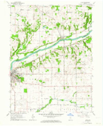
9 topographic sheets cover this place, the earliest surveyed in 1953 and the latest in 1987. It stands in Logan Township. It lies in ZIP code area 47918. The Survey maps it on the Attica quadrangle. 3,036 people lived here at the 2020 count. It stands 545 feet above sea level.
On record in Attica
Buildings and businesses the archive holds for this place. Each opens its own page, with the source record it came from.
On the National Register 7 records
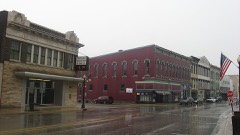 Attica Downtown Historic Districtlisted 1993
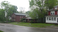 Attica Main Street Historic Districtlisted 1994
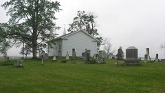 Bethel Church and Graveyardlisted 1995
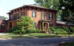 Brady Street Historic Districtlisted 1990
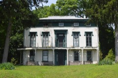 James and Lucinda McDonald Houselisted 2016
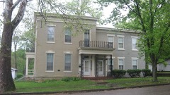 Marshall M. Milford Houselisted 1989
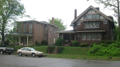 Old East Historic Districtlisted 1990
Population over time
2 figuresAttica fell from 3,245 to 3,036 between 2010 and 2020. These are the recorded population figures Wikidata holds for this place, reached through the Geographic Names Information System number this page is keyed on rather than by name, so they belong to this place and not to another of the same name. Most are census counts, but not all are: an early figure may be a founding or settlement estimate, and an estimate published within five years of a census is left out. The change column is computed, and is left blank where more than 20 years separate a figure from the one before it, because a gap that long is not a change between two counts.
| Year | People | Change |
|---|---|---|
| 2010 | 3,245 | |
| 2020 | 3,036 | -209 (-6%) |
Topographic sheets covering this place
6 surveys from 9 printed sheetsMatched by testing this settlement's coordinate against the published boundary of every sheet in the United States Geological Survey's historical collection. Each opens the scanned sheet at the Survey.
- 1953 USGS Danville quadrangle1:250000, 3 printings
- 1955 USGS Danville quadrangle1:250000
- 1956 USGS Danville quadrangle1:250000
- 1962 USGS Attica quadrangle1:24000, 2 printings
- 1984 USGS Danville quadrangle1:100000
- 1987 USGS Danville quadrangle1:100000



In the county-history sources
34,278 words on this townshipHistory of Fountain County : Together with Historic Notes on the Wabash Valley, Gleaned from Early Authors, Old Maps and Manuscripts, published 1881 names this settlement in its chapter on Logan Township. These are the passages that mention it, exactly as the scans read.
The history of this immediate vicinity opens out shortly after the battle of Tippecanoe, and a legend is still told that the prophet, the noted Tecumseh's brother, wliile on his way to join his tribe with the allied Indians at Tippecanoe, held a council of war under a large burroak tree which stood, until a few years ago, in the rear of the old Methodist church in Attica. This legend lent such a charm to the old oak that many would have gladly seen it spared. Several yeais before anv settlement was made in this vicinity a trading post was established near the village of Independence, six miles north of Attica. Here a daring French-Canadian, named Chiquot, bartered with the wily red man. At that time the river bottoms just opposite and a few miles above Attica were used by the Indian squaws as corn fields, and while the sinewy warriors scoured the forests for game, or lazily paddled over the placid waters of the Wabash, their dusky mates hovered over the fires at the wigwams or watched the growing crops from the peculations of the birds of the air or more formidable marauders from the deep recesses of the woods. And when autumn came, and the silver frosts tipped the blades of maize with yellow and gold, the cars were plucked and dried and carried in skins to the tops of the adjacent clitfs. where they were buried in the earth. On one occasion when a pair of Indians were making their excavation for the ai)ove purpose they came upon a rich vein of copper, and threw out great chunks of ore tliat was very nearly free from dross. AVith their usual cunningness they kept their discovery a secret for a time, and would stealthily dig out all tliey could carry and trade it to Chiquot. At length others of the triiie discovered it, and in time Chiquot acquired quite a cargo, which he loaded on a flat-boat and floated down to Yincennes, wliere he found a market for it. A numbcrof the older citizens of this township, among them John E. Latta Sr. and Enoch Farmer, spent years trying to discover the iiidden treasure, but without avail. Efforts were made to bribe fiie Indians, and scores of the old corn-holes were dug out, but all were unsucces--ful. In 1822 two tribes of Indians, the Kickapoos and Pottawalomies, got into a dispute which resulted in a collision, and a bloodv pitched liattle was fought on the cliffs across the river, bclow E-ickapoo falls. A large number on both sides were slain, and for long
Passage source: History of Fountain County : Together with Historic Notes on the Wabash Valley, Gleaned from Early Authors, Old Maps and Manuscripts, published 1881.
Prior to 1833 the territory now constituting Logan belonged to Shawnee and Davis townships, but the residents of Attica considered it a great inconvenience to go to Rob Roy to cast their ballots, and they accordingly asked for a new township. At tlie March session of the year named the board of commissioners organized Logan township, with the Ibllowing boundaries: beginning at the Wabash river, where the line dividing Sues, li and 23, T. 21, R. 8, strikes the saine, thence east with the said section line to the southeast corner of Sec. 14, T. 21, R. 7, thence north with the section line to the river. The township contains 13,799 acres, and has a population of 2,G09.
Passage source: History of Fountain County : Together with Historic Notes on the Wabash Valley, Gleaned from Early Authors, Old Maps and Manuscripts, published 1881.
The first settler we have any knowledge of was Josiah Bryant, who in 1822 entered the farm now owned by William Clapham. In May, 1824, Abi'am Trullinger entered land near the Claj-pool farm, and in November of that year all the land comprising this township was placed on the market, the sales being iield at Crawfordsville ; 81-25 per acre was the price, and purchases were made by Stephen Taylor, Benjamin Gordy, Jacob Wilkinson, John Brady, Jacob Ilushaw Sr., and Jacob Young. The latter bought the. valuable land now owned by William and Ed. Hughes. At this sale the land comprising the city of Attica could not be sold at any price. October 24, 1824, Jacob Turman settled near the Bryant farm, four miles east of Attica. He was a Methodist minister, and the first preacher who found his way to this section. For years previous he had been missionary among the Indians in the southern part of the state, and his acquaintance with their customs and habits saved his, as well as his neighbors', lives, after he removed here. He built a log-house tiie same 3'ear he entered his land, which was noted because of its durability. It was put together strongly, and in those days was considered the palace of the Wabash. When the Kickapoos or Pottawatomies got on the war-path this house was the rendezvous for all the settlers, the women and children being locked in tlio house while the men stood guard outside. The same year E. Pain entered the Henry JSTave farm, and several other families located <3uring the close of the year. In the spring of 1826 there was another land sale, and George Hollingsworth bought the land comprising Attica at §1.25 per acre.
Passage source: History of Fountain County : Together with Historic Notes on the Wabash Valley, Gleaned from Early Authors, Old Maps and Manuscripts, published 1881.
Machine-read from a century-old scan, so expect the errors a machine makes: misspelled names, dropped words, stray characters.
Read the whole chapter on Logan Township - it names this place 69 more 69 times.
Mines and quarries near this place
4 within 5 milesRegional context, not property-specific evidence. The federal mineral resources record lists 4 workings within 5 miles of Attica: 2 producers, 2 past producers. 2 still produce. What was taken out: Sand and Gravel, Construction. Distance is straight-line from the map coordinates, so a quarry counted here may appear on a neighbouring settlement's page as well.
| Where | Site | Commodity | Status | Recorded |
|---|---|---|---|---|
| Harrison Steel Co Quarry | Sand and Gravel, Construction | Past Producer | ||
| Neal Gravel Co. Inc. | Sand and Gravel, Construction | Past Producer | ||
| Wabash Gravel | Sand and Gravel, Construction | Producer | ||
| Warren Co. Hwy. | Sand and Gravel, Construction | Producer |
Storms near this place
32 since 1995Regional context, not property-specific evidence. The National Weather Service names Attica in 32 storm reports between 1995 and 2025: 20 thunderstorm wind, 8 hail, 3 flash flood, 1 flood. The reports record 1 injury. Each account below is quoted exactly as the forecast office filed it, from the NOAA Storm Events Database, and each date opens the federal record of that event.
| When | Event | Place named | Harm | What the report says |
|---|---|---|---|---|
| October 2021 | Thunderstorm Wind | Attica | 1 hurt, $500,000 | Significant tree damage across the town of Attica due to strong straight line winds associated with a bookend vortex. 3 houses had damage from trees falling on them with one minor injury in one of the residences. Near the golf course on the south side of the town, a free standing radio antenna was bent over with a noticeable amount of rust at the base. Elsewhere, the high school lost a portion of the roof which led to water damage in the school. |
| August 2009 | Thunderstorm Wind | Attica | $15,000 | Multiple trees, including one against a house, were downed in Attica due to thunderstorm wind gusts. Power was also out to parts of Attica. |
| March 2022 | Thunderstorm Wind | Attica | $10,000 | Thunderstorm winds blew off shingles and broke 1 inch tree limbs. |
| May 2025 | Thunderstorm Wind | Attica | $5,000 | Multiple reports of trees downed by thunderstorm wind gusts. |
| June 1998 | Thunderstorm Wind | Attica | $5,000 | Thunderstorm winds blew down trees on cars and power lines. |
| July 2002 | Flash Flood | Attica | $3,000 | Car attempted to drive across flooded roadway and stalled. Rescue was required. No injuries. |
| July 1995 | Thunderstorm Wind | Attica | $2,000 | Power lines were downed just east of Attica. |
| July 2002 | Flash Flood | Attica | $2,000 | no account filed |
| July 1997 | Thunderstorm Wind | Attica | $1,500 | Thunderstorm winds blew down trees and power lines in Attica. |
| July 2020 | Thunderstorm Wind | Attica | $1,000 | Trees downed due to thunderstorm wind gusts near Pine Street and also on Brady Street. |
| June 2019 | Thunderstorm Wind | Attica | - | A measured 62 mph thunderstorm wind gust was reported near Attica. |
| February 2009 | Flood | Attica | - | Seven unspecified roads were closed due to high water. |
| May 2009 | Thunderstorm Wind | Attica | - | One tree was blown down by thunderstorm winds at 170 South. |
| May 2009 | Flash Flood | Attica | - | US Highway 41 was flooded to a depth of 1 foot by heavy rainfall. |
| May 2005 | Thunderstorm Wind | Attica | - | Several trees were blown down. |
| July 2005 | Thunderstorm Wind | Attica | - | Trees and large limbs were blown down. |
| July 2003 | Thunderstorm Wind | Attica | - | Trees down |
| September 2002 | Thunderstorm Wind | Attica | - | Trees down |
| March 2017 | Hail | Attica | - | no account filed |
| August 2012 | Hail | Attica | - | no account filed |
| August 2012 | Hail | Attica | - | no account filed |
| April 2006 | Hail | Attica | - | no account filed |
| May 2003 | Thunderstorm Wind | Attica | - | no account filed |
| May 2003 | Hail | Attica | - | no account filed |
| July 2003 | Thunderstorm Wind | Attica | - | no account filed |
| November 2002 | Thunderstorm Wind | Attica | - | no account filed |
| October 2001 | Thunderstorm Wind | Attica | - | no account filed |
| May 2000 | Thunderstorm Wind | Attica | - | no account filed |
| May 2000 | Hail | Attica | - | no account filed |
| June 1996 | Thunderstorm Wind | Attica | - | no account filed |
| April 1996 | Hail | Attica | - | no account filed |
| May 1995 | Hail | Attica | - | no account filed |
Nearest settlements
The eight closest, with where each one stands in the county. Distances are straight-line, computed from the Geographic Names Information System coordinates.
| Map | Place | Distance | Sheets |
|---|---|---|---|
| Rob Roy | 4.0 miles | 9 | |
| Riverside | 4.9 miles | 9 | |
| Maysville Crossing | 6.0 miles | 9 | |
| Vine | 6.0 miles | 9 | |
| Aylesworth | 6.3 miles | 9 | |
| Fountain | 6.8 miles | 9 | |
| Roberts | 7.9 miles | 8 | |
| Newtown | 8.2 miles | 9 |
Elsewhere
Matched on this settlement's Geographic Names Information System number rather than its name, so it cannot be a different place of the same name in another state.
| Wikipedia article on Attica | An encyclopaedic summary. Its text is share-alike, so it is linked here rather than copied. |
| Wikidata item Q2087882 | The structured record the population and elevation above come from. Public domain (CC0). |
Provenance
This settlement is recorded in the Geographic Names Information System as feature 430330. The sheet list is computed by point-in-boundary test against the United States Geological Survey's historical topographic inventory. Both are works of the United States government and carry no copyright under 17 U.S.C. 105.
Mines and quarries. USGS Mineral Resources Data System (MRDS) https://mrdata.usgs.gov/mrds/ A work of the United States government, no copyright under 17 U.S.C. 105.
Storms. NOAA National Centers for Environmental Information, Storm Events Database https://www.ncei.noaa.gov/stormevents/ A work of the United States government, no copyright under 17 U.S.C. 105. Narratives are quoted verbatim from the National Weather Service report and are not edited or summarised.