 Block
Hillham, Indiana
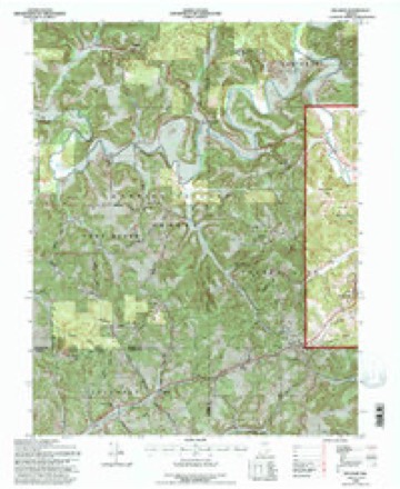
13 topographic sheets cover this place, the earliest surveyed in 1951 and the latest in 1993. It stands in Columbia Township. It lies in ZIP code area 47432. It lies near Happy Hollow. The Survey maps it on the Hillham quadrangle. It stands 554 feet above sea level.
Topographic sheets covering this place
8 surveys from 13 printed sheetsMatched by testing this settlement's coordinate against the published boundary of every sheet in the United States Geological Survey's historical collection. Each opens the scanned sheet at the Survey.
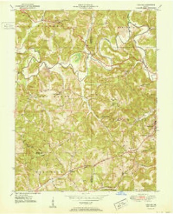
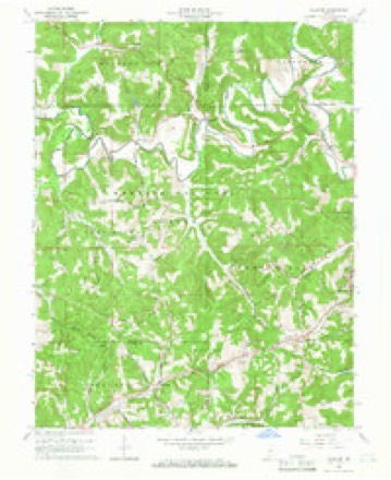
- 1951 USGS Hillham quadrangle1:24000
- 1956 USGS Vincennes quadrangle1:250000, 4 printings
- 1957 USGS Vincennes quadrangle1:250000
- 1958 USGS Vincennes quadrangle1:250000, 2 printings
- 1965 USGS Hillham quadrangle1:24000, 2 printings
- 1986 USGS Bedford quadrangle1:100000
- 1990 USGS Bedford quadrangle1:100000
- 1993 USGS Hillham quadrangle1:24000



In the county-history sources
784 words on this townshipHistory of Dubois County from Its Primitive Days to 1910, published 1910 names this settlement in its chapter on Columbia Township. These are the passages that mention it, exactly as the scans read.
Hillham. On November 18, 1S36, George Wineinger purchased of the United States, one hundred twenty acres, where Hillham now stands. John A. Wineinger began a store there in 1850. A postoffice was established in i860. The town is situated in the northeast corner of Dubois county, being but one-half mile from Martin county, and the same distance from Orange county. Hillham has not been established as a town; no surve}' and plat have been made. It has a church and several stores and mills.
Passage source: History of Dubois County from Its Primitive Days to 1910, published 1910.
The early merchants at Hillham were Solomon Williams, Walker and Walker, Freeman and McCarrell, John Price, and Dr. Wm. A. Line. Among the early physicians were Drs. Line, Walker, Courtney, Blackman, and Newland. A Masonic lodge was organized at Hillham in 1875, by James B. Freeman, Wm. M. Hoggart, John W. Simmons, James R. Wineinger, and W. A. Charnes. It has disbanded. Among the early postmasters of Hillham were S. W. Williams, W. A. Line, J. B. Freeman, J. N. Howe, Jas. Braden, J. S. Blackman, and C. W. Newland.
Passage source: History of Dubois County from Its Primitive Days to 1910, published 1910.
Machine-read from a century-old scan, so expect the errors a machine makes: misspelled names, dropped words, stray characters.
Fires near this place
12 since 2000Regional context, not property-specific evidence. The federal wildfire occurrence database lists 12 fires within 5 miles of Hillham between 2000 and 2019, burning about 37 acres in total. None started naturally. 1 was recorded as arson. Distance is straight-line from the map coordinates, so a fire counted here may appear on a neighbouring settlement's page as well.
| Reported cause | Fires |
|---|---|
| Debris and open burning | 8 |
| Missing data/not specified/undetermined | 2 |
| Arson/incendiarism | 1 |
| Recreation and ceremony | 1 |
The most recent of them, most recent first, with the day each was reported and the service that recorded it.
| Date | Cause | Size | Reported by | Name on the report |
|---|---|---|---|---|
| 28 September 2001 | Arson/incendiarism | 12 acres | Hoosier National Forest | SPURGEON |
| 8 July 2012 | Recreation and ceremony | 1.0 acres | Hoosier National Forest | 56 S CURVE |
| 27 April 2009 | Missing data/not specified/undetermined | 3.0 acres | Hoosier National Forest | CASINO |
| 28 March 2019 | Debris and open burning | under an acre | Hoosier National Forest | GOLF BALL |
| 10 March 2001 | Debris and open burning | 4.0 acres | Hoosier National Forest | COUNTY LINE |
| 29 February 2004 | Debris and open burning | 2.0 acres | Hoosier National Forest | FRENCH LICK |
| 28 February 2004 | Debris and open burning | under an acre | Hoosier National Forest | TWO DOG |
| 6 November 2016 | Debris and open burning | 7.2 acres | Hoosier National Forest | CABIN |
Settlements close enough to share some of these fires:
Storms near this place
4 since 2023Regional context, not property-specific evidence. The National Weather Service names Hillham in 4 storm reports between 2023 and 2025: 2 hail, 1 tornado, 1 thunderstorm wind. No death or injury is recorded in these reports. Each account below is quoted exactly as the forecast office filed it, from the NOAA Storm Events Database, and each date opens the federal record of that event.
| When | Event | Place named | Harm | What the report says |
|---|---|---|---|---|
| December 2025 | Thunderstorm Wind | Hillham | - | A tree fell down on State Road 56 E before a motorist hit it. |
| June 2023 | Hail | Hillham | - | The West Badin Springs Hotel had extensive hail damage which caused the closure of the atrium for several days. Multiple types of roof covering, including clay tiles, shingles, and safety glass panels that were made with a wire mesh inside, were damaged and widespread. Many of the glass panels were original to the hotel that opened in 1902. Multiple holes were observed through the safety glass and vertical glass windows that were on the side of the atrium and in a roof access door. Many of these holes were the size of softballs or larger. Visual dents could also be seen on the parts of the roof covered in shingles. Pieces of shingles were torn, and clay tiles were broken with broken pieces falling on the roof below. The heaviest damage was on parts of the building facing the northwest. |
| June 2023 | Tornado (EF1) | Hillham | - | The tornado started just west of Haw Creek Road in southern Martin County. While in Martin County the tornado traveled around 8 miles to the East-Southeast and produced EF2 damage. Once the tornado crossed into Dubois County, it began to weaken. It snapped and uprooted trees. The tornado lifted just before North 960 East in Dubois County. |
| June 2023 | Hail | Hillham | - | no account filed |
Nearest settlements
The eight closest, with where each one stands in the county. Distances are straight-line, computed from the Geographic Names Information System coordinates.
| Map | Place | Distance | Sheets |
|---|---|---|---|
| Cuzco | 2.9 miles | 13 | |
| Crystal | 3.2 miles | 13 | |
| Thales | 5.2 miles | 12 | |
| Ellsworth | 6.0 miles | 13 | |
| Dubois Crossroads | 6.3 miles | 13 | |
| Dubois | 7.3 miles | 13 | |
| Kellerville | 7.3 miles | 13 | |
| Celestine | 9.8 miles | 13 |
Elsewhere
Matched on this settlement's Geographic Names Information System number rather than its name, so it cannot be a different place of the same name in another state.
| Wikipedia article on Hillham | An encyclopaedic summary. Its text is share-alike, so it is linked here rather than copied. |
| Wikidata item Q5763154 | The structured record the population and elevation above come from. Public domain (CC0). |
Provenance
This settlement is recorded in the Geographic Names Information System as feature 436212. The sheet list is computed by point-in-boundary test against the United States Geological Survey's historical topographic inventory. Both are works of the United States government and carry no copyright under 17 U.S.C. 105.
Wildfire. Short, Karen C. 2022. Spatial wildfire occurrence data for the United States, 1992-2020 [FPA_FOD_20221014]. 6th Edition. Fort Collins, CO: Forest Service Research Data Archive. https://doi.org/10.2737/RDS-2013-0009.6 Collected with United States Government funding and usable without additional permissions or fees.
Storms. NOAA National Centers for Environmental Information, Storm Events Database https://www.ncei.noaa.gov/stormevents/ A work of the United States government, no copyright under 17 U.S.C. 105. Narratives are quoted verbatim from the National Weather Service report and are not edited or summarised.