 Block
Hillsboro, Indiana
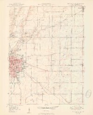
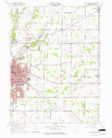
11 topographic sheets cover this place, the earliest surveyed in 1950 and the latest in 1986. It stands in Prairie Township. It lies in ZIP code area 47362. It stands on Slo Run. The Survey maps it on the New Castle East quadrangle. It stands 1,086 feet above sea level.
Topographic sheets covering this place
5 surveys from 11 printed sheetsMatched by testing this settlement's coordinate against the published boundary of every sheet in the United States Geological Survey's historical collection. Each opens the scanned sheet at the Survey.
- 1950 USGS New Castle East quadrangle1:24000, 2 printings
- 1953 USGS Cincinnati quadrangle1:250000, 3 printings
- 1957 USGS Cincinnati quadrangle1:250000
- 1960 USGS New Castle East quadrangle1:24000, 3 printings
- 1986 USGS New Castle quadrangle1:100000, 2 printings



In the county-history sources
18,112 words on this townshipHistory of Henry County, Indiana : Together with Sketches of Its Cities, Villages, and Towns ... Also a Condensed History of Indiana, Embracing Accounts of Pre-historic Races, Aborigines, Winnebago and Black Hawk Wars, and a Brief Review of Its Civil and Political History., published 1884 names this settlement in its chapter on Prairie Township. These are the passages that mention it, exactly as the scans read.
Among the earliest members of Lebanon church were Jesse Mellett and wife, John Miller and wife, Ruth Way man, Mrs. Whittaker, Mrs. A. Yeach, Mr. Jones and wife. The early ministers were Jesse Mellett, Charles Mellett, John Baldridge, T. S. Lyons and Ara Cole.
Passage source: History of Henry County, Indiana : Together with Sketches of Its Cities, Villages, and Towns ... Also a Condensed History of Indiana, Embracing Accounts of Pre-historic Races, Aborigines, Winnebago and Black Hawk Wars, and a Brief Review of Its Civil and Political History., published 1884.
Keeder, and Hugh D., deceased. Mr. Hazelton died Jan. 9, 1880. He was a member of the Hunkard church, as is also his wife. Mrs. Hazelton has two daughters bj her former marriage - Hannah, wife of William H. Garrett, and Phoebe, wife of Nathan Garrett. The farm contains 18 J acres of line land. Mrs. Hazelton is an energetic woman and a good manager, and superintends the business affairs of the farm.
Passage source: History of Henry County, Indiana : Together with Sketches of Its Cities, Villages, and Towns ... Also a Condensed History of Indiana, Embracing Accounts of Pre-historic Races, Aborigines, Winnebago and Black Hawk Wars, and a Brief Review of Its Civil and Political History., published 1884.
Franklin B. Miller is a native of Bedford County, Pa., born Feb. 28, 1852. He learned the miller's trade when eighteen years of age, and in 1874 came to Indiana (Wayne County) ; from there went to Illinois and remained six months; then returned to Wayne County; thence to Delaware County, and in 1877 to Hew Castle, Henry County. He rented the Johnson & Fisher mills four years, and then bought an interest in the Eagle Mills, on Buck Creek, Luray. He is a practical miller, understanding every detail of the business. He does a general custom and exchange business, making a good grade of fiour. Mr. Miller was married in 1876 to Ella Cannaday, daughtgr of George H. '^annaday, of Delaware County, Ind. They have two children - Ora and Jennie. Mr. Miller has been Postmaster of Luray since May 2, 1881.
Passage source: History of Henry County, Indiana : Together with Sketches of Its Cities, Villages, and Towns ... Also a Condensed History of Indiana, Embracing Accounts of Pre-historic Races, Aborigines, Winnebago and Black Hawk Wars, and a Brief Review of Its Civil and Political History., published 1884.
Machine-read from a century-old scan, so expect the errors a machine makes: misspelled names, dropped words, stray characters.
Read the whole chapter on Prairie Township - it names this place 1 more 1 time.
Mines and quarries near this place
1 within 5 milesRegional context, not property-specific evidence. The federal mineral resources record lists 1 working within 5 miles of Hillsboro: 1 past producer. None of them still produces. What was taken out: Sand and Gravel, Construction. Distance is straight-line from the map coordinates, so a quarry counted here may appear on a neighbouring settlement's page as well.
| Where | Site | Commodity | Status | Recorded |
|---|---|---|---|---|
| Mt. Summit Pit | Sand and Gravel, Construction | Past Producer |
Storms near this place
1 since 2008Regional context, not property-specific evidence. The National Weather Service names Hillsboro in 1 storm report in 2008: 1 flash flood. The reports record 1 death. Each account below is quoted exactly as the forecast office filed it, from the NOAA Storm Events Database, and each date opens the federal record of that event.
| When | Event | Place named | Harm | What the report says |
|---|---|---|---|---|
| June 2008 | Flash Flood | Hillsboro | 1 killed, $10,000 | Heavy rains swelled small streams and creeks in Henry County. A woman died attempting to cross a flooded bridge over Slow Run Creek, also known as Colony Creek, on County Road 250 North near Hillsboro Road around 5:30 AM EST. Her vehicle submerged and swept downstream about a mile. |
Nearest settlements
The eight closest, with where each one stands in the county. Distances are straight-line, computed from the Geographic Names Information System coordinates.
| Map | Place | Distance | Sheets |
|---|---|---|---|
| Van Nuys | 1.3 miles | 11 | |
| Messick | 1.6 miles | 11 | |
| Foley | 2.5 miles | 11 | |
| Fayne Siding | 3.1 miles | 11 | |
| Ashland | 3.2 miles | 11 | |
| Belmont | 3.3 miles | 11 | |
| New Castle | 3.4 miles | 11 | |
| Mount Summit | 3.8 miles | 13 |
Elsewhere
Matched on this settlement's Geographic Names Information System number rather than its name, so it cannot be a different place of the same name in another state.
| Wikipedia article on Hillsboro | An encyclopaedic summary. Its text is share-alike, so it is linked here rather than copied. |
| Wikidata item Q14688423 | The structured record the population and elevation above come from. Public domain (CC0). |
Provenance
This settlement is recorded in the Geographic Names Information System as feature 436215. The sheet list is computed by point-in-boundary test against the United States Geological Survey's historical topographic inventory. Both are works of the United States government and carry no copyright under 17 U.S.C. 105.
Mines and quarries. USGS Mineral Resources Data System (MRDS) https://mrdata.usgs.gov/mrds/ A work of the United States government, no copyright under 17 U.S.C. 105.
Storms. NOAA National Centers for Environmental Information, Storm Events Database https://www.ncei.noaa.gov/stormevents/ A work of the United States government, no copyright under 17 U.S.C. 105. Narratives are quoted verbatim from the National Weather Service report and are not edited or summarised.