 Block
Mount Summit, Indiana
13 topographic sheets cover this place, the earliest surveyed in 1953 and the latest in 1986. It stands in Prairie Township. It lies in ZIP code area 47361. It stands on Summit Brook. The Survey maps it on the Sulphur Springs quadrangle. 342 people lived here at the 2020 count. It stands 1,093 feet above sea level.
Population over time
2 figuresMount Summit fell from 352 to 342 between 2010 and 2020. These are the recorded population figures Wikidata holds for this place, reached through the Geographic Names Information System number this page is keyed on rather than by name, so they belong to this place and not to another of the same name. Most are census counts, but not all are: an early figure may be a founding or settlement estimate, and an estimate published within five years of a census is left out. The change column is computed, and is left blank where more than 20 years separate a figure from the one before it, because a gap that long is not a change between two counts.
| Year | People | Change |
|---|---|---|
| 2010 | 352 | |
| 2020 | 342 | -10 (-3%) |
Topographic sheets covering this place
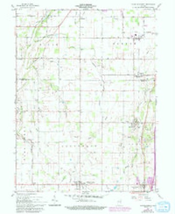
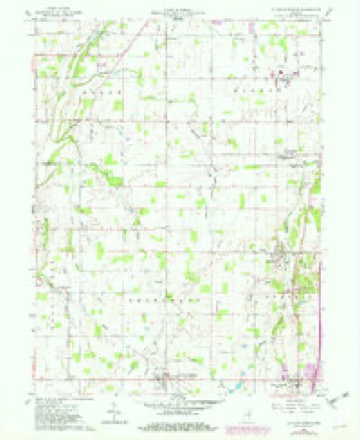
5 surveys from 13 printed sheetsMatched by testing this settlement's coordinate against the published boundary of every sheet in the United States Geological Survey's historical collection. Each opens the scanned sheet at the Survey.
- 1953 USGS Muncie quadrangle1:250000, 5 printings
- 1956 USGS Muncie quadrangle1:250000
- 1960 USGS Sulpher Springs quadrangle1:24000
- 1960 USGS Sulphur Springs quadrangle1:24000, 3 printings
- 1986 USGS Muncie quadrangle1:100000, 3 printings



In the county-history sources
18,112 words on this townshipHistory of Henry County, Indiana : Together with Sketches of Its Cities, Villages, and Towns ... Also a Condensed History of Indiana, Embracing Accounts of Pre-historic Races, Aborigines, Winnebago and Black Hawk Wars, and a Brief Review of Its Civil and Political History., published 1884 names this settlement in its chapter on Prairie Township. These are the passages that mention it, exactly as the scans read.
Luray^ in the northern part of the township, is another village, old but small. It was laid out in 1836 by Lot Hazel ton. It is situated ten miles north of Hew Castle and a mile and a half east ' of the railroad. The building of the railroad took the life out of the place. A postoffice was established here in 1850, George Louthain, Postmaster.
Passage source: History of Henry County, Indiana : Together with Sketches of Its Cities, Villages, and Towns ... Also a Condensed History of Indiana, Embracing Accounts of Pre-historic Races, Aborigines, Winnebago and Black Hawk Wars, and a Brief Review of Its Civil and Political History., published 1884.
George Burton was born Oct. 1, 1825, in Jefferson County, Ind., a son of Henry and Mary Ann (Alcone) Burton, natives of Virginia and Kentucky respectively, the former having come to Indiana in 1813 when thirteen years old, and the latter a few years later. George lived at home till he reached the age of fourteen years when he went to Shelby ville, Ind., to learn the trade of a saddler and harness-maker from Woodville Brown, with whom he remained seven years and three months. In 1846 he enlisted in the Mexican war in Company Eight under the command of Captain Voorhis Conover. He participated in the battle of Buena Vista and other minor engagements, and was discharged in the fall of 1817. He then returned to Shelbyville, and from there went to Bush ville, where he worked at his trade two years and after following his trade one year in Vienna, Bush Co., Ind., he returned to Kushville and went from there to Dublin, Wayne County, and from there to New Castle, where he opened a saddler and harness-maker's shop and carried on extensive business for twenty-three years. June 20, 1863, he was appointed Captain of the New Castle Guards for four years by Governor Morton. He enlisted in Company A, Thirtieth Indiana Volunteers, and was discharged at Nashville, Tenn., in 1865. He was married in 1818, to Corella, daughter of Henry and Matilda (Bell) Fitch, by whom he had six children - Hickison, Mary, Ellen, Julia, George and Matilda Frances, all deceased. His wife died in 1860 and he was again married July 3, 1862, to Hannah A., daughter of James and Kosana (Fitzgerald) Fitch, natives of Kentucky. To this union were born seven children - James L., born Oct. 8, 1863; Clara B., Aug. 29, 1866; Anna L., Feb. 21, 1868; Blanche L., April 20, 1870; Jessie A., July 30, 1872; Sally J. L., March 9, 1875; William Heniy, July 9, 1877. Mr. Burton is at present residing on a farm of 165 acres of highly cultivated land on sections 23 and 24. He is a member of New Castle Lodge, No. 91, A. F. & A. M. In politics he is a Republican.
Passage source: History of Henry County, Indiana : Together with Sketches of Its Cities, Villages, and Towns ... Also a Condensed History of Indiana, Embracing Accounts of Pre-historic Races, Aborigines, Winnebago and Black Hawk Wars, and a Brief Review of Its Civil and Political History., published 1884.
John Hedrick^ a prominent farmer of Prairie Township, was born in Eastern Virginia, Aug. 30, 1818. His father, George Hedrick, was a native of Pennsylvania, born in 1786, but when about eight years of age moved with his father, Philip Hedrick, to Virginia, and there grew to manhood, and married Drusiila Ball, a native of Virginia. After his marriage he moved to Tennessee, where he lived three years, and in 1820 moved to Wayne County, Ind., and settled on Green's Fork, near Washington. In 1824 he moved to Henry County, and settled in the woods on land now owned by our subject. He entered eighty acres from the Government which he improved and lived on till his death in 1863. His wife died in 1838. They had a family of eleven children, six of whom are living, all residents of Henry County. John Hedrick was reared on his father's farm, receiving only a limited education. He was married in 1845 to Sarah Bales, daughter of Parnel'^ Bales. After his marriage he rented a farm for several years, and then bought one in Blue Biver Township, which he afterward exchanged for the old homestead. His farm contains 105 acres of choice land, and he has a neat and substantial frame dwelling, with good farm buildings. Mr. and Mrs. Hedrick have had four children - Philip, died in 1877; Mary E., wife of Abram Daniel; Olive, wife of Joel Frazier; and El n ora E., wife of George W. Miller. They are*lnembers of the Christian church at Hillsboro.
Passage source: History of Henry County, Indiana : Together with Sketches of Its Cities, Villages, and Towns ... Also a Condensed History of Indiana, Embracing Accounts of Pre-historic Races, Aborigines, Winnebago and Black Hawk Wars, and a Brief Review of Its Civil and Political History., published 1884.
Machine-read from a century-old scan, so expect the errors a machine makes: misspelled names, dropped words, stray characters.
Read the whole chapter on Prairie Township - it names this place 14 more 14 times.
Mines and quarries near this place
4 within 5 milesRegional context, not property-specific evidence. The federal mineral resources record lists 4 workings within 5 miles of Mount Summit: 2 past producers, 1 unknown, 1 producer. 1 still produces. What was taken out: Sand and Gravel, Construction. Distance is straight-line from the map coordinates, so a quarry counted here may appear on a neighbouring settlement's page as well.
| Where | Site | Commodity | Status | Recorded |
|---|---|---|---|---|
| Luray Pit | Sand and Gravel, Construction | Producer | ||
| Mt. Summit Pit | Sand and Gravel, Construction | Past Producer | ||
| Oakville Pit | Sand and Gravel, Construction | Unknown | ||
| Springport Plant | Sand and Gravel, Construction | Past Producer |
Nearest settlements
The eight closest, with where each one stands in the county. Distances are straight-line, computed from the Geographic Names Information System coordinates.
| Map | Place | Distance | Sheets |
|---|---|---|---|
| Fayne Siding | 2.0 miles | 11 | |
| Foley | 2.7 miles | 11 | |
| Springport | 3.0 miles | 13 | |
| Sulphur Springs | 3.1 miles | 13 | |
| Van Nuys | 3.5 miles | 11 | |
| Rogersville | 3.6 miles | 13 | |
| Hillsboro | 3.8 miles | 11 | |
| Luray | 4.7 miles | 13 |
Elsewhere
Matched on this settlement's Geographic Names Information System number rather than its name, so it cannot be a different place of the same name in another state.
| Wikipedia article on Mount Summit | An encyclopaedic summary. Its text is share-alike, so it is linked here rather than copied. |
| Wikidata item Q1940870 | The structured record the population and elevation above come from. Public domain (CC0). |
Provenance
This settlement is recorded in the Geographic Names Information System as feature 439701. The sheet list is computed by point-in-boundary test against the United States Geological Survey's historical topographic inventory. Both are works of the United States government and carry no copyright under 17 U.S.C. 105.
Mines and quarries. USGS Mineral Resources Data System (MRDS) https://mrdata.usgs.gov/mrds/ A work of the United States government, no copyright under 17 U.S.C. 105.