 Block
Huntertown, Indiana
12 topographic sheets cover this place, the earliest surveyed in 1953 and the latest in 1994. It stands in Perry Township. It lies in ZIP code area 46748. It stands on Willow Creek Branch. The Survey maps it on the Huntertown quadrangle. 9,141 people lived here at the 2020 count. It stands 837 feet above sea level.
Research this city
On record in Huntertown
Buildings and businesses the archive holds for this place. Each opens its own page, with the source record it came from.
On the National Register 2 records
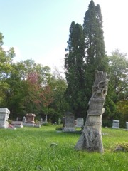 Dutch Ridge Historic Districtlisted 1995
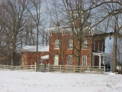 Fisher West Farmlisted 1985
Population over time
2 figuresHuntertown grew from 4,810 to 9,141 between 2010 and 2020. These are the recorded population figures Wikidata holds for this place, reached through the Geographic Names Information System number this page is keyed on rather than by name, so they belong to this place and not to another of the same name. Most are census counts, but not all are: an early figure may be a founding or settlement estimate, and an estimate published within five years of a census is left out. The change column is computed, and is left blank where more than 20 years separate a figure from the one before it, because a gap that long is not a change between two counts.
| Year | People | Change |
|---|---|---|
| 2010 | 4,810 | |
| 2020 | 9,141 | +4,331 (+90%) |
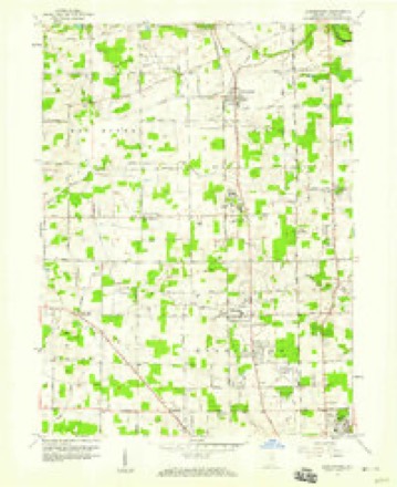
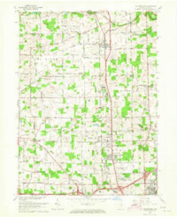
Topographic sheets covering this place
6 surveys from 12 printed sheetsMatched by testing this settlement's coordinate against the published boundary of every sheet in the United States Geological Survey's historical collection. Each opens the scanned sheet at the Survey.
- 1953 USGS Fort Wayne quadrangle1:250000, 4 printings
- 1956 USGS Fort Wayne quadrangle1:250000, 2 printings
- 1957 USGS Huntertown quadrangle1:24000
- 1963 USGS Huntertown quadrangle1:24000, 3 printings
- 1984 USGS Fort Wayne quadrangle1:100000
- 1994 USGS Fort Wayne quadrangle1:100000




In the county-history sources
6,446 words on this townshipHistory of Allen County, Indiana., published 1880 names this settlement in its chapter on Perry Township. These are the passages that mention it, exactly as the scans read.
Alvin Hall was born in New London. Conn., May 11, 1810. His parents gave him all the opportunities for an education that were afforded by the common schools, and they were well improved up to the time he was sixteen years of age, when he became possessed of the passion that appears to be implanted in every American's bosom - to "go West;" and he went as far as Ontario County in Western New York, where he remained about one year and a half, when he again moved on further West, this time to Huron County, Ohio. Here he settled down and learned the trade of a carpenter and joiner. On the 27th of November, 1832, he was united in marriage to Miss Betsey Miller, of Huron County.
Passage source: History of Allen County, Indiana., published 1880.
In that year, Thomas Dunten and his nephew, Horace F. Dunten, started from Jefferson County, N. Y., to find a Western home. There was little in this locality to prepossess them in its favor. They were confronted by dense forests, and severe labor and trials stared them in the face ; but, beyond this, their acute foresight discerned a rich reward for such labor, and their decision was made. They purchased land, and began at once the erection of a cabin for shelter. Soon they began the work of clearing the land, and, in due time, were enabled to raise sufficient for the satisfaction of their immediate necessities. Thomas Dunten remained in the township until his decease, and, during that time, was largely interested in its growth and development. Horace F. Dunten was, at the time of his arrival, a young man of twenty years, and gave to his work the zest and enthusiasm of early manhood. His subsequent life has been passed in the town¬ ship, and now, at a ripe old age, he enjoys the fruits of his labors and a compe¬ tence well earned. He still resides on Section 17, on the farm cleared by his own hand. Late in the fall of 1833, Ephraim H. Dunten, Sr., joined his son, Horace F., and settled on the same section. He also cleared a farm, and remained in the township until death ended his labors. He was accompanied by his son George, who assisted him to " make" his farm, and is now a prosperous farmer himself. Albert Wood came with Mr. Dunten, in the fall of 1833, and continued to reside upon his farm until his decease, in 1878. Nathaniel Fitch, an unmarried man. came from Pennsylvania in the same year, and, after clearing a farm, married Miss Sarah De Long and reared a large family, several of whom are now living in the township. He was a man of great natural ability, and was highly esteemed by his neighbors. He was a blacksmith, and conducted that trade in connection with farming. A long life of labor and industry brought him a rich return, and made him the possessor of a fine fortune. He remained in the township until his death, which occurred in January, 1878.
Passage source: History of Allen County, Indiana., published 1880.
Benjamin and Amasiah Parker came from Jefferson County, N. \ ., in the spring of 1834, and were prominent movers in many of the public improvements subsequently inaugurated in the township. In the same season, Ephraim H. Dunten, Jr., located near the present site of Huntertown, where he erected a building in which he kept the first tavern in the township. Subsequently, he removed to Fort Wayne, where he was engaged in business for a short time. Returning to Perry Township, he made it his home until 1854. when he fell a victim to cholera, and died.
Passage source: History of Allen County, Indiana., published 1880.
Machine-read from a century-old scan, so expect the errors a machine makes: misspelled names, dropped words, stray characters.
Read the whole chapter on Perry Township - it names this place 21 more 21 times.
Mines and quarries near this place
6 within 5 milesRegional context, not property-specific evidence. The federal mineral resources record lists 6 workings within 5 miles of Huntertown: 4 producers, 1 past producer, 1 plant. 5 still produce. What was taken out: Sand and Gravel, Construction. Distance is straight-line from the map coordinates, so a quarry counted here may appear on a neighbouring settlement's page as well.
| Where | Site | Commodity | Status | Recorded |
|---|---|---|---|---|
| Brudi Pit 4 | Sand and Gravel, Construction | Producer | ||
| Canyon Sand & Gravel Pit | Sand and Gravel, Construction | Producer | ||
| Indian Springs Pit | Sand and Gravel, Construction | Producer | ||
| Lampe Sand Pit | Sand and Gravel, Construction | Past Producer | ||
| Midwest Plant No. 2 | Sand and Gravel, Construction | Plant | ||
| Plant Number 7 N | Sand and Gravel, Construction | Producer |
Storms near this place
26 since 1999Regional context, not property-specific evidence. The National Weather Service names Huntertown in 26 storm reports between 1999 and 2023: 14 thunderstorm wind, 10 hail, 1 flood, 1 lightning. The reports record 2 injuries. Each account below is quoted exactly as the forecast office filed it, from the NOAA Storm Events Database, and each date opens the federal record of that event.
| When | Event | Place named | Harm | What the report says |
|---|---|---|---|---|
| May 2000 | Thunderstorm Wind | Huntertown | 2 hurt, $3,000,000 | Numerous trees and power lines down within a 5 by 6 block area on the western side of Huntertown. Several buildings damaged...including two businesses and one home which were destroyed. An additional 21 homes sustained minor to moderate damage. State of emergency declared. |
| June 2022 | Lightning | Huntertown | $40,000 | Local fire officials reported lightning struck a house on the 1200 block of Harvest Bay Drive. Damage was caused to the attic of the house as well as the loss of the garage. No injuries were reported. Damage is estimated at $40,000. |
| July 2023 | Thunderstorm Wind | Huntertown | $5,000 | Tree down on Coldwater road. Additional trees down in this area. |
| July 2006 | Thunderstorm Wind | Huntertown | $5,000 | A tree fell onto a garage with the spotter estimating 60 mph winds. Damage is estimated at $5,000. |
| August 2023 | Thunderstorm Wind | Huntertown | $2,000 | ABC21 reported that a large tree limb was down on power lines. About 800 customers were without power. |
| August 2021 | Thunderstorm Wind | Huntertown | $1,000 | A fire department reported a large tree down blocking the road. |
| July 2022 | Thunderstorm Wind | Huntertown | - | Tree damage was reported via mPING. |
| July 2022 | Thunderstorm Wind | Huntertown | - | Damage to trees was reported via mPING. |
| August 2019 | Thunderstorm Wind | Huntertown | - | Emergency management officials reported a five foot diameter tree was blown down. |
| March 2017 | Thunderstorm Wind | Huntertown | - | The public reported a large tree down onto a local roadway. |
| July 2015 | Flood | Huntertown | - | Flooding of creeks reported in Huntertown. |
| June 2008 | Thunderstorm Wind | Huntertown | - | Law enforcement officials reported several trees, tree limbs and power lines down in the northern part of the county, especially the Huntertown area. |
| June 2008 | Thunderstorm Wind | Huntertown | - | Law enforcement officials reported several trees, tree limbs and power lines down in the northern part of the county, especially the Huntertown area. |
| June 2002 | Hail | Huntertown | - | A trained spotter reported nickel size hail in Huntertown. |
| June 2000 | Thunderstorm Wind | Huntertown | - | Trees down. |
| September 1999 | Thunderstorm Wind | Huntertown | - | A few trees were reported blown down. |
| June 2022 | Hail | Huntertown | - | no account filed |
| June 2013 | Hail | Huntertown | - | no account filed |
| May 2007 | Hail | Huntertown | - | no account filed |
| May 2007 | Hail | Huntertown | - | no account filed |
| May 2007 | Hail | Huntertown | - | no account filed |
| May 2007 | Hail | Huntertown | - | no account filed |
| March 2003 | Hail | Huntertown | - | no account filed |
| June 2001 | Hail | Huntertown | - | no account filed |
| August 2001 | Hail | Huntertown | - | no account filed |
| May 2000 | Thunderstorm Wind | Huntertown | - | no account filed |
Nearest settlements
The eight closest, with where each one stands in the county. Distances are straight-line, computed from the Geographic Names Information System coordinates.
| Map | Place | Distance | Sheets |
|---|---|---|---|
| Allen | 2.3 miles | 12 | |
| Royville | 2.9 miles | 12 | |
| Academie | 4.2 miles | 12 | |
| Cedar Canyons | 4.4 miles | 12 | |
| Wallen | 4.7 miles | 12 | |
| Cedar Shores | 5.3 miles | 12 | |
| Dunn Mill | 5.7 miles | 12 | |
| Ludwig Park | 6.4 miles | 12 |
Elsewhere
Matched on this settlement's Geographic Names Information System number rather than its name, so it cannot be a different place of the same name in another state.
| Wikipedia article on Huntertown | An encyclopaedic summary. Its text is share-alike, so it is linked here rather than copied. |
| Wikidata item Q2166527 | The structured record the population and elevation above come from. Public domain (CC0). |
Provenance
This settlement is recorded in the Geographic Names Information System as feature 436630. The sheet list is computed by point-in-boundary test against the United States Geological Survey's historical topographic inventory. Both are works of the United States government and carry no copyright under 17 U.S.C. 105.
Mines and quarries. USGS Mineral Resources Data System (MRDS) https://mrdata.usgs.gov/mrds/ A work of the United States government, no copyright under 17 U.S.C. 105.
Storms. NOAA National Centers for Environmental Information, Storm Events Database https://www.ncei.noaa.gov/stormevents/ A work of the United States government, no copyright under 17 U.S.C. 105. Narratives are quoted verbatim from the National Weather Service report and are not edited or summarised.