 Block
Huntsville, Indiana
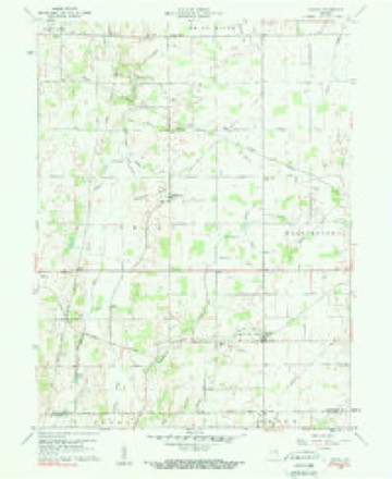
12 topographic sheets cover this place, the earliest surveyed in 1953 and the latest in 1986. It stands in Union Township. It lies in ZIP code area 47358. It stands on Huntsville Drain. The Survey maps it on the Carlos quadrangle. It stands 1,161 feet above sea level.
Topographic sheets covering this place
4 surveys from 12 printed sheetsMatched by testing this settlement's coordinate against the published boundary of every sheet in the United States Geological Survey's historical collection. Each opens the scanned sheet at the Survey.
- 1953 USGS Muncie quadrangle1:250000, 5 printings
- 1956 USGS Muncie quadrangle1:250000
- 1960 USGS Carlos quadrangle1:24000, 3 printings
- 1986 USGS Muncie quadrangle1:100000, 3 printings



In the county-history sources
60,303 words on this townshipPast and Present of Randolph County, Indiana : with Biographical Sketches of Representative Citizens and Genealogical Records of Many of the Old Families, published 1914 names this settlement in its chapter on Union Township. These are the passages that mention it, exactly as the scans read.
Elder Isaiah P. Watts has been an elder ever since the organization and a trustee ever since 1874. December 28, 1874, Jerre Smith died. In 1870, William D. Frazee had moved to Indianapolis, Indiana, and I. P. Watts was the only teaching elder left.
Passage source: Past and Present of Randolph County, Indiana : with Biographical Sketches of Representative Citizens and Genealogical Records of Many of the Old Families, published 1914.
It was a number of years after the new church was dedicated before the church was able to employ a minister full time. We had half time preaching by hired ministers all the time and Brother Watts the other half. Among these I recall Elder A. H. Moore, Elder Garey, Elder Vinson, Elder John Ellis. During the time Ellis was here he and Brother Watts held a meeting for four weeks, preaching turn about each night. The result was forty-five additions, thirty out of the Sunday school. After that the church had Brother Wise, of Indianapolis, for all time, Brother Chatley was first I believe. Brother Arch Hall, of Butler, Brother Dailey, Brother A. W. Hall, Brother C. E. Wells, Brother Hough, Brother Hammond, Brother James Floyd, Brother H. C. Patterson, Brother Vernon and Brother Persinger. During its existence the church has had over a thousand members and today is one of the great moral and spiritual forces in Winchester and has commenced the building of a great new church.
Passage source: Past and Present of Randolph County, Indiana : with Biographical Sketches of Representative Citizens and Genealogical Records of Many of the Old Families, published 1914.
Union City. - Was first organized in the house of Martin Cox, Washington township, Darke county, Ohio, by Rev. Isaac Ogden, presiding missionary, November 8, 1835, with six members. The ministers have been Revs. Gulick, Ogden, Meeks, Campbell, Drake, Lower, Eastman, Coulter, Ziegler. Mr. Drake was pastor seven years, and received into the church 167 persons. The greatest number of addition in any one year (1851) was thirty-eight. The church was changed to Union City in 1862. The first meeting-house was a log building near Martin Cox's, now used as a woodhouse at Cox's school house. The next house was what is now the German
Passage source: Past and Present of Randolph County, Indiana : with Biographical Sketches of Representative Citizens and Genealogical Records of Many of the Old Families, published 1914.
Machine-read from a century-old scan, so expect the errors a machine makes: misspelled names, dropped words, stray characters.
Read the whole chapter on Union Township - it names this place 8 more 8 times.
Nearest settlements
The eight closest, with where each one stands in the county. Distances are straight-line, computed from the Geographic Names Information System coordinates.
| Map | Place | Distance | Sheets |
|---|---|---|---|
| Scott Corner | 3.2 miles | 11 | |
| Modoc | 3.4 miles | 11 | |
| Buena Vista | 3.4 miles | 12 | |
| Unionport | 3.7 miles | 12 | |
| Carlos | 3.7 miles | 12 | |
| Pinch | 4.6 miles | 11 | |
| Bloomingport | 5.1 miles | 19 | |
| Snow Hill | 6.0 miles | 19 |
Elsewhere
Matched on this settlement's Geographic Names Information System number rather than its name, so it cannot be a different place of the same name in another state.
| Wikipedia article on Huntsville | An encyclopaedic summary. Its text is share-alike, so it is linked here rather than copied. |
| Wikidata item Q17386754 | The structured record the population and elevation above come from. Public domain (CC0). |
Provenance
This settlement is recorded in the Geographic Names Information System as feature 436639. The sheet list is computed by point-in-boundary test against the United States Geological Survey's historical topographic inventory. Both are works of the United States government and carry no copyright under 17 U.S.C. 105.