 Block
Jefferson, Indiana
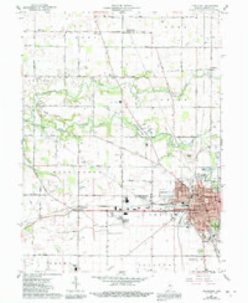
10 topographic sheets cover this place, the earliest surveyed in 1953 and the latest in 1984. It stands in Washington Township. It lies in ZIP code area 46041. The Survey maps it on the Frankfort quadrangle. It stands 860 feet above sea level.
Topographic sheets covering this place
5 surveys from 10 printed sheetsMatched by testing this settlement's coordinate against the published boundary of every sheet in the United States Geological Survey's historical collection. Each opens the scanned sheet at the Survey.
- 1953 USGS Danville quadrangle1:250000, 3 printings
- 1955 USGS Danville quadrangle1:250000
- 1956 USGS Danville quadrangle1:250000
- 1961 USGS Frankfort quadrangle1:24000, 3 printings
- 1984 USGS Lafayette quadrangle1:100000, 2 printings




In the county-history sources
1,341 words on this townshipCombination Atlas Map of Clinton County, Indiana, published 1878 names this settlement in its chapter on Washington Township. These are the passages that mention it, exactly as the scans read.
For several months Clark was the only white man in the present limits of Washington Township. However, early in the year 1827, David Kilgore, with his family, settled on the farm belonging to Moses Harshman. Mrs. Kilgore is still living. As Mr. Clark was unmarried at the time of his settlement, to Mrs. K. is due the honor of heing the first white woman in Clinton County.
Passage source: Combination Atlas Map of Clinton County, Indiana, published 1878.
PAbout 1832, John P. Cruthers came from Oxford and located j Jefferson, with the design of establishing a college. Mr. Cruthe being an energetie man, and being assisted by the citizens, who we highly pleased with the prospeet of an educational institution in thei midst, a two-story frame building was soon erected, and the advantages of a first-class education offered to the 'Sons and daughters 3 Clinton and adjoining counties. The leaders in the enterprise failed to remember that the assistance of each member of the fami) those early times was required to obtain a living. The time money necessary for a collegiate course could not be spared. H the school run but a short time, when, for want of proper suppo it was abandoned. = x The township was organized Saturday, May 15, 1830. The missioners, at the same time, authorized an election to be held at the | house of John Ross, in Jefferson. John Benson was appointed A spector for that year. Before the organization of the townshi while the county was yet a territory, Zabiua Babcock s Justice of the Peace. After the organization, Abner Ba chosen to fill this office. The business of Justice in those e: was very extensive. Mr. Baker informs us that in one day on docket thirty-two cases. : d
Passage source: Combination Atlas Map of Clinton County, Indiana, published 1878.
Machine-read from a century-old scan, so expect the errors a machine makes: misspelled names, dropped words, stray characters.
Read the whole chapter on Washington Township - it names this place 3 more 3 times.
Mines and quarries near this place
2 within 5 milesRegional context, not property-specific evidence. The federal mineral resources record lists 2 workings within 5 miles of Jefferson: 2 producers. All of them still produce. What was taken out: Stone, Sand and Gravel, Construction. Distance is straight-line from the map coordinates, so a quarry counted here may appear on a neighbouring settlement's page as well.
| Where | Site | Commodity | Status | Recorded |
|---|---|---|---|---|
| Clinton County Highway Department | Stone | Producer | ||
| Frankfort Sand and Gravel Pit | Sand and Gravel, Construction | Producer |
Storms near this place
4 since 2000Regional context, not property-specific evidence. The National Weather Service names Jefferson in 4 storm reports between 2000 and 2012: 3 hail, 1 thunderstorm wind. No death or injury is recorded in these reports. Each account below is quoted exactly as the forecast office filed it, from the NOAA Storm Events Database, and each date opens the federal record of that event.
| When | Event | Place named | Harm | What the report says |
|---|---|---|---|---|
| May 2000 | Hail | Jefferson | $15,000,000 | no account filed |
| March 2012 | Hail | Jefferson | - | no account filed |
| June 2008 | Hail | Jefferson | - | no account filed |
| April 2001 | Thunderstorm Wind | Jefferson | - | no account filed |
Nearest settlements
The eight closest, with where each one stands in the county. Distances are straight-line, computed from the Geographic Names Information System coordinates.
| Map | Place | Distance | Sheets |
|---|---|---|---|
| Manson | 2.7 miles | 10 | |
| Woodside Park | 3.4 miles | 10 | |
| Frankfort | 4.2 miles | 10 | |
| Wesley Manor | 4.3 miles | 10 | |
| Mattix Corner | 4.6 miles | 10 | |
| Fickle | 4.7 miles | 10 | |
| Hamilton | 4.7 miles | 10 | |
| East Park | 5.2 miles | 9 |
Elsewhere
Matched on this settlement's Geographic Names Information System number rather than its name, so it cannot be a different place of the same name in another state.
| Wikipedia article on Jefferson | An encyclopaedic summary. Its text is share-alike, so it is linked here rather than copied. |
| Wikidata item Q6175338 | The structured record the population and elevation above come from. Public domain (CC0). |
Provenance
This settlement is recorded in the Geographic Names Information System as feature 436957. The sheet list is computed by point-in-boundary test against the United States Geological Survey's historical topographic inventory. Both are works of the United States government and carry no copyright under 17 U.S.C. 105.
Mines and quarries. USGS Mineral Resources Data System (MRDS) https://mrdata.usgs.gov/mrds/ A work of the United States government, no copyright under 17 U.S.C. 105.
Storms. NOAA National Centers for Environmental Information, Storm Events Database https://www.ncei.noaa.gov/stormevents/ A work of the United States government, no copyright under 17 U.S.C. 105. Narratives are quoted verbatim from the National Weather Service report and are not edited or summarised.