| June 1990 | Thunderstorm Wind | not stated | 2 killed, 2 hurt | no account filed |
| April 1953 | Tornado (F3) | not stated | 1 killed, 6 hurt, $2,500,000 | no account filed |
| April 1965 | Tornado (F4) | not stated | 34 hurt | no account filed |
| July 1996 | Thunderstorm Wind | Frankfort | 6 hurt, $2,000,000 | no account filed |
| June 1968 | Tornado (F2) | not stated | 5 hurt, $250,000 | no account filed |
| November 2017 | Thunderstorm Wind | Frankfort | 1 hurt, $205,000 | Part of the Walmart's roof collapsed and the front of the store was damaged due to damaging straight-line thunderstorm winds. Two semi truck was knocked over as well. One man inside an overturned truck was taken to the hospital for non-life threatening injuries. A church's steeple was bent by the severe wind. Multiple trees and large branches were snapped and the roof of Frankfort High School sustained some minor damage. Many other homes and structures sustained damage as well. |
| May 2000 | Hail | Jefferson | $15,000,000 | no account filed |
| July 2003 | Flash Flood | Frankfort | $1,000,000 | no account filed |
| March 2023 | Tornado (EF2) | Colfax | $700,000 | Continuation of the tornado that first impacted Montgomery and Boone Counties (as an EF1 and EF0, respectively). The tornado continued to track to the northeast, parallel to and roughly 0.8 miles southeast of West Manson Colfax Road, while intensifying. Near the intersection of County Roads 700 South and 750 West a homestead ascertained EF1-intensity damage, with 2 outbuildings on cinder blocks completely destroyed, the collapse of chimney and significant roof damage.||The tornado then reached peak intensity as an EF2 with peak winds of 120 mph, for about 0.5 miles prior to crossing US Highway 52 at the intersection with County Road 650 South. Through this most-intense segment, a large homestead lost large sections of roof structure, with a garage's brick walls blown out, while a large and poorly-anchored barn was destroyed; with a collapse of a nearby communications tower. EF1-intensity damage continued for another 1.6 miles towards Interstate Route 65, as a few barns were completely destroyed across this rural portion of southwestern Clinton County.||The tornado caused minimal EF0-intensity damage for the following 2 miles, including where it crossed Interstate Route 65, while occasionally dropping debris the vortex had picked up earlier in its path. The circulation restrengthened to EF1 intensity for its final 1.7 miles, causing significant damage just before ending about 3 miles southwest of Frankfort: hardwood trees were downed at County Road 400 South; before extensive damage near County Road 300 South which included the destruction of several barns/farm outbuildings among corresponding tree damage, including a concrete tower and a silo (at separate buildings) both leaning southwest, while another farm outbuilding's roof panels were wrapped around trees. |
| March 2026 | Thunderstorm Wind | Boyleston | $250,000 | Numerous trees, limbs, and utility poles were blown down by thunderstorm winds across the county. |
| July 2005 | Tornado (F1) | Frankfort | $250,000 | An F1 tornado touched down briefly on the northeast side of Frankfort, destroying a garage and causing damage to other structures. |
| April 2004 | Tornado (F1) | Frankfort | $250,000 | A low-topped supercell produced an F1 tornado near Frankfort. The tornado destroyed 2 garages and a high school scoreboard and also damaged a barn. |
| April 1975 | Tornado (F2) | not stated | $250,000 | no account filed |
| March 1961 | Tornado (F2) | not stated | $250,000 | no account filed |
| July 2005 | Tornado (F0) | Michigantown | $175,000 | An F0 tornado touched down briefly in Michigantown. One mobile home was destroyed and four others were moved. |
| November 2013 | Tornado (EF2) | Michigantown | $60,000 | At 1513EST, the EF-2 tornado touched down in Michigantown. This EF-2 tornado caused damage to a hog farm and several properties northeast of Michigantown, with additional damage found to the east of Rossville. At 1519EST, the tornado crossed into southwest Howard County. The tornado was at its strongest as it crossed through the southeast side of Kokomo, causing extensive property damage. A BMO Bank was destroyed with significant damage to several fast food restaurants along South Washington Street. The tornado lifted 2 miles north of Greentown at 1536EST. |
| June 2023 | Thunderstorm Wind | Frankfort | $50,000 | Large tree downed on an unoccupied car by thunderstorm wind gusts. Numerous powerlines also downed. |
| June 2016 | Thunderstorm Wind | Forest | $50,000 | Two hog barns collapsed and a house was damaged near this location due to damaging thunderstorm wind gusts. |
| May 2011 | Thunderstorm Wind | Frankfort | $50,000 | Twenty high voltage towers in a row were twisted or knocked to the ground near 1900 West Barner Street due to damaging thunderstorm wind gusts. This location is just north of State Route 28 and just outside the business park. |
| July 1994 | Thunderstorm Wind | Kilmore | $50,000 | In Kilmore several houses sustained roof damage, and a metal shed outside of Kilmore was destroyed. |
| May 2002 | Flash Flood | Countywide | $50,000 | no account filed |
| March 2023 | Thunderstorm Wind | Forest | $40,000 | Thunderstorm winds collapsed barn doors on County Road 700 North at 1050 East, and also lifted a barn roof which collapsed beams on County Road 700 North at 1070 East. |
| March 2022 | Thunderstorm Wind | Frankfort | $40,000 | Thunderstorm winds blew down a tree that that fell on and damaged two cars. |
| May 2017 | Tornado (EF1) | Forest | $40,000 | An EF-1 tornado briefly touched down in Forest, Indiana. The approximate 95 mph tornado winds caused significant damage to a fire station and a nearby pole barn. Some roof damage also occurred to a home. |
| June 2004 | Flash Flood | Countywide | $38,000 | no account filed |
| April 2011 | Thunderstorm Wind | Mulberry | $35,000 | A grain elevator was destroyed and part of a building was blown in due to damaging thunderstorm wind gusts in Mulberry. A home was reported to have sustained damage as well. |
| May 2022 | Thunderstorm Wind | Michigantown | $30,000 | Thunderstorm winds downed trees and power lines across multiple areas between Frankfort and Michigantown. |
| August 2014 | Thunderstorm Wind | Colfax | $30,000 | WLFI reported numerous trees and power lines down in Colfax due to damaging thunderstorm wind gusts. Some of the trees were large white oaks. Many large sugar maple limbs were down too. Hail accompanied the wind resulting in some siding and roofing damage. No information on the size of the hail. |
| June 2009 | Thunderstorm Wind | Boyleston | $25,000 | A three car garage, made of metal sheeting, was damaged due to severe thunderstorm winds. Three utility poles were also downed near this residence. This information was obtained from The Times - Frankfort. The time and location are estimated. |
| June 1990 | Tornado (F1) | not stated | $25,000 | no account filed |
| May 1968 | Tornado (F2) | not stated | $25,000 | no account filed |
| April 1965 | Tornado (F4) | not stated | $25,000 | no account filed |
| August 1961 | Tornado (F2) | not stated | $25,000 | no account filed |
| March 2025 | Thunderstorm Wind | Fickle | $20,000 | A 65 mph thunderstorm wind gust was estimated at this location with a semi truck blown over on Interstate 65 between mile markers 156 and 157. |
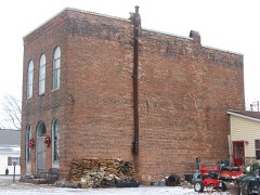
| March 2025 | Thunderstorm Wind | Colfax | $20,000 | Top edge of brick facade on the front of a building extending above the roof line was damaged by thunderstorm wind gusts. |
| July 2023 | Thunderstorm Wind | Colfax | $20,000 | Thunderstorm winds downed power lines at County Roads 700 West and 380 South. |
| June 2015 | Thunderstorm Wind | Greetingsville | $20,000 | Many trees were reported to be snapped in half and large trees uprooted due to damaging thunderstorm wind gusts. Many tree limbs, both large and small, were downed as well as an outhouse being blown off its' base. The yard was completely covered in leaves, shingles, and limbs. |
| September 2005 | Thunderstorm Wind | Frankfort | $20,000 | A grain silo was blown over. |
| June 2016 | Thunderstorm Wind | Rossville | $15,000 | An estimated 80 mph thunderstorm wind gust was observed in this location. Trees and power lines were downed, along with dime sized hail. |
| February 2014 | Thunderstorm Wind | Fickle | $15,000 | A semi-truck was overturned on Interstate 65 near Frankfort. The truck was leaking propane and the Interstate had to be shut down. |
| January 2008 | Thunderstorm Wind | Frankfort | $15,000 | A garage was blown into a porch due to damaging thunderstorm winds. Broken power poles were also found in Frankfort. |
| April 2006 | Hail | Geetingsville | $15,000 | A sheriff deputy's car was damaged. |
| July 1997 | Thunderstorm Wind | Frankfort | $15,000 | Thunderstorm winds damaged a barn roof northwest of Frankfort. |
| August 2014 | Thunderstorm Wind | Frankfort | $12,000 | Trees were downed from Delphi to Frankfort due to damaging thunderstorm wind gusts. Duke Energy reported numerous service calls because of this. |
| June 2010 | Thunderstorm Wind | Frankfort | $12,000 | A semi-truck was blown over on State Route 28 due to thunderstorm wind gusts. The time this event occurred is estimated. |
| June 2009 | Thunderstorm Wind | Fickle | $12,000 | A semi-truck was overturned on Interstate 65 near the Indiana 28 exit, due to severe thunderstorm winds. This information was obtained from the Lafayette Journal and Courier. The time and location are estimated. |
| June 2009 | Thunderstorm Wind | Antioch | $12,000 | An estimated wind gust of 60 mph was observed near Antioch. Also, an 16 to 18 inch diameter tree was downed near the intersection of Highway 38 and 39. Utility poles were also knocked down along Highway 38, south of Frankfort. |
| August 2009 | Thunderstorm Wind | Fickle | $12,000 | A semi-truck was blown over at Interstate 65 and State Route 28 due to thunderstorm wind gusts. The time this even occurred is estimated. |
| March 2025 | Thunderstorm Wind | Kilmore | $10,000 | Part of a barn blown off and a fence blown down by thunderstorm wind gusts. |
| March 2025 | Thunderstorm Wind | Colfax | $10,000 | Thunderstorm wind gusts downed 9 power poles along County Road 750 West. |
| July 2021 | Flash Flood | Clinton Co Arpt | $10,000 | Water was noted to be flowing over several city roads in Frankfort with other reports of rural roads with deep standing water. |
| July 2020 | Thunderstorm Wind | Rossville | $10,000 | Tree limbs, trees, and power lines downed due to thunderstorm wind gusts in the nearby area. A roof was blown off a house near the intersection of State Road 39 and County Road 700N. |
| July 2020 | Thunderstorm Wind | Michigantown | $10,000 | Tree limbs, trees, and power lines downed due to thunderstorm wind gusts in the nearby area. |
| June 2010 | Thunderstorm Wind | Mulberry | $10,000 | A roof was blown off of a hog barn by straight line thunderstorm wind gusts near the intersection of W County Road 200 N and N County Road 900 W. Some of the metal and lumber from the roof was littering the corn field on the same property. All hogs were accounted for. This report was relayed by WFLI. |
| August 2009 | Thunderstorm Wind | Frankfort | $10,000 | Multiple trees were downed in Frankfort due to thunderstorm wind gusts. |
| April 2006 | Thunderstorm Wind | Countywide | $10,000 | Trees were downed and windows blown out through the county. |
| May 2006 | Thunderstorm Wind | Frankfort | $10,000 | A semi was blown off the highway. |
| November 2005 | Thunderstorm Wind | Countywide | $10,000 | Trees and power lines were downed countywide. |
| July 2001 | Thunderstorm Wind | Mulberry | $10,000 | no account filed |
| June 2016 | Thunderstorm Wind | Rossville | $7,000 | Trees were downed in Rossville due to damaging thunderstorm wind gusts. |
 Block