 Block
Cassville, Indiana
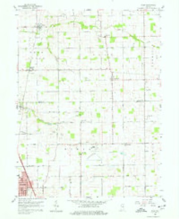
10 topographic sheets cover this place, the earliest surveyed in 1953 and the latest in 1985. It stands in Howard Township. It lies in ZIP code area 46901. The Survey maps it on the Miami quadrangle. It stands 827 feet above sea level.
Topographic sheets covering this place
5 surveys from 10 printed sheetsMatched by testing this settlement's coordinate against the published boundary of every sheet in the United States Geological Survey's historical collection. Each opens the scanned sheet at the Survey.
- 1953 USGS Danville quadrangle1:250000, 3 printings
- 1955 USGS Danville quadrangle1:250000
- 1956 USGS Danville quadrangle1:250000
- 1959 USGS Miami quadrangle1:24000, 3 printings
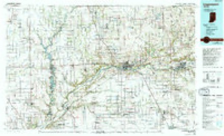
- 1985 USGS Logansport quadrangle1:100000, 2 printings



In the county-history sources
11,525 words on this townshipCounties of Howard and Tipton, Indiana. Historical and Biographical.., published 1883 names this settlement in its chapter on Howard Township. These are the passages that mention it, exactly as the scans read.
The settlement of Howard Township by the whites dates back to the year 1840, at which time the first pioneer, a man by name of Kimball, made his appearance and located on Wild Cat, a short distance south of David Farley's farm. The country at that time was in possession of the Indians, with whom Kimball lived for several years. He adopted their mode of dress, passed the greater part of his time at their camp, participated in their hunting excursions, and was to all intents and purposes a savage himself. He remained here until about the year 1843, when, becoming restive under the increasing civilization, he took his departure and joined his red companions in the West. Several other transient settlers, whose names were not learned, came about the same time with the foregoing, and located temporarily near Cassville. They associated with the Indians also, and took their departure about the same time the latter quitted the country.
Passage source: Counties of Howard and Tipton, Indiana. Historical and Biographical.., published 1883.
On the 6th day of August, 1845, Elder Laomi Ashley held a meeting at the residence of Thomas Martindale, near the present site of Cassville, and organized a society of the Christian, or "New Light" Church. A sermon was preached upon the occasion, and the following persons received into membership: John Hicks, Rebecca Hicks, Thomas Martindale, Francis Martindale, Jonathan Martindale, Elizabeth Martindale, William Stanley, Nancy Stanley, William Pearson, Mary Pearson, Keziah Garrett and Elizabeth Dale. For several years, Martindale's residence was used as a meeting place, and the society increased in numbers under the earnest labors of Ashley, and his successor. Elder Isaac Johnson. Amcng the early pastors was Abraham Sneethen, who deserves more than a passing notice. He was a native of Virginia, and a man of unblemished character, and was considered quite a noted preacher in his day. At an early age, he moved to Ohio, when that State was on the outskirts of civilization, and settled with his parents near Cincinnati. He entered the ministry while yet a young man, and preached at Cincinnati Avhen that city was a mere hamlet of a dozen houses. From Ohio he came to this State, where he became widely and favorably known as a pioneer evangelist. He was a sincere Christian, whose life was spent in
Passage source: Counties of Howard and Tipton, Indiana. Historical and Biographical.., published 1883.
The Cassville Methodist Episcopal Church was organized about the year 1849, with a strong membership. Their first house of worship was built in 1856, but was not completed until three years later. It was used until the year 1874, at which time their present edifice was erected. This is a large, commodious brick building, the finest in the county outside of Kokomo, and cost the sum of $4,000. The church at the present time has a large membership, and is in a flourishing condition.
Passage source: Counties of Howard and Tipton, Indiana. Historical and Biographical.., published 1883.
Machine-read from a century-old scan, so expect the errors a machine makes: misspelled names, dropped words, stray characters.
Read the whole chapter on Howard Township - it names this place 7 more 7 times.
Mines and quarries near this place
1 within 5 milesRegional context, not property-specific evidence. The federal mineral resources record lists 1 working within 5 miles of Cassville: 1 producer. All of them still produce. What was taken out: Fire Clay (Refractory). Distance is straight-line from the map coordinates, so a quarry counted here may appear on a neighbouring settlement's page as well.
| Where | Site | Commodity | Status | Recorded |
|---|---|---|---|---|
| American Standard Plant | Fire Clay (Refractory) | Producer |
Storms near this place
7 since 2005Regional context, not property-specific evidence. The National Weather Service names Cassville in 7 storm reports between 2005 and 2026: 4 thunderstorm wind, 3 hail. No death or injury is recorded in these reports. Each account below is quoted exactly as the forecast office filed it, from the NOAA Storm Events Database, and each date opens the federal record of that event.
| When | Event | Place named | Harm | What the report says |
|---|---|---|---|---|
| June 2020 | Thunderstorm Wind | Cassville | $15,000 | A tree of unknown size was downed on a house due to thunderstorm wind gusts. |
| June 2006 | Thunderstorm Wind | Cassville | $1,000 | Trees and power lines were downed. |
| August 2017 | Thunderstorm Wind | Cassville | - | An estimated 60 mph thunderstorm wind gust was observed in this location. |
| June 2011 | Thunderstorm Wind | Cassville | - | A 60 mph thunderstorm wind gust was measured near the intersection of County Roads 600 North and 150 West on the Howard and Miami county line. |
| April 2026 | Hail | Cassville | - | no account filed |
| April 2026 | Hail | Cassville | - | no account filed |
| June 2005 | Hail | Cassville | - | no account filed |
Nearest settlements
The eight closest, with where each one stands in the county. Distances are straight-line, computed from the Geographic Names Information System coordinates.
| Map | Place | Distance | Sheets |
|---|---|---|---|
| Kokomo | 5.1 miles | 11 | |
| Shambaugh Siding | 5.6 miles | 11 | |
| Darrough Chapel | 5.8 miles | 10 | |
| Vermont | 6.4 miles | 10 | |
| Plevna | 8.0 miles | 10 | |
| Kappa Corner | 8.1 miles | 9 | |
| Alto | 8.6 miles | 11 | |
| Judson | 8.8 miles | 9 |
Elsewhere
Matched on this settlement's Geographic Names Information System number rather than its name, so it cannot be a different place of the same name in another state.
| Wikipedia article on Cassville | An encyclopaedic summary. Its text is share-alike, so it is linked here rather than copied. |
| Wikidata item Q2941323 | The structured record the population and elevation above come from. Public domain (CC0). |
Provenance
This settlement is recorded in the Geographic Names Information System as feature 432221. The sheet list is computed by point-in-boundary test against the United States Geological Survey's historical topographic inventory. Both are works of the United States government and carry no copyright under 17 U.S.C. 105.
Mines and quarries. USGS Mineral Resources Data System (MRDS) https://mrdata.usgs.gov/mrds/ A work of the United States government, no copyright under 17 U.S.C. 105.
Storms. NOAA National Centers for Environmental Information, Storm Events Database https://www.ncei.noaa.gov/stormevents/ A work of the United States government, no copyright under 17 U.S.C. 105. Narratives are quoted verbatim from the National Weather Service report and are not edited or summarised.