 Block
Laketon, Indiana
11 topographic sheets cover this place, the earliest surveyed in 1953 and the latest in 1986. It stands in Pleasant Township. It lies in ZIP code area 46943. It stands on Otter Creek. The Survey maps it on the North Manchester South quadrangle. 606 people lived here at the 2020 count. It stands 755 feet above sea level.
Population over time
2 figuresLaketon fell from 623 to 606 between 2010 and 2020. These are the recorded population figures Wikidata holds for this place, reached through the Geographic Names Information System number this page is keyed on rather than by name, so they belong to this place and not to another of the same name. Most are census counts, but not all are: an early figure may be a founding or settlement estimate, and an estimate published within five years of a census is left out. The change column is computed, and is left blank where more than 20 years separate a figure from the one before it, because a gap that long is not a change between two counts.
| Year | People | Change |
|---|---|---|
| 2010 | 623 | |
| 2020 | 606 | -17 (-3%) |
Topographic sheets covering this place
4 surveys from 11 printed sheetsMatched by testing this settlement's coordinate against the published boundary of every sheet in the United States Geological Survey's historical collection. Each opens the scanned sheet at the Survey.
- 1953 USGS Muncie quadrangle1:250000, 5 printings
- 1956 USGS Muncie quadrangle1:250000
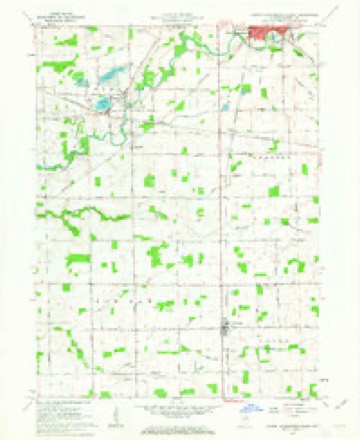
- 1961 USGS North Manchester South quadrangle1:24000, 3 printings
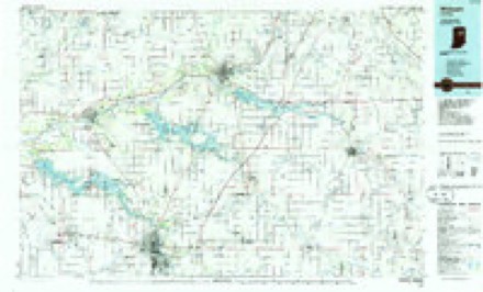
- 1986 USGS Wabash quadrangle1:100000, 2 printings


In the county-history sources
7,000 words on this townshipHistory of Wabash County Indiana, published 1914 names this settlement in its chapter on Pleasant Township. These are the passages that mention it, exactly as the scans read.
Eel River and its tributaries are chiefly responsible for the pleasant outlook of the country. That stream enters from the eastern border of the township and flows generally in a southwesterly direction, through the southeast central and southern sections into Paw Paw Township toward Roann. On its way, it passes Laketon and South Laketon, and receives Otter, Silver and Scpiirrel creeks from the north. These, with several smaller tril>utaries from that direction, bind together various chains of little lakes.
Passage source: History of Wabash County Indiana, published 1914.
This feature is most pronounced in the watercourse west of Laketon, which embraces Long, Round and Mud lakes in a sort of triangle. Long Lake, nearly a mile long and one-third as wide, is the largest compact body of water in Pleasant Township. South of its west end is Round Lake, considerably smaller and lying directly west of Laketon, wliile
Passage source: History of Wabash County Indiana, published 1914.
The site of the old Laketon is a level and l)eautiful tract, with Round Lake at the west and Long Lake at the northwest. A mile west, on Silver Creek, James (.'ox estaljlished a grist mill, or corn cracker, about the time the town was platted. William Johnson and Ira Burr were the first merchants of tlie place, and within a few years a blacksmith shop was built and several dwellings appeared, while along in the 'SOs it had a number of stores, a schoolhouse (District No. 12), and a newspaper. The last-named, the Laketon Herald, was estal)lished in 1883 by Charles A. Richards, then a veteran printer who had been "at the case" for over sixty years.
Passage source: History of Wabash County Indiana, published 1914.
Machine-read from a century-old scan, so expect the errors a machine makes: misspelled names, dropped words, stray characters.
Read the whole chapter on Pleasant Township - it names this place 11 more 11 times.
Storms near this place
4 since 2009Regional context, not property-specific evidence. The National Weather Service names Laketon in 4 storm reports between 2009 and 2017: 2 thunderstorm wind, 2 hail. No death or injury is recorded in these reports. Each account below is quoted exactly as the forecast office filed it, from the NOAA Storm Events Database, and each date opens the federal record of that event.
| When | Event | Place named | Harm | What the report says |
|---|---|---|---|---|
| March 2009 | Thunderstorm Wind | Laketon | $65,000 | A National Weather Service (NWS) survey team examined the damage at a farm west of North Manchester on State Route 114. Over half of a barn roof was removed from strong winds, likely around 70 mph, entering through a possible door opening. Adjacent buildings, including a house, suffered minor damage, including siding and some shingles. A wooden playground suffered damage from the winds as did some shingles on the residence. Damage is estimated at around $60,000 for the barn and around $5,000 for the swing set and roof damage. |
| May 2017 | Thunderstorm Wind | Laketon | - | The public reported several large trees uprooted, as well as some smaller trees snapped in the middle. |
| October 2014 | Hail | Laketon | - | no account filed |
| October 2014 | Hail | Laketon | - | no account filed |
Nearest settlements
The eight closest, with where each one stands in the county. Distances are straight-line, computed from the Geographic Names Information System coordinates.
| Map | Place | Distance | Sheets |
|---|---|---|---|
| Newton | 0.9 miles | 11 | |
| Ijamsville | 1.0 miles | 11 | |
| Bolivar | 2.7 miles | 11 | |
| North Manchester | 4.0 miles | 10 | |
| Servia | 5.2 miles | 11 | |
| Urbana | 5.7 miles | 11 | |
| Disko | 6.1 miles | 10 | |
| Roann | 6.4 miles | 11 |
Elsewhere
Matched on this settlement's Geographic Names Information System number rather than its name, so it cannot be a different place of the same name in another state.
| Wikipedia article on Laketon | An encyclopaedic summary. Its text is share-alike, so it is linked here rather than copied. |
| Wikidata item Q6479184 | The structured record the population and elevation above come from. Public domain (CC0). |
Provenance
This settlement is recorded in the Geographic Names Information System as feature 437557. The sheet list is computed by point-in-boundary test against the United States Geological Survey's historical topographic inventory. Both are works of the United States government and carry no copyright under 17 U.S.C. 105.
Storms. NOAA National Centers for Environmental Information, Storm Events Database https://www.ncei.noaa.gov/stormevents/ A work of the United States government, no copyright under 17 U.S.C. 105. Narratives are quoted verbatim from the National Weather Service report and are not edited or summarised.