 Block
North Manchester, Indiana
10 topographic sheets cover this place, the earliest surveyed in 1953 and the latest in 1994. It stands in Chester Township. It lies in ZIP code area 46962. It stands on Pony Creek. The Survey maps it on the North Manchester North quadrangle. 5,277 people lived here at the 2020 count. It stands 771 feet above sea level.
On record in North Manchester
Buildings and businesses the archive holds for this place. Each opens its own page, with the source record it came from.
On the National Register 8 records
 Lentz House (Hotel Sheller)listed 1982
 Manchester College Historic Districtlisted 1990
 Thomas R. Marshall Schoollisted 2004
 Noftzger-Adams Houselisted 1979
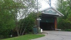 North Manchester Covered Bridgelisted 1982
 North Manchester Historic Districtlisted 2002
 North Manchester Public Librarylisted 1996
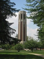 Peabody Memorial Towerlisted 2010
Population over time
2 figuresNorth Manchester fell from 6,112 to 5,277 between 2010 and 2020. These are the recorded population figures Wikidata holds for this place, reached through the Geographic Names Information System number this page is keyed on rather than by name, so they belong to this place and not to another of the same name. Most are census counts, but not all are: an early figure may be a founding or settlement estimate, and an estimate published within five years of a census is left out. The change column is computed, and is left blank where more than 20 years separate a figure from the one before it, because a gap that long is not a change between two counts.
| Year | People | Change |
|---|---|---|
| 2010 | 6,112 | |
| 2020 | 5,277 | -835 (-14%) |
Topographic sheets covering this place
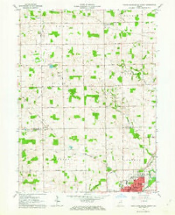
5 surveys from 10 printed sheetsMatched by testing this settlement's coordinate against the published boundary of every sheet in the United States Geological Survey's historical collection. Each opens the scanned sheet at the Survey.
- 1953 USGS Fort Wayne quadrangle1:250000, 4 printings
- 1956 USGS Fort Wayne quadrangle1:250000, 2 printings
- 1962 USGS North Manchester North quadrangle1:24000, 2 printings
- 1984 USGS Fort Wayne quadrangle1:100000
- 1994 USGS Fort Wayne quadrangle1:100000




Fires near this place
1 since 2003Regional context, not property-specific evidence. The federal wildfire occurrence database lists 1 fire within 5 miles of North Manchester in 2003, burning about 1 acre in total. None started naturally. None was recorded as arson. Distance is straight-line from the map coordinates, so a fire counted here may appear on a neighbouring settlement's page as well.
| Reported cause | Fires |
|---|---|
| Debris and open burning | 1 |
The most recent of them, most recent first, with the day each was reported and the service that recorded it.
| Date | Cause | Size | Reported by | Name on the report |
|---|---|---|---|---|
| 29 April 2003 | Debris and open burning | 1.0 acres | Indiana State Fire Marshal's Office | not named |
Settlements close enough to share some of these fires:
Storms near this place
46 since 1995Regional context, not property-specific evidence. The National Weather Service names North Manchester in 46 storm reports between 1995 and 2026: 23 thunderstorm wind, 16 hail, 3 flood, 3 tornado. The reports record 3 injuries. Each account below is quoted exactly as the forecast office filed it, from the NOAA Storm Events Database, and each date opens the federal record of that event.
| When | Event | Place named | Harm | What the report says |
|---|---|---|---|---|
| June 2000 | Tornado (F2) | North Manchester | 3 hurt, $700,000 | The tornado touched down again, hitting a farm at 1300 N and 100 W. A man suffered a broken leg here. Two hog sheds and a large grain bin were destroyed. A 200-yard swath of trees were uprooted to the northeast along the railroad tracks. Another man suffered back and chest injuries as the tornado continued to the intersection of 1300 N and Meridian Road and demolished the barn in which he stood. A 5th wheel camper was rolled 50 yards from its original position destroying it. The tornado continued to the next farm just south of 1400 N and 100 E. The barn was destroyed and the house suffered moderate damage, primarily from flying tree debris. The tornado snapped a utility pole, which fell on an 18-year-old boy, breaking his leg. Many trees and power lines were downed along the way. From here, the tornado continued until the Wabash/Kosciusko county line. |
| June 2000 | Tornado (F1) | North Manchester | $100,000 | The initial tornado touchdown occurred near the intersection of SR 15 and 114. Two barns were deroofed and a grain silo was partially blown down. Several trees and limbs were taken down. The tornado lifted briefly as it crossed SR 15. It then continued on the ground for one half mile before striking another farm just west of the intersection of SR 114 and 400 W. A barn roof was blown off, and several trees and power lines were taken down. Crop damage was noted in an adjacent field. The tornado then lifted until it touched down about 1 mile to the northeast. |
| July 1998 | Thunderstorm Wind | North Manchester | $100,000 | TREE FELL ON HOME AND DESTROYED PORCH. COAST TO COAST STORE LOST THEIR GREEN HOUSE AND SECURITY FENCE AS IT BECAME AIRBORNE IN THE HIGH WINDS. |
| January 2008 | Flood | North Manchester | $75,000 | County officials reported high water on some roadways both in the county and also in a few cities, including North Manchester and Roann. 2.7 inches of rain was observed near North Manchester. The Eastside Mobile Home Park next to the Eel river in North Manchester was evacuated as flood waters moved into the park and under trailers. Luckily, no water got into the trailers and residents were able to return home by Jan 11th. A rescue from a residence was needed in Roann to get 2 adults and a 5 month old child. No exact damage figures are available, but are estimated at $75,000, mainly for road repairs and some basement flooding. |
| June 2008 | Lightning | North Manchester | $50,000 | Lightning struck a house on State Route 13 in the city of North Manchester, causing extensive damage to the residence. No injuries were reported but damage is estimated at $50,000. |
| June 2000 | Thunderstorm Wind | North Manchester | $50,000 | Barn destroyed and windows blown out of a brick house. |
| May 2024 | Thunderstorm Wind | North Manchester | $35,000 | Video on Facebook shows power poles snapped on Sate Road 13. Also a report of a barn destroyed one-half mile away. |
| October 2008 | Thunderstorm Wind | North Manchester | $15,000 | Emergency management officials reported trees down in North Manchester, with some onto vehicles. |
| June 1999 | Thunderstorm Wind | North Manchester | $2,000 | Trees reported down in North Manchester. |
| May 2025 | Thunderstorm Wind | North Manchester | $1,000 | Mature oak tree lost part of its top. |
| May 2024 | Hail | North Manchester | $1,000 | no account filed |
| June 2023 | Hail | North Manchester | $1,000 | no account filed |
| June 2023 | Hail | North Manchester | $1,000 | no account filed |
| June 2023 | Hail | North Manchester | $1,000 | no account filed |
| May 2024 | Thunderstorm Wind | North Manchester | $500 | Large tree branches snapped in North Manchester. |
| June 1995 | Thunderstorm Wind | North Manchester | $2 | A barn was blown down just south of North Manchester. A 20-foot length of roof was blown off the water plant and and a farm wagon was blown over and destroyed in North Manchester. Trees and lines were reported down across the Northern part of the county. |
| March 2022 | Thunderstorm Wind | North Manchester | - | The public reported a lean-to style airplane hangar and anchoring posts destroyed. |
| June 2020 | Thunderstorm Wind | North Manchester | - | Numerous large tree branches down including one uprooted. |
| June 2020 | Thunderstorm Wind | North Manchester | - | Tree fell on house. Time estimated by radar. |
| August 2020 | Thunderstorm Wind | North Manchester | - | Emergency management officials reported large tree limbs were blown down in North Manchester. |
| September 2019 | Thunderstorm Wind | North Manchester | - | The public shared photos on social media of a tree snapped at the base with some corn stalks blown over on State Route 114, West of North Manchester. |
| May 2019 | Tornado (EF1) | North Manchester | - | A damage survey found intermittent tree damage noted along this damage path that was primarily through open fields. One property sustained roof damage to a barn and a small shed sustained significant damage. Trees were topped and a recreational vehicle was moved/turned about 6 inches. |
| May 2017 | Thunderstorm Wind | North Manchester | - | The public reported multiple trees down in the area. |
| June 2017 | Thunderstorm Wind | North Manchester | - | The public reported minor roof damage to a Dairy Queen on State Route 13, north of State Route 114. |
| July 2011 | Thunderstorm Wind | North Manchester | - | Emergency management officials reported trees and power lines down throughout North Manchester. Locations included County Road 300 West at State Route 114, County Road 625 West near State Route 16 and along College Avenue. |
| June 2009 | Hail | North Manchester | - | Emergency management officials reported quarter size hail. |
| February 2008 | Flood | North Manchester | - | The local newspaper reported that 14 residences in the Eastside Trailer Court, in North Manchester, had to be evacuated due to rising waters from the Eel River. No damage was reported to any of the residences. |
| April 2006 | Hail | North Manchester | - | Hail ranging from penny to nickel size was reported around North Manchester. |
| May 2000 | Thunderstorm Wind | North Manchester | - | Minor wind damage. |
| June 2000 | Thunderstorm Wind | North Manchester | - | Trees and power lines down. |
| August 2000 | Thunderstorm Wind | North Manchester | - | Power lines down. 2 large trees down. |
| April 1999 | Flood | North Manchester | - | State Road 13 was reported to be flooded south of North Manchester. |
| July 1999 | Thunderstorm Wind | North Manchester | - | Trees blown down along CR 700 N. |
| July 1998 | Thunderstorm Wind | North Manchester | - | TREES DOWN. |
| April 2026 | Hail | North Manchester | - | no account filed |
| February 2026 | Hail | North Manchester | - | no account filed |
| May 2005 | Hail | North Manchester | - | no account filed |
| April 2003 | Hail | North Manchester | - | no account filed |
| June 2002 | Hail | North Manchester | - | no account filed |
| August 2001 | Hail | North Manchester | - | no account filed |
| May 2000 | Hail | North Manchester | - | no account filed |
| May 2000 | Hail | North Manchester | - | no account filed |
| April 1999 | Hail | North Manchester | - | no account filed |
| June 1998 | Thunderstorm Wind | North Manchester | - | no account filed |
| May 1996 | Hail | North Manchester | - | no account filed |
| October 1996 | Thunderstorm Wind | North Manchester | - | no account filed |
Nearest settlements
The eight closest, with where each one stands in the county. Distances are straight-line, computed from the Geographic Names Information System coordinates.
| Map | Place | Distance | Sheets |
|---|---|---|---|
| Bolivar | 2.7 miles | 11 | |
| Liberty Mills | 2.9 miles | 10 | |
| Servia | 3.4 miles | 11 | |
| Newton | 3.6 miles | 11 | |
| Laketon | 4.0 miles | 11 | |
| Ijamsville | 4.4 miles | 11 | |
| Urbana | 7.2 miles | 11 | |
| Disko | 9.3 miles | 10 |
Elsewhere
Matched on this settlement's Geographic Names Information System number rather than its name, so it cannot be a different place of the same name in another state.
| Wikipedia article on North Manchester | An encyclopaedic summary. Its text is share-alike, so it is linked here rather than copied. |
| Wikidata item Q2023141 | The structured record the population and elevation above come from. Public domain (CC0). |
Provenance
This settlement is recorded in the Geographic Names Information System as feature 440278. The sheet list is computed by point-in-boundary test against the United States Geological Survey's historical topographic inventory. Both are works of the United States government and carry no copyright under 17 U.S.C. 105.
Wildfire. Short, Karen C. 2022. Spatial wildfire occurrence data for the United States, 1992-2020 [FPA_FOD_20221014]. 6th Edition. Fort Collins, CO: Forest Service Research Data Archive. https://doi.org/10.2737/RDS-2013-0009.6 Collected with United States Government funding and usable without additional permissions or fees.
Storms. NOAA National Centers for Environmental Information, Storm Events Database https://www.ncei.noaa.gov/stormevents/ A work of the United States government, no copyright under 17 U.S.C. 105. Narratives are quoted verbatim from the National Weather Service report and are not edited or summarised.