 Block
Laurel, Indiana
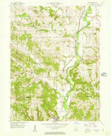
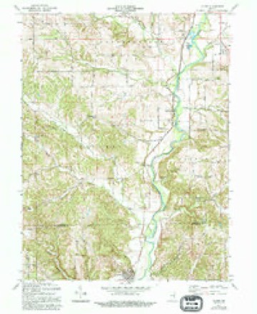
10 topographic sheets cover this place, the earliest surveyed in 1953 and the latest in 1986. It stands in Laurel Township. It lies in ZIP code area 47024. It stands on Sayres Branch. The Survey maps it on the Alpine quadrangle.
Topographic sheets covering this place
5 surveys from 10 printed sheetsMatched by testing this settlement's coordinate against the published boundary of every sheet in the United States Geological Survey's historical collection. Each opens the scanned sheet at the Survey.
- 1953 USGS Cincinnati quadrangle1:250000, 3 printings
- 1956 USGS Alpine quadrangle1:24000
- 1957 USGS Cincinnati quadrangle1:250000
- 1971 USGS Alpine quadrangle1:24000, 3 printings
- 1986 USGS New Castle quadrangle1:100000, 2 printings



In the county-history sources
1,990 words on this townshipHistory of Franklin County, Indiana : Her People, Industries and Institutions, published 1915 names this settlement in its chapter on Laurel Township. These are the passages that mention it, exactly as the scans read.
Laurel was platted, originally, Xovember 30, 1836, by pioneer James Conwell, who had been selling goods from his house before that date. At first he intended naming his new town site Xew Baltimore, but later changed his notion and called his town Laurel after a town in his old home state, Maryland. It is situated on the old canal and is described on the maps as being situated on parts of sections 9 and 10 in township 12, range 12 east. It is on the Big Four system of railroad. During the first few years of its history it grew very rapidly, especially during the years in which the canal was being constructed, which was from 1839 to 1845. "Dove," the first canal boat to pass through the canal at this point, was owned by W. Harding, of Laurel. The opening of the canal brought in several new business factors, including IVIessrs. William S. Geyer, George and Samuel Shoup, David Hazzard, Louis Steffey, the Snyder brothers. Doctor Giftord, James A. Derbyshire, Horatio Burgoyne, Joel Palmer and a few others. The population of Laurel in 19 10 was five hundred and three.
Passage source: History of Franklin County, Indiana : Her People, Industries and Institutions, published 1915.
Without further evidence of the spirit of enterprise and busv industries at this point, one has, today, but to look upon the ruins of numerous stone and brick structures, many years ago the scene of shops and factories and flouring mills. A wonderful talc conld these old buildings tell were they gifted with tongues. Here men bought anfl soM, manufactured an<l .>hi[)ped by water navigation many useful products. The old canal, completed in 1845, was the great artery of trade to and from the town, which grew rapidly until 1852. Fortunes were here made, and in several instances lost. Many men of more than ordinary note have, at one time or another, resided in Laurel.
Passage source: History of Franklin County, Indiana : Her People, Industries and Institutions, published 1915.
The next mill built was by John Ferris, three and a half miles below the town of Laurel. This mill burned and was never rebuilt. Mr. Webster then constructed a rude mill, near Laurel, at the site of the later "Laurel Wreath mills." It was of but little account. In 1843 Samuel Fisher removed and enlarged this mill and it was rebuilt by the Conwells once if not more times; it was burned in 1855. David Hazzard rebuilt in 1857, selling out to Johnson & ]Moak, and they in turn to James A. Derbyshire. It burned again in 1868, and in 1879 it was again rebuilt by Fisher & Withers. Later it was operated by Flerman B. Buhlmann. It was originally propelled by the waters of the river, but later utilized the water from a cut-oflf of the canal.
Passage source: History of Franklin County, Indiana : Her People, Industries and Institutions, published 1915.
Machine-read from a century-old scan, so expect the errors a machine makes: misspelled names, dropped words, stray characters.
Read the whole chapter on Laurel Township - it names this place 11 more 11 times.
Mines and quarries near this place
10 within 5 milesRegional context, not property-specific evidence. The federal mineral resources record lists 10 workings within 5 miles of Laurel: 6 producers, 4 past producers. 6 still produce. What was taken out: Limestone, Dimension, Stone, Crushed/Broken. Distance is straight-line from the map coordinates, so a quarry counted here may appear on a neighbouring settlement's page as well.
| Where | Site | Commodity | Status | Recorded |
|---|---|---|---|---|
| Derbyshire Quarry | Stone, Crushed/Broken | Producer | ||
| Booher Stone Quarry | Limestone, Dimension | Producer | ||
| Denny Stone Quarry | Limestone, Dimension | Past Producer | ||
| Franklin County Quarry | Limestone, Dimension | Past Producer | ||
| Henson Stone Quarry | Limestone, Dimension | Past Producer | ||
| Holzhause Stone Quarry | Limestone, Dimension | Producer | ||
| Laurel Stone Quarry | Limestone, Dimension | Past Producer | ||
| Ogle Stone Quarry | Limestone, Dimension | Producer | ||
| Rabbit Hollow Quarry | Limestone, Dimension | Producer | ||
| Turner Stone Quarry | Limestone, Dimension | Producer |
Storms near this place
23 since 2000Regional context, not property-specific evidence. The National Weather Service names Laurel in 23 storm reports between 2000 and 2026: 13 thunderstorm wind, 4 flash flood, 3 hail, 3 flood. The reports record 6 deaths. Each account below is quoted exactly as the forecast office filed it, from the NOAA Storm Events Database, and each date opens the federal record of that event.
| When | Event | Place named | Harm | What the report says |
|---|---|---|---|---|
| March 2020 | Flash Flood | Laurel | 6 killed, $100,000 | A bridge collapsed on Sanes Creek Road near Tee Hill Road due to flash flooding on Sanes Creek. Two vehicles were swept into the water, leading to six fatalities. M48VE, M47VE, F35VE, M13VE, F7VE, F4VE. |
| January 2005 | Flash Flood | Laurel | $30,000 | Numerous roads were flooded and closed in town. Several homes were evacuated along Jackson Street. |
| July 2023 | Thunderstorm Wind | Laurel | $20,000 | Numerous trees and power lines were downed across the northwest portions of Franklin County. |
| August 2009 | Flash Flood | Laurel | $20,000 | The town of Laurel was flooded due to flash flooding caused by heavy rainfall. |
| April 2025 | Thunderstorm Wind | Laurel | $10,000 | Several trees and power poles were downed. |
| May 2008 | Thunderstorm Wind | Laurel | $8,000 | Trees were knocked down across the county. |
| June 2021 | Thunderstorm Wind | Laurel | $5,000 | Several trees were downed. |
| September 2000 | Thunderstorm Wind | Laurel | $5,000 | Trees were knocked down by thunderstorm winds. |
| June 2006 | Thunderstorm Wind | Laurel | $3,000 | A few trees were knocked down. |
| July 2005 | Thunderstorm Wind | Laurel | $3,000 | Two trees were downed. |
| November 2001 | Thunderstorm Wind | Laurel | $3,000 | Two trees were knocked down near Laurel and in the vicinity of Oldenburg. |
| July 2021 | Thunderstorm Wind | Laurel | $2,000 | A couple of trees were downed near Laurel. |
| November 2013 | Thunderstorm Wind | Laurel | $2,000 | Five trees were reported down west of Metamora due to thunderstorm winds. |
| October 2010 | Thunderstorm Wind | Laurel | $2,000 | Trees and large tree limbs were reported down due to damaging thunderstorm winds. |
| August 2009 | Flood | Laurel | $2,000 | Multiple roads still had high water on them due to previous heavy rainfall. |
| June 2000 | Thunderstorm Wind | Laurel | $2,000 | Trees were downed. |
| June 2025 | Thunderstorm Wind | Laurel | $1,000 | A tree was downed in Laurel. |
| August 2013 | Flash Flood | Laurel | $1,000 | High water was reported over roads in the area due to heavy rainfall. |
| March 2026 | Flood | Laurel | - | Tee Hill Road was closed due to high water over the roadway. |
| May 2022 | Flood | Laurel | - | Stone Church Road was closed due to high water. |
| May 2010 | Hail | Laurel | - | no account filed |
| April 2006 | Hail | Laurel | - | no account filed |
| April 2006 | Hail | Laurel | - | no account filed |
Nearest settlements
The eight closest, with where each one stands in the county. Distances are straight-line, computed from the Geographic Names Information System coordinates.
| Map | Place | Distance | Sheets |
|---|---|---|---|
| Mount Auburn | 0.6 miles | 10 | |
| Midway | 3.3 miles | 10 | |
| Lake View | 3.4 miles | 10 | |
| Metamora | 4.3 miles | 10 | |
| Millville | 4.9 miles | 10 | |
| Andersonville | 5.4 miles | 10 | |
| Pinhook | 6.0 miles | 11 | |
| Buena Vista | 6.3 miles | 10 |
Provenance
This settlement is recorded in the Geographic Names Information System as feature 437653. The sheet list is computed by point-in-boundary test against the United States Geological Survey's historical topographic inventory. Both are works of the United States government and carry no copyright under 17 U.S.C. 105.
Mines and quarries. USGS Mineral Resources Data System (MRDS) https://mrdata.usgs.gov/mrds/ A work of the United States government, no copyright under 17 U.S.C. 105.
Storms. NOAA National Centers for Environmental Information, Storm Events Database https://www.ncei.noaa.gov/stormevents/ A work of the United States government, no copyright under 17 U.S.C. 105. Narratives are quoted verbatim from the National Weather Service report and are not edited or summarised.