 Block
From the record
13 National Register listings published here · the county-history sources tell 1 story.
Sources: the county history on the Internet Archive · the National Register database, National Park Service
88 topographic sheets cover 45 settlements here, and 13 properties are on the National Register of Historic Places.
13 National Register listings published here · the county-history sources tell 1 story.
Sources: the county history on the Internet Archive · the National Register database, National Park Service
Among them: Great Flood Of March 25, I913. These passages come from the identified county-history source books. Each inset names its own source and opens the exact section it comes from.
The flood of March 25, 1913, was the greatest in volume of water, destruction of property and loss of life, of any that has ever visited this part of the White Water valley. Hundreds of thousands of dollars' worth of property was destroyed and fifteen lives lost. Six hundred people in Brookville were rendered homeless and scores of dwellings swept away and torn to pieces.
Every property in this county listed on the National Register of Historic Places, with the year it was listed and the federal nomination document.
| Photograph | Property | Type | Listed | Reference |
|---|---|---|---|---|
 | Brookville Historic District | district | 1975 | 75000018 |
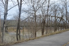 | Cedar Grove Bridge | structure | 2014 | 14000801 |
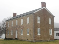 | Franklin County Seminary | building | 1974 | 74000020 |
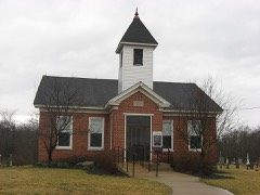 | Franklin United Brethren Church, Old | building | 1995 | 95000201 |
 | Hermitage, The | building | 2004 | 04000209 |
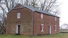 | Little Cedar Grove Baptist Church | building | 1990 | 90000366 |
 | Metamora Historic District | district | 1992 | 92001646 |
 | Oldenburh Historic District | district | 1983 | 83000031 |
 | Joseph Shafer Farm | building | 1982 | 82000038 |
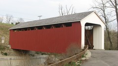 | Snow Hill Covered Bridge | structure | 1995 | 95000208 |
 | Stockheughter Covered Bridge | structure | 2002 | 02000198 |
 | Salmon Turrell Farmstead | building | 2009 | 09000423 |
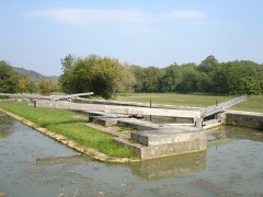 | Whitewater Canal Historic District | district | 1973 | 73000272 |
Franklin County has 2 covered bridges on the National Register. Each is a listed structure with a federal nomination on file.
| Snow Hill Covered Bridge | Listed 1995 |
| Stockheughter Covered Bridge | Listed 2002 |
Every wildfire the federal occurrence database records inside this county: 1 of them, burning about 3 acres. None started naturally and none was recorded as arson. Each settlement page carries the fires within five miles of it.
| Reported cause | Fires |
|---|---|
| Recreation and ceremony | 1 |
The five largest, by the area the report gives. None of them was recorded as arson.
| Date | Cause | Size | Reported by | Name on the report |
|---|---|---|---|---|
| 31 October 2004 | Recreation and ceremony | 3.0 acres | Indiana State Fire Marshal's Office | not named |
Every settlement page carries the fires within five miles of it - see the settlement index below.
The NOAA Storm Events Database holds 244 reports for this county, causing 11 deaths, 12 injuries and about $3,184,250 in recorded property damage. Each settlement page carries the reports that name it.
| Kind of event | Reports |
|---|---|
| Thunderstorm Wind | 116 |
| Hail | 49 |
| Flash Flood | 37 |
| Flood | 28 |
| Tornado | 13 |
| Lightning | 1 |
The most serious of them, by death, then injury, then recorded damage. The accounts are quoted exactly as the forecast office filed them.
| When | Event | Place named | Harm | What the report says |
|---|---|---|---|---|
| March 2020 | Flash Flood | Laurel | 6 killed, $100,000 | A bridge collapsed on Sanes Creek Road near Tee Hill Road due to flash flooding on Sanes Creek. Two vehicles were swept into the water, leading to six fatalities. M48VE, M47VE, F35VE, M13VE, F7VE, F4VE. |
| April 1974 | Tornado (F4) | not stated | 2 killed, 10 hurt | no account filed |
| July 2023 | Flash Flood | Oak Forest | 2 killed, $200,000 | Wolf Creek rose six feet out of its banks and caused widespread flash flooding along Wolf Creek Road. Two people were killed when a small cabin they were staying in was washed away. |
| December 2018 | Flood | Peppertown | 1 killed, $2,000 | A 63 year old woman attempted to cross a stream in a car on a slab of concrete. The water was extremely high and fast after heavy rainfall in the area. The car was swept off the slab and the women's body was discovered about 1 1/2 miles down stream the next day. F63VE. |
| April 1965 | Tornado (F1) | not stated | 1 hurt, $25,000 | no account filed |
| August 2002 | Lightning | Oldenburg | 1 hurt | A man was struck by lightning at the Cricket Ridge Golf Club on State Route 229. |
| June 2021 | Flash Flood | Oldenburg | $500,000 | Numerous reports of flash flooding were received from southern portions of Franklin County. Multiple road wash outs and erosions occurred along Barber Road, Bessler Road, Cane Mill Road, Cherry Hill Road, County Line Road, Creek Road, Elkhorn Road, Enochsburg Road, Gobles Creek Road, Monroe Road, Mountford Lane, Orchard Road, Pine Road, Pipe Creek Road, Possum Hollow Road, River Road, Russell Road, Shanks Road, Siemon Road, Sorber Road, St. Peters Road, Stockpile Road and Webb Road. |
| September 2016 | Flash Flood | Stavetown | $500,000 | Water was flowing over several roads across Franklin County, including U.S. Route 52. One bridge on River Road sustained significant damage. On Big Cedar Road, the pavement on a section of the road was peeled away and laid into a field beside the road. Several other bridge approaches were damaged in the county and numerous culvert pipes were destroyed. |
| May 2012 | Tornado (EF1) | Mt Carmel | $250,000 | The tornado touched down and produced significant damage to 3 farmsteads. There was damage to several large buildings which consisted primarily of aluminum and wood. Several small sheds which were not anchored down were either blown completely off their foundation or moved from the foundation. Some of the larger buildings had collapsed walls, doors blown in, broken windows, and large sections of their roofs torn off. Several silos were severely damaged. A narrow path of wood and metal debris extended across the farm fields between the farmsteads. Several trees 3 to 6 inches in diameter were snapped and twisted. Based on the damage surveyed, the maximum wind speed of this tornado was estimated at 95 miles per hour. |
| October 1992 | Tornado (F1) | not stated | $250,000 | no account filed |
| July 2023 | Flash Flood | Blooming Grove | $200,000 | Five to 7 inches of rain caused widespread flash flooding across much of Franklin County. Several roads and culverts were damaged due to the rushing water. |
| July 2023 | Flash Flood | Oak Forest | $100,000 | A vehicle was washed off a roadway along Blue Creek Road. The rushing water also caused road and culvert damage. |
| July 2021 | Flash Flood | Brookville | $100,000 | Water was flowing across a roadway and carrying debris. A few roads washout were also reported across central Franklin County. |
| August 2023 | Tornado (EF0) | Whitcomb | $70,000 | The tornado first touched down in the vicinity of Palawana Circle and Deer Ridge Road where some minor garden and tree branch damage was noted. From there, the tornado continued east, causing some minor roof and siding damage to several homes between Garr Hill and Deer Ridge Roads. Additionally, numerous trees were damaged and/or uprooted. At one residence, a back yard barn was completely destroyed and a house garage had partial wall and roof collapse. The tornado then continued east, causing minor tree damage along Pea Ridge Road. After crossing State Route 101, more significant tree damage occurred in a forested area just to the south of Pea Ridge Road. The tornado then crossed several fields before lifting along Liberty Pike, where minor tree damage was noted. |
| April 2025 | Tornado (EF0) | Mt Carmel | $50,000 | The first signs of tornadic damage were observed north of Sparks Road near Sharptown, Indiana, where trees were uprooted or snapped. Additional damage to trees was found to the northeast of the start location along Wesley Chapel Road and Drewersburg Road. Minor damage continued along Dickson Road and State Route 252 and tree damage, minor damage to homes, and minor damage to a church were found along State Line Road, Hamilton Scipio Road, and Cincinnati Brookville Road. The tornado crossed the Indiana-Ohio state line into western Butler County, Ohio, just east of Scipio at 2326EST and continued northeast across Butler County, Ohio, before ending near McGonigle, Ohio, at 2333EST. |
| July 2023 | Flash Flood | Cedar Grove | $50,000 | A culvert and a portion of Richland Creek Road were washed out. |
| June 2021 | Flash Flood | Whitcomb | $50,000 | Several roads were closed across the northeast part of Franklin County due to flash flooding, including Liberty Pike and Whitcomb Road, Kunkel Road north of Whitcomb Road and Farm Hill Road between Mud Road and Liberty Pike. An old bridge from the early 1900s was washed out. |
| November 2004 | Tornado (F1) | Andersonville | $50,000 | A tornado crossed into northwest Franklin County from Rush County, just north of State Route 244. The tornado moved across US Route 52 near Andersonville, and continued northeast. Several homes and buildings sustained structural damage on County Line, Sanes Creek and Keal Roads. A shed was moved thirty feet, and a barn was completely destroyed. Trees were also downed along the storm path. The tornado lifted about a quarter mile south of the Fayette County line. |
| January 2005 | Flash Flood | Laurel | $30,000 | Numerous roads were flooded and closed in town. Several homes were evacuated along Jackson Street. |
| June 2021 | Flash Flood | St Peters | $25,000 | Blue Creek Road was washed out near County Line Road. |
| May 1990 | Tornado (F0) | not stated | $25,000 | no account filed |
| August 1969 | Tornado (F2) | not stated | $25,000 | no account filed |
| July 2023 | Thunderstorm Wind | Laurel | $20,000 | Numerous trees and power lines were downed across the northwest portions of Franklin County. |
| August 2009 | Flash Flood | Laurel | $20,000 | The town of Laurel was flooded due to flash flooding caused by heavy rainfall. |
| March 2025 | Thunderstorm Wind | Raymond | $15,000 | A barn roof collapsed along with some shingles removed from residential home. Several trees were downed. |
| August 2013 | Thunderstorm Wind | Andersonville | $15,000 | Trees and power lines were downed in the northern portions of Franklin County due to thunderstorm winds. |
| August 2009 | Flash Flood | Metamora | $15,000 | Flowing water upwards of one foot deep was reported on State Road 121 near Laurel and Highway 52 near Metamora. |
| August 2009 | Flash Flood | Metamora | $15,000 | Damage from flooding has occurred across several roads across western portions of the county. |
| April 2006 | Thunderstorm Wind | Countywide | $12,000 | Numerous trees were downed across the county. A barn was blown onto Springfield Road. |
| March 2025 | Thunderstorm Wind | Raymond | $10,000 | Barn doors were caved in along with some shingle damage to a home. A few trees were downed. |
| May 2025 | Tornado (EF0) | St Peters | $10,000 | The tornado first developed in Ripley County, Indiana at 1902EST near E County Road 1150 N. The tornado travelled northeast, into Dearborn County and continued into Franklin County at 1910EST just north of N County Line Road, where a barn roof was removed. The tornado dissipated just northeast of this location at 1911EST. |
| April 2025 | Thunderstorm Wind | Laurel | $10,000 | Several trees and power poles were downed. |
| April 2025 | Thunderstorm Wind | Cedar Grove | $10,000 | The walls of a large barn collapsed. |
| May 2024 | Flash Flood | St Marys | $10,000 | Flash flooding occurred along Pipe Creek, causing some pavement scouring on Pipe Creek Road. |
| May 2024 | Flash Flood | Oldenburg | $10,000 | Flowing water along Huntersville Road caused some road damage. |
| July 2024 | Tornado (EF0) | Whitcomb | $10,000 | The tornado began along a wooded area west of Holland Road and south of Oxford Pike. Drone footage revealed broken branches and convergent swirls within crops along the wooded area. The tornado continued northeast, remaining west of Holland Road. A property near the intersection of Holland Road and Oxford Pike received minor damage. An outbuilding sustained roof panel loss and the residence had minor roof damage along with blown out windows. Tree damage observed around the property was also convergent. The damage to and around the property suggested estimated peak winds|around 75 mph. The tornado entered an open field north of Oxford Pike, where tornadic swirls were evident within the crops. This was the final evidence of the tornado and it is believed to have quickly dissipated north of Oxford Pike. |
| July 2023 | Thunderstorm Wind | Brookville | $10,000 | Numerous trees were downed across Franklin County. |
| July 2012 | Thunderstorm Wind | Brookville | $10,000 | Several trees were downed, along with power lines due to damaging thunderstorm winds. |
| September 2012 | Thunderstorm Wind | Buena Vista | $10,000 | Numerous trees and limbs were down in the western part of Franklin county due to damaging thunderstorm winds. |
| July 2002 | Thunderstorm Wind | Brookville | $10,000 | Trees were blown down. A boat was capsized on Brookville Lake. |
| January 2000 | Flash Flood | Cedar Grove | $10,000 | Heavy rainfall caused flooding across roads. |
| July 1998 | Thunderstorm Wind | Countywide | $10,000 | Numerous trees downed. |
| March 1997 | Thunderstorm Wind | Countywide | $10,000 | no account filed |
| May 2008 | Thunderstorm Wind | Laurel | $8,000 | Trees were knocked down across the county. |
| July 2008 | Hail | Stavetown | $8,000 | no account filed |
| July 2003 | Thunderstorm Wind | Countywide | $7,000 | Trees were downed. |
| June 1995 | Hail | New Trenton | $7,000 | no account filed |
| July 2008 | Thunderstorm Wind | St Marys | $6,000 | Trees were knocked down. |
| April 2026 | Thunderstorm Wind | Mt Carmel | $5,000 | A couple of barns were damaged. |
| May 2024 | Tornado (EF1) | Whitcomb | $5,000 | The tornado started just to the east of Brookville Lake, in a field just west of the Hickory Woods Campground. Tornadic damage was first observed at the Hickory Woods Campground where numerous trees were blown over, snapped or uprooted. Numerous camping units and manufactured homes were also overturned or damaged. On the other side of State Road 101, two outbuildings were destroyed and additional tree damage occurred.||The tornado briefly moved to the northeast and produced damage along Whitcomb Road. One outbuilding was destroyed and a few trees were snapped or blown over. The tornado then moved southeast where the next area of visible damage was along Liberty Pike, Oxford Pike and Urban Road. One two story single family home on Oxford Pike had its roof completely lifted off and there was also visible exterior wall collapse on the second story of one side of the home. Winds here were estimated to be up to 110 mph, representing high-end EF-1 damage. ||Once the tornado moved to Springfield Road, it appeared to have weakened. Minor tree damage was observed on Springfield Road and damage to a barn was seen on Raymond Road. The tornado then moved into Butler County, Ohio, at 2008EST, about 5 miles south-southwest of Oxford, and ended shortly thereafter at 2009EST. |
| April 2024 | Thunderstorm Wind | Brookville | $5,000 | Several trees were downed along U.S. Route 52. |
| June 2021 | Thunderstorm Wind | Laurel | $5,000 | Several trees were downed. |
| December 2015 | Thunderstorm Wind | St Peters | $5,000 | Several trees were knocked down along Route 229 as well as on Weatherman Road. |
| March 2008 | Flood | Oldenburg | $5,000 | Multiple roads across the county were flooded and closed. |
| March 2008 | Flood | Metamora | $5,000 | Numerous roads were flooded and closed throughout the county. |
| June 2008 | Flash Flood | Hamburg | $5,000 | Eight roads were flooded across the county. |
| December 2006 | Thunderstorm Wind | Oldenburg | $5,000 | A few trees were downed in the southern part of the county. |
| May 2004 | Thunderstorm Wind | Countywide | $5,000 | A few trees were knocked down. |
| July 2003 | Thunderstorm Wind | Countywide | $5,000 | Trees were downed. |
| November 2002 | Thunderstorm Wind | Countywide | $5,000 | Trees were downed across the county. |
The Survey's mineral resources record lists 13 workings inside this county. 7 still produce and 6 are closed or unrecorded. Each settlement page carries the workings within five miles of it.
| Commodity | Workings |
|---|---|
| Limestone, Dimension | 10 |
| Clay | 1 |
| Stone, Crushed/Broken | 1 |
| Sand and Gravel, Construction | 1 |
The least common of them first, because a county's hundredth gravel pit says nothing its first ten did not.
| Where | Site | Commodity | Status | Recorded |
|---|---|---|---|---|
| Batesville Clay Mine & Plant | Clay | Past Producer | ||
| Derbyshire Quarry | Stone, Crushed/Broken | Producer | ||
| Harrison Sand & Gravel Pit | Sand and Gravel, Construction | Producer | ||
| Booher Stone Quarry | Limestone, Dimension | Producer | ||
| Denny Stone Quarry | Limestone, Dimension | Past Producer | ||
| Franklin County Quarry | Limestone, Dimension | Past Producer | ||
| Henson Stone Quarry | Limestone, Dimension | Past Producer | ||
| Holzhause Stone Quarry | Limestone, Dimension | Producer | ||
| Laurel Stone Quarry | Limestone, Dimension | Past Producer | ||
| Ogle Stone Quarry | Limestone, Dimension | Producer | ||
| Rabbit Hollow Quarry | Limestone, Dimension | Producer | ||
| Sipes Stone Quarry | Limestone, Dimension | Past Producer | ||
| Turner Stone Quarry | Limestone, Dimension | Producer |
History of Franklin County, Indiana : Her People, Industries and Institutions devotes a chapter to each township: its boundaries and streams, who settled it and when, the mills, the schools and the churches. All 5 are reproduced here in full. Each row shows the township's own shape and where it lies in the county, drawn from the Census Bureau's boundary. Which settlements belong to which township is computed from that same boundary, not taken from the book.
| Shape and position in the county | Township | Settlements in it | Length | Sections |
|---|---|---|---|---|
| Blooming Grove Township | Blooming Grove, Pinhook | 5,761 words | 8 | |
| Brookville Township | Brookville, Mound Haven, Oak Tree Crossroads, Stavetown, Whitcomb, Yellow Bank | 16,177 words | 23 | |
| Fairfield Township | Fairfield, Lakeshore Resort, New Fairfield | 5,732 words | 8 | |
| Laurel Township | Laurel, Midway, Mount Auburn | 1,990 words | 3 | |
| Metamora Township | Metamora, Millville | 1,145 words | 1 |
One book written about this county, cut here where the book itself is cut, at its printed chapters: 15 chapters in all. Every chapter is public domain, machine-read from the scan and reproduced complete. A chapter already given under one of the county's towns is not repeated in this list.
| Chapter | Length |
|---|---|
| Chapter 1: Related State Iiistorv | 11,095 words |
| Chapter 2: Geology | 5,393 words |
| Chapter 3: Organization' (jl" Fraxklix Couxty | 6,470 words |
| Chapter 4: Historv of I'-Raxklix Colxtv's Court (lolsks | 3,153 words |
| Chapter 5: Organization and Noundarv Cflanges of Townships | 31,207 words in 2 parts |
| Chapter 7: The Courts of Fraxklix County | 1,727 words |
| Chapter 8: County Oi-Ficials | 871 words |
| Chapter 9: Highways and Transportation | 8,700 words |
| Chapter 12: Military History of Franklin County | 18,234 words in 2 parts |
| Chapter 13: Banks and Banking | 2,406 words |
| Chapter 14: Benenolf.xt Institctions | 3,195 words |
| Chapter 15: Secret Societies Ok L-Kanki.in Couxtv | 4,986 words |
| Chapter 16: Literary Clubs and Social Organizations | 23,718 words in 2 parts |
| Chapter 18: Ciiukches of Franklin County | 26,405 words in 2 parts |
| Chapter 19: Newspapers of Fraxklix County | 3,925 words |
Named settlements recorded in the Geographic Names Information System, each with the topographic sheets covering it. Villages, hamlets and abandoned places alike. Each is shown with the nearest named watercourse or landform and the survey quadrangle it falls on.
Whitewater township · 47016 · On Elkhorn Creek · Cedar Grove quadrangle
13 sheets, 1915 to 1986
No longer a settlement
Brookville township · 47012 · On Butlers Run · Brookville quadrangle
10 sheets, 1953 to 1986
Highland township · 47016 · On Big Cedar Creek · Cedar Grove quadrangle
13 sheets, 1915 to 1986
Fairfield township · 47012 · On Salt Well Creek · New Fairfield quadrangle
17 sheets, 1915 to 1986
Highland township · 47012 · Near Long Hollow Hill · Spades quadrangle
9 sheets, 1953 to 1986
Fairfield township · 47012 · On Salt Well Creek · Everton quadrangle
11 sheets, 1953 to 1986
Brookville township · 47012 · On Little Cedar Creek · Whitcomb quadrangle
13 sheets, 1915 to 1986
Laurel township · 47024 · Near Wiley Indian Mound · Alpine quadrangle
10 sheets, 1953 to 1986
Fairfield township · 47012 · On Blue Lick · New Fairfield quadrangle
17 sheets, 1915 to 1986
Whitewater township · 47035 · On Whistle Creek · Cedar Grove quadrangle
13 sheets, 1915 to 1986
Butler township · 47012 · On Long Acres Branch · Brookville quadrangle
10 sheets, 1953 to 1986
Brookville township · 47012 · On Little Cedar Creek · Spades quadrangle
9 sheets, 1953 to 1986
Springfield township · 47012 · On East Fork Big Cedar Creek · Whitcomb quadrangle
13 sheets, 1915 to 1986
Whitewater township · 47060 · Near Elkhorn Hill · Harrison quadrangle
15 sheets, 1915 to 1996
Highland township · 47060 · On South Gate Hill · Cedar Grove quadrangle
13 sheets, 1915 to 1986
Brookville township · 47012 · On Wolf Creek · Brookville quadrangle
10 sheets, 1953 to 1986
Brookville township · 47030 · On Yellow Bank Creek · Brookville quadrangle
10 sheets, 1953 to 1986
Highland township · 47012 · On East Fork Blue Creek · Spades quadrangle
9 sheets, 1953 to 1986
The vanished settlements of Franklin County: the places named above that are no longer on the map.