 Block
Metamora, Indiana
10 topographic sheets cover this place, the earliest surveyed in 1953 and the latest in 1986. It stands in Metamora Township. It lies in ZIP code area 47030. It stands on Salt Creek. The Survey maps it on the Metamora quadrangle.
On record in Metamora
Buildings and businesses the archive holds for this place. Each opens its own page, with the source record it came from.
On the National Register 2 records
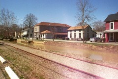 Metamora Historic Districtlisted 1992
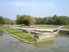 Whitewater Canal Historic Districtlisted 1973
Topographic sheets covering this place
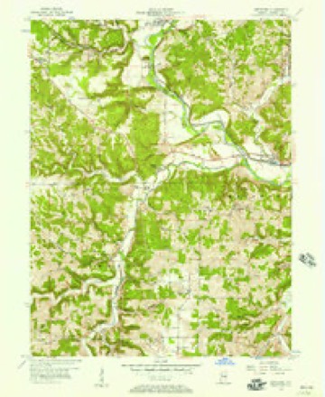
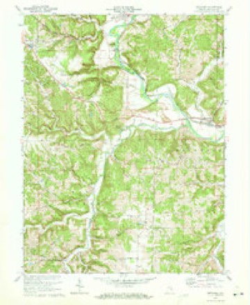
5 surveys from 10 printed sheetsMatched by testing this settlement's coordinate against the published boundary of every sheet in the United States Geological Survey's historical collection. Each opens the scanned sheet at the Survey.
- 1953 USGS Cincinnati quadrangle1:250000, 3 printings
- 1956 USGS Metamora quadrangle1:24000
- 1957 USGS Cincinnati quadrangle1:250000
- 1972 USGS Metamora quadrangle1:24000, 3 printings
- 1986 USGS Greensburg quadrangle1:100000, 2 printings



In the county-history sources
1,145 words on this townshipHistory of Franklin County, Indiana : Her People, Industries and Institutions, published 1915 names this settlement in its chapter on Metamora Township. These are the passages that mention it, exactly as the scans read.
This town, ur village, properly speaking, was platted by David Mount and William Holland, March 20, 1838, to which have been added several extensions. It was named for a character found in a novel - "Metamora, the beautiful squaw." It was named by Mrs. John A. Matson. Its population in 1910 was five hundred and eighty-eight. It is situated on the north side of Whitewater river and directly on the old canal, with one of the locks within the center of the town, the same now furnishing the water-power for the flouring mills, but which in former years afforded water-jKjwer for numerous factories. This was when the town was in the zenith of its commercial glory. The geographical location of the town is in section 34. The first man to sell general merchandise at this point was David Mount, who conducted a small store in his residence. The next to engage in merchandise v/as John Adair, who finally sold to William Holland.
Passage source: History of Franklin County, Indiana : Her People, Industries and Institutions, published 1915.
The following have served as postmasters at !Metamora since the establishment of the office, first known as Duck Creek Crossing, in April, 1826. The dates given are time of appointment. These names and dates were furnished the author by the department at Washington : Duck Creek Crossing - Daniel Churchill. April 14. 1826; J(3hn Reid, April 2^, 1S2Q: Asahel Gilmer. November 19, 1830; William Holland, February 25, 1833. Name changed.
Passage source: History of Franklin County, Indiana : Her People, Industries and Institutions, published 1915.
Machine-read from a century-old scan, so expect the errors a machine makes: misspelled names, dropped words, stray characters.
Mines and quarries near this place
2 within 5 milesRegional context, not property-specific evidence. The federal mineral resources record lists 2 workings within 5 miles of Metamora: 1 producer, 1 past producer. 1 still produces. What was taken out: Limestone, Dimension. Distance is straight-line from the map coordinates, so a quarry counted here may appear on a neighbouring settlement's page as well.
| Where | Site | Commodity | Status | Recorded |
|---|---|---|---|---|
| Denny Stone Quarry | Limestone, Dimension | Past Producer | ||
| Turner Stone Quarry | Limestone, Dimension | Producer |
Storms near this place
15 since 1994Regional context, not property-specific evidence. The National Weather Service names Metamora in 15 storm reports between 1994 and 2022: 8 thunderstorm wind, 3 hail, 2 flood, 2 flash flood. No death or injury is recorded in these reports. Each account below is quoted exactly as the forecast office filed it, from the NOAA Storm Events Database, and each date opens the federal record of that event.
| When | Event | Place named | Harm | What the report says |
|---|---|---|---|---|
| August 2009 | Flash Flood | Metamora | $15,000 | Flowing water upwards of one foot deep was reported on State Road 121 near Laurel and Highway 52 near Metamora. |
| August 2009 | Flash Flood | Metamora | $15,000 | Damage from flooding has occurred across several roads across western portions of the county. |
| March 2008 | Flood | Metamora | $5,000 | Numerous roads were flooded and closed throughout the county. |
| June 1998 | Thunderstorm Wind | Metamora | $5,000 | Trees downed. |
| June 2022 | Thunderstorm Wind | Metamora | $4,000 | A tree and some power lines were downed along State Route 229. |
| May 2011 | Thunderstorm Wind | Metamora | $2,000 | A large tree limb fell onto a house due to damaging thunderstorm winds. |
| August 2009 | Flood | Metamora | $2,000 | Multiple roads still had high water on them from previous heavy rainfall. |
| August 2020 | Thunderstorm Wind | Metamora | $1,000 | A large tree was knocked down over a road. |
| May 2015 | Thunderstorm Wind | Metamora | $1,000 | Several large limbs were downed across central Franklin County. |
| August 2011 | Thunderstorm Wind | Metamora | $1,000 | Two trees were reported down due to damaging thunderstorm winds. |
| July 2009 | Thunderstorm Wind | Metamora | $1,000 | Large trees were reported down. |
| June 1994 | Thunderstorm Wind | Metamora | - | Three large trees were blown down. |
| April 2012 | Hail | Metamora | - | no account filed |
| May 2011 | Hail | Metamora | - | no account filed |
| May 2006 | Hail | Metamora | - | no account filed |
Nearest settlements
The eight closest, with where each one stands in the county. Distances are straight-line, computed from the Geographic Names Information System coordinates.
| Map | Place | Distance | Sheets |
|---|---|---|---|
| Millville | 0.8 miles | 10 | |
| Yellow Bank | 3.8 miles | 10 | |
| Peppertown | 4.0 miles | 10 | |
| Midway | 4.2 miles | 10 | |
| Laurel | 4.3 miles | 10 | |
| Mount Auburn | 4.9 miles | 10 | |
| Oak Forest | 5.3 miles | 10 | |
| Blooming Grove | 5.4 miles | 11 |
Provenance
This settlement is recorded in the Geographic Names Information System as feature 439045. The sheet list is computed by point-in-boundary test against the United States Geological Survey's historical topographic inventory. Both are works of the United States government and carry no copyright under 17 U.S.C. 105.
Mines and quarries. USGS Mineral Resources Data System (MRDS) https://mrdata.usgs.gov/mrds/ A work of the United States government, no copyright under 17 U.S.C. 105.
Storms. NOAA National Centers for Environmental Information, Storm Events Database https://www.ncei.noaa.gov/stormevents/ A work of the United States government, no copyright under 17 U.S.C. 105. Narratives are quoted verbatim from the National Weather Service report and are not edited or summarised.