 Block
Lawrence, Indiana
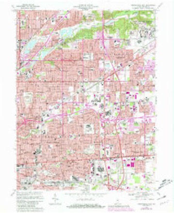
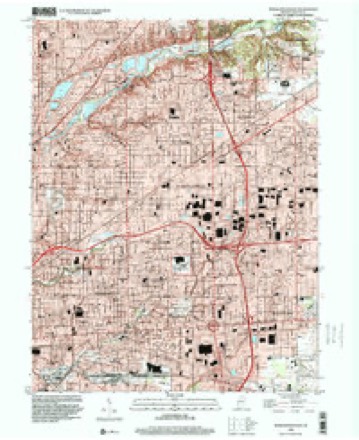
17 topographic sheets cover this place, the earliest surveyed in 1948 and the latest in 1998. It stands in Lawrence Township. It lies in ZIP code area 46226. It stands on Field Creek. The Survey maps it on the Indianapolis East quadrangle. 49,370 people lived here at the 2020 count. It stands 873 feet above sea level.
On record in Lawrence
Buildings and businesses the archive holds for this place. Each opens its own page, with the source record it came from.
On the National Register 2 records
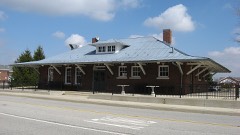 Fort Harrison Terminal Stationlisted 1984
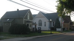 Oaklandon Historic Districtlisted 2013
Population over time
2 figuresLawrence grew from 46,001 to 49,370 between 2010 and 2020. These are the recorded population figures Wikidata holds for this place, reached through the Geographic Names Information System number this page is keyed on rather than by name, so they belong to this place and not to another of the same name. Most are census counts, but not all are: an early figure may be a founding or settlement estimate, and an estimate published within five years of a census is left out. The change column is computed, and is left blank where more than 20 years separate a figure from the one before it, because a gap that long is not a change between two counts.
| Year | People | Change |
|---|---|---|
| 2010 | 46,001 | |
| 2020 | 49,370 | +3,369 (+7%) |
Topographic sheets covering this place
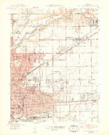
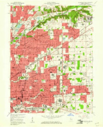
9 surveys from 17 printed sheetsMatched by testing this settlement's coordinate against the published boundary of every sheet in the United States Geological Survey's historical collection. Each opens the scanned sheet at the Survey.
- 1948 USGS Indianapolis East quadrangle1:24000, 2 printings
- 1953 USGS Indianapolis quadrangle1:250000, 4 printings
- 1956 USGS Indianapolis quadrangle1:250000
- 1957 USGS Indianapolis quadrangle1:250000, 2 printings
- 1959 USGS Indianapolis East quadrangle1:24000
- 1962 USGS Indianapolis quadrangle1:250000
- 1967 USGS Indianapolis East quadrangle1:24000, 3 printings
- 1986 USGS Indianapolis quadrangle1:100000, 2 printings
- 1998 USGS Indianapolis East quadrangle1:24000





In the county-history sources
25,786 words on this townshipHistory of Indianapolis and Marion County, Indiana, published 1884 names this settlement in its chapter on Lawrence Township. These are the passages that mention it, exactly as the scans read.
This township is situated in the extreme northeastern portion of the county, and is seven miles square, containing forty-nine square miles, or thirty thousand eight hundred and nineteen acres of land. It is bounded on the north by Hamilton County, on the east by Hancock County, on the south by Warren township, and on the west by Washington township. The surface of the country is generally level, except along the streams, where it is somewhat broken, and in some localities hilly. The soil is well adapted to the culture of wheat, corn, rye, barley, and most vegetables, but the culture of fruit has proved to be unprofitable during the past few years, though in a few localities this branch of agriculture has yielded a good revenue. About thirty-five years ago immense crops of peaches were raised, but the peach crop has been almost an entire failure during the last twenty years. The soil is principally clay, but consists of four grades, viz. : white clay, or beech flats ; black loam of the flats ; limestone or clay hills ; and bottomland, or dark chocolate loam intermixed with sand. Originally the township was covered with a heavy growth of timber, consisting principally of walnut, sugar, poplar, ash, beech, hickory, sycamore, lime, buckeye, oak, and hackberry. In the lowlands, the primitive forest abounded with grape-vines, frequently growing to an enormous height. Beneath the forest and the net-work of vines grew pawpaws, leatherwood, prickly-ash, black haw, and other underbrush. At the Lawrence district fair, September, 1883, John Johnson exhibited fifty-four natural varieties of timber of the township. Nearly all the valuable timber was recklessly destroyed in the clearing of the land, or has since been sold in the market. In an early day the level lands were covered with immense sheets of water, quagmires, and ponds.
Passage source: History of Indianapolis and Marion County, Indiana, published 1884.
Lawrence township was erected April 16, 1822, by order of the board of county commissioners, and on the same day and by the same authority it was joined to Washington for purposes of township organization (neither township being sufficiently populous to be organized separatelyj. This union of the two townships as one continued until Sept. 4, 1826, when the board of justices ordered that Lawrence be taken from Washington and separately organized, and that an election be held on the first Saturday in the following October at the house of John Johnson for choice of a justice of the peace for Lawrence, Alexander Wilson to be inspector of said election. The election was held as ordered, and resulted in the choice of Peter Casteller as justice of the peace. The following is a list of officers of the township from its erection to the present time, viz. :
Passage source: History of Indianapolis and Marion County, Indiana, published 1884.
William Perry and John Newton (twins), the next eldest, were the first white children born in the township. The former served in the Twenty-fifth Indiana Regiment, and was killed in 1862 at the battle of Prairie Grove, Ark. The latter is a farmer, and lives on his farm one mile northeast of Lawrence.
Passage source: History of Indianapolis and Marion County, Indiana, published 1884.
Machine-read from a century-old scan, so expect the errors a machine makes: misspelled names, dropped words, stray characters.
Read the whole chapter on Lawrence Township - it names this place 40 more 40 times.
Mines and quarries near this place
2 within 5 milesRegional context, not property-specific evidence. The federal mineral resources record lists 2 workings within 5 miles of Lawrence: 1 past producer, 1 producer. 1 still produces. What was taken out: Sand and Gravel, Construction, Stone. Distance is straight-line from the map coordinates, so a quarry counted here may appear on a neighbouring settlement's page as well.
| Where | Site | Commodity | Status | Recorded |
|---|---|---|---|---|
| Lawrence City-Own Crews | Stone | Producer | ||
| Standard Materials Corp S&G Pit | Sand and Gravel, Construction | Past Producer |
Storms near this place
26 since 1998Regional context, not property-specific evidence. The National Weather Service names Lawrence in 26 storm reports between 1998 and 2025: 12 hail, 11 thunderstorm wind, 1 lightning, 1 tornado. The reports record 1 death and 19 injuries. Each account below is quoted exactly as the forecast office filed it, from the NOAA Storm Events Database, and each date opens the federal record of that event.
| When | Event | Place named | Harm | What the report says |
|---|---|---|---|---|
| July 2006 | Lightning | Lawrence | 1 killed, 1 hurt | Two boys, aged 9 and 11, were struck by lightning while standing under a tree and playing in the rain. The 9-year-old died a short time later at Wishard Hospital. The 11-year-old was injured, but survived. |
| May 2008 | Tornado (EF2) | Lawrence | 18 hurt, $29,000,000 | Numerous structures were damaged in Marion County with the hardest hit area being an apartment complex near 38th Street and Mitthoefer Road. The tornado was associated with an embedded supercell that was overtaken by a line. Based on damage indicators, wind speeds were estimated around 125 mph. This tornado formed near 42nd Street and Post Road and tracked southeastward for 3.1 miles before exiting Marion County on North County Line Road 500 meters south of East 38th Street. The tornado continued in Hancock County. While in Marion County the tornado was rated EF-2 and while in Hancock County the tornado was rated EF-1. The tornado continued to the southeast in Hancock County for 4.0 miles. This made the entire path length 7.1 miles. The width of the tornado while in Hancock County was 100 yards and lasted from 2132 until 2136. Overall, the tornado was on the ground from 2127 until 2136. The tornado lifted in Hancock County 500 feet south of West 200 North on North 400 West. While in Hancock County the tornado damaged barns, houses, billboards, trees, and powerlines. |
| August 2004 | Thunderstorm Wind | Lawrence | $25,000 | A large tree fell along with several power lines and a power pole. Three mobile homes were damaged by the falling tree and pole. Damage amounts were estimated. |
| April 2024 | Thunderstorm Wind | Lawrence | $10,000 | Roof damage caused by thunderstorm wind gusts reported across Lawrence. |
| May 2018 | Thunderstorm Wind | Lawrence | $8,000 | A large tree limb broke off due damaging thunderstorm wind gusts and damaged a parked car. Power lines were always reported down. |
| January 2012 | Thunderstorm Wind | Lawrence | $3,000 | Trees were reported downed on Boy Scout Road due to damaging thunderstorm wind gusts. |
| April 2011 | Thunderstorm Wind | Lawrence | $2,000 | Tree limbs, six to eight inches in diameter, were blown down due to damaging thunderstorm wind gusts. |
| June 1998 | Thunderstorm Wind | Lawrence | $1,000 | Power lines downed. |
| August 2010 | Flood | Lawrence | $500 | High water was reported on roadways in and around the city of Lawrence due to thunderstorm heavy rainfall. |
| February 2024 | Thunderstorm Wind | Lawrence | - | A 60 mph thunderstorm wind gust was estimated at this location. |
| August 2016 | Thunderstorm Wind | Lawrence | - | An estimated 60 mph thunderstorm wind gust was observed near 32nd Street and Shadeland Avenue. Small hail was also reported. |
| June 2013 | Hail | Lawrence | - | This report was received via Twitter. |
| September 2008 | Hail | Lawrence | - | Three-quarter inch hail fell at 38th Street and Shadeland Avenue. |
| July 2005 | Thunderstorm Wind | Lawrence | - | Several large trees were downed. |
| March 2025 | Hail | Lawrence | - | no account filed |
| April 2012 | Hail | Lawrence | - | no account filed |
| April 2012 | Hail | Lawrence | - | no account filed |
| May 2011 | Hail | Lawrence | - | no account filed |
| May 2009 | Hail | Lawrence | - | no account filed |
| May 2009 | Hail | Lawrence | - | no account filed |
| April 2007 | Thunderstorm Wind | Lawrence | - | no account filed |
| April 2006 | Hail | Lawrence | - | no account filed |
| May 2006 | Hail | Lawrence | - | no account filed |
| May 2005 | Hail | Lawrence | - | no account filed |
| June 2002 | Thunderstorm Wind | Lawrence | - | no account filed |
| March 1998 | Hail | Lawrence | - | no account filed |
Nearest settlements
The eight closest, with where each one stands in the county. Distances are straight-line, computed from the Geographic Names Information System coordinates.
| Map | Place | Distance | Sheets |
|---|---|---|---|
| Robinson (historical) | 0.2 miles | 17 | |
| Brendonwood | 2.4 miles | 17 | |
| Fairwood Hills | 3.1 miles | 19 | |
| Avalon Hills | 3.2 miles | 19 | |
| Trilobi Hills | 3.2 miles | 12 | |
| Devonshire | 3.4 miles | 19 | |
| East Brightwood (historical) | 3.6 miles | 17 | |
| Millersville | 3.7 miles | 17 |
Elsewhere
Matched on this settlement's Geographic Names Information System number rather than its name, so it cannot be a different place of the same name in another state.
| Wikipedia article on Lawrence | An encyclopaedic summary. Its text is share-alike, so it is linked here rather than copied. |
| Wikidata item Q1806779 | The structured record the population and elevation above come from. Public domain (CC0). |
Provenance
This settlement is recorded in the Geographic Names Information System as feature 437666. The sheet list is computed by point-in-boundary test against the United States Geological Survey's historical topographic inventory. Both are works of the United States government and carry no copyright under 17 U.S.C. 105.
Mines and quarries. USGS Mineral Resources Data System (MRDS) https://mrdata.usgs.gov/mrds/ A work of the United States government, no copyright under 17 U.S.C. 105.
Storms. NOAA National Centers for Environmental Information, Storm Events Database https://www.ncei.noaa.gov/stormevents/ A work of the United States government, no copyright under 17 U.S.C. 105. Narratives are quoted verbatim from the National Weather Service report and are not edited or summarised.