 Block
Lawrenceville, Indiana
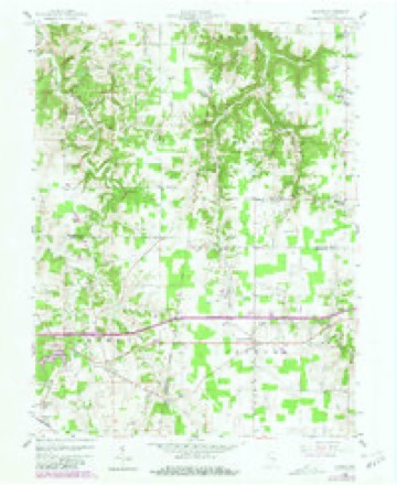
9 topographic sheets cover this place, the earliest surveyed in 1953 and the latest in 1986. It stands in Jackson Township. It lies in ZIP code area 47041. The Survey maps it on the Spades quadrangle. It stands 961 feet above sea level.
Topographic sheets covering this place
4 surveys from 9 printed sheetsMatched by testing this settlement's coordinate against the published boundary of every sheet in the United States Geological Survey's historical collection. Each opens the scanned sheet at the Survey.
- 1953 USGS Cincinnati quadrangle1:250000, 3 printings
- 1957 USGS Cincinnati quadrangle1:250000
- 1958 USGS Spades quadrangle1:24000, 3 printings
- 1986 USGS Greensburg quadrangle1:100000, 2 printings



In the county-history sources
1,427 words on this townshipHistory of Dearborn County Indiana, published 1915 names this settlement in its chapter on Jackson Township. These are the passages that mention it, exactly as the scans read.
Lawrence and family, consisting of eight sons and two daughters, emigrated in the spring of 1818. from the state of Pennsylvania, and settled in the neighborhood of the present site of the village of Lawrenceville. All of the sons and daughters, save two, were persons of families. They came by boat down the Ohio, and from Lawrenceburg up the meanderings of Tanners creek to the place of settlement in wagons. They brought with them $1,500 in gold and among them was purchased from the government ten quarter sections of land. The home place, as it was called, was the northwest quarter of sec¬ tion 17, the home of Isaac Lawrence. This large body of land was all situated within two miles of the home place. From this beginning the families of Lawrence became very numerous and at one time numbered over three hun¬ dred persons. Although at this writing there are but two families of the name in the township."
Passage source: History of Dearborn County Indiana, published 1915.
The towns of Lawrenceville and Morgantown were laid out as rivals. They are, in fact, one and the same place, a road separating the towns. Mor¬ gantown was laid out by Jonathan Lawrence, in November, 1836. Robert Rowe was the engineer. The original plat contained thirty-six lots. It is claimed that the name of Morgantown was given after Daniel R. L. Moigan, a nephew of Gen. John Morgan, the raider. James and Philip Lawrence kept the first store in the town, and the store was run by Mr. Morgan, after whom the town received its name. The place is practically eliminated as a town at present and the whole neighborhood is now known as Lawrenceville. Law¬ renceville was laid out on October 25, 1836, by John K. Lawrence. It will be observed that he was eleven days ahead of the founders of Morgantown. Isaac Johnson, John Bird and Lewis Snyder were the early storekeepers in the place. The vijlage has a population of 100, while the town that was once a rival seems to have been wiped off the map.
Passage source: History of Dearborn County Indiana, published 1915.
Machine-read from a century-old scan, so expect the errors a machine makes: misspelled names, dropped words, stray characters.
Storms near this place
9 since 1995Regional context, not property-specific evidence. The National Weather Service names Lawrenceville in 9 storm reports between 1995 and 2025: 4 thunderstorm wind, 2 hail, 2 flash flood, 1 tornado. No death or injury is recorded in these reports. Each account below is quoted exactly as the forecast office filed it, from the NOAA Storm Events Database, and each date opens the federal record of that event.
| When | Event | Place named | Harm | What the report says |
|---|---|---|---|---|
| March 1997 | Thunderstorm Wind | Lawrenceville | $100,000 | no account filed |
| May 2025 | Tornado (EF0) | Lawrenceville | $10,000 | The tornado first developed in Ripley County, Indiana at 1902EST near E County Road 1150 N. The tornado moved northeast into Dearborn County, Indiana at 1909EST and produced damage at a property off of N County Line Road, where half of a barn roof was uplifted. Additionally, a home at the same property had shingle and siding damage. The tornado continued northeast and entered into Franklin County at 1910EST, just north of N County Line Road, where the tornado dissipated shortly after at 1911EST. |
| June 2021 | Flash Flood | Lawrenceville | $10,000 | Water was rushing over the road near the intersection of Trackville Road and Hickory Road. People needed to be rescued from a vehicle trapped in the high water along Trackville Road. |
| August 2016 | Thunderstorm Wind | Lawrenceville | $3,000 | Numerous trees were knocked down on State Route 46, half a mile west of St. Peters Road. |
| June 1998 | Thunderstorm Wind | Lawrenceville | $3,000 | Trees downed. |
| June 2025 | Thunderstorm Wind | Lawrenceville | $1,000 | A tree was uprooted and some corn was flattened at a property on Legion Road. |
| September 2016 | Flash Flood | Lawrenceville | - | High water was reported on several roadways in the Lawrenceville area. Two motorists had to be rescued from cars in flood waters on Trackville Road and Lawrenceville Road. |
| May 2024 | Hail | Lawrenceville | - | no account filed |
| July 1995 | Hail | Lawrenceville | - | no account filed |
Nearest settlements
The eight closest, with where each one stands in the county. Distances are straight-line, computed from the Geographic Names Information System coordinates.
| Map | Place | Distance | Sheets |
|---|---|---|---|
| Hubbells Corner | 3.0 miles | 9 | |
| New Alsace | 3.6 miles | 9 | |
| Weisburg | 4.1 miles | 9 | |
| Saint Leon | 4.4 miles | 13 | |
| Dover | 5.5 miles | 17 | |
| Yorkville | 6.3 miles | 17 | |
| Logan | 7.9 miles | 17 | |
| Bonnell | 8.3 miles | 17 |
Elsewhere
Matched on this settlement's Geographic Names Information System number rather than its name, so it cannot be a different place of the same name in another state.
| Wikipedia article on Lawrenceville | An encyclopaedic summary. Its text is share-alike, so it is linked here rather than copied. |
| Wikidata item Q6504814 | The structured record the population and elevation above come from. Public domain (CC0). |
Provenance
This settlement is recorded in the Geographic Names Information System as feature 437677. The sheet list is computed by point-in-boundary test against the United States Geological Survey's historical topographic inventory. Both are works of the United States government and carry no copyright under 17 U.S.C. 105.
Storms. NOAA National Centers for Environmental Information, Storm Events Database https://www.ncei.noaa.gov/stormevents/ A work of the United States government, no copyright under 17 U.S.C. 105. Narratives are quoted verbatim from the National Weather Service report and are not edited or summarised.