 Block
Weisburg, Indiana
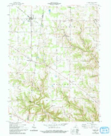
9 topographic sheets cover this place, the earliest surveyed in 1953 and the latest in 1986. It stands in Jackson Township. It lies in ZIP code area 47041. The Survey maps it on the Sunman quadrangle. It stands 932 feet above sea level.
Topographic sheets covering this place
4 surveys from 9 printed sheetsMatched by testing this settlement's coordinate against the published boundary of every sheet in the United States Geological Survey's historical collection. Each opens the scanned sheet at the Survey.
- 1953 USGS Cincinnati quadrangle1:250000, 3 printings
- 1957 USGS Cincinnati quadrangle1:250000
- 1958 USGS Sunman quadrangle1:24000, 3 printings
- 1986 USGS Greensburg quadrangle1:100000, 2 printings



In the county-history sources
1,427 words on this townshipHistory of Dearborn County Indiana, published 1915 names this settlement in its chapter on Jackson Township. These are the passages that mention it, exactly as the scans read.
For some time after the Lawrence families settled in the township they made a hand mill for doing the grinding for the neighborhood. The stones used in the old mill were in the possession of Isaac S. Lawrence in 1885, but whether anyone now is keeping them, like Mr. Lawrence, just for a souvenir of "old times'' is not known. Later on, a grist-mill was erected on the west fork of Tanners creek, run by water power. A good steam-mill for making flour and other products is now being operated at Weisburg. The town was named for the owner of the mill, Philip Weis.
Passage source: History of Dearborn County Indiana, published 1915.
Weisburg was laid out by Jasper Montgomery on January 7, 1858, and platted by Samuel Kennedy, one of Dearborn county's old-time engineers. Besides the flour-mill mentioned it has a store, blacksmith shop and several saloons, and is a place of considerable business, being a good shipping point for all the country near by.
Passage source: History of Dearborn County Indiana, published 1915.
Machine-read from a century-old scan, so expect the errors a machine makes: misspelled names, dropped words, stray characters.
Storms near this place
4 since 2011Regional context, not property-specific evidence. The National Weather Service names Weisburg in 4 storm reports between 2011 and 2022: 3 thunderstorm wind, 1 tornado. No death or injury is recorded in these reports. Each account below is quoted exactly as the forecast office filed it, from the NOAA Storm Events Database, and each date opens the federal record of that event.
| When | Event | Place named | Harm | What the report says |
|---|---|---|---|---|
| June 2021 | Thunderstorm Wind | Weisburg | $50,000 | Numerous trees and power lines were blown down across Dearborn County. |
| May 2011 | Tornado (EF0) | Weisburg | $40,000 | The tornado initially touched down in Ripley County at 1743 near County Road 900. Numerous large trees were down in different directions and at least one power pole was snapped in this location. The tornado then continued to the northeast and passed into Dearborn County at 1745 just northwest of Tangman Road. Along Tangman Road, large trees were down in different directions, a metal roof was torn off of a large pole barn, and a barn was destroyed due to the tornado. A short distance to the northeast, trees were snapped near Hill Road. The tornado lifted in Dearborn County at 1747. Damage estimates for Ripley County were five thousand dollars. Damage estimates for Dearborn County were forty thousand dollars. Maximum estimated wind speed based on damage was around eighty miles per hour. The tornado was on the ground for 1.48 miles in Ripley County and 1.60 miles in Dearborn County. The entire path length of the tornado was 3.08 miles. |
| July 2016 | Thunderstorm Wind | Weisburg | $2,000 | Siding and a portion of outer wall sheathing was ripped off the side of a house. |
| April 2022 | Thunderstorm Wind | Weisburg | $1,000 | A large tree was downed near the intersection of Weisburg and Hilbert Roads. |
Nearest settlements
The eight closest, with where each one stands in the county. Distances are straight-line, computed from the Geographic Names Information System coordinates.
| Map | Place | Distance | Sheets |
|---|---|---|---|
| Hubbells Corner | 1.2 miles | 9 | |
| New Alsace | 2.5 miles | 9 | |
| Lawrenceville | 4.1 miles | 9 | |
| Yorkville | 4.3 miles | 17 | |
| Manchester | 4.9 miles | 9 | |
| Bonnell | 5.1 miles | 17 | |
| Dover | 5.5 miles | 17 | |
| Kyle | 6.3 miles | 17 |
Elsewhere
Matched on this settlement's Geographic Names Information System number rather than its name, so it cannot be a different place of the same name in another state.
| Wikipedia article on Weisburg | An encyclopaedic summary. Its text is share-alike, so it is linked here rather than copied. |
| Wikidata item Q7980374 | The structured record the population and elevation above come from. Public domain (CC0). |
Provenance
This settlement is recorded in the Geographic Names Information System as feature 449744. The sheet list is computed by point-in-boundary test against the United States Geological Survey's historical topographic inventory. Both are works of the United States government and carry no copyright under 17 U.S.C. 105.
Storms. NOAA National Centers for Environmental Information, Storm Events Database https://www.ncei.noaa.gov/stormevents/ A work of the United States government, no copyright under 17 U.S.C. 105. Narratives are quoted verbatim from the National Weather Service report and are not edited or summarised.