 Block
Linn Grove, Indiana
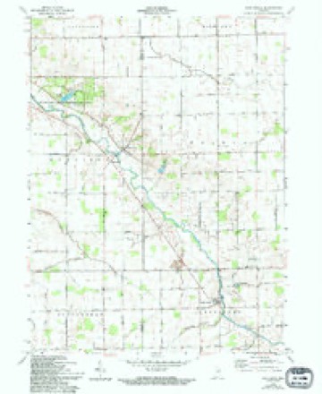
11 topographic sheets cover this place, the earliest surveyed in 1953 and the latest in 1986. It stands in Hartford Township. It lies in ZIP code area 46711. The Survey maps it on the Linn Grove quadrangle. It stands 830 feet above sea level.
Topographic sheets covering this place
4 surveys from 11 printed sheetsMatched by testing this settlement's coordinate against the published boundary of every sheet in the United States Geological Survey's historical collection. Each opens the scanned sheet at the Survey.
- 1953 USGS Muncie quadrangle1:250000, 5 printings
- 1956 USGS Muncie quadrangle1:250000
- 1962 USGS Linn Grove quadrangle1:24000, 3 printings
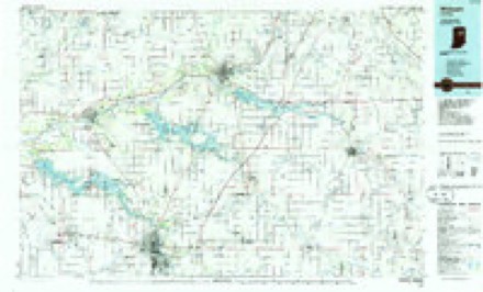
- 1986 USGS Wabash quadrangle1:100000, 2 printings


In the county-history sources
1,165 words on this townshipSnow's History of Adams County, Indiana, published 1907 has no passage naming this settlement, which was common for smaller places. Its township is covered in full.
The chapter on Hartford Township covers the township.
Read the chapter on Hartford Township - 1,165 words.
Mines and quarries near this place
2 within 5 milesRegional context, not property-specific evidence. The federal mineral resources record lists 2 workings within 5 miles of Linn Grove: 2 producers. All of them still produce. What was taken out: Stone, Crushed/Broken, Stone. Distance is straight-line from the map coordinates, so a quarry counted here may appear on a neighbouring settlement's page as well.
| Where | Site | Commodity | Status | Recorded |
|---|---|---|---|---|
| Adams City Highway Dept. | Stone | Producer | ||
| Linn Grove Quarry | Stone, Crushed/Broken | Producer |
Storms near this place
9 since 2000Regional context, not property-specific evidence. The National Weather Service names Linn Grove in 9 storm reports between 2000 and 2023: 5 thunderstorm wind, 2 hail, 1 tornado, 1 flood. The reports record 1 death. Each account below is quoted exactly as the forecast office filed it, from the NOAA Storm Events Database, and each date opens the federal record of that event.
| When | Event | Place named | Harm | What the report says |
|---|---|---|---|---|
| March 2023 | Flood | Linn Grove | 1 killed | Indiana DNR officials reported a 55 year old male was driving north on County Road 300 West, north of County Road 850 South and disregarded road closed signs due to high water levels on the Wabash River. The driver's van entered the flood water at approximately 430 am EST and began to submerge. He left the van in an effort to exit the flood waters, but was subsequently found deceased roughly 50 yards southwest of the submerged van by first responders. |
| June 2023 | Thunderstorm Wind | Linn Grove | $10,000 | A 24 inch diameter healthy maple tree was uprooted. A grove of trees was heavily damaged, with varying sizes of trees uprooted or snapped. |
| June 2023 | Hail | Linn Grove | $5,000 | Quarter to half dollar size hail covered the road like snow about two inches deep. |
| May 2022 | Thunderstorm Wind | Linn Grove | - | A trained spotter reported a few large trees were blown down. |
| May 2019 | Thunderstorm Wind | Linn Grove | - | The public shared a picture on twitter of a large barn with roughly one quarter of its roof blown off. |
| August 2016 | Tornado (EF1) | Linn Grove | - | A ground survey and eyewitness reports along with an aerial survey by Emergency Management indicated a funnel cloud was skipping along this path and occasionally touching down. The aerial survey indicated several touch downs within the middle of bean and corn fields. Ground survey found several taller barn structures with partial roofs torn off and lofted several hundred yards in pieces. Larger trees had large limbs broken off while smaller trees were knocked down or uprooted. |
| April 2011 | Thunderstorm Wind | Linn Grove | - | Law enforcement officials reported roofs off of several outbuildings as well as a chicken coop being blown over. Debris from some structures was blown into adjacent roads. |
| September 2000 | Thunderstorm Wind | Linn Grove | - | Tree limbs and one tree blown down. |
| August 2011 | Hail | Linn Grove | - | no account filed |
Nearest settlements
The eight closest, with where each one stands in the county. Distances are straight-line, computed from the Geographic Names Information System coordinates.
| Map | Place | Distance | Sheets |
|---|---|---|---|
| Perryville | 3.7 miles | 10 | |
| Berne | 4.4 miles | 13 | |
| Ceylon | 5.0 miles | 12 | |
| Geneva | 5.4 miles | 12 | |
| Honduras | 7.8 miles | 10 | |
| Coppess Corner | 8.0 miles | 13 | |
| Monroe | 8.6 miles | 13 | |
| Elm Tree Crossroads | 10.7 miles | 13 |
Elsewhere
Matched on this settlement's Geographic Names Information System number rather than its name, so it cannot be a different place of the same name in another state.
| Wikipedia article on Linn Grove | An encyclopaedic summary. Its text is share-alike, so it is linked here rather than copied. |
| Wikidata item Q6554516 | The structured record the population and elevation above come from. Public domain (CC0). |
Provenance
This settlement is recorded in the Geographic Names Information System as feature 437965. The sheet list is computed by point-in-boundary test against the United States Geological Survey's historical topographic inventory. Both are works of the United States government and carry no copyright under 17 U.S.C. 105.
Mines and quarries. USGS Mineral Resources Data System (MRDS) https://mrdata.usgs.gov/mrds/ A work of the United States government, no copyright under 17 U.S.C. 105.
Storms. NOAA National Centers for Environmental Information, Storm Events Database https://www.ncei.noaa.gov/stormevents/ A work of the United States government, no copyright under 17 U.S.C. 105. Narratives are quoted verbatim from the National Weather Service report and are not edited or summarised.