 Block
Honduras, Indiana
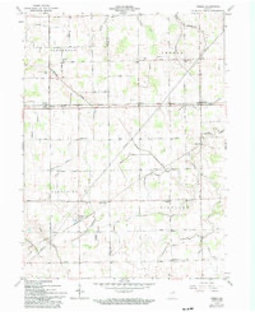
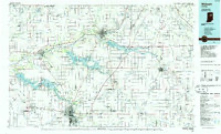
10 topographic sheets cover this place, the earliest surveyed in 1953 and the latest in 1986. It stands in Kirkland Township. It lies in ZIP code area 46733. The Survey maps it on the Preble quadrangle. It stands 840 feet above sea level.
Topographic sheets covering this place
4 surveys from 10 printed sheetsMatched by testing this settlement's coordinate against the published boundary of every sheet in the United States Geological Survey's historical collection. Each opens the scanned sheet at the Survey.
- 1953 USGS Muncie quadrangle1:250000, 5 printings
- 1956 USGS Muncie quadrangle1:250000
- 1962 USGS Preble quadrangle1:24000, 2 printings
- 1986 USGS Wabash quadrangle1:100000, 2 printings


In the county-history sources
735 words on this townshipSnow's History of Adams County, Indiana, published 1907 names this settlement in its chapter on Kirkland Township. These are the passages that mention it, exactly as the scans read.
Kirkland township is four by six miles in size and was organized in 1S41. It was named after the son of Samuel L. Rugg, then an officer of the count). This was one of the last townships organized in the county and some of the earliest residents were: John Hartman, William Dehl, Samuel Steele, Daniel Wcldy, Samuel Adgitt, Augustus LeBrun, Robert Niblick and William Beinelce. In 1850 this township claimed the distinction of having the oldest man in eastern Indiana. He was William Nottingham, who lived in section 4 on what is now W. D. Hoffman's farm. At that time it is said that he was one hundred and five years old. This township had the fourth steam saw mill in the county, it was built by William Dehl in 1856 and was located in section 2. Until about 1S80 there were no towns in this township. The town plat of Courryville was recorded on the 261b day of February, 1880. This town has twenty lots and two streets, Main and Calhoun; is located on the west hue of the Vour.ty, three miles from either end of the township. Courryville is on the Cloverleaf Railroad and is one of the timber towns that ceased to grow since the timber industries have been removed. The proprietor of this town site is Henry Jackson. The town of Peterson is another village. This is a mile from the north line and the same distance from the east boundary of the township. It was once quite a business center in the timber trade. Steele & Lenhart operated an extensive saw mill, headingfactory and stirrup works here in the seventies, but these industries have ceased to exist. It now has a blacksmith shop, grain warehouse, an elevator, stock yards and general store, which is kept by H. A. Eriner, who is ticket agent, freight agent, storekeeper and telephone manager. This village has never been platted, but its grounds are bought and sold by metes and bounds. The second brick school house within the county was built here in 1874 by Trustee Daniel Weldy. It was torn down in 1893 by Trustee Joshua Bright and a fine two-room brick graded school house built to take its place. The first frame house in this township was the residence of Samuel Steele and was built in 1852. The first brick residence was built by Robert Niblick in 1856, in section 10. At Mr. Niblick's house for a long time the postefhee of Gaih was kept. In 1868 the first frame church was built in section 26, which has later been called Honduras. This is but a cross-road corner, that took its name from the. postofhee kept there. It has a smali store and blacksmith shop. This church was used by several denominations and was erected by the Christian Union organization. Among some of those interested in its erection were : James Sarf , Vincent D. Bell, Jesse Smith and Isaac Sutbine. This church building burned down and was replaced about 1886 by another frame known as the Zion Christian Union church. In 1877, or thereabout, the River Brethren erected a substantial frame church in section 23, on the present Decatur & Bluffton stoned road. The early school houjes in this township were all log" structures. The Hartmanschool was at the present town of Peterson. The Steele school was the election school house. The Hoffman school house was in section 14. The Beech Grove school was in section 16. The Steele school house was built in 1848 and the Dehl school house was the first frame schoc! house built in the township. This township had a large amount of wet land and until the railroad passed through the township in 1880 its development was backward. One of the first stone roads in the county was built through this township in 1892-3 and against the will of a majority of its taxpayers.
Passage source: Snow's History of Adams County, Indiana, published 1907.
Machine-read from a century-old scan, so expect the errors a machine makes: misspelled names, dropped words, stray characters.
Fires near this place
2 since 2004Regional context, not property-specific evidence. The federal wildfire occurrence database lists 2 fires within 5 miles of Honduras in 2004, burning about 4 acres in total. None started naturally. None was recorded as arson. Distance is straight-line from the map coordinates, so a fire counted here may appear on a neighbouring settlement's page as well.
| Reported cause | Fires |
|---|---|
| Debris and open burning | 1 |
| Recreation and ceremony | 1 |
The most recent of them, most recent first, with the day each was reported and the service that recorded it.
| Date | Cause | Size | Reported by | Name on the report |
|---|---|---|---|---|
| 7 November 2004 | Recreation and ceremony | 2.0 acres | Indiana State Fire Marshal's Office | not named |
| 30 October 2004 | Debris and open burning | 2.0 acres | Indiana State Fire Marshal's Office | not named |
Settlements close enough to share some of these fires:
Nearest settlements
The eight closest, with where each one stands in the county. Distances are straight-line, computed from the Geographic Names Information System coordinates.
| Map | Place | Distance | Sheets |
|---|---|---|---|
| Peterson | 3.9 miles | 10 | |
| Coppess Corner | 4.1 miles | 13 | |
| Elm Tree Crossroads | 4.6 miles | 13 | |
| Monroe | 5.2 miles | 13 | |
| Magley | 5.2 miles | 10 | |
| Preble | 5.2 miles | 10 | |
| Decatur | 7.4 miles | 13 | |
| Linn Grove | 7.8 miles | 11 |
Elsewhere
Matched on this settlement's Geographic Names Information System number rather than its name, so it cannot be a different place of the same name in another state.
| Wikipedia article on Honduras | An encyclopaedic summary. Its text is share-alike, so it is linked here rather than copied. |
| Wikidata item Q5893062 | The structured record the population and elevation above come from. Public domain (CC0). |
Provenance
This settlement is recorded in the Geographic Names Information System as feature 436378. The sheet list is computed by point-in-boundary test against the United States Geological Survey's historical topographic inventory. Both are works of the United States government and carry no copyright under 17 U.S.C. 105.
Wildfire. Short, Karen C. 2022. Spatial wildfire occurrence data for the United States, 1992-2020 [FPA_FOD_20221014]. 6th Edition. Fort Collins, CO: Forest Service Research Data Archive. https://doi.org/10.2737/RDS-2013-0009.6 Collected with United States Government funding and usable without additional permissions or fees.